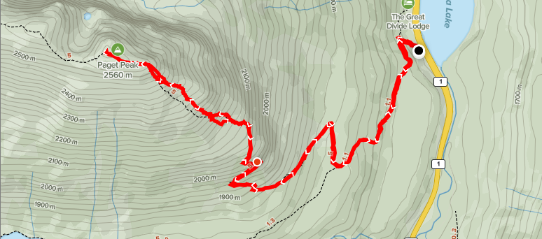
Distance: 10.21km
Elevation: 966m
Total Time: 4 hours 15 minutes
Date: October 3rd, 2020
My friend Jeremy and I were looking to do a bigger objective around the end of September and were bouncing a few ideas around. Initially we were set on Castle Towers in Garabaldi Provincial Park, but as our targeted weekend approached, the weather was looking bleak all across the province. For the first time, I looked as far east as Alberta and was super pleased I did. Not only was the weather looking great, but there was a bottomless list of cool summits to aim for.
Since I was going to have to drive the ~8 hours from Vancouver to Alberta, I figured we’ll make a weekend of it and stay over night. With a 2 day agenda now on the plate, I first chose Molar Mountain as our big day 2 objective and then had a look at hikes in and around the Banff area for our day 1 objective. There were a lot of good options, but I ended up focusing on hikes in Yoho, because we chose to stay in Golden for the inexpensive accommodation and proximity to Molar Mountain trail head.
With that factored in, I finally settled on Paget peak, just west of the border to Banff and Yoho National parks. At just under 1000m of elevation gain and a total of ~10km round trip it seemed like the perfect “warm-up” hike for day 2. We’d be arriving in the area around lunch time, so needed a shorter hike anyways.
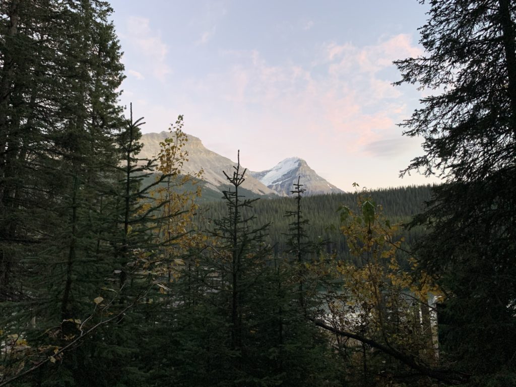
I drove to Kelowna on the 2nd of October to break up the trip and then left with Jeremy on the 3rd to drive out to Yoho National Park. We initially planned for end of September, but something came up at the last minute so we pushed back one more weekend. We pulled into the trail head for Paget Peak around 3:18pm on the 3rd, a lot later than expected, but lots of daylight ahead of us.
The beginning of the trail is just a modest incline through the woods without much to speak of. Somewhere around the 2km mark, the elevation gain increases steadily and you start to get brief periods breaking in and out of the woods. I was trying to keep a decent pace, matching what I normally do on the coast, but was really struggling to keep up. At 10km and 1000m total elevation, I was expecting to breeze up the trail, but it was not so. A little perplexed I finally, honed in on our starting elevation. It was 1600m higher start than the coast and while not significant, it was still making a noticeable difference.
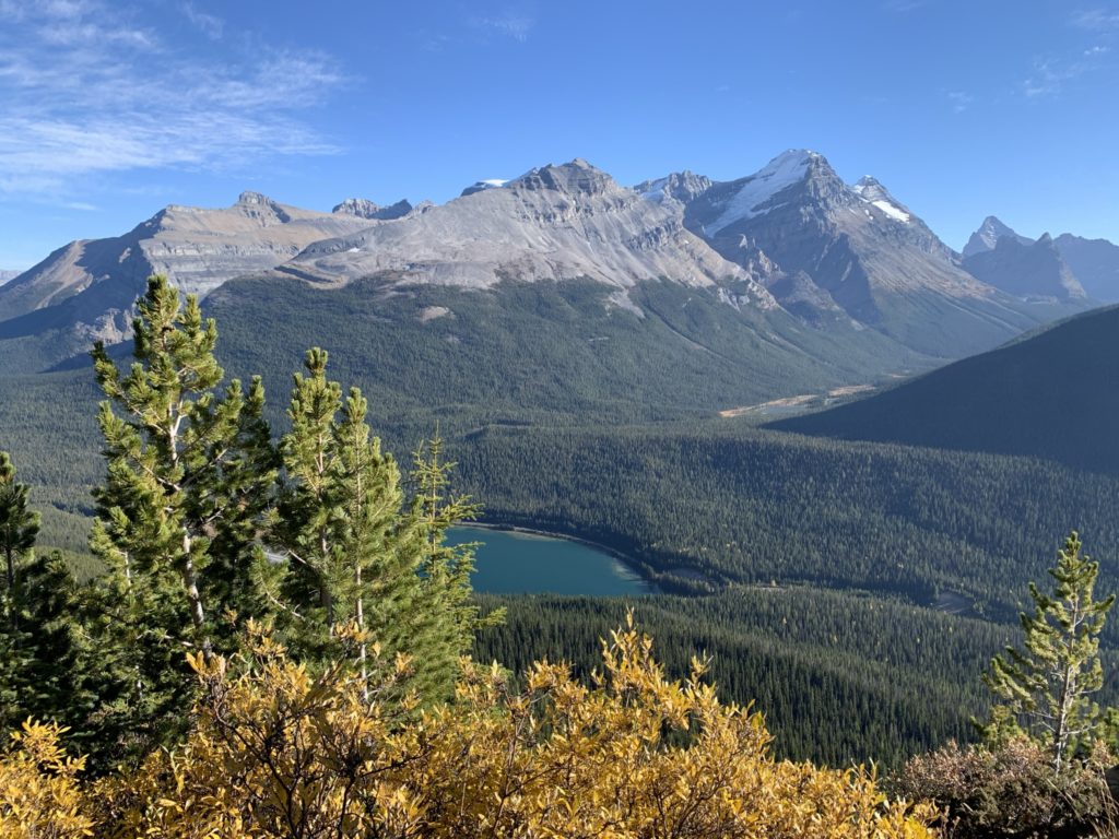
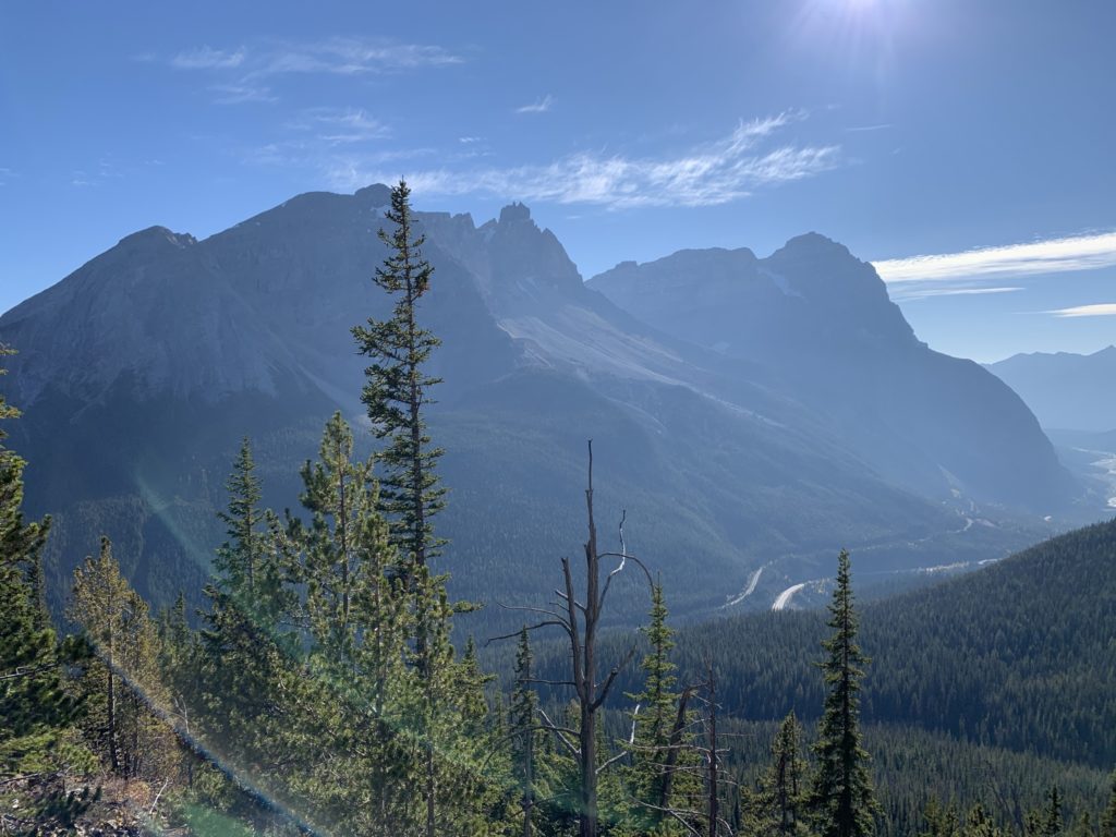
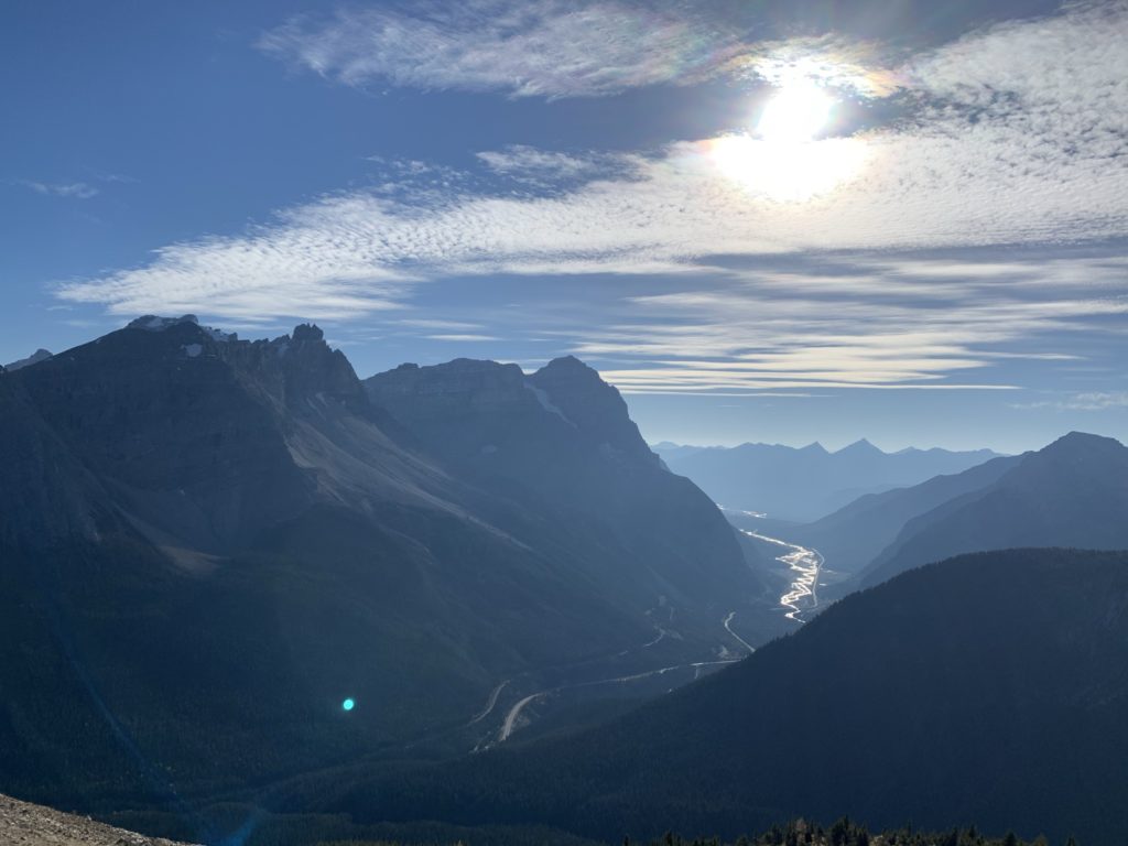
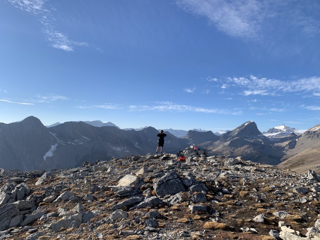
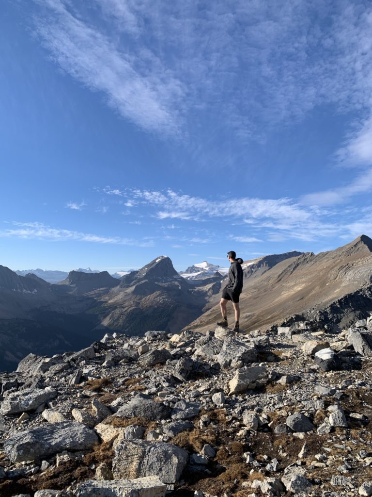
Nonetheless, we slogged on wanting to get a good feel for what the following day would be like. At around 7km in, we reached a look out with a small hut and pretty amazing views of Mount Victoria, Mount Stephen and Cathedral Mountain. Coming from the coastal mountains, this area of the Rockies really blew me away with very different looking peaks.
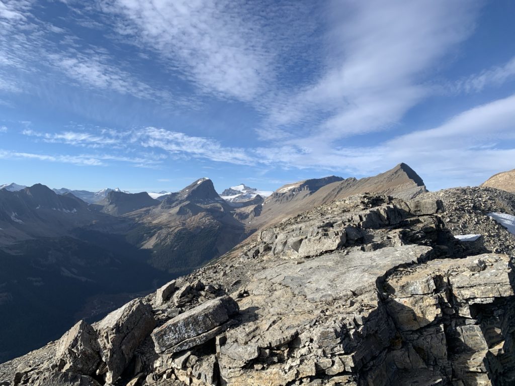
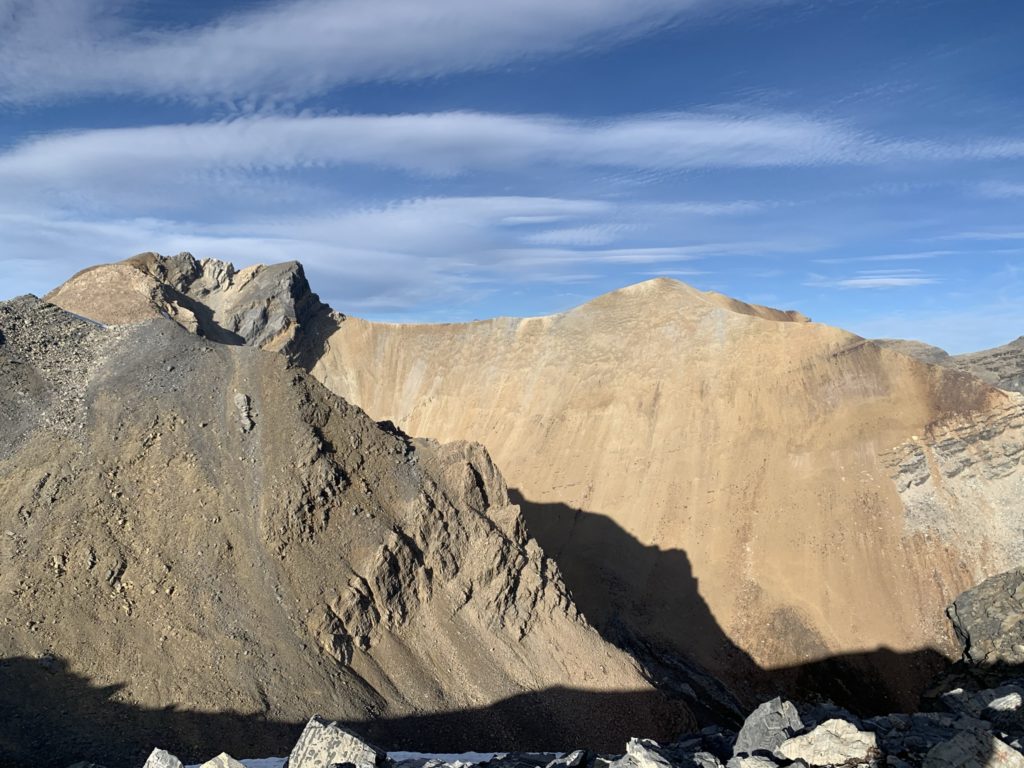
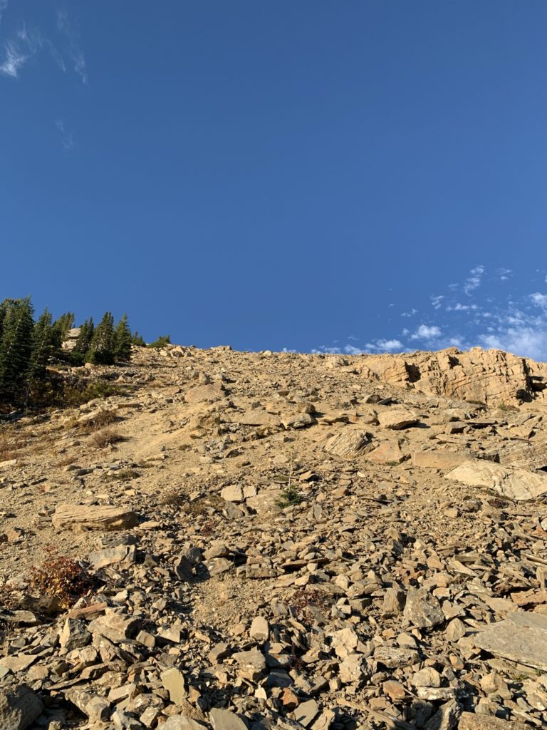
We pushed on after taking a few photos as the views seemed to open up more towards the top. Maybe 50-75 meters above the lookout, the scramble section begins. The terrain is mostly talus slopes with an established trail that steepens in some sections. It’s pretty straightforward trek to the top, just a lot of elevation gain and some very loose spots.

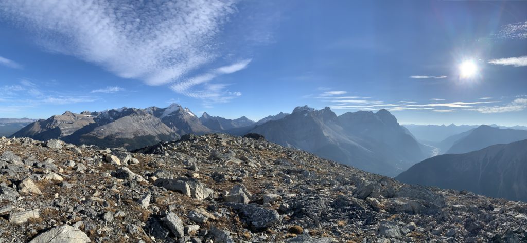
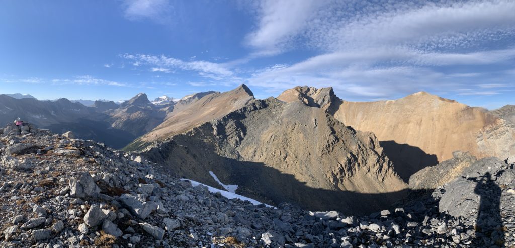
When we reached the top, we had 360 views of the surrounding mountain areas. It looked like the sun was setting soon, so we decided to stick around so that we’d have a chance to catch it was we went down.
The route back is bit hard on the knees and the loose slippery sections were a pain without any poles. Once we made it past the open terrain it eased back into the forested section and it was a basic plod back to the car from there.
With Paget peak now ascended and a better feeling for how we were performing at the higher elevation, I had a feeling our Molar Mountain objective was too ambitious. When we returned to Golden later at night, we changed our objectives to Little Hector and Mount Andromache instead. Paget peak should definitely be on the to-do list if you want unobstructed views and a straight forward hike up.