Distance: 13.6km (including Little Hector)
Elevation: 1,894m (including Little Hector)
Total Time: 9 hours 31 minutes (including Little Hector)
Date: October 4th, 2020
Note: I discovered post-trip that the true summit is western most point as documented on bivouac.com. The eastern summit (Andromache E1) is what’s incorrectly marked on OSM-based maps as the true summit. Nonetheless, Bivouac keeps this an unofficially named summit point, so I’ll keep this report up at the very least so you don’t make the same mistake I did!
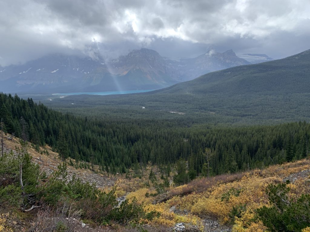
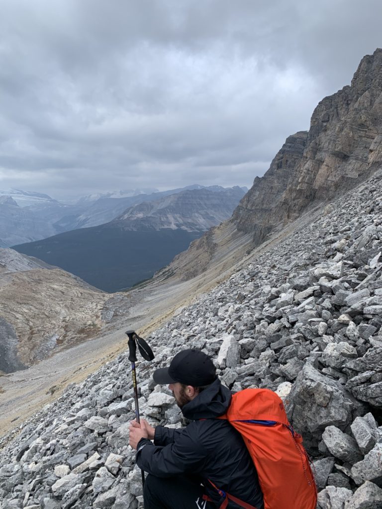
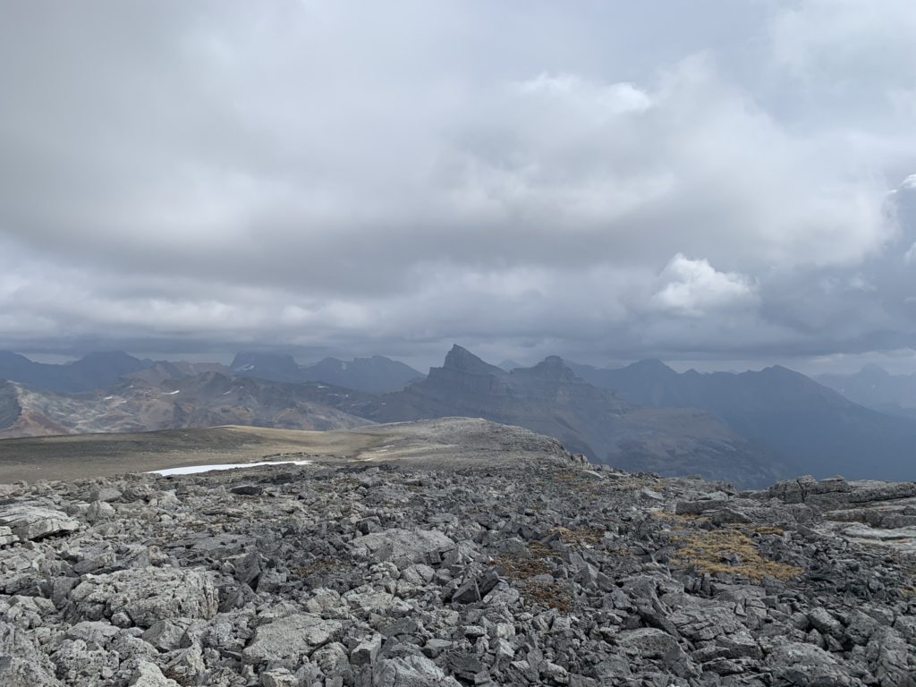
Jeremy and I had just completed our first objective of the day: Little Hector and were now linked up on the trail to Mount Andromache. It was about 11:40am with plenty of daylight ahead of us, but also another ~600m of elevation to the top. At this point a dense layer of clouds had rolled in and was obscuring the very top of Little Hector. Mount Andromache still looked just below the cloud layer, but we were set on going cloud cover or not.
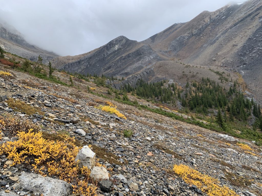
The route up Mount Andromache is pretty straightforward with sustained class 2 terrain the entire way. It’s mostly just a slog up 3 distinct scree/talus slopes to the first peak. Based on the maps/trip reports, we were heading for the first peak thinking it was Mount Andromache. We would later find out that it was actually an unnamed peak lower than the true Mount Andromache summit further west. Oh well, it was a fun objective nonetheless.
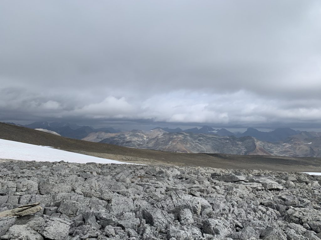
We started past the low point, a tarn at the 2400m elevation mark and followed our way eastwards until the slope eased near the eastern most aspect of Mount Andromache. We cut a sharp left and ascended directly up the slope. There were a few micro terrain sections that we had to navigate around, including a small cliff band at around 2530 meters. At this point the slope steepens further and it became hell to gain any elevation. Every few steps forward, we’d slide back.
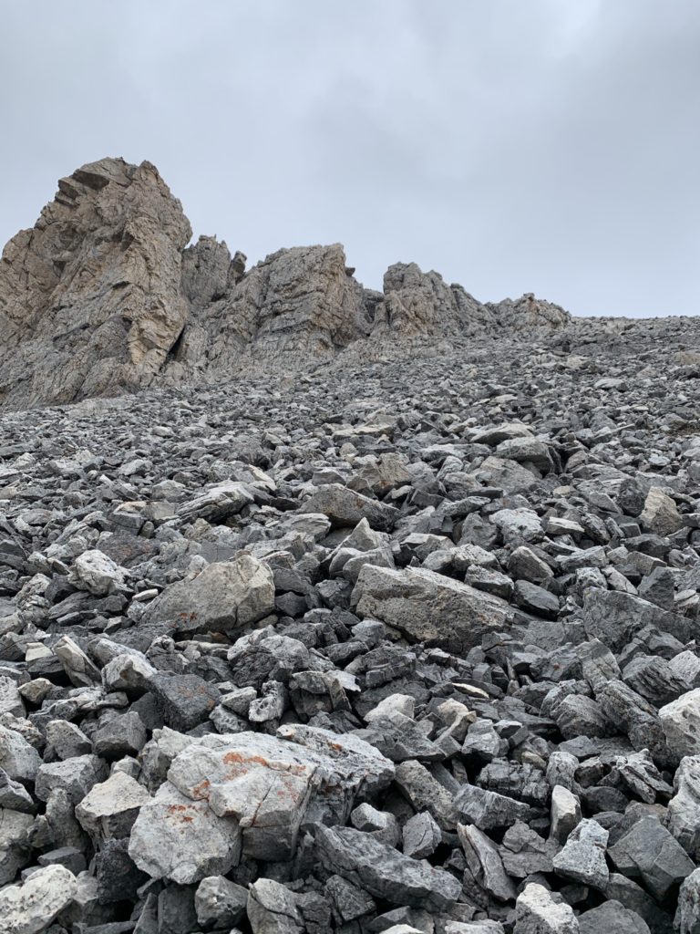
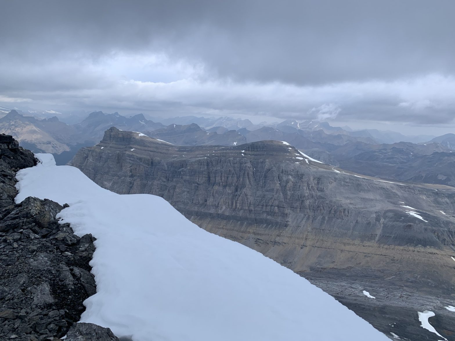
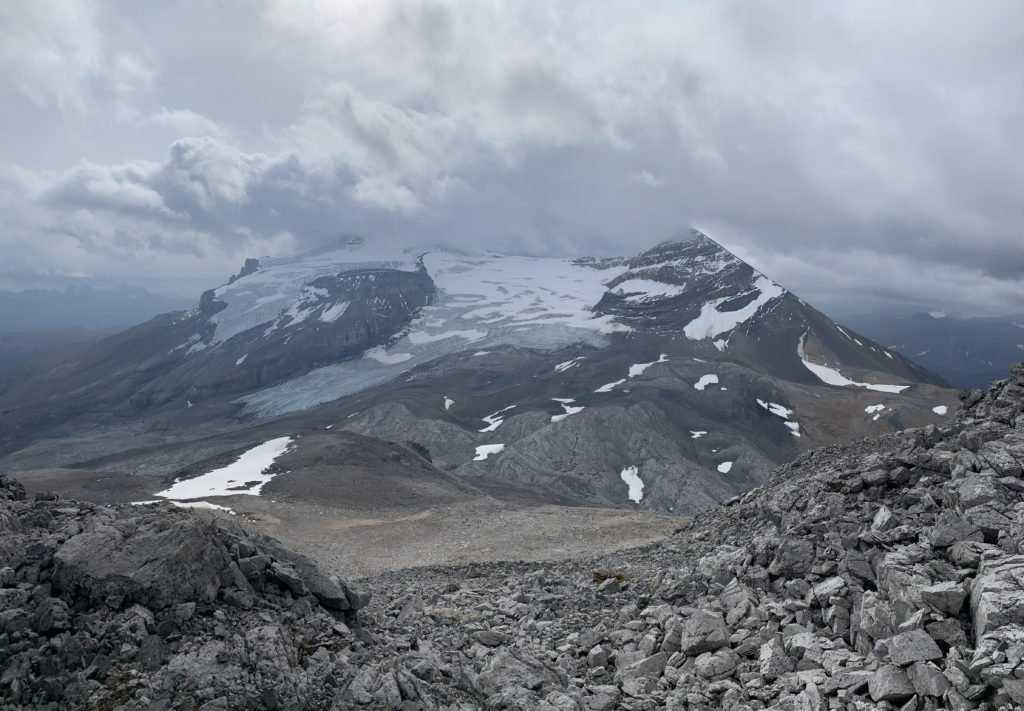
This part was slow going, but eventually, at around the 2700 meter mark we reached the first plateau. From here we were able to pick an easy route up a big talus and screen slope and pushed on. Thankfully the second slope was mellower and much easier to ascend. When we hit the ~2850m mark there was another plateau and the final slope to the summit became visible. We took a break here to have lunch and check out the surroundings.
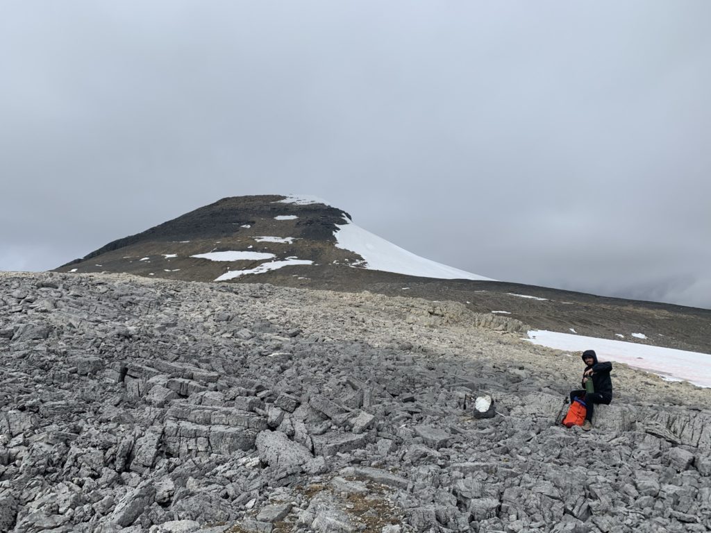
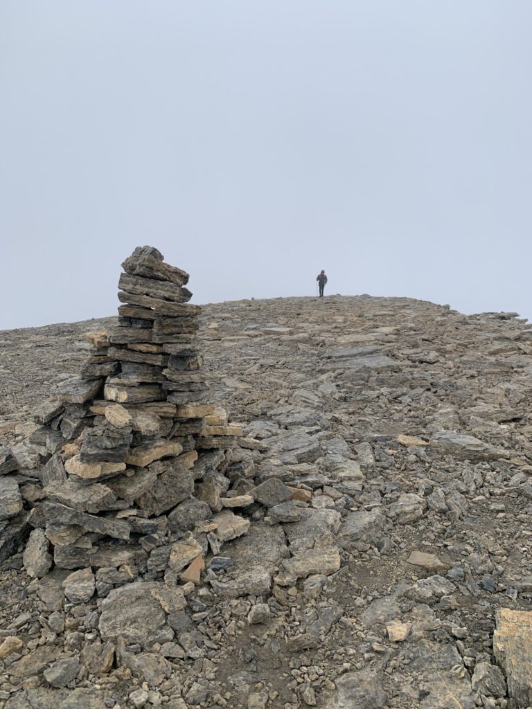
Both of us were feeling pretty bagged by this point, but the summit was within reach and all that stood between us and it was one last talus/scree slope. We made our final effort up the hill and reached the summit cairn around 1:00pm. The clouds were now covering the top and it started to drizzle rain. We took a few photos and then started the long trip back to the bottom.
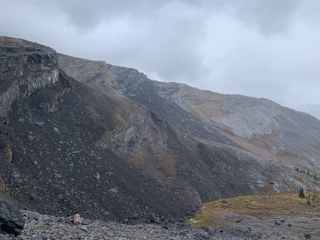
I was concerned the rain would make the rocky descent slippery and dangerous, but in fact the rock was very porous and had no effect on traction whatsoever. We back tracked our original route down the third and second slopes, but for the first slope decided to follow some cairns we missed on the way up. This route produced a much tamer ascent/descent approach up the first slope… too bad we hadn’t found it on the way up. We made quick ground on the way down as a fair bit of the slope was loose and you could essentially just run down it.
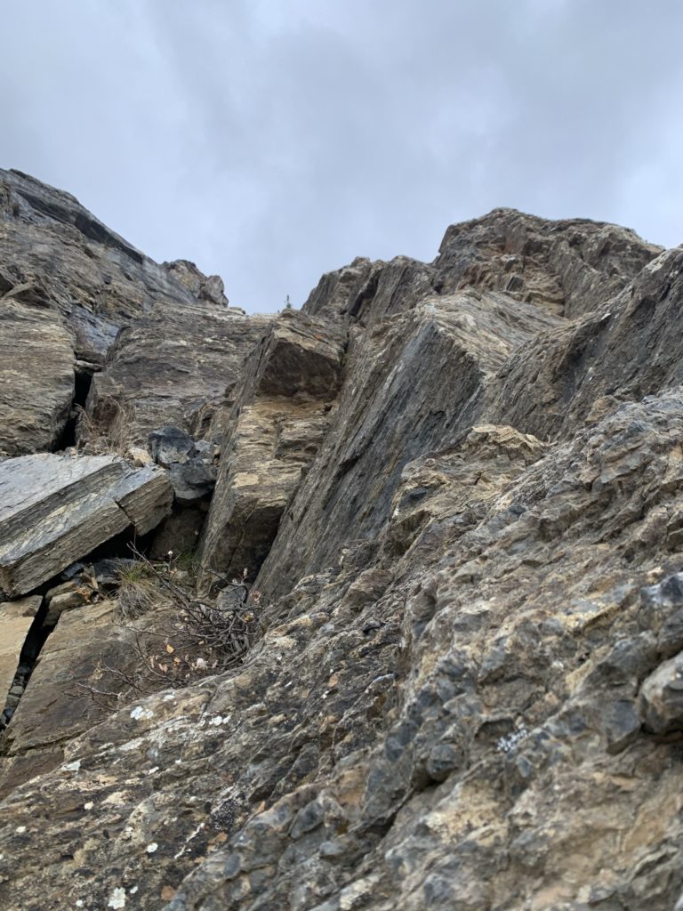
Now we continued along past the tarn and stuck to the bottom side of Mount Andromache. We followed an established path all the way back to the cliff band just above the forested section of trail. Here we ran into some issues finding our original path up. It seems, in the darkness, we had ascended a fairly exposed route and neither of us were keen on down-climbing it. We did a bit of searching and found a tamer route down, but it still required some careful foot placement and stemming to reach terra firma again.
At last we were back on the forest trail. It’s a short 1km back to the car and it took us no time to reach the parking lot. It was a great feeling getting two amazing summits in one day and lots of fun scrambling throughout. It was now a 4 hour drive back to Kelowna, but the sun was still up and no issues with traffic. Another fantastic weekend with 3 peaks down!
If there’s one thing I can appreciate about scrambling in the Rockies it’s the amazingly short approaches. A kilometer or two and you’re already above the tree line and surrounded by unprecedented views!