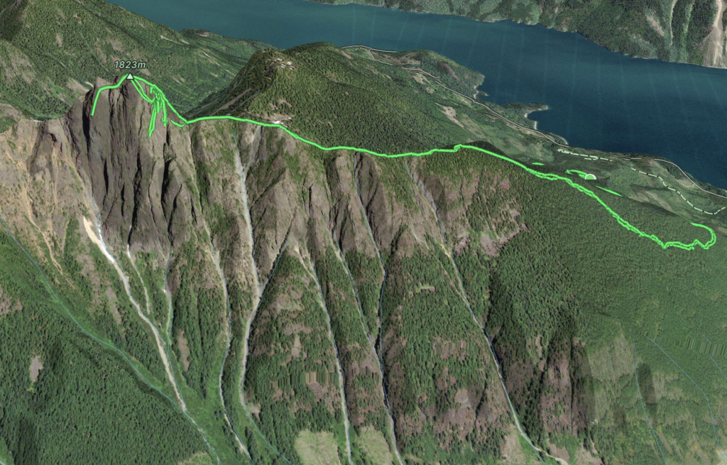
Elevation Gain: 1,589m
Distance: ~15km (GPS was skewed from the ramp section)
Total Time: 14 hours 35 minutes
Date: June 3rd, 2023
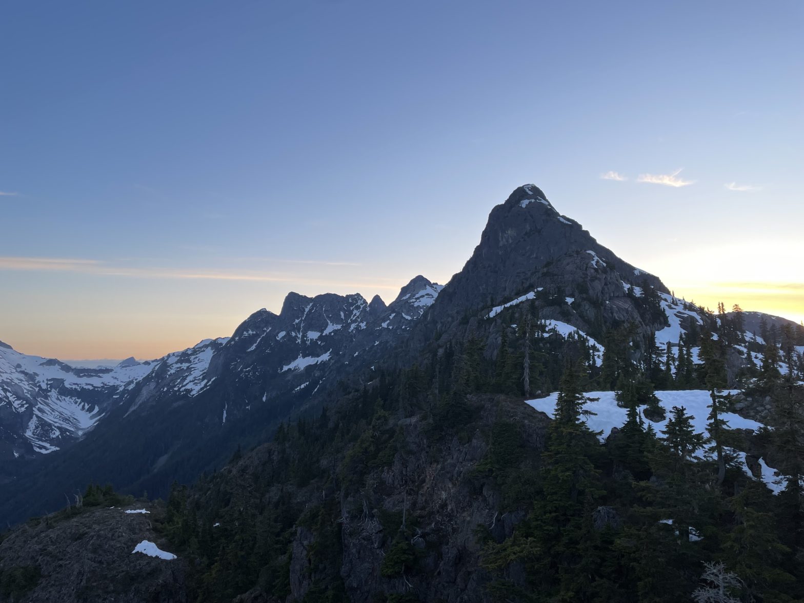
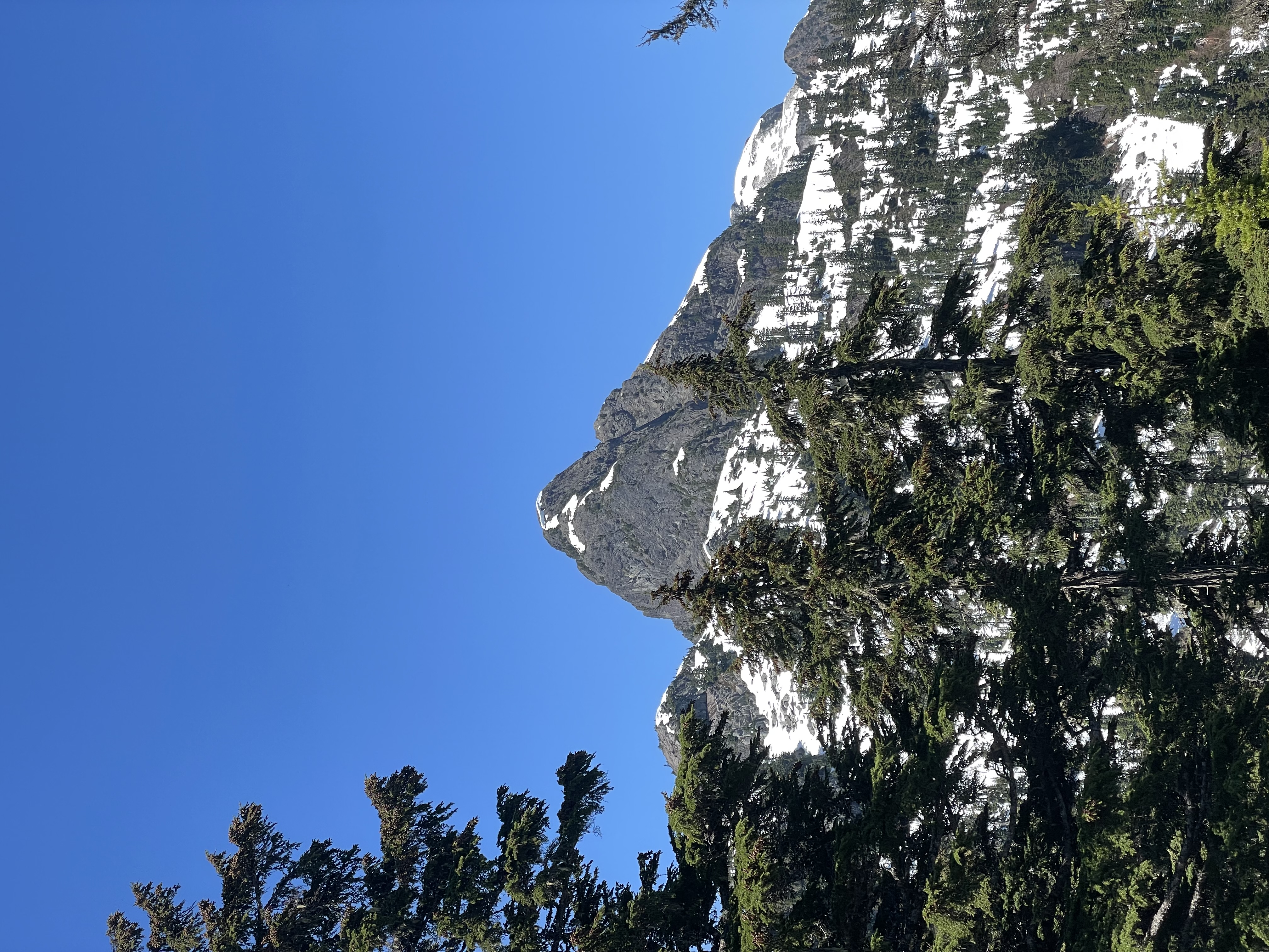
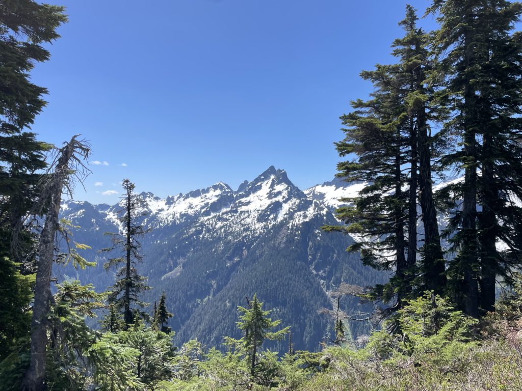
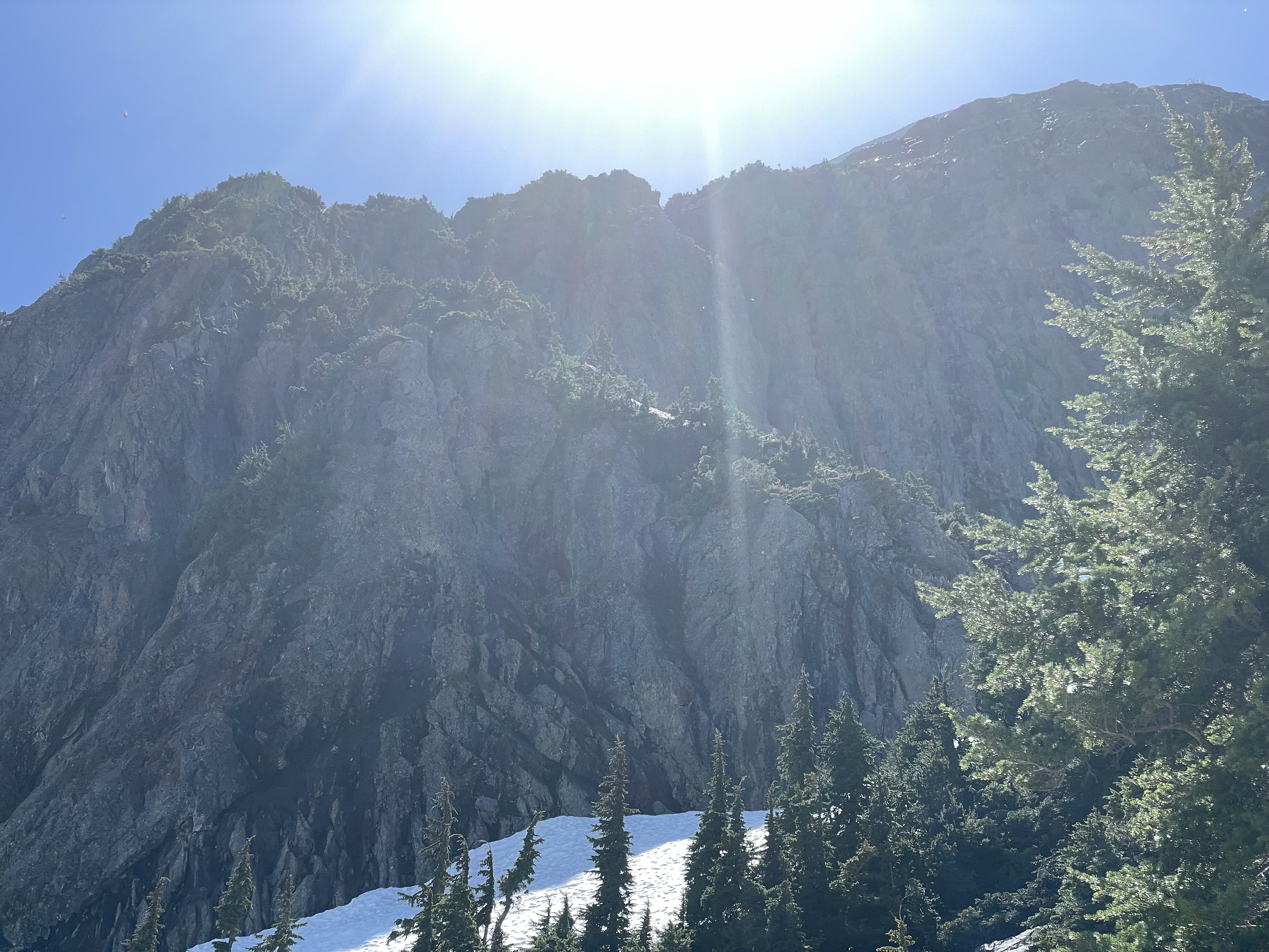
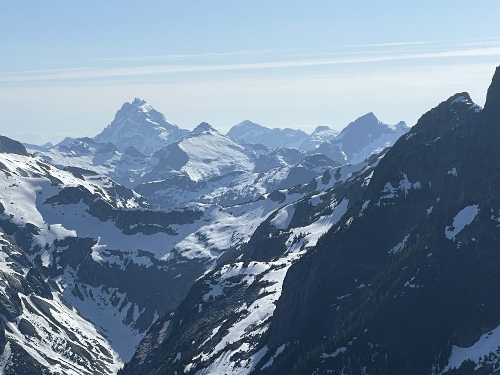
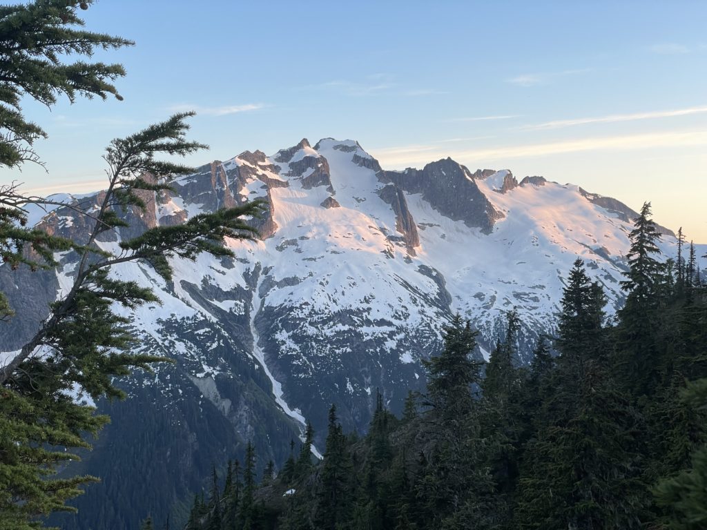
Hidden away up the trio creek valley lies a prominent and imposing set of rock spires known aptly as the Trio Creek Spires. This area sees few visitors, but most come for the much higher Grainger Peak. En route they are able to see the steep south face that seems to offer no easy way up. Personally, I saw them for the first time from across Harrison Lake, while ascending Mount Breakenridge. Just visible in the foreground of Grainger stood a sharp fin of rock that appeared steep and challenging from all angles. I was immediately captivated and discovered later that these were in fact the Trio Creek Spires. Further research turned up virtually no results. I found a few excellent photos of the south side from Grainger and Doctor’s Peak reports, but no trips on the spires themselves.
The only mention of an ascent was one obscure post on super topo mentioning that it had been climbed once, maybe twice (perhaps there is a report somewhere, but to date I’ve not found one). With almost no beta to speak of and perhaps less than 5 ascents ever, I pushed this summit to the top of my list. My original plan was to go for the similarly obscure Doctors Peak and get a chance to scope out route options on the way. However, in the first weekend of June the weather was looking superb and the recent satellite imagery showed the spires were looking sufficiently snow free. Furthermore, I discovered a new spur road had been built in late 2022 that travelled up to 950m and could bring us to within ~2.5km of the spires from the east ridge. I decided then and there to make an attempt on it, knowing there’s a good chance to fail. Andrea was of course on board and we managed to recruit her strong climbing friend Mike which would bolster our chances of success.
Most accounts of the south face indicated poor-looking rock quality and steep technical faces. With that, I figured we’d need to haul up ropes and trad gear and in case the rock offered limited protection, some pitons should we need to bail with no other means. There’s still substantial snow on the north aspects so we’d bring ice axes and crampons as well. A few evenings before our attempt, Mike produced a highly detailed (10m resolution) LIDAR based topo-map and that changed the game for us. It indicated the most aspects of the summit including from the west looked quite technical (especially if the rock quality turned out to be poor). However from the east side there was a gully that we could descend, traverse around and reach a hidden ramp with lower angle terrain. I still thought a direct ascent up the East face might be possible, but this gave us an excellent option should it not go.
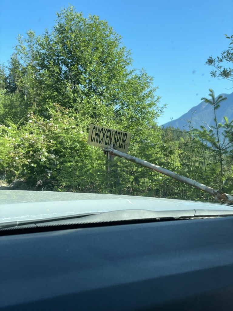
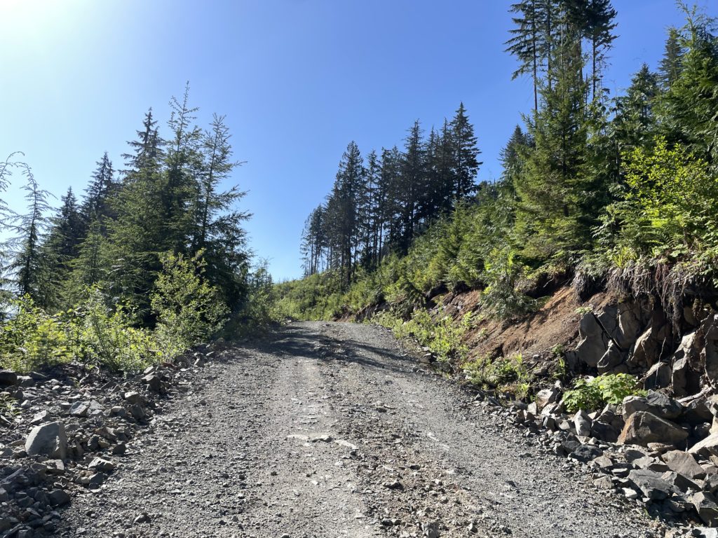
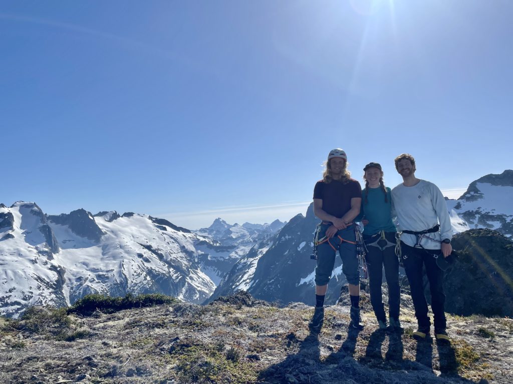
On Saturday morning, Andrea and I left Vancouver around 4:30am and picked Mike up in Chilliwack. We then drove ~49km down Harrison West FSR before reaching the Trio Creek turn off. There have been frequent reports of a locked gate, but thankfully we passed through with no issue. The next step was locating the spur road that would take us to the new extension I spotted on the satellite images. It was initially a bit challenging to find, but we did eventually locate the “Chicken Spur”, as it was labelled, and drove as high as we could.
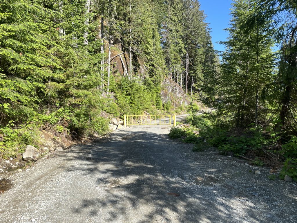
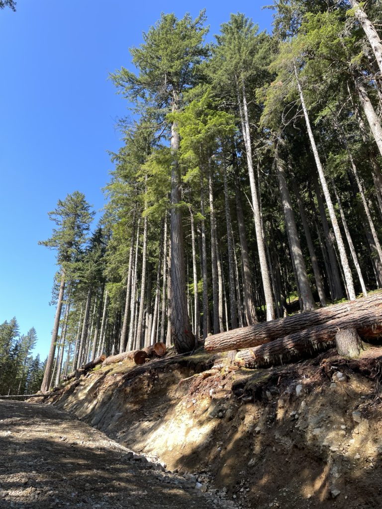
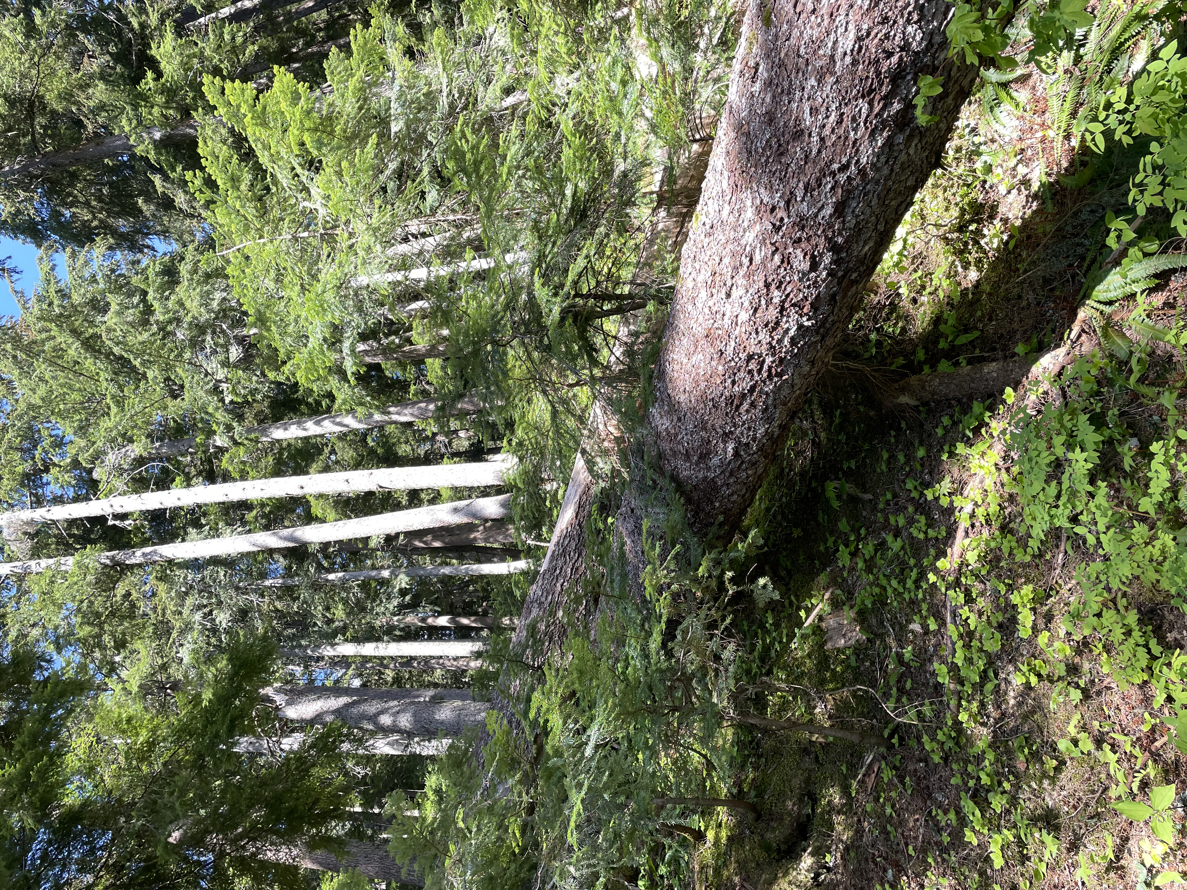
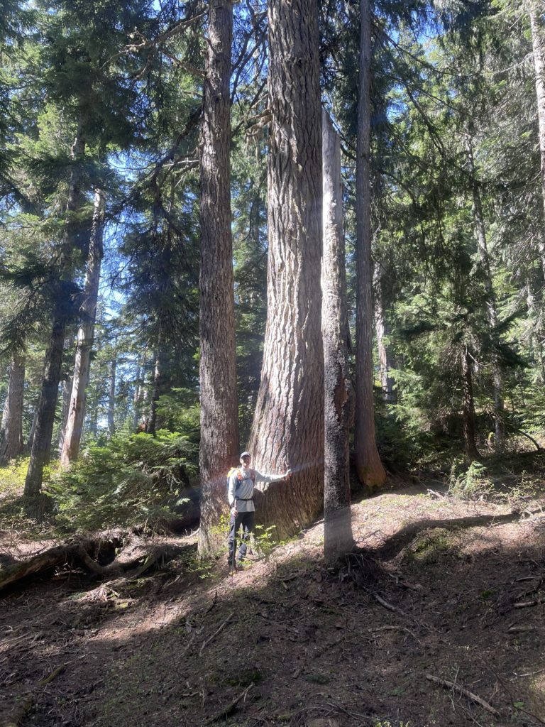
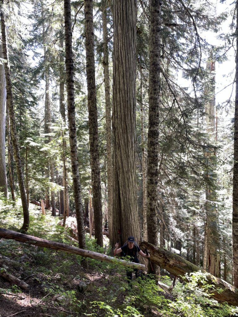
Unfortunately, we hit a locked gate around 2km in, but that still eliminated 600m elevation and 4km one-way of road walking had the lower gate been closed. We set out on the road climbing up the numerous switch backs and thankful for all the bush whacking we were getting to avoid. At around 750m we reached the new extension and walked alongside large, pristine old growth forest that was marked for logging. It was a shame to see as the trees were really magnificent. We pressed on to the end of the road and then had a lunch break.
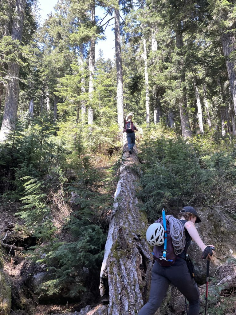
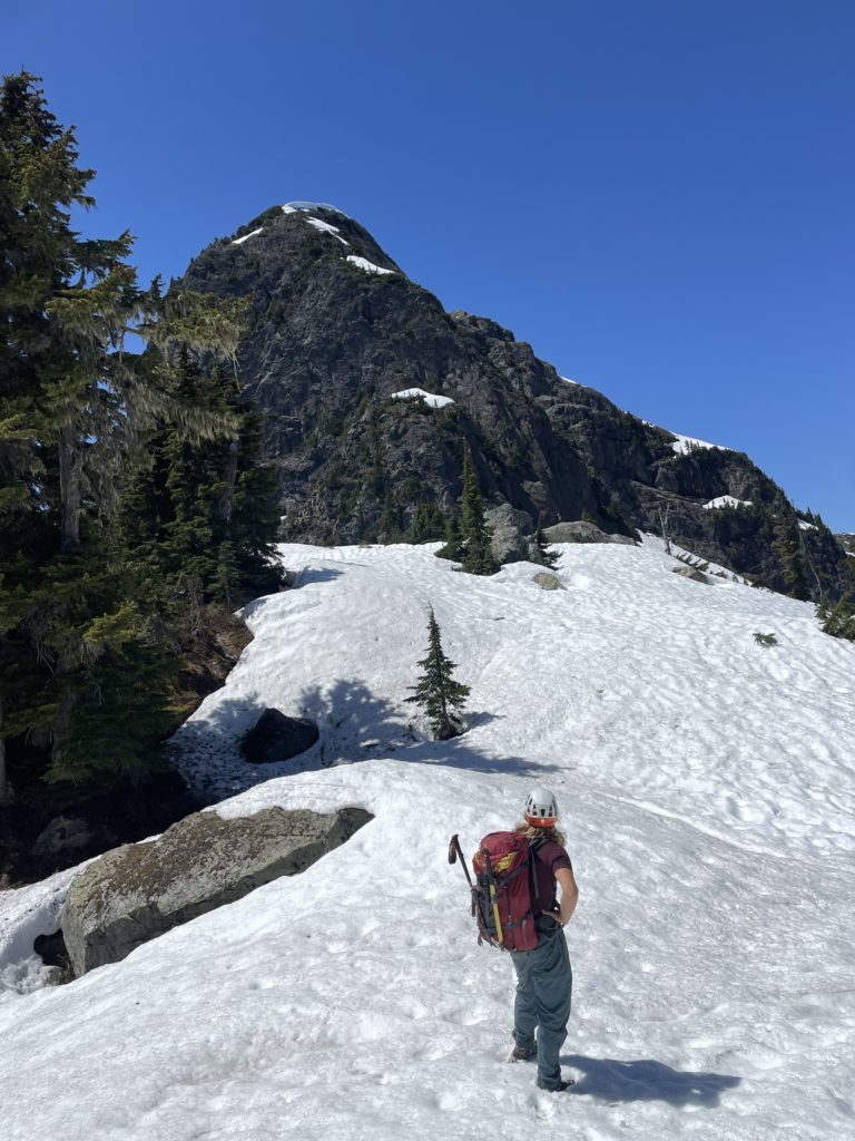
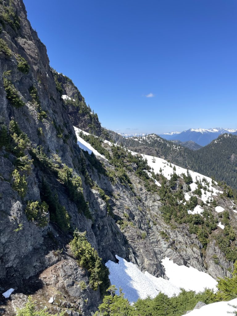
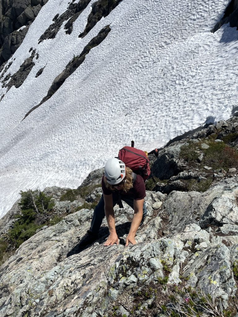
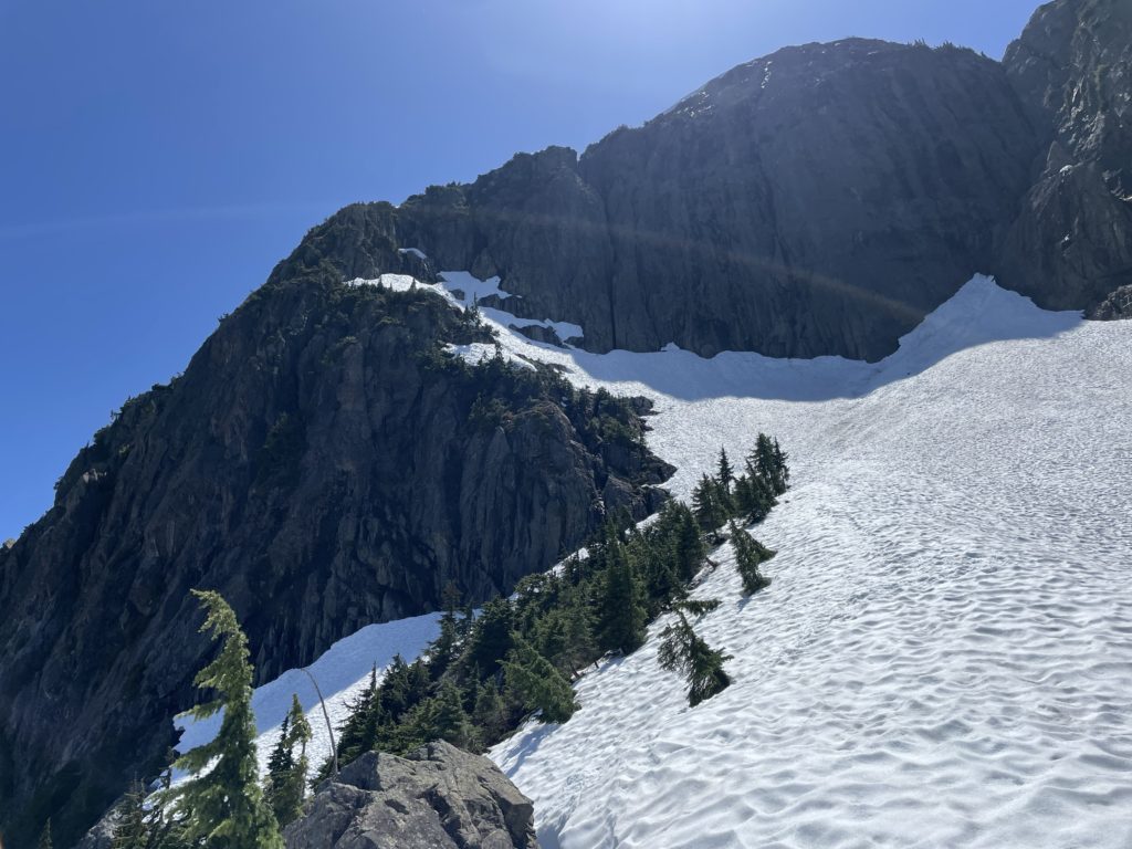
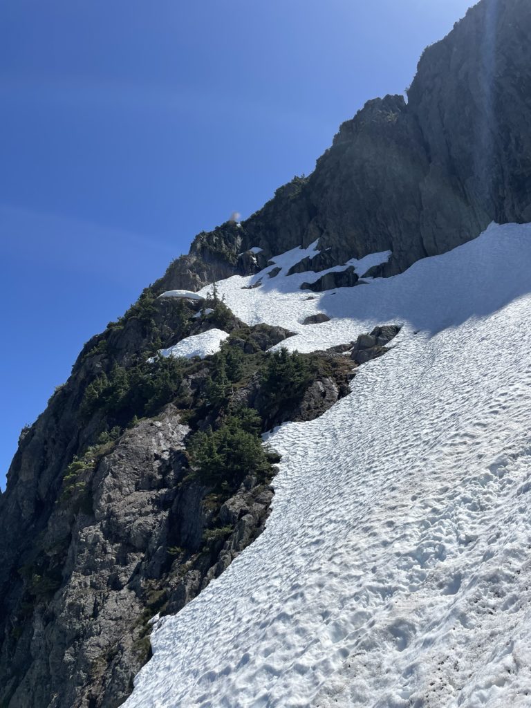
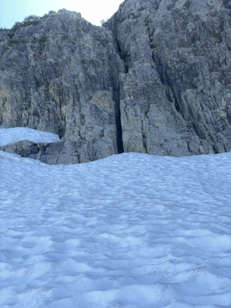
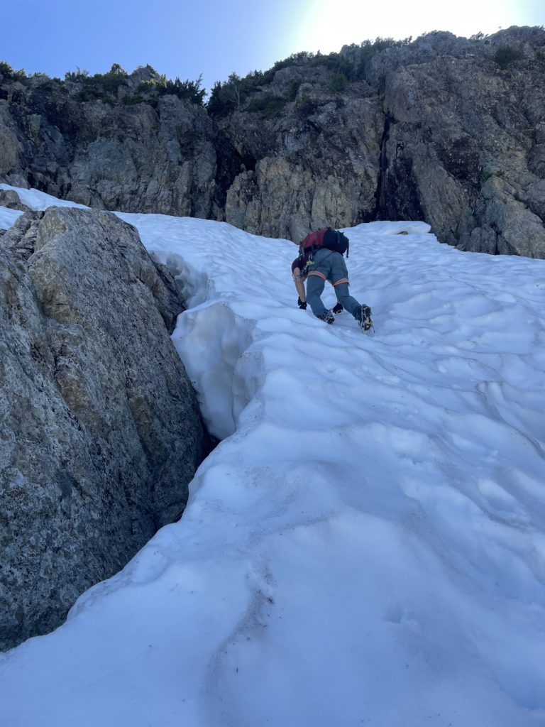
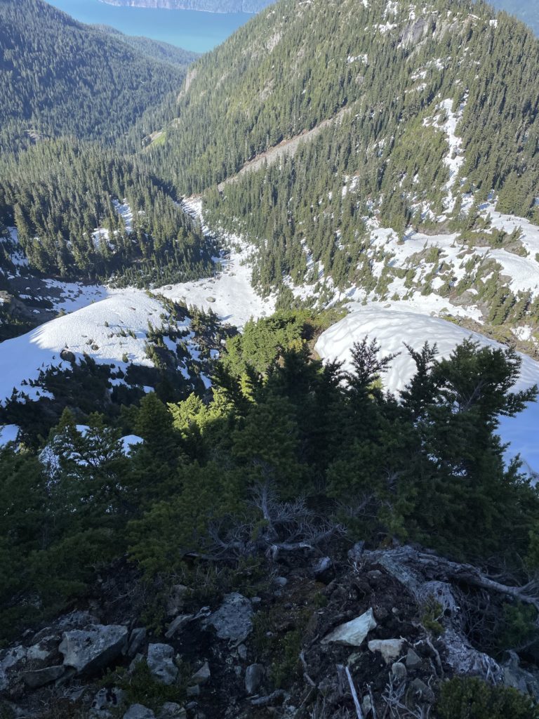
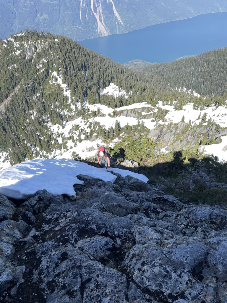
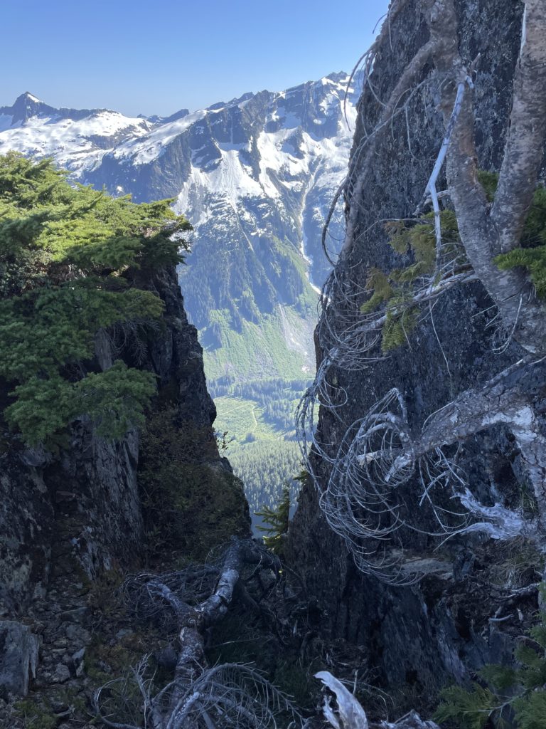
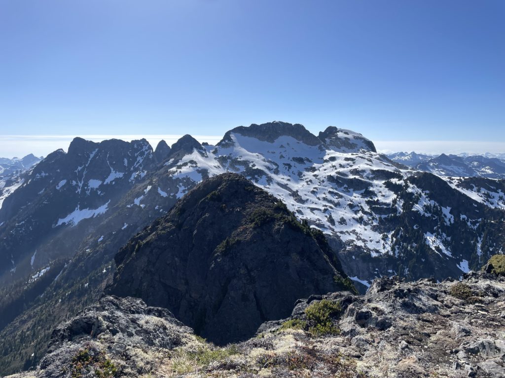
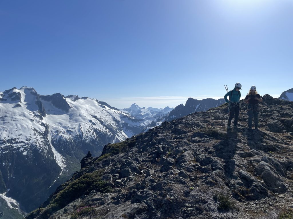
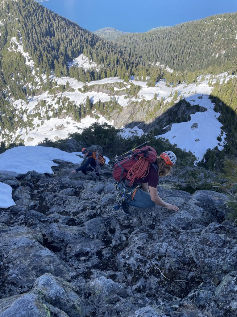
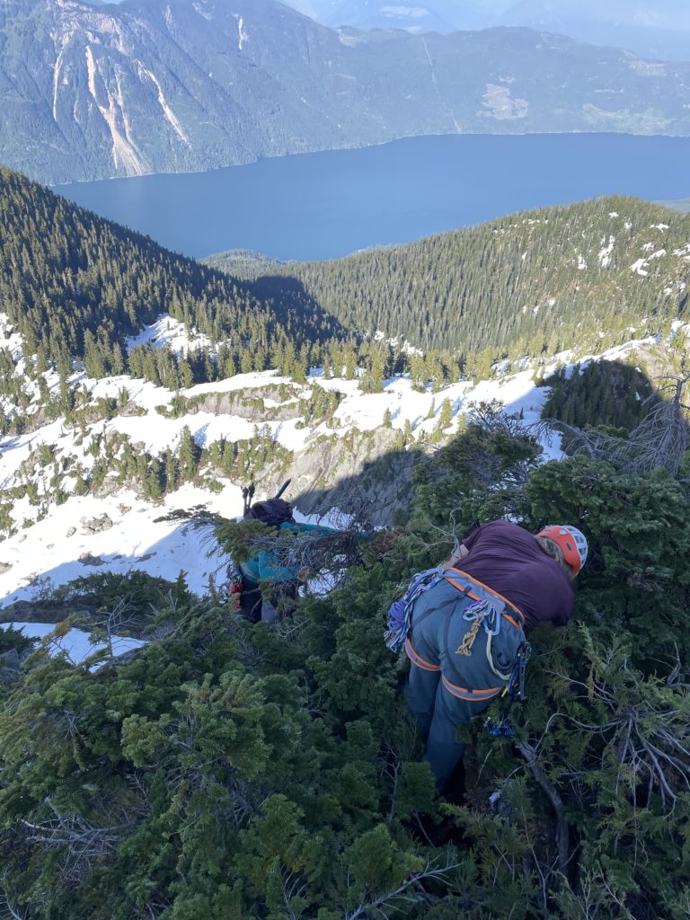
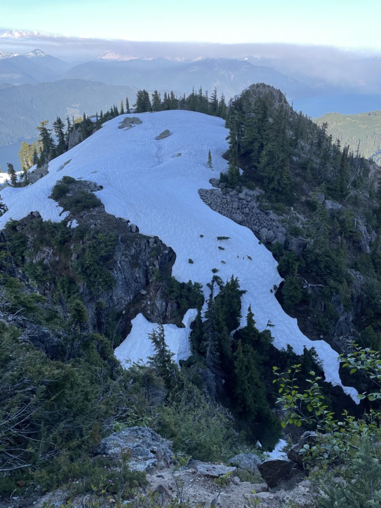
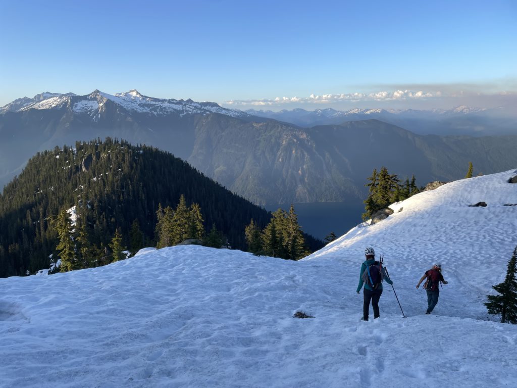
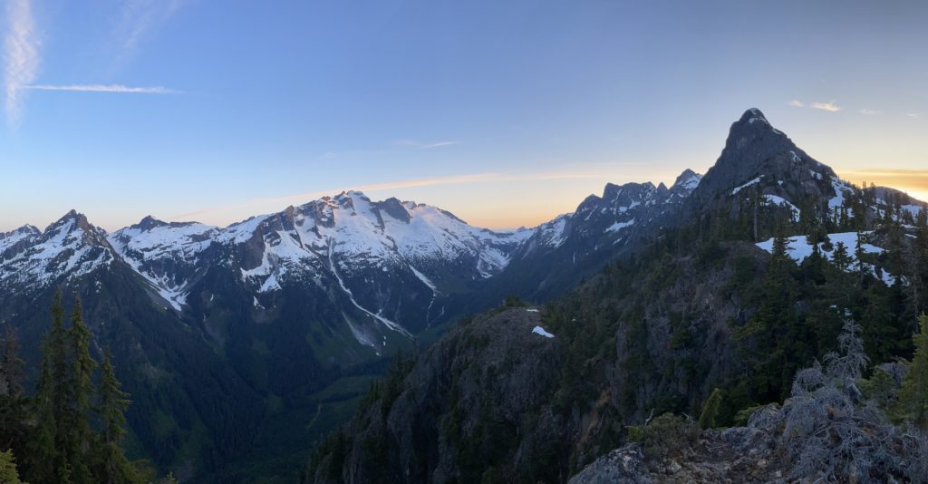
From the road we bushwhacked for a short ways until the terrain opened up into typical old growth under-canopy terrain. Mostly bush free and easy walking. Mike lead us up through the forest to gain the obvious east ridge. Once on the ridge we found nearly continuous snow that made for even more pleasant travel. At around the 1400m mark a gap in the trees gave us our first good look at the East face. Indeed it was incredibly steep from this side as well. The route had significantly more krummholz than expected and that was a good sign for natural protection, rappel anchors, etc. It was somewhat reminiscent of the East/West Lions in appearance. There was still another 2KM of ridge traversing to the base of the summit, but there were relatively few ups and downs. A single notch with an easy bypass posed the only minor issue on the way and by 1PM we were at the base.
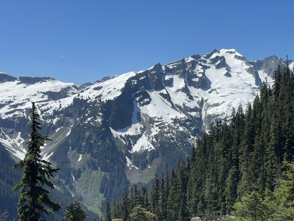

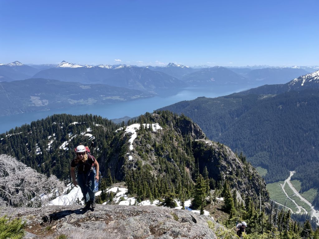
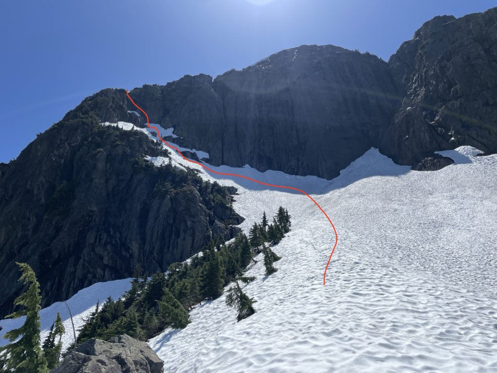
Now directly under the East face it looked like all mid 5th class terrain. There first third of the route looked like low 5th/4th class climbing, but at the top of that was a vertical crux to gain the ridge. Some ramps seemed to offer a weakness out, but we weren’t sure if it would go. As a result, we opted to try the ramp option we’d found on the high-res topo and if that didn’t go we could return and give the direct east face an attempt.
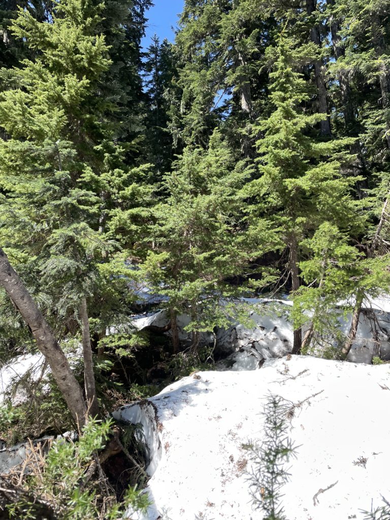
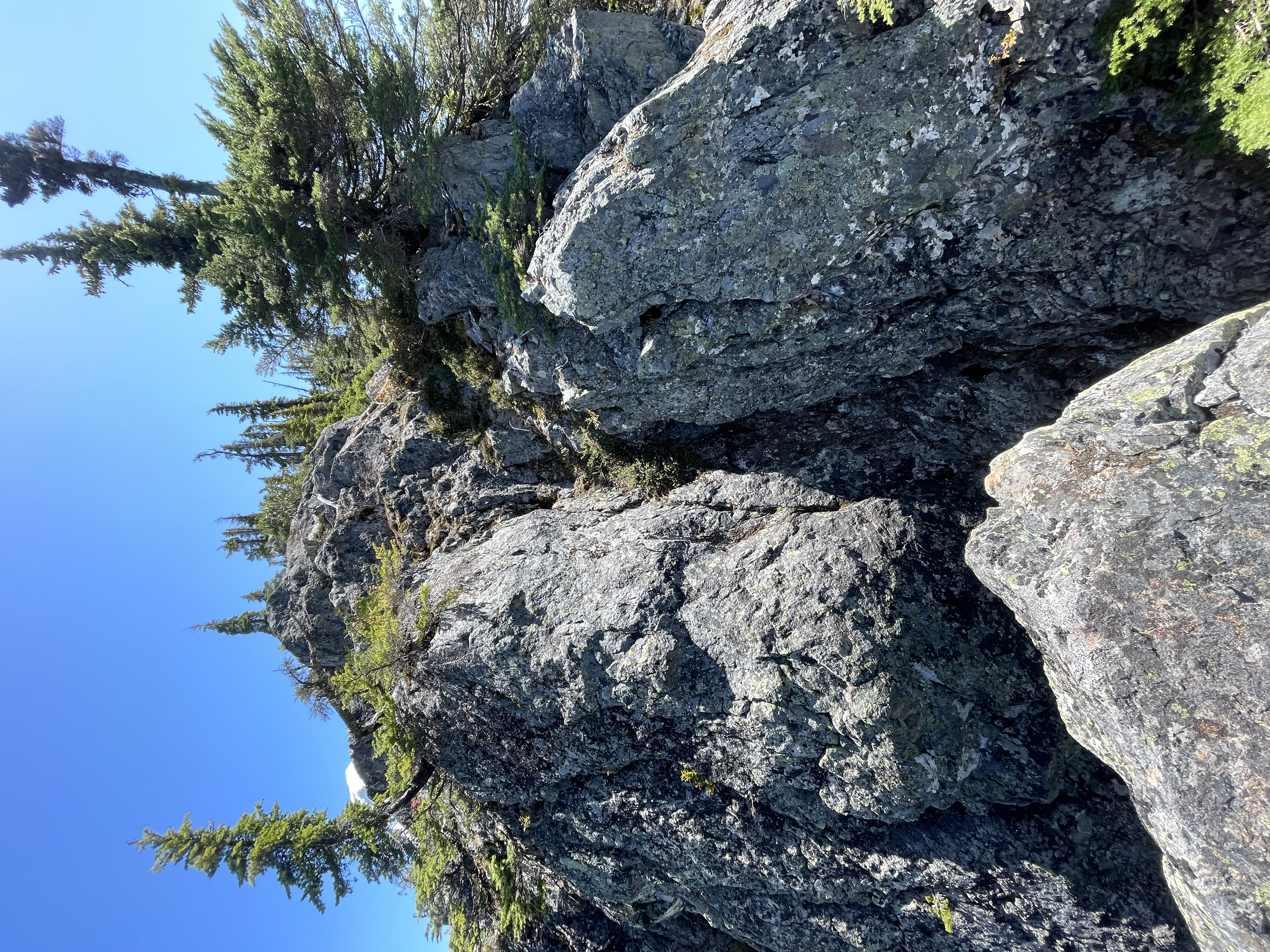
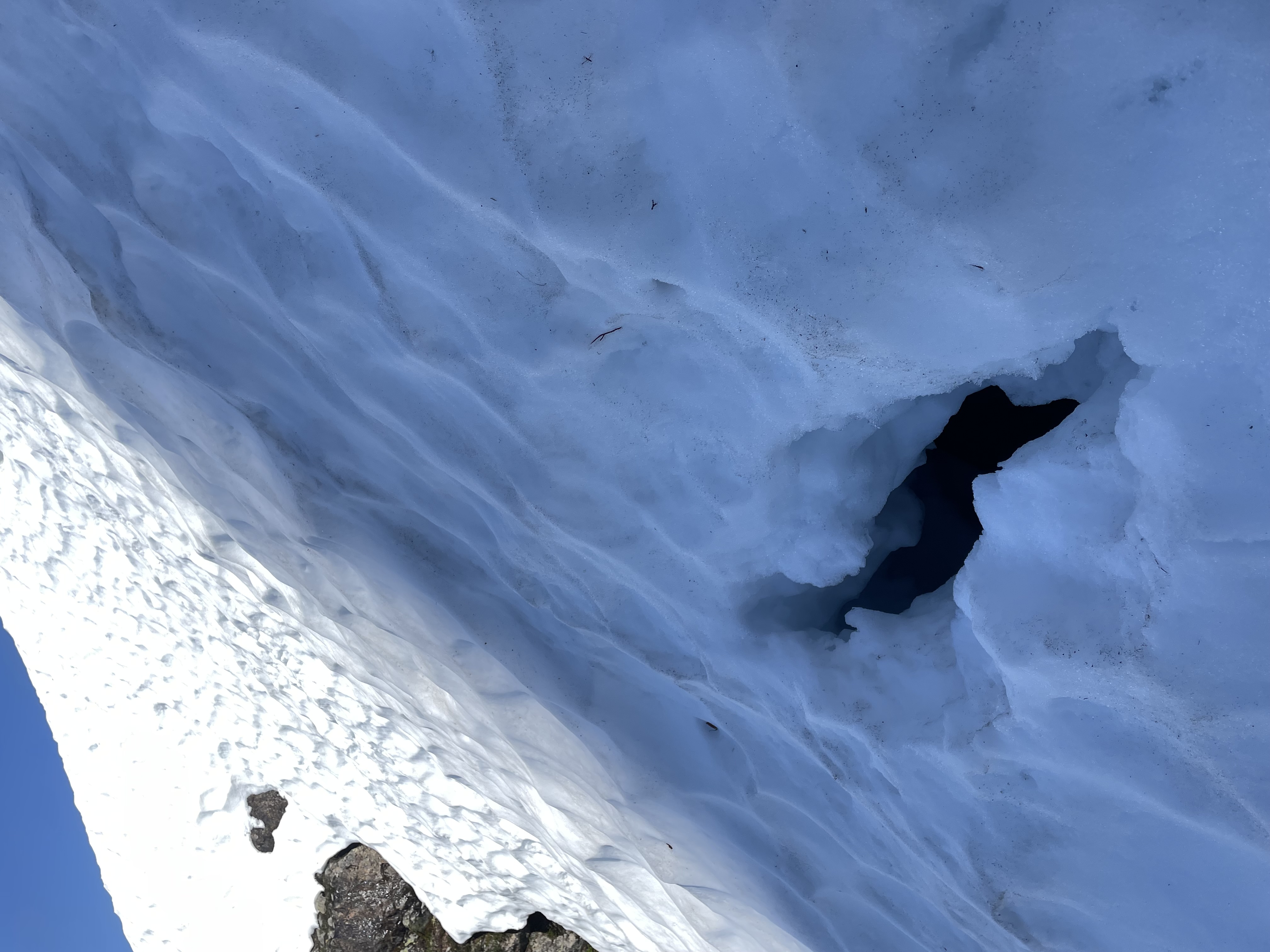
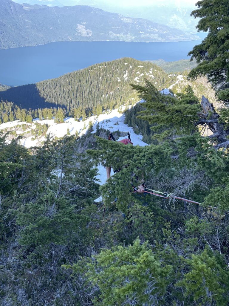
The gully we mapped out was still snowed in, but not very steep so we simply brought the axes out and started our descent. Once we dropped enough to get around the massive head wall on the north side we traversed over to a bluffy mini-cirque of sorts to gain the entrance of the ramp on the north west side. The mini-cirque was easy to ascend with ledgy slabs and then a short bushwhack to exit. So far on the route we had observed much better rock quality than expected and it was now looking likely that we’d have decent protection options should things get technical.
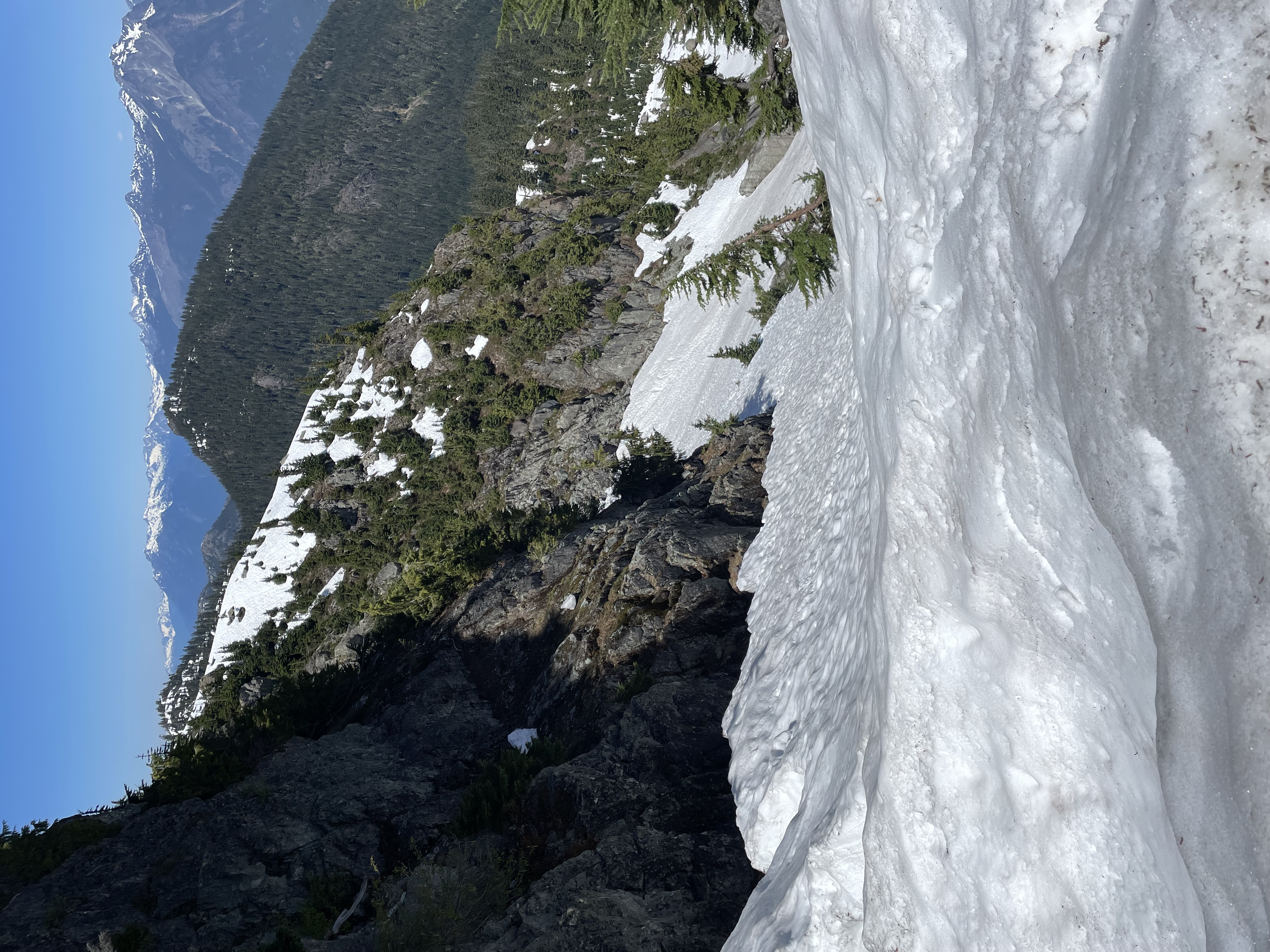
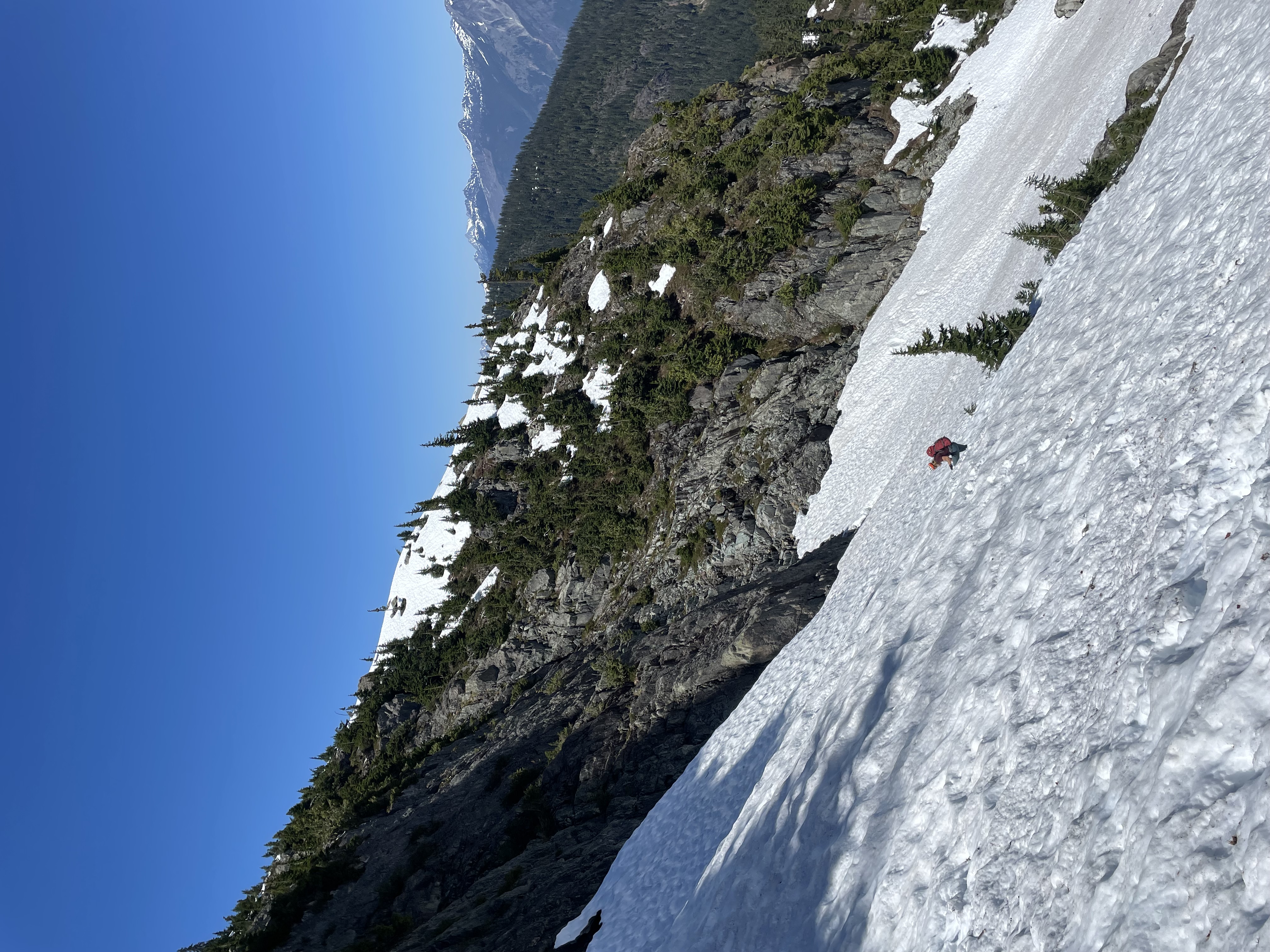
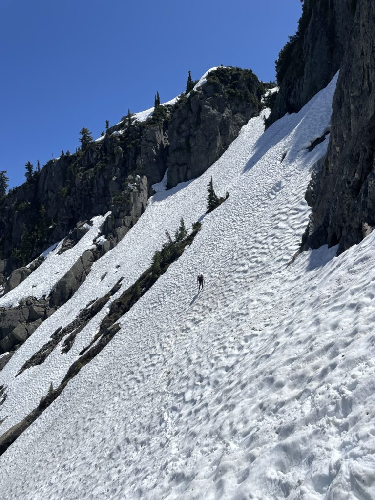
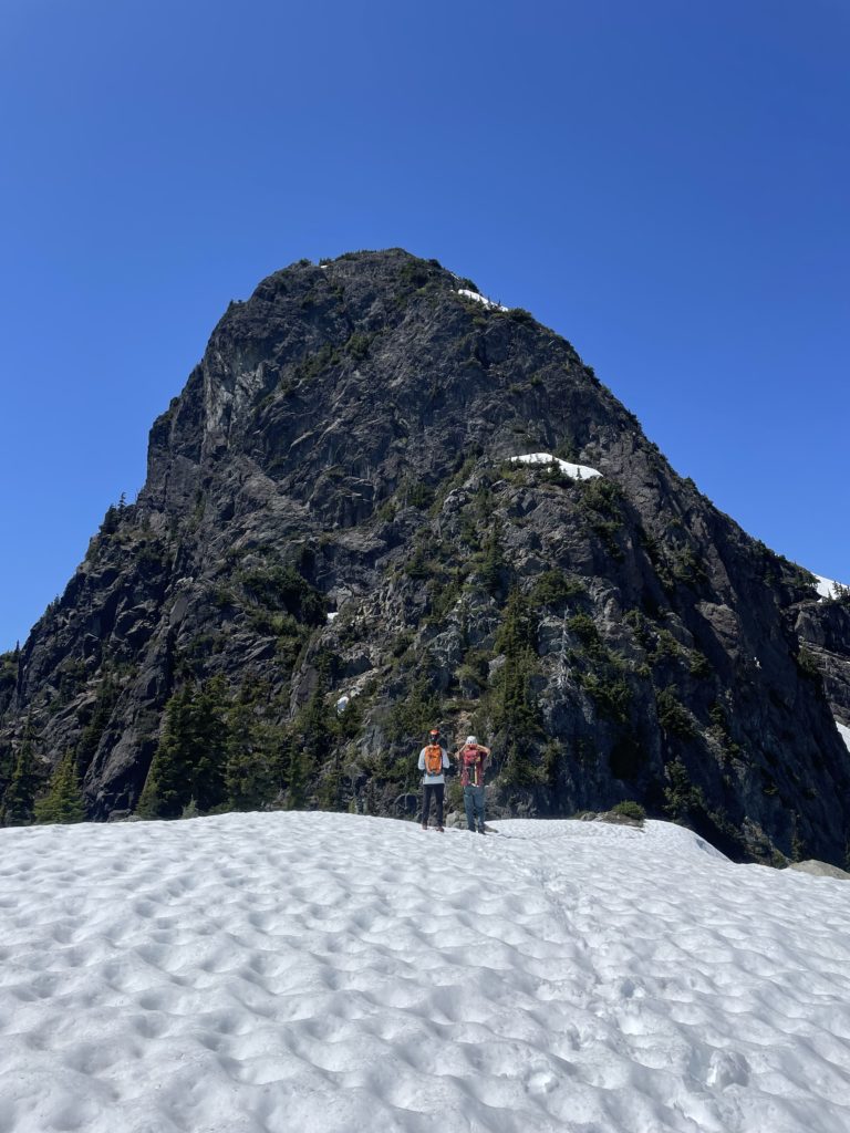
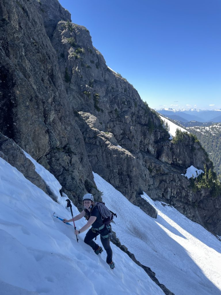
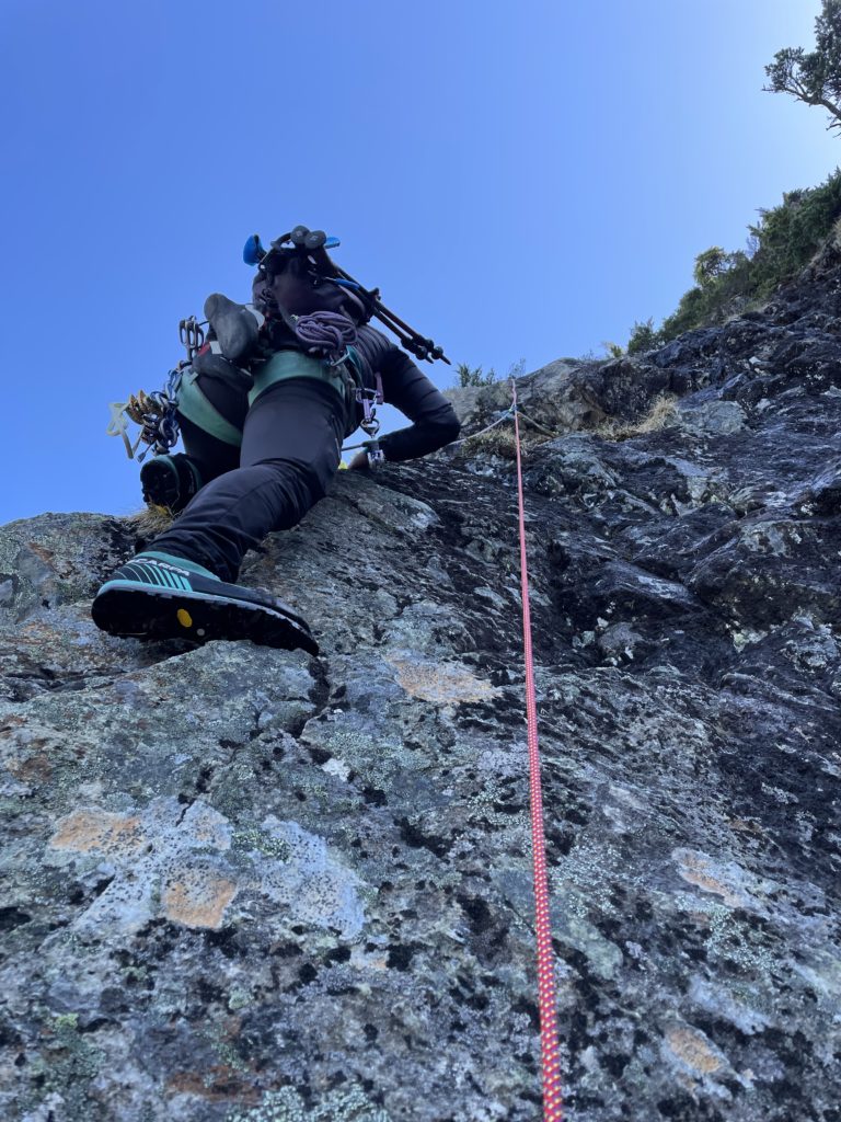
We were now at the base of the snow ramp and it ran quite high, almost directly to the ridge. There appeared to be one 15-20m pitch of climbing that we could then gain the tamer upper ridge line with. I lead the way up the ramp, initially without crampons and traversed across a semi-exposed section above the cirque. I was able to reach a dry rocky patch and opted to put on my cramp ons after I saw the route was going to steepen quite a bit.
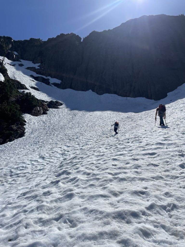
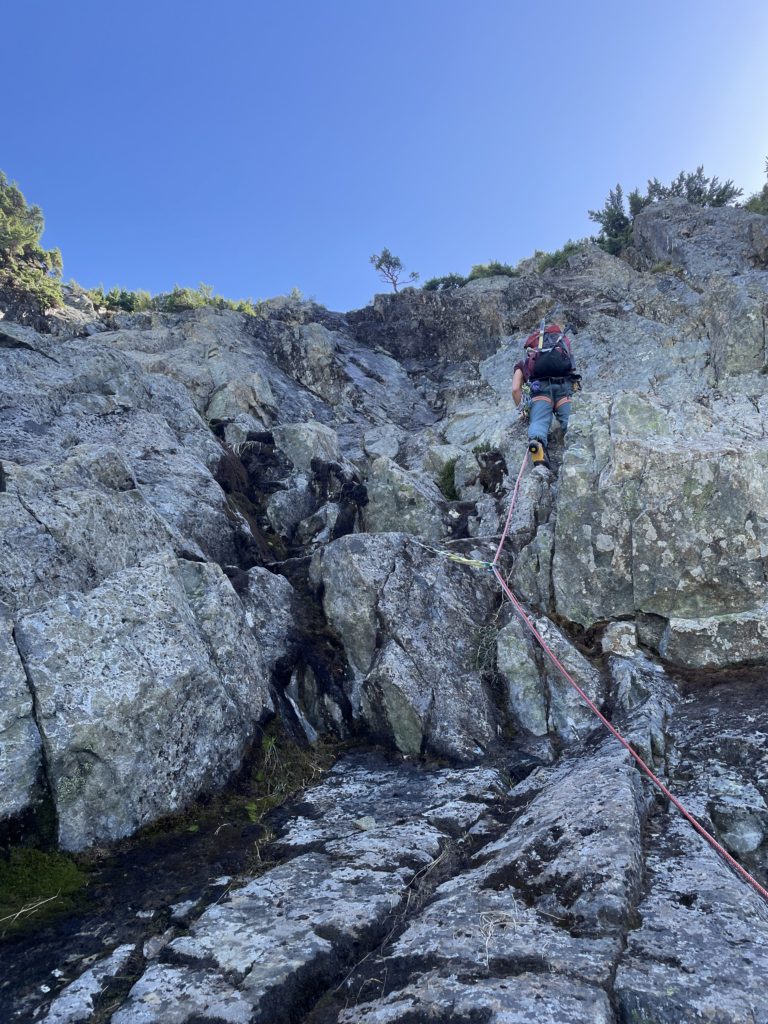
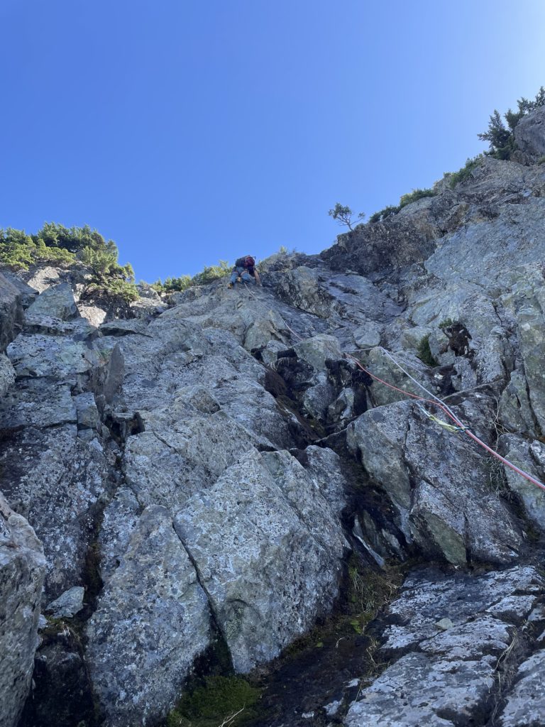
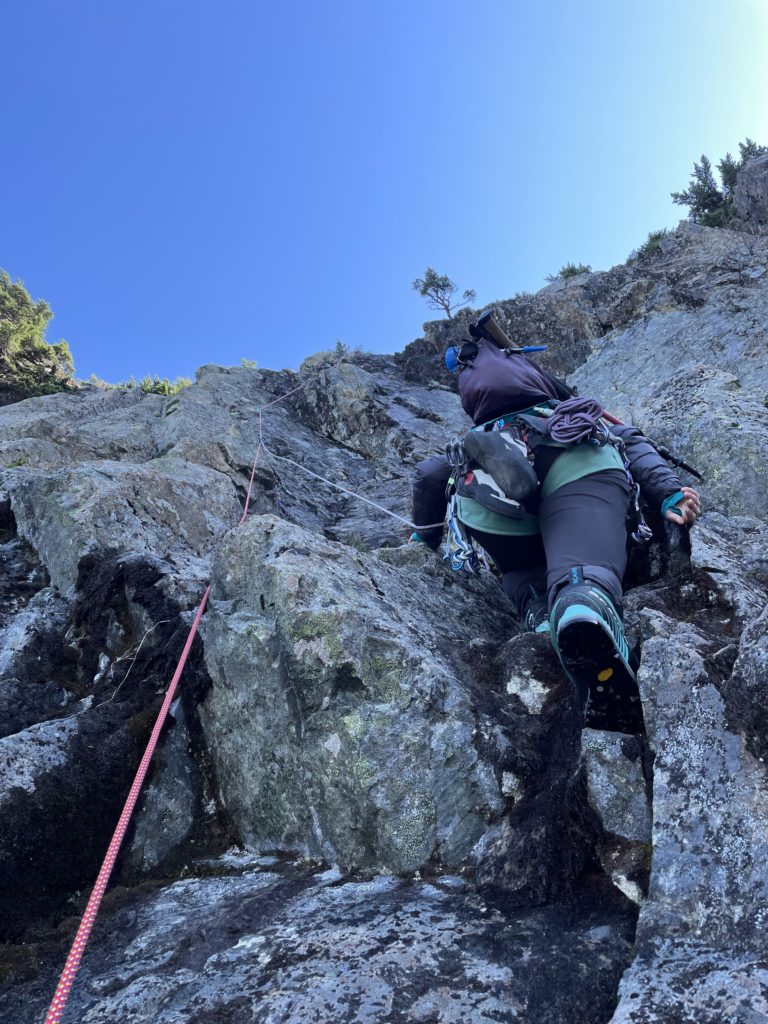
Andrea and Mike joined me at the rocky patch and then I started the lead up the ramp again. About 2/3rds of the way up I came across a set of of large glide cracks and guided Mike around to a more solid section. He then lead us up the final section to the base of the first rock pitch. The ramp steepened at the top to about 40 degrees with one short section around 50 degrees before we reached dry rock. There was a bit of an awkward downclimb to get into the channel between rock pitch and the ramp, but soon we were all three at the base.
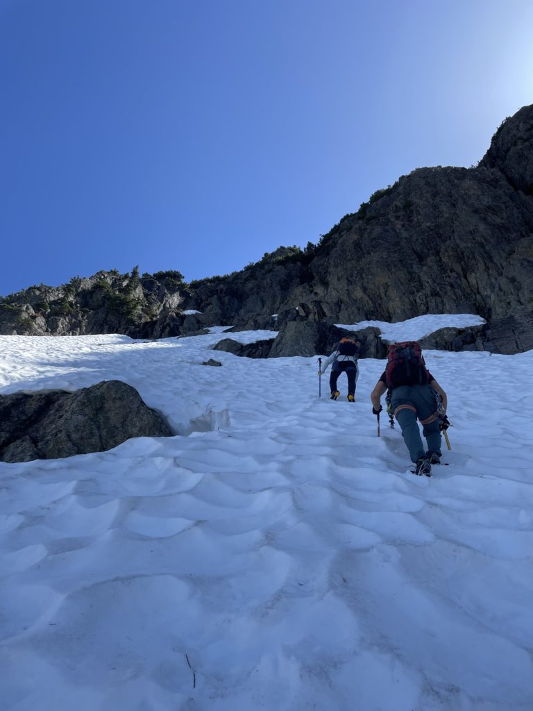
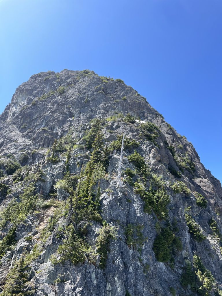
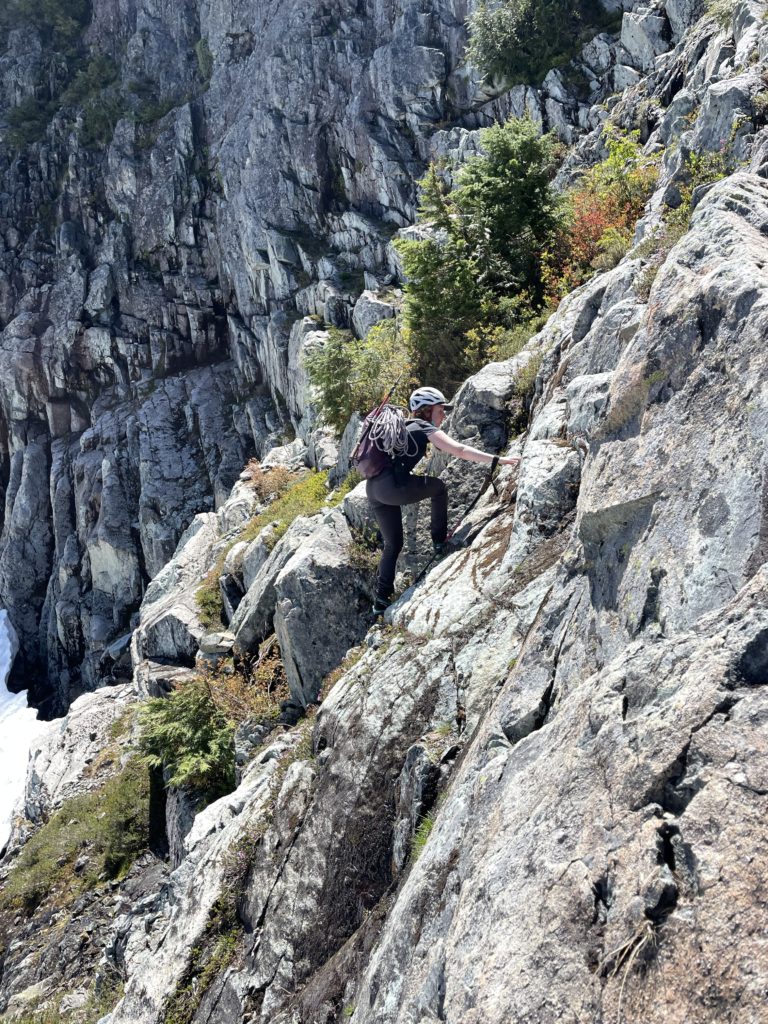
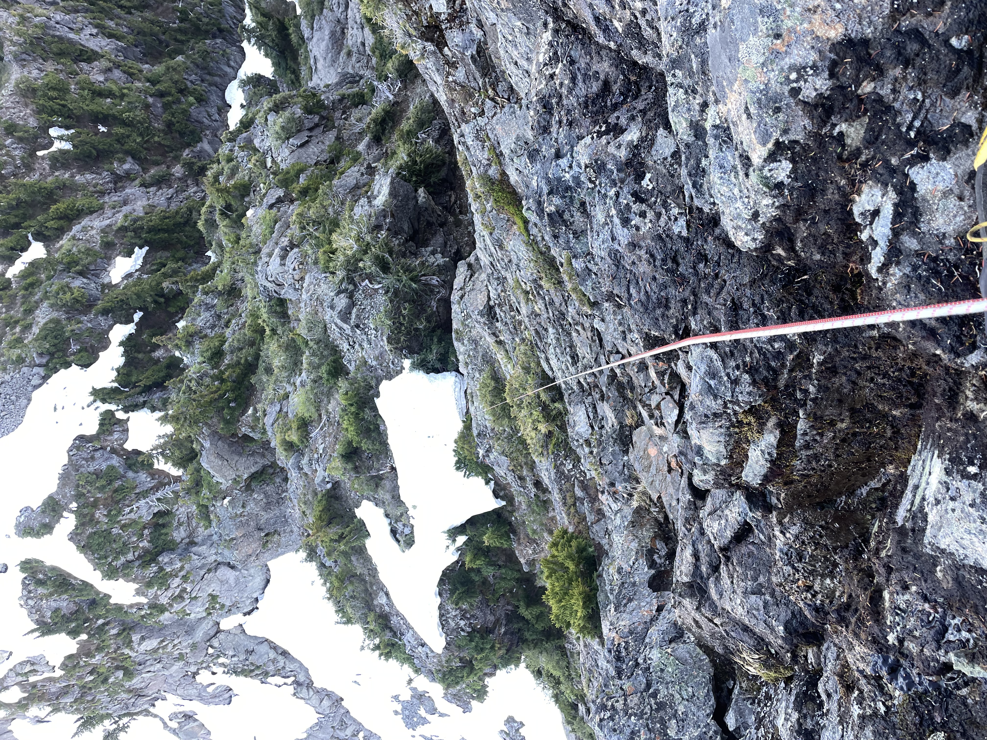
Mike was keen to lead and Andrea and I were happy to follow, so he geared up to start the first pitch. We had brought two 8mm x 60m ropes to enable long rappels and an easy system for climbing in threes. With everyone tied in, I put Mike on belay and he started up the rock face. As he climbed it was clear the rock quality was pretty good with a few chossy spots and manageable protection. The challenging part was actually dealing with the seeping and largely wet upper sections. Nonetheless, he lead a clean line up to the ridge and then Andrea and I followed up shortly after. The climbing proved to be fun and looking around I could see that most of the terrain on this side was bluffy and technical. Without the snow ramp, there would be even more of this terrain to cover, but I do feel it would be possible given the rock quality so far.
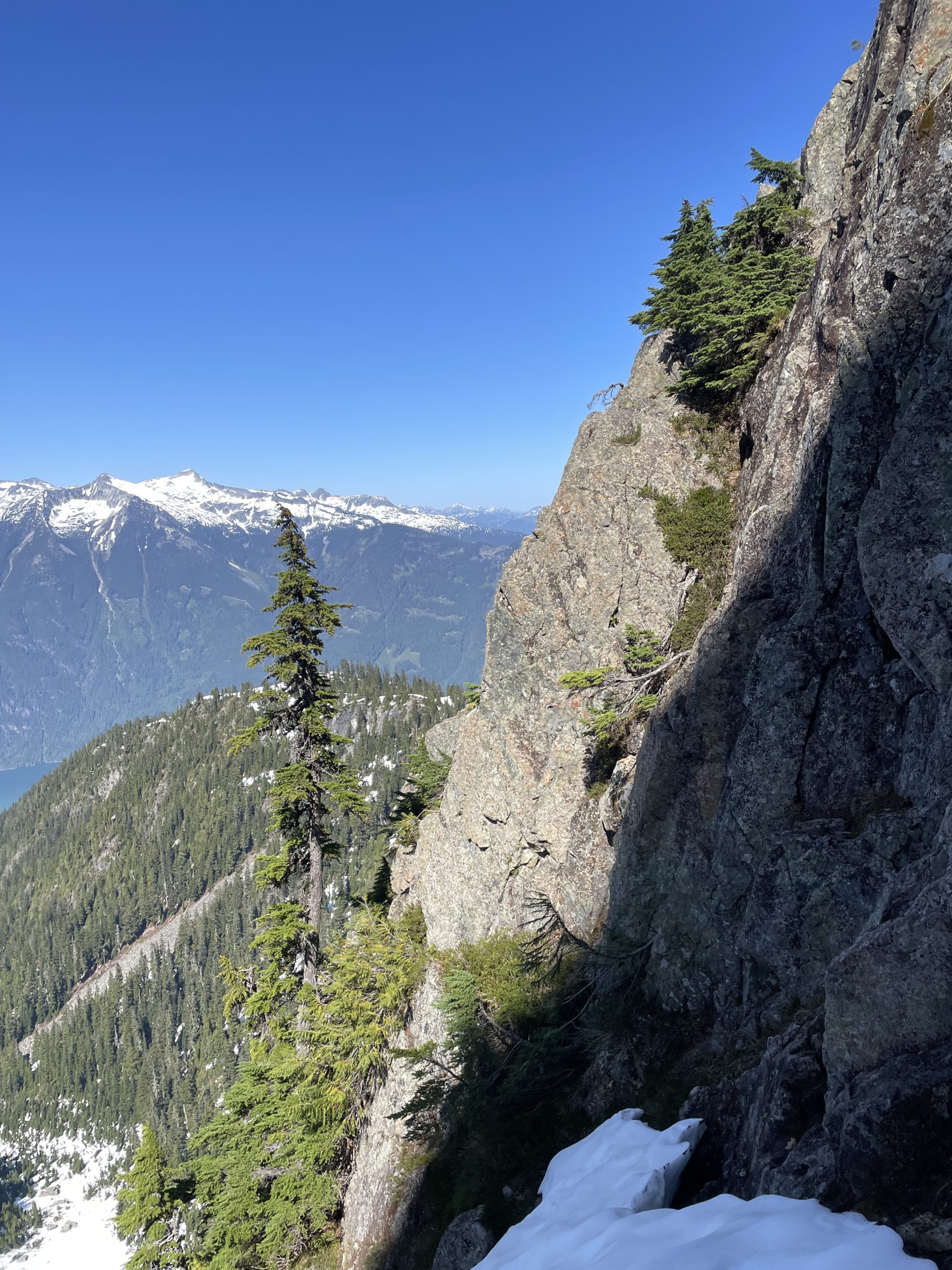
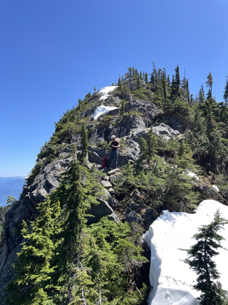
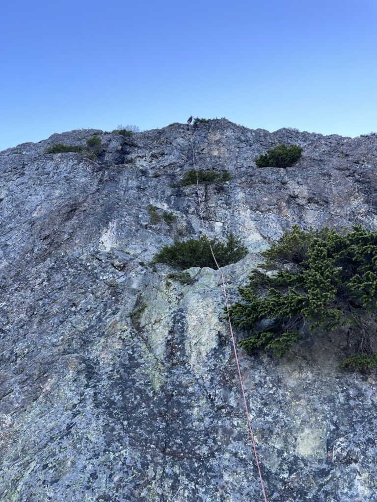
Once on the ridge, Mike lead a second “pitch” of mostly bushwhacking until the ridge opened up to scrambling terrain above. Save for a few steep steps, one could probably un-rope here if they felt comfortable in this type of terrain. Now with the remainder of the ridge opened up and seeming to be just scramble terrain, we packed everything up and headed up to the summit. Sure enough, there were no more difficulties left and we topped out to some unbelievable views.
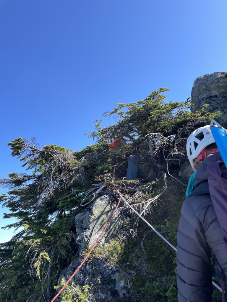
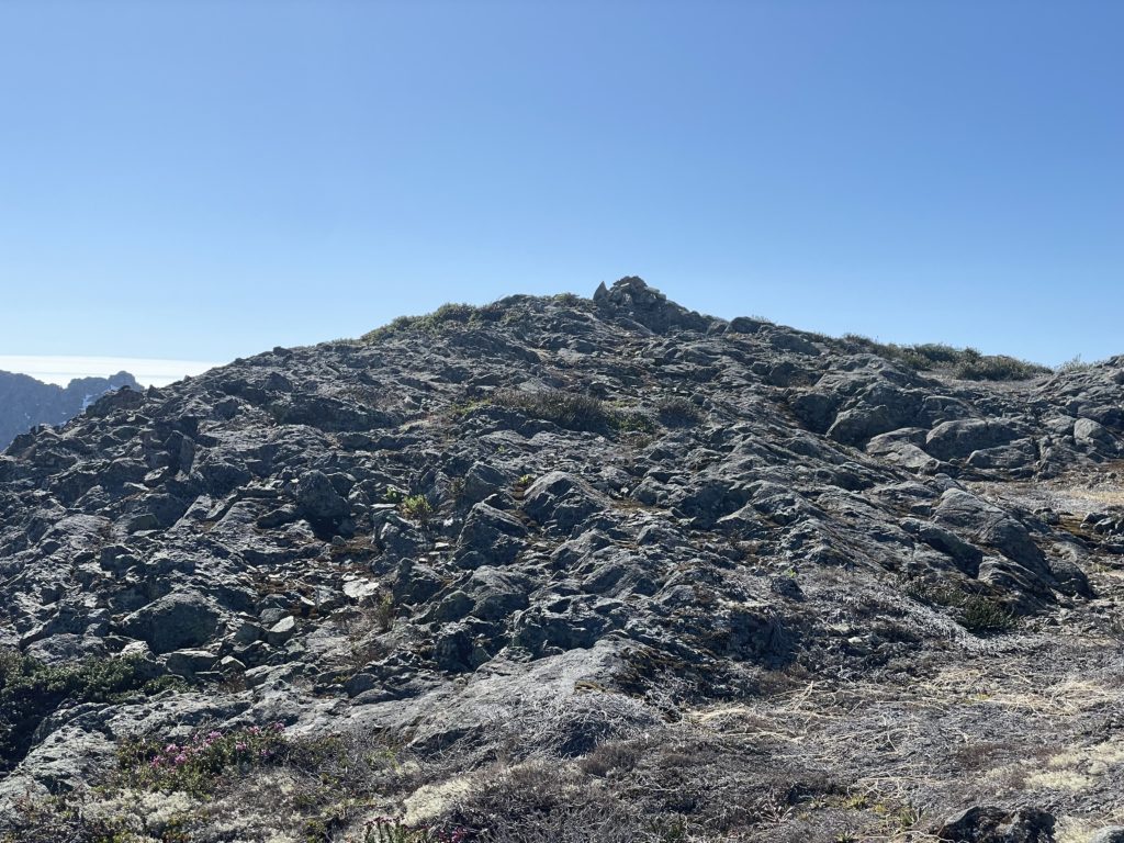
Situated on the top, to not much of a surprise, stood a cairn. There was no summit registry, but was clear now it had it been climbed at least once. Time for some sleuthing to figure out who placed it there!
By now it was around 5PM and we briefly considered going for the shorter west tower, but there was no easy way up. Given how much time we had left, we decided to skip on it and enjoy the sunshine on the summit for a bit instead. Once 5pm rolled around it was time to figure out how to get off this thing. We decided to skip the circuitutous snow ramp descent/traverse and opted to rappel directly off the east face down to the ridge. From our initial vantage at the base it looked like 2-3 straight forward rappels, but we’d later find out that’s not the case.
From the summit we scrambled back to our last anchor station and slung some webbing and a rappel ring around a telephone pole sized sub-alpine tree. Andrea lead the first rappel down to the top of the vertical east face and located another tree for us to setup an anchor off of. With the 60m rope and bushy terrain this first rappel gave a taste of what’s to come, but by now we were committed. The next rappel was awesome with a near full 60m vertical face to head down. We caught a good luck at the first route option we had eyed up and while very exposed probably didn’t exceed 5.5/5.6 climbing. Protection was a bit limited and lots of precarious blocks would have to be avoided though.
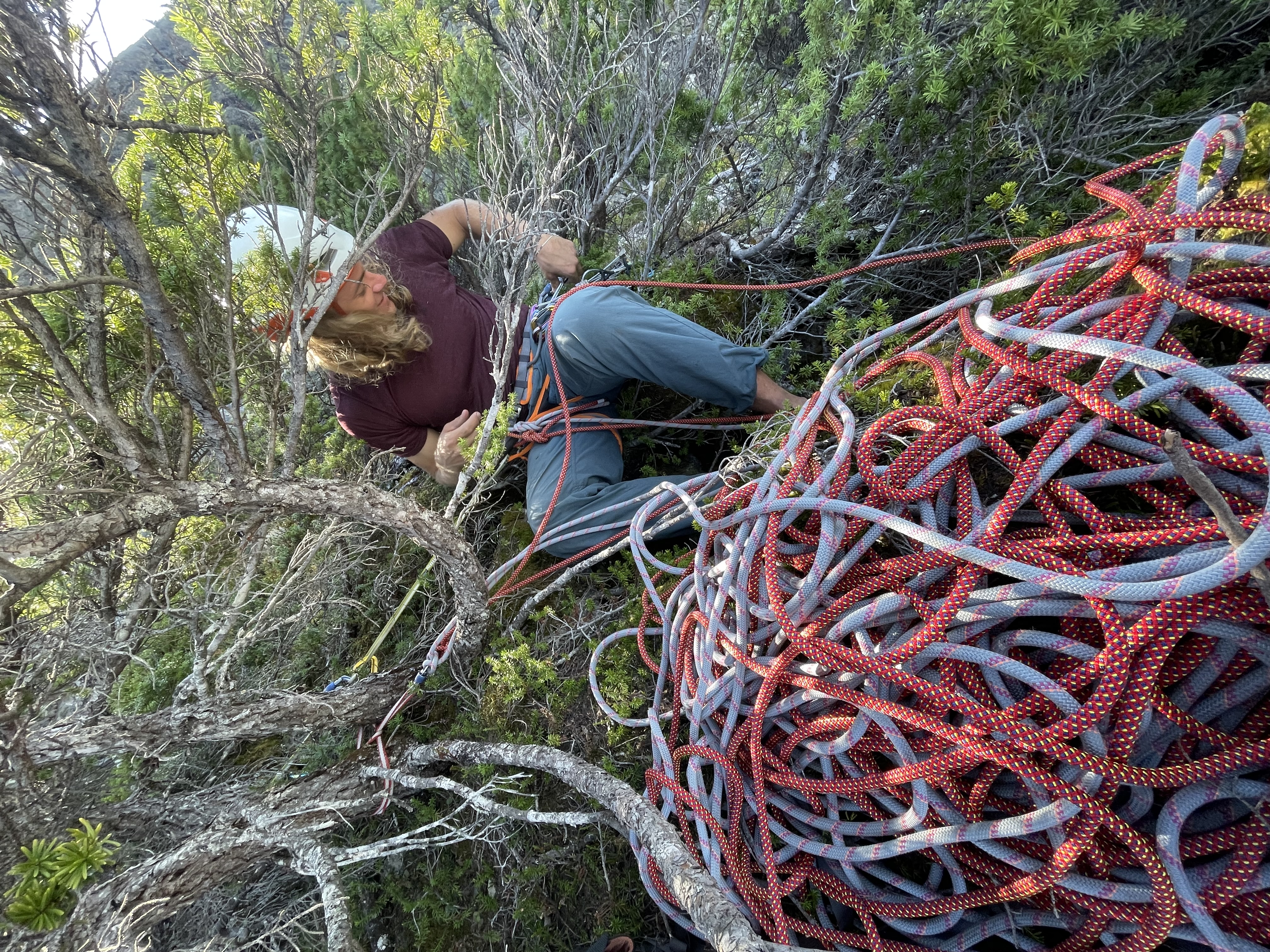
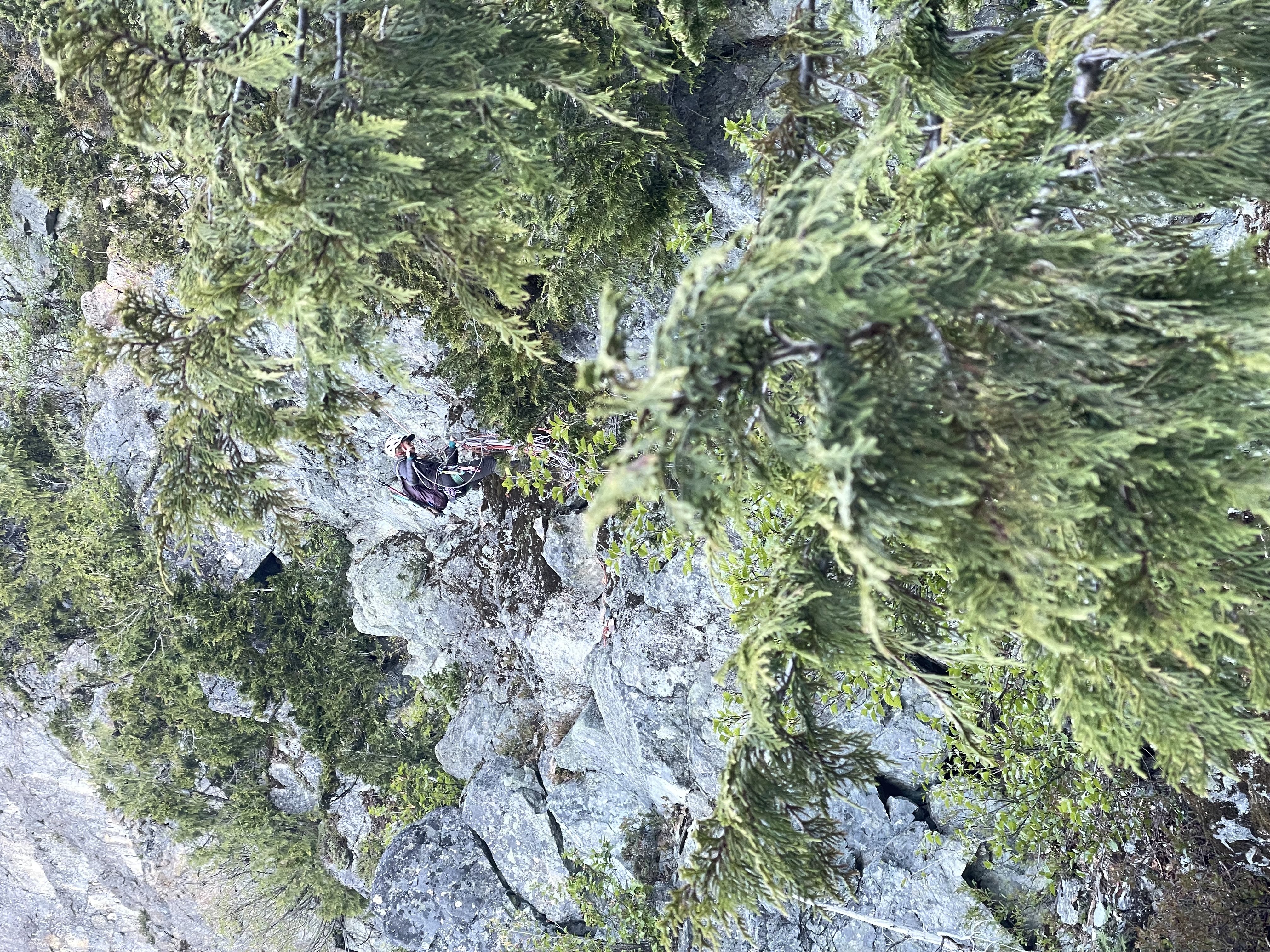
Now came the next two rappels which consumed a great deal of time. The terrain on the lower east face was tamer 4th, to low 5th but looked challenging to downclimb and navigate so that’s why we decided on a rappel. However, it’s not continuously vertical and as such was going to be awkward. I went first, armed with two saddle-bagged coils of rope (great in theory, if there’s no bush) and dispatched with the first 30m with no issue. Then a short flat section in which the rope coils got tangled beyond my wildest dreams before the next and final vertical bush section. After faffing with the ropes I continued my descent and managed to get within 30m of the ridge. Below was some sandy, loose 4th class terrain and I wasn’t sure if a rappel or down climb was the best option.
I waited for Mike to descend and then decided I’d go check it out. I managed to make a few strenuous down climb moves to avoid all the bad rock and reached the ridge line at last. I called above that it was better to rappel this section and so Andrea and Mike got to work setting up a final station. Natually given the awkward rappel I had done, the rope was exceptionally tough to pull and the battle went on for about 15 minutes before the rope was successfully retrieved. Andrea and Mike did their final rappel and then we packed everything up for the ridge return.
All told it took us nearly 2 hours to get off the summit with 4 rappels. Now that we’ve established a few rappel stations it would probably be more efficient, but it’s certainly a challenge to get off this particular peak. Returning down the ridge was straightforward business, but we were all getting low on energy as it’s been 11.5 hours on the move already. We descended through the forest in the dark, but it was easy terrain and we soon joined the moonlight spur road. Once on the road it’s auto-pilot time and we reached the truck around 11:30PM.
I drove us around 25km down the Harrison West FSR before finally having to pull over to do a quick 10 minute nap. Andrea took a turn driving after we exited the FSR and got us to the drop-off spot for Mike. Here we took another 30 minute nap, but it didn’t help much. Another 1.5 hours later and we finally reached home at 4:30am.
Trio Creek Spires was a long day, but an absolutely amazing adventure. It was an awesome opportunity to head out to a technical looking summit with no beta and figure it out for ourselves. In the end the route is not so challenging from a rock climbing perspective and I suspect there is likely a low 5th class vege-route somewhere in the bluffy terrain. The rock quality ended up being significantly better than expected so no need for heavy pitons, just a light alpine rack or less if you’re comfortable soloing this type of terrain. The two 60m ropes proved crucial to enabling a rappel onto the east ridge. However, you could probably get away with a 30m and rappel back onto the snow ramp then simply down climb it.
first ascent was by Chris Gill and Paul Adam in 1990. other known ascents by Jordan Peters and Justin Thibault, and then by Adam Palmer and partner