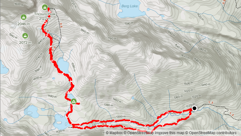
Elevation Gain: 1,034m
Distance: 12.2km
Total Time: 5 hours 53 minutes
Date: July 28th, 2021
Tricouni Peak is a very popular summit located just north of Cloudburst on the east side of Squamish Valley. I first saw this peak last year on my ascent of Cypress Peak and heard it was a more difficult, albeit very fun scramble. I put it on the list, but wanted to wait for ideal conditions to take it on. That time finally came this week, after I finished an extended work shift and was looking to spend a mid-week day off to get out in the mountains. My usual scrambling partner was unavailable, so I canvassed the SWBC Peak Bagging group to see if anyone would be interested in joining. I had a friendly reach out from Tom Ginsberg and he was keen to bag Tricouni as well.
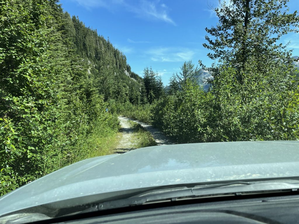
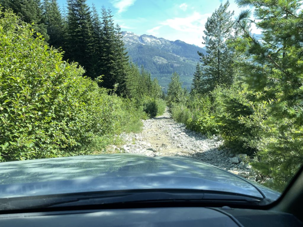
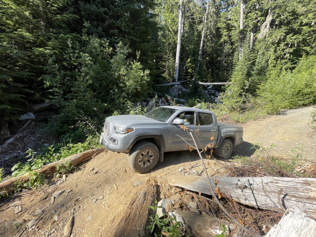
I didn’t need to do much planning for this route as it’s well documented in Matt Gunn’s scrambles book and I had recent route beta from Holly and Andrew in the SWBC Peak Bagging group. With that, Tom and I agreed to a leisurely start and on the Wednesday we left Vancouver at 7:30am. I had to make a quick pit stop in Squamish to renew insurance and then we were back on track heading down the Squamish Valley road. A few kilometers down and we turned onto the Branch 200 FSR. For the first 6-7km, the road was in decent shape, but it started to deteriorate afterwards. By the last 1-2km, a proper high clearance 4×4 was required to get through the worst of it. Thankfully the Tacoma had no issues and we made it to the upper most parking lot by ~10:20am.
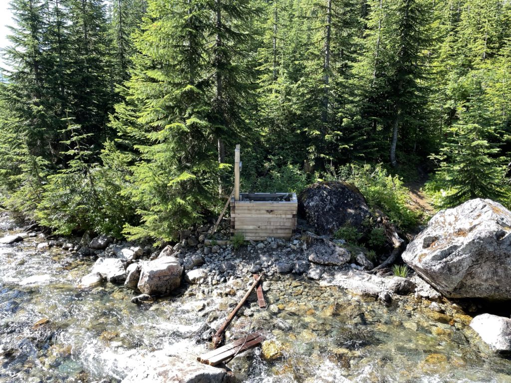
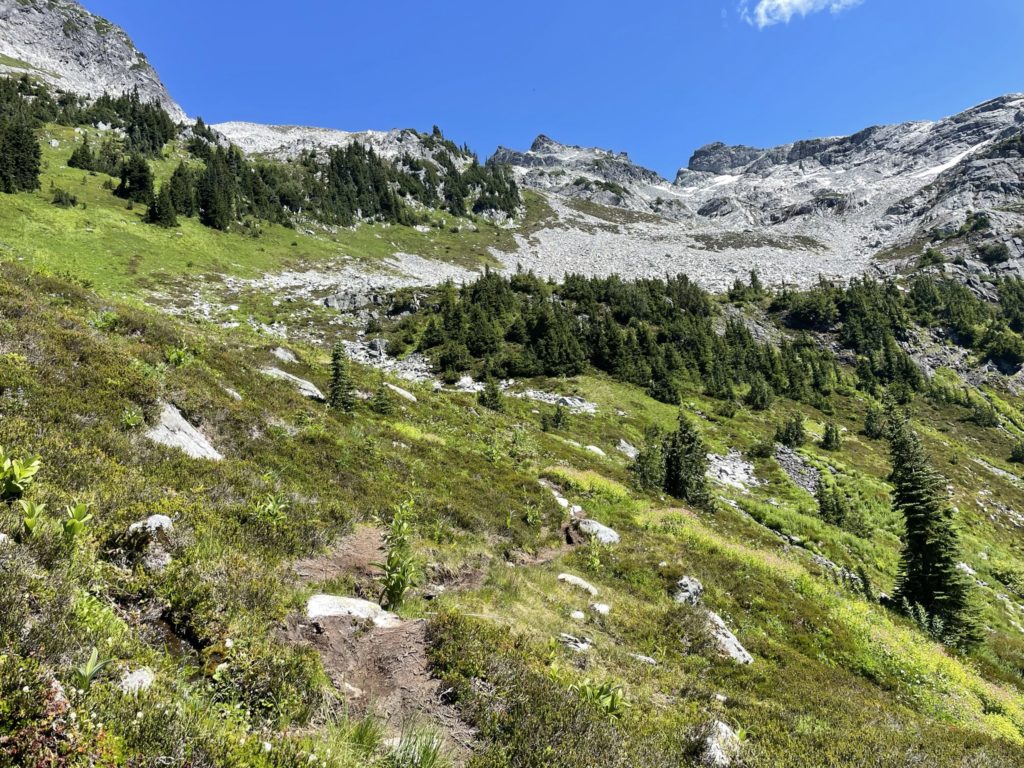
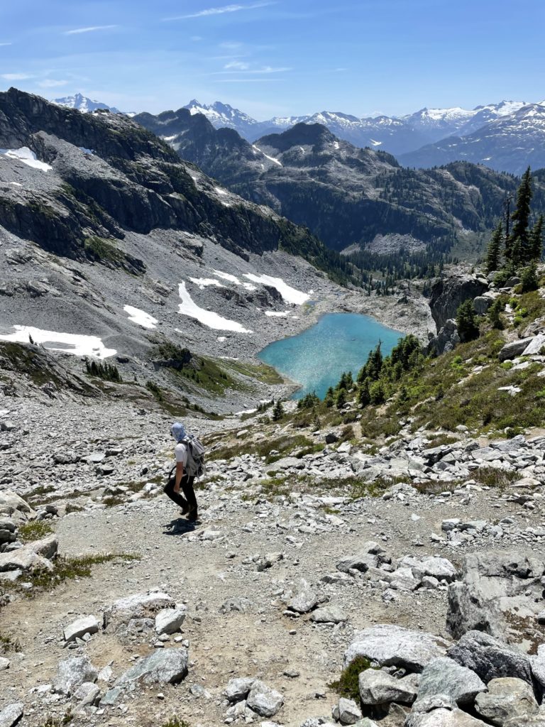
At ~10:34am we were started on the trail and immediately met with a junction. A sign was hung on a tree stating the left trail was high and dry and the right side went through sensitive wet lands, but both trails ended at the same location. High and dry sounded nicer to both of us, so left we went. This part of the trail followed along the west side of the Pendant Heart Lake drainage and crossed over several boulder fields. A few times we lost the trail and had to cut through a field or two, but otherwise it was an uneventful plod all the way to the first lake.
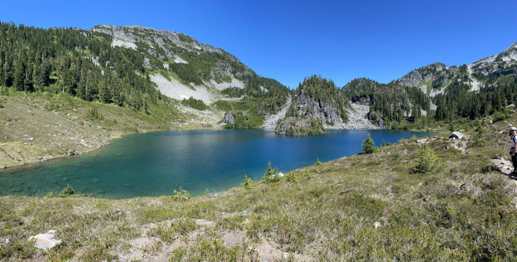
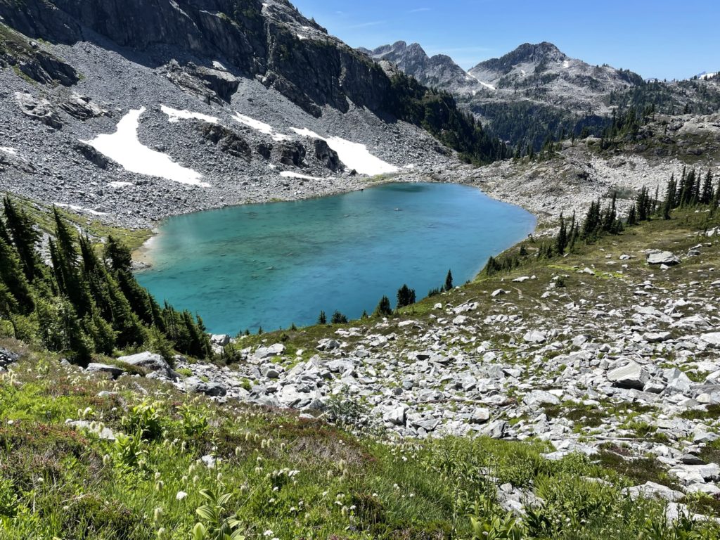
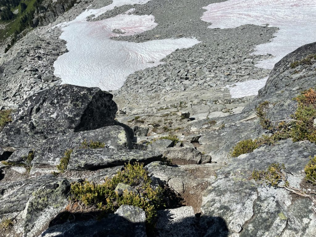
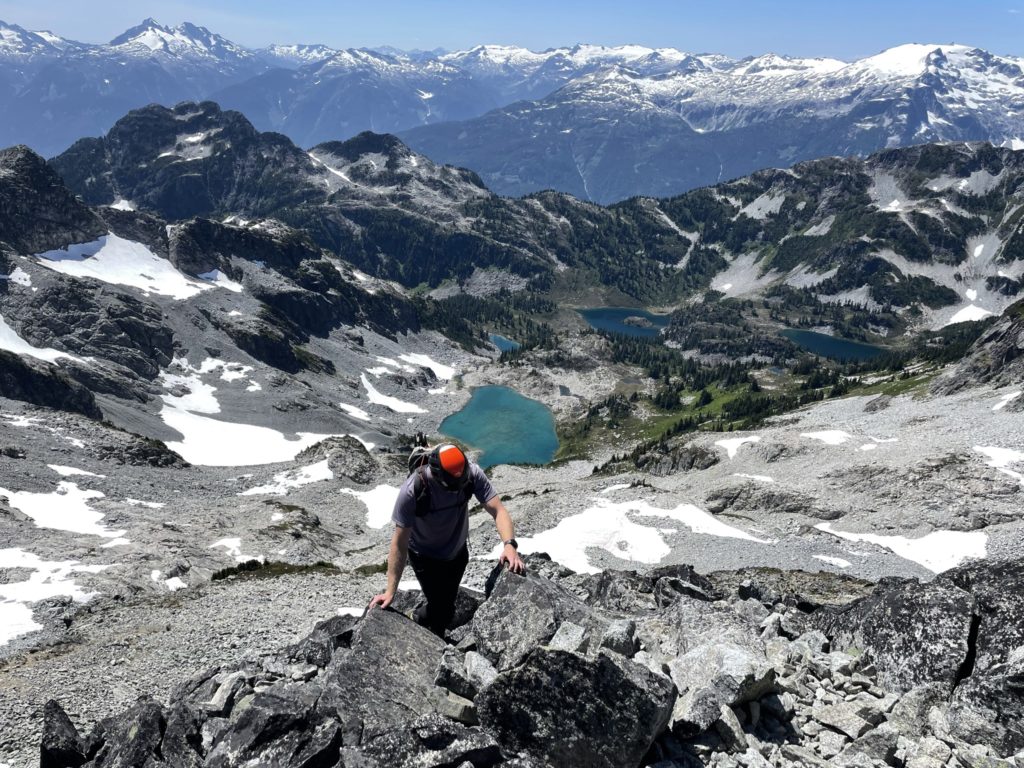
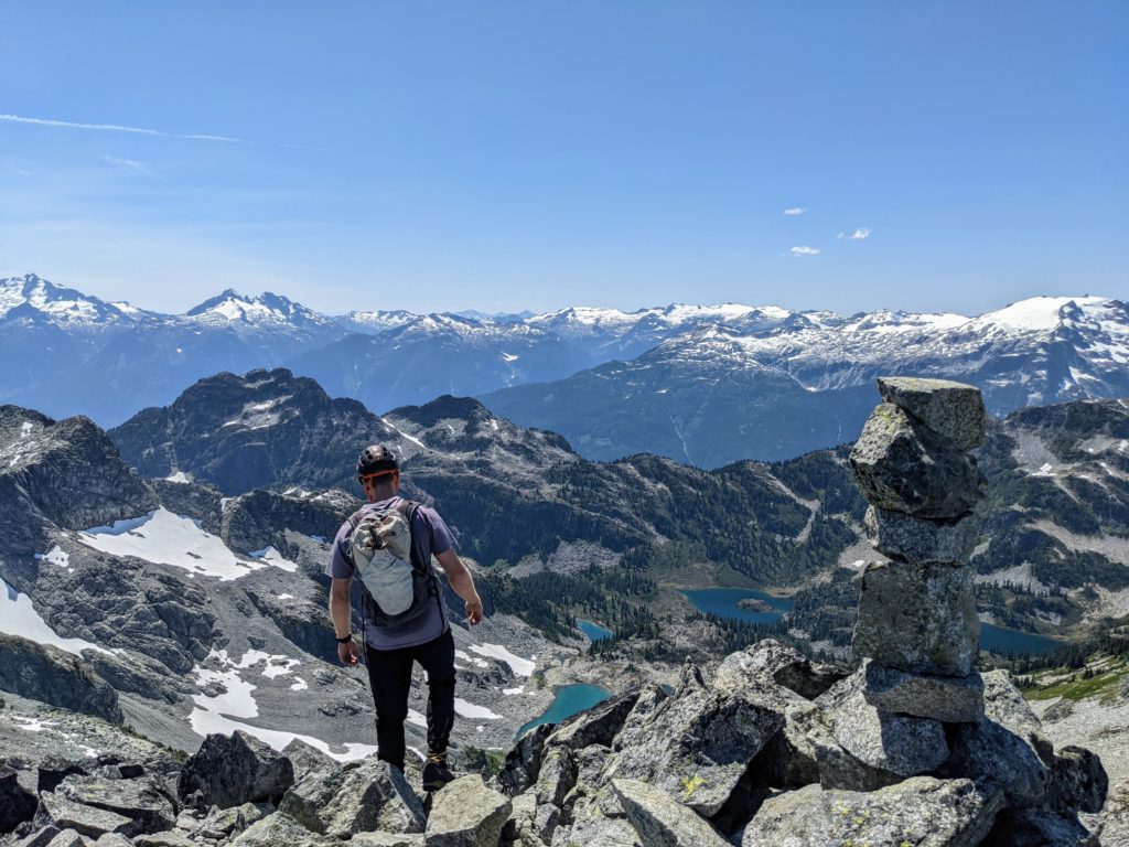
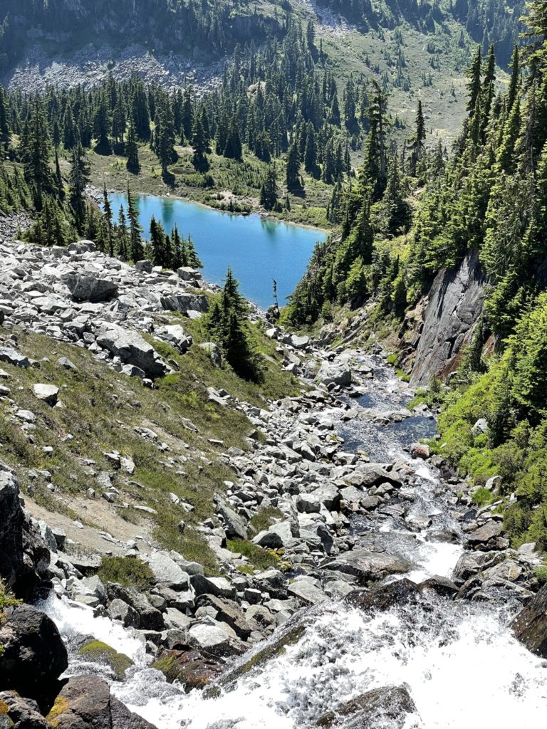
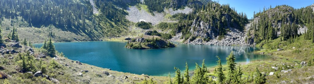
At Pendant Heart Lake we turned east and followed the well worn path up to Spearpoint Lake. Here we had a good vantage of the summit and saw quite a few options to gain the final ridge to the top. We initially headed south along Spearpoint lake before realizing we were following an inccorrect path and back tracked around to the north side. From there we followed a faint path up through the fields before crossing at climber’s left underneath a small cliff band. Here we realized we’d gone off course a bit, but it continuing under the cliff band we were able to easily rejoin with the main trail. Finally on the main trail, we hopped over a boulder field until reaching the final lake aptly named: Reflection Lake.
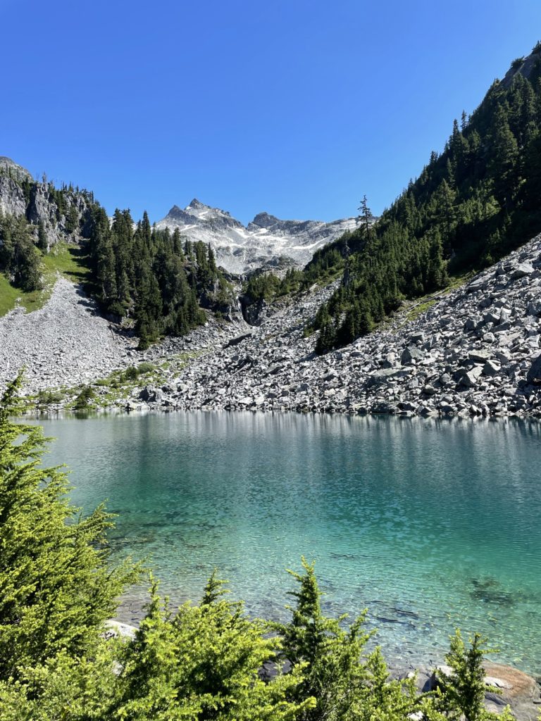
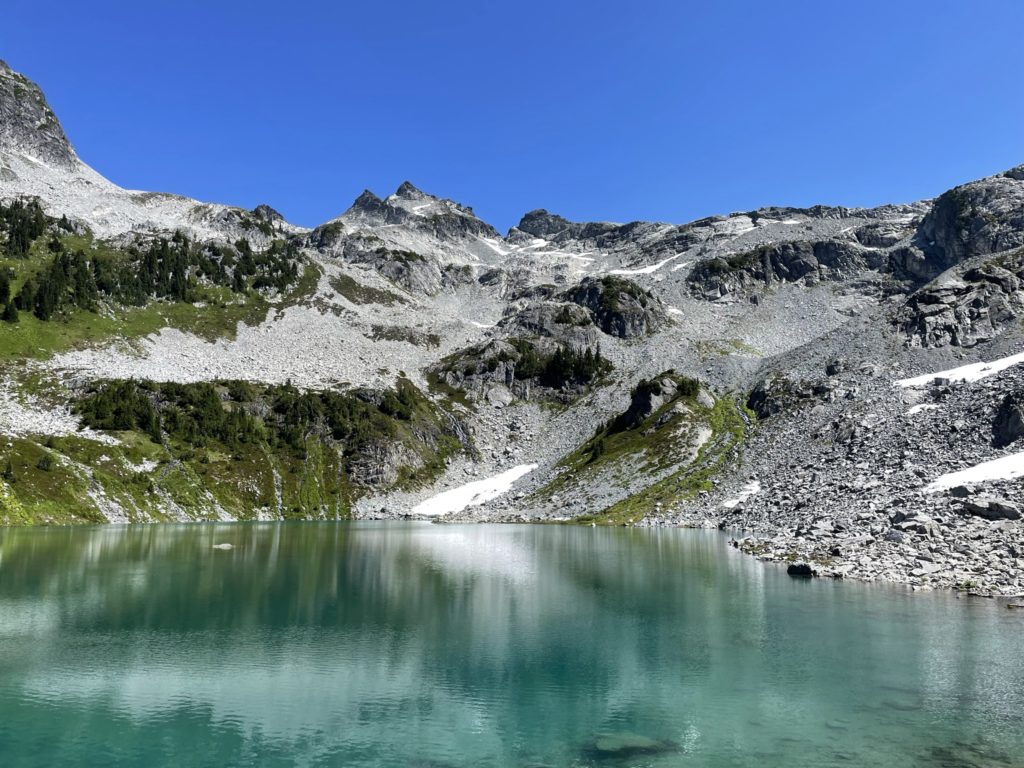
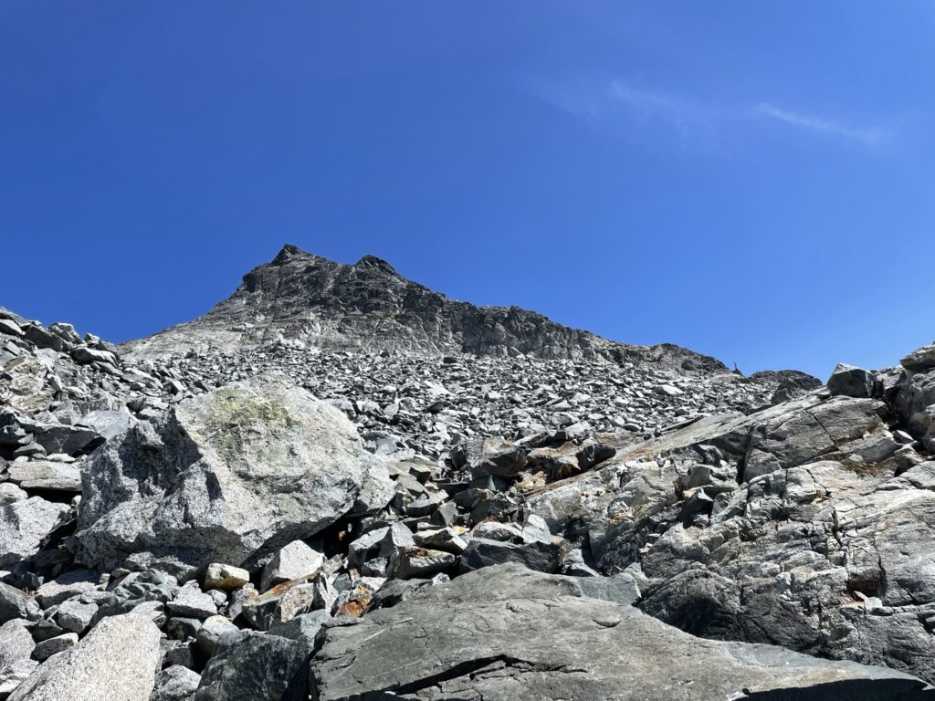
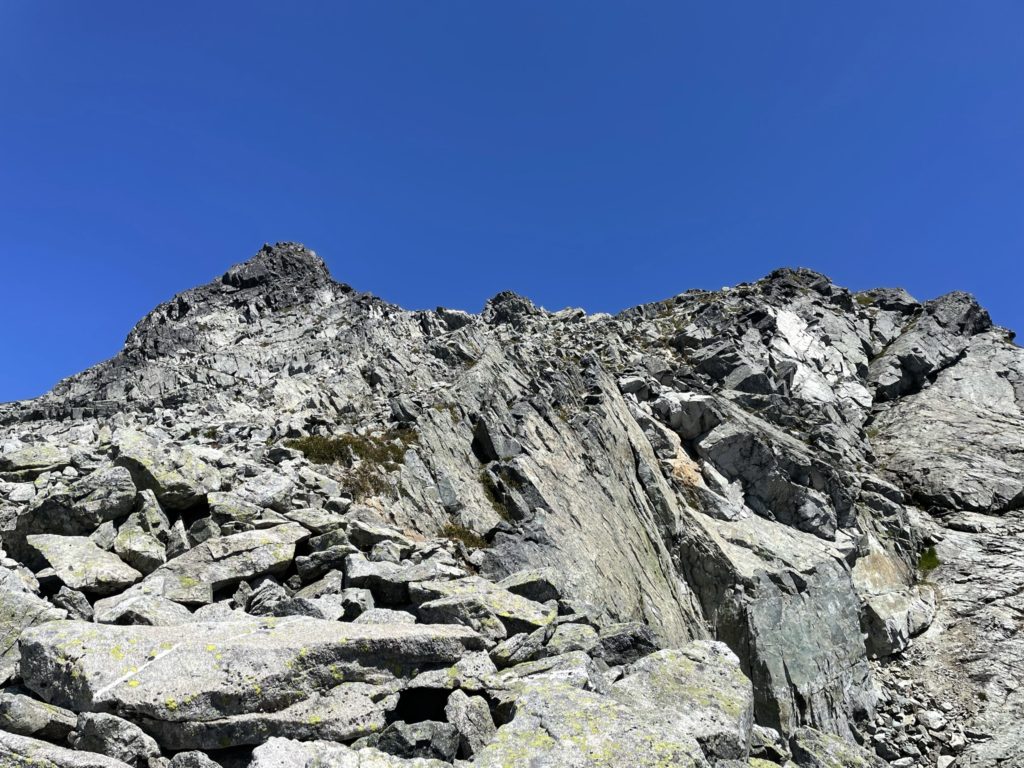
From Reflection Lake we could see two obvious routes to the top over a long boulder field. One veered climber’s left and then gained the ridge via a weakness in one of the upper cliff bands and the other ascended straight up the boulder field to a notch at the summit ridge and then continued up towards the summit. I knew from speaking with Holly that the notch involved more exposed climbing and that the route at climber’s left (a.k.a. the route in Matt Gunn’s book) was the better option.
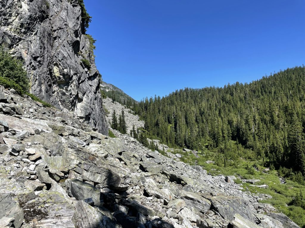
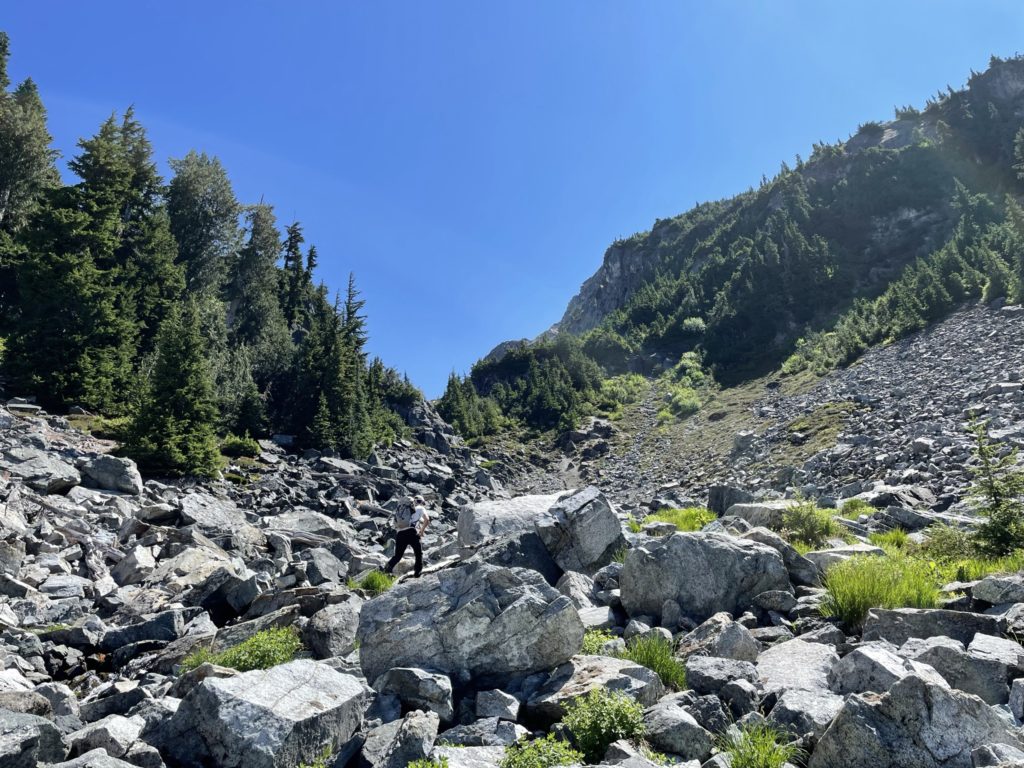
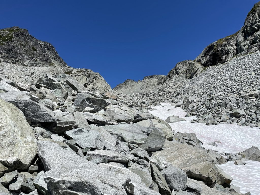
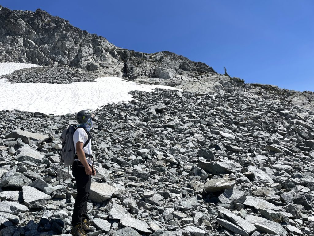
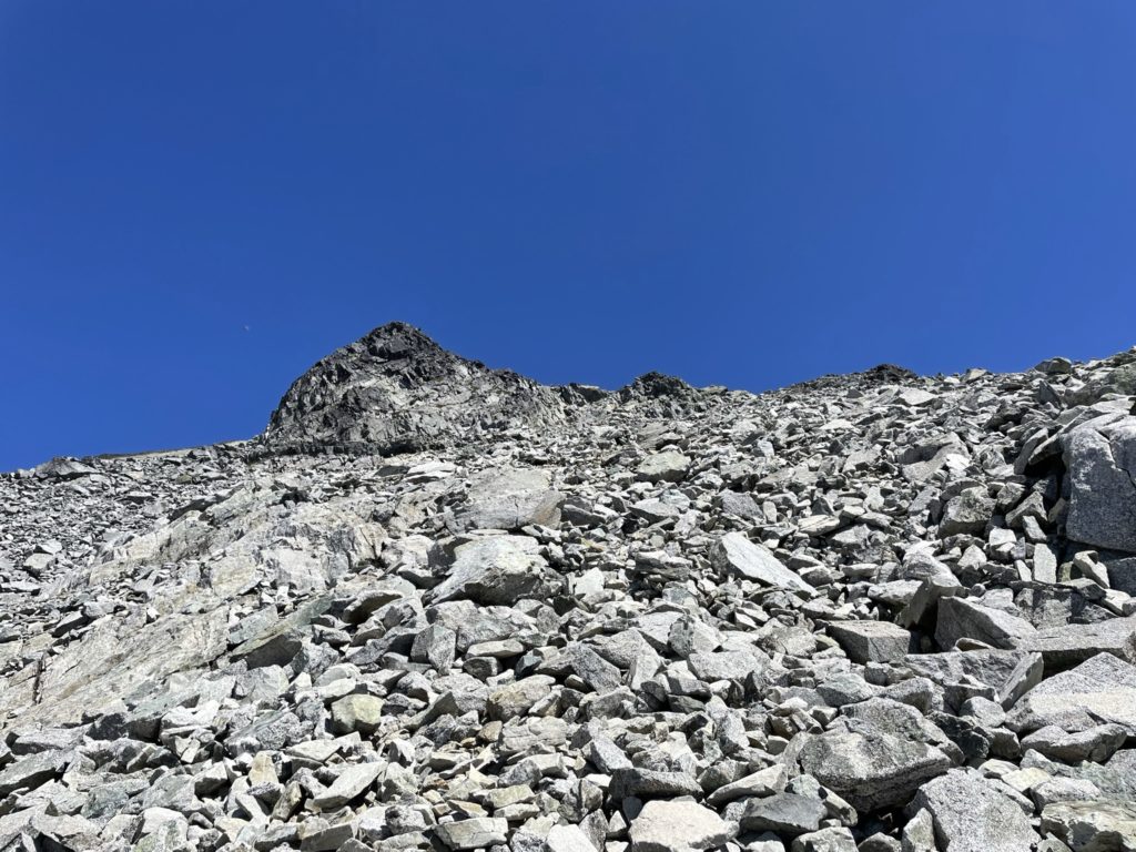
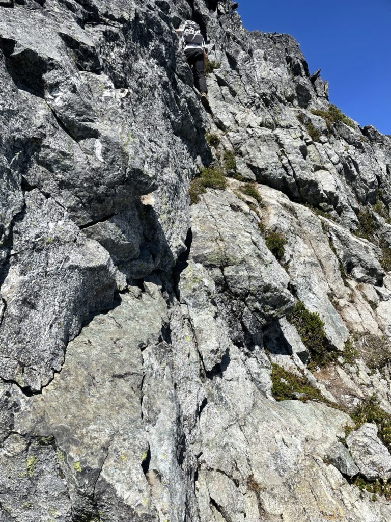
Tom and I opted for the tried and true route and started our away around the north side of Reflection Lake. We continued along a fainter trail up through the boulder fields gaining a fair a bit of elevation as we rose quickly above the lake. Soon after we reached the entrance to a large gully of boulders at around 1800m in elevation. We pushed further West through this gully and then spotted an obvious route up the cliffs on the north side. As we got closer we also saw a few cairns clearly marking the route.
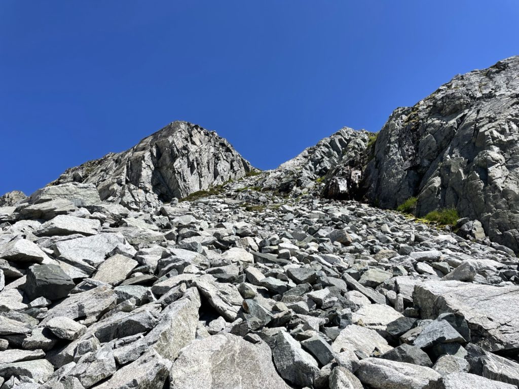
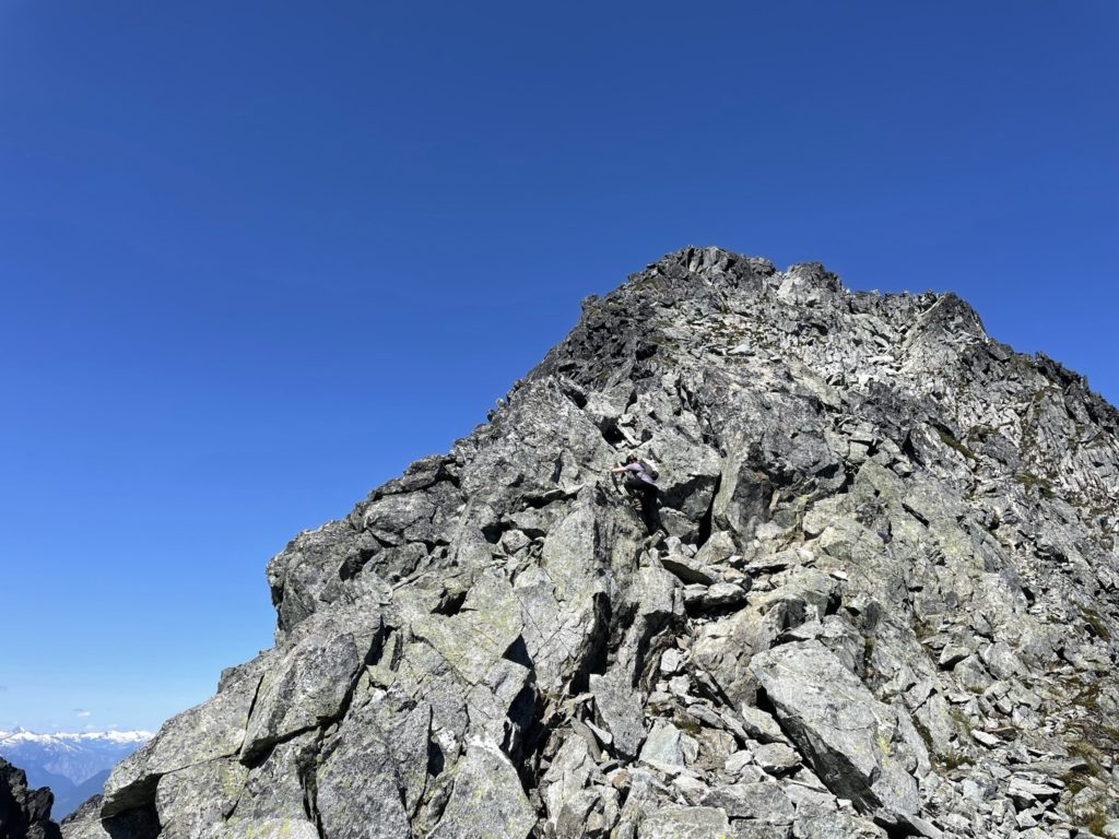
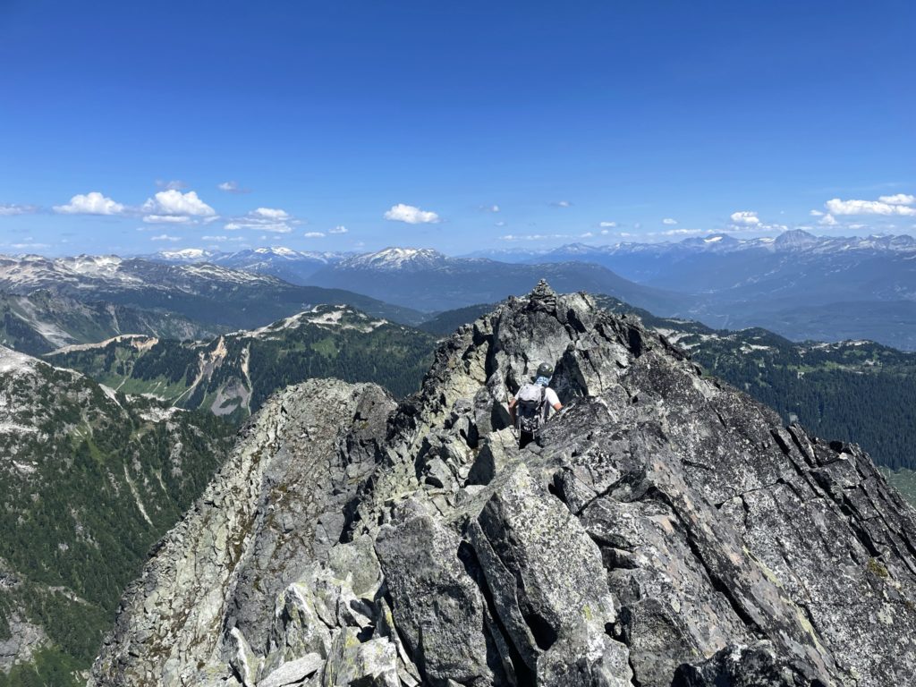
Once above the gully the boulder field continued up to the ridge line where we saw another weakness to gain the ridge. Again there were multiple cairns marking the way, so it was fairly obvious which way to go. Here the fun scrambling started with a bit of class 2/class 3 to gain the final slope to the ridge. There was minimal exposure and excellent rock quality. Tom and I made quick work of this section and then followed another well worn path up to the final ridge.
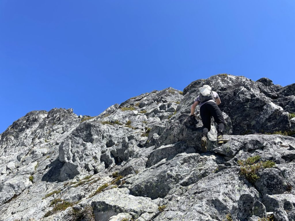
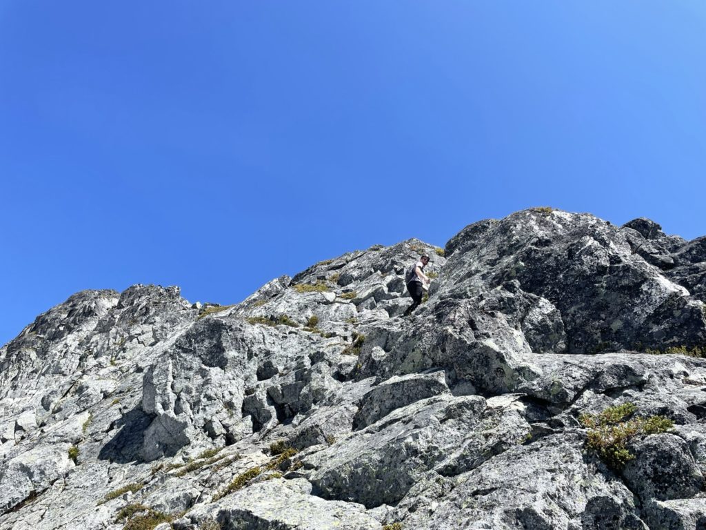
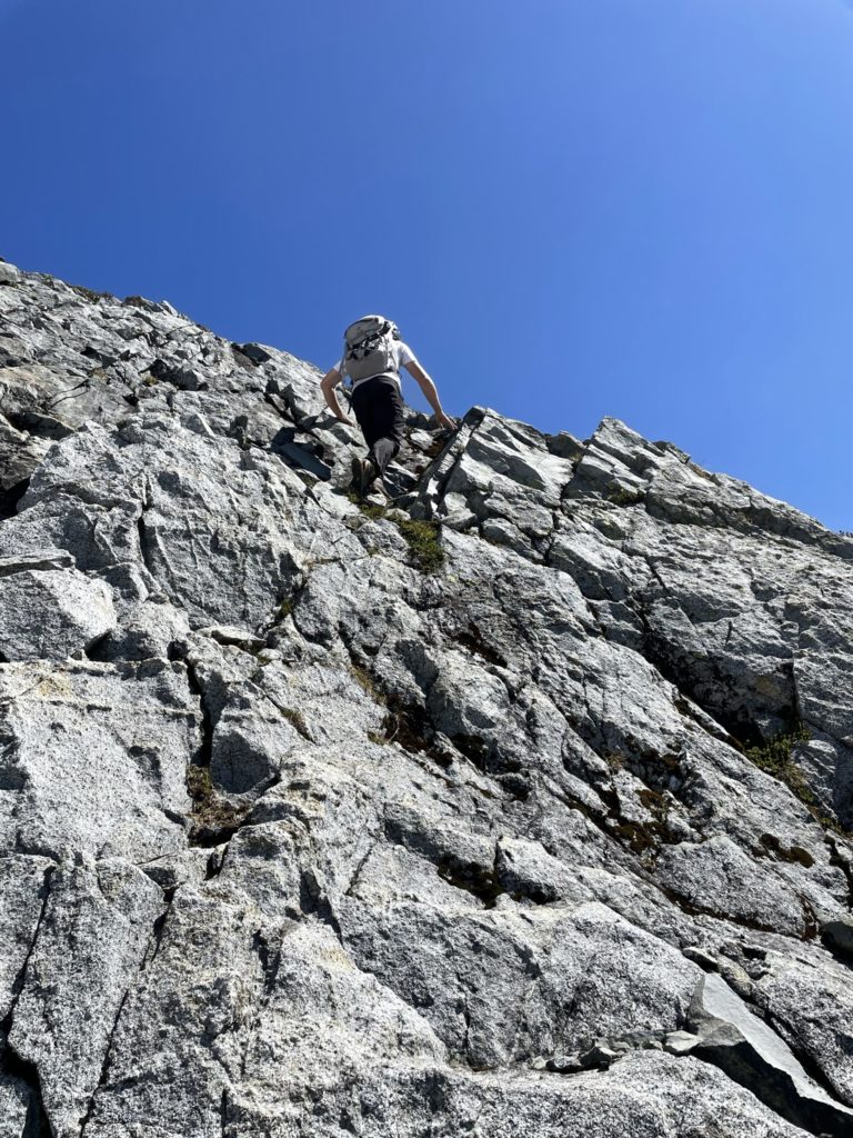
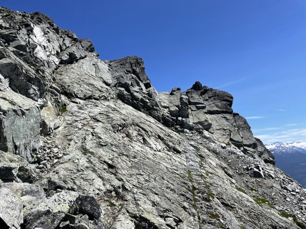
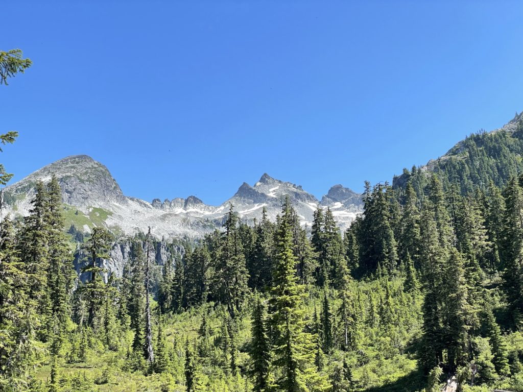
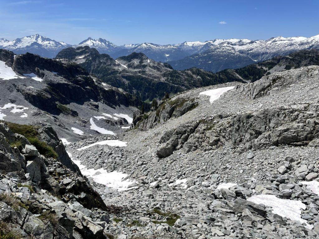
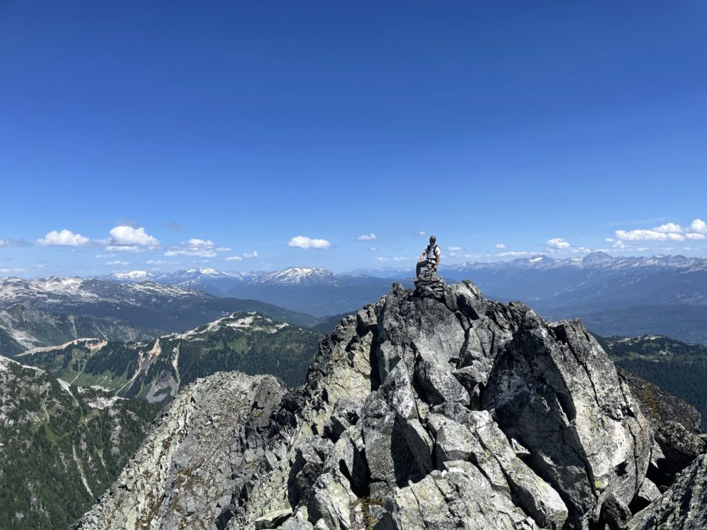
On the ridge, we could pick out a number of options up to the summit, but all routes were essentially the same. Tom and I took turns scrambling up first and grabbing photos as the other headed up. The scrambling here was excellent with a very fun class 3 section before gaining the summit. At the top we could see there was another high point around 10m from the first and so we opted to traverse the ridge gain the “north” summit as well. The ridge traverse was straightforward and while it looked exposed from the “south” summit it was actually a non-issue once you started over the first part of the ridge.

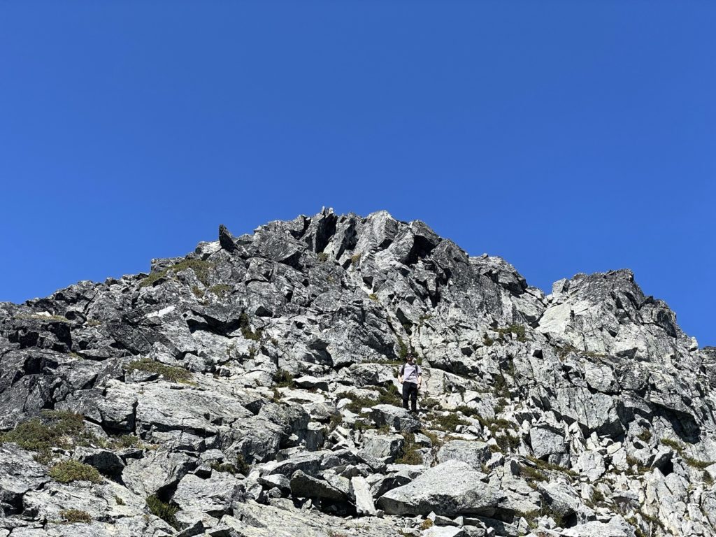
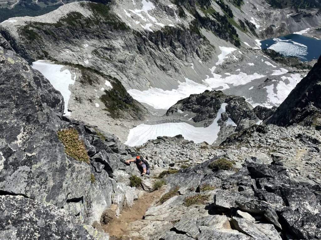
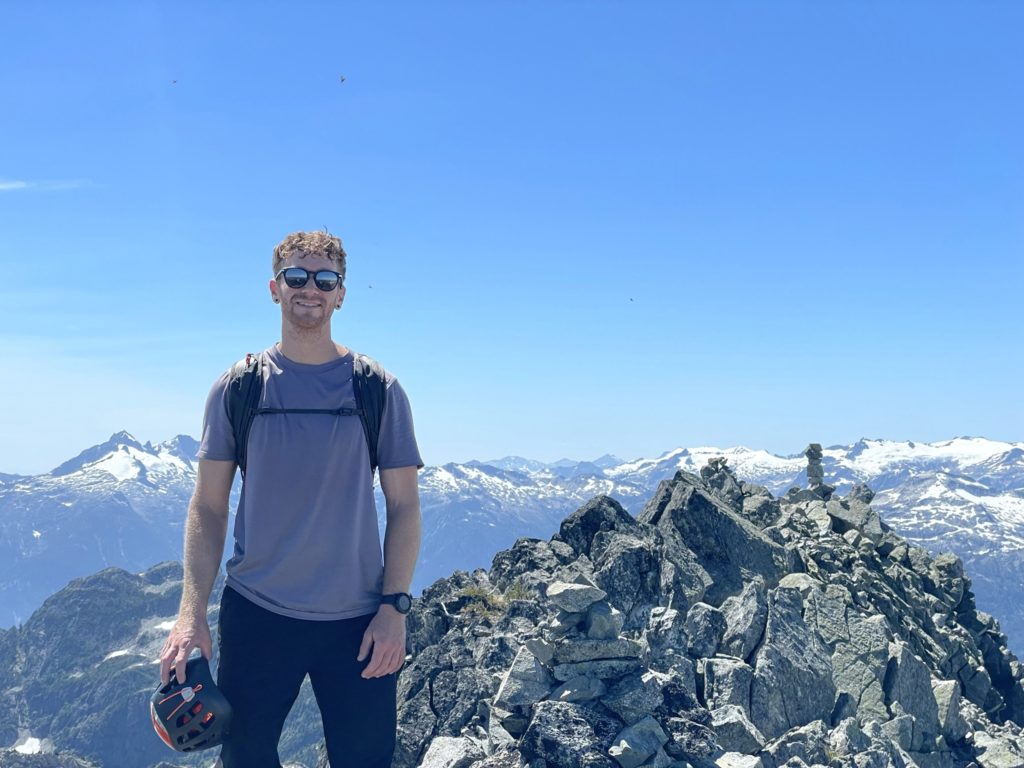
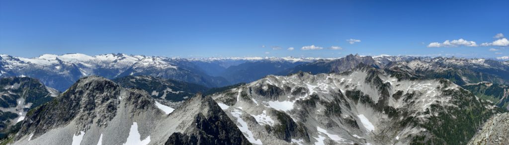
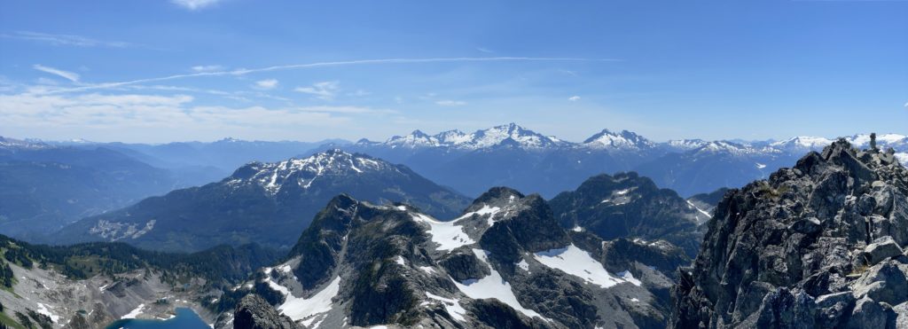
At the summit, we hung out for awhile, having lunch and taking photos of the surrounding peaks and lakes. After finishing our food, we began the descent down. Traversing the ridge back to the south summit was easy and then down climbing the class 3 section just below the summit was no problem either thanks to generous hand and foot holds. From there we back tracked along the ridge line and continued along below the ridge line the last section of class 2/3 scrambling. Here again it was a straight forward down climb onto the boulder field above the gully. With the final bit of fun scrambling out of the way, we started the long boulder hopping descent back to Reflection Lake and then down to Spearpoint Lake. We stopped briefly at Spearpoint for a nice swim and cool off and then headed down to the final lake.
From there we opted to take the wetland route on the way back, hoping to avoid the boulders. The route was indeed very muddy in sections, but overall ended up being faster than the high and dry route and we made it back to the truck with a round trip time just under 6 hours.
Tricouni Peak really is a type 1 fun kind of summit and it boasts exceptional views of deep blue/green lakes along the way. The scrambling is super fun with great rock and minimal exposure and the views at the top give you a great vantage over a menagerie of famous peaks. If this peak isn’t on your list yet, it should be!