Elevation Gain: 553m
Distance: 5.81km
Total Time: 2 hours 46 minutes
Date: July 13th, 2021
Mt 7. is a 2592m peak located just south east of Golden in the Mt 7. North Ridge Recreation site. This peak first came to my attention when my brother and I were looking for a short peak to grab on the way to Banff. I couldn’t find much information on this mountain except for this old trip report. Despite the lack of info it had an all trails GPS track that went most of the way to the top and advertised a short 9km round trip distance. Without much else to go on and too lazy to find anything else, we settled on Mt. 7 and decided to play it by ear when we arrived on the day of.
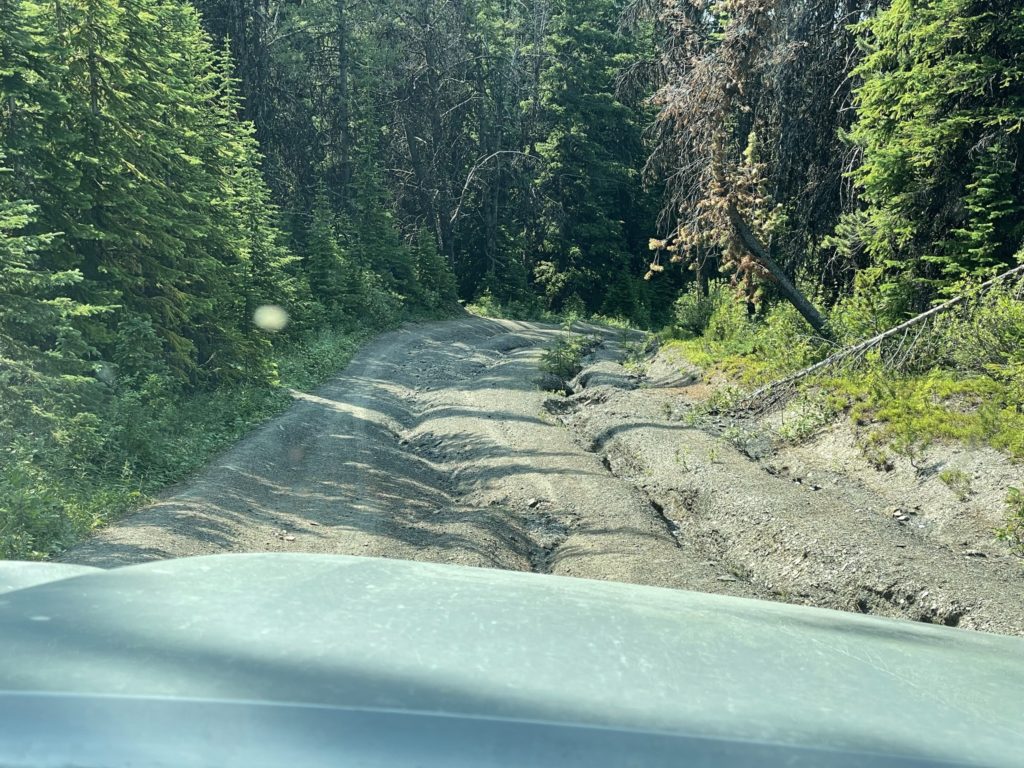
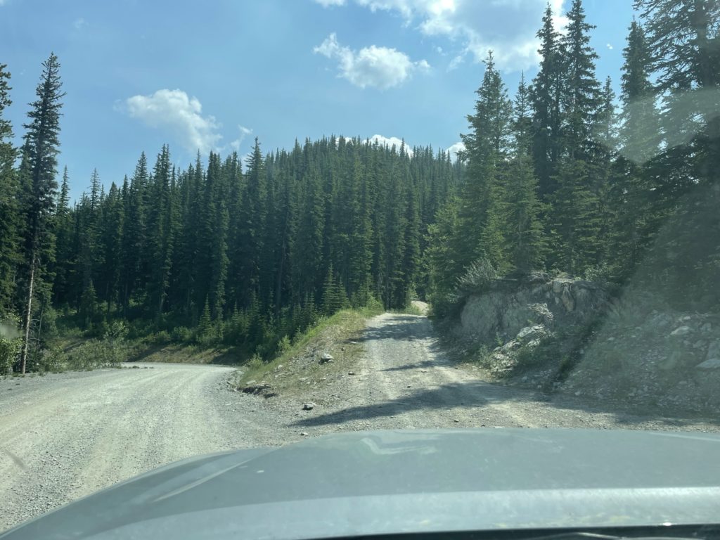
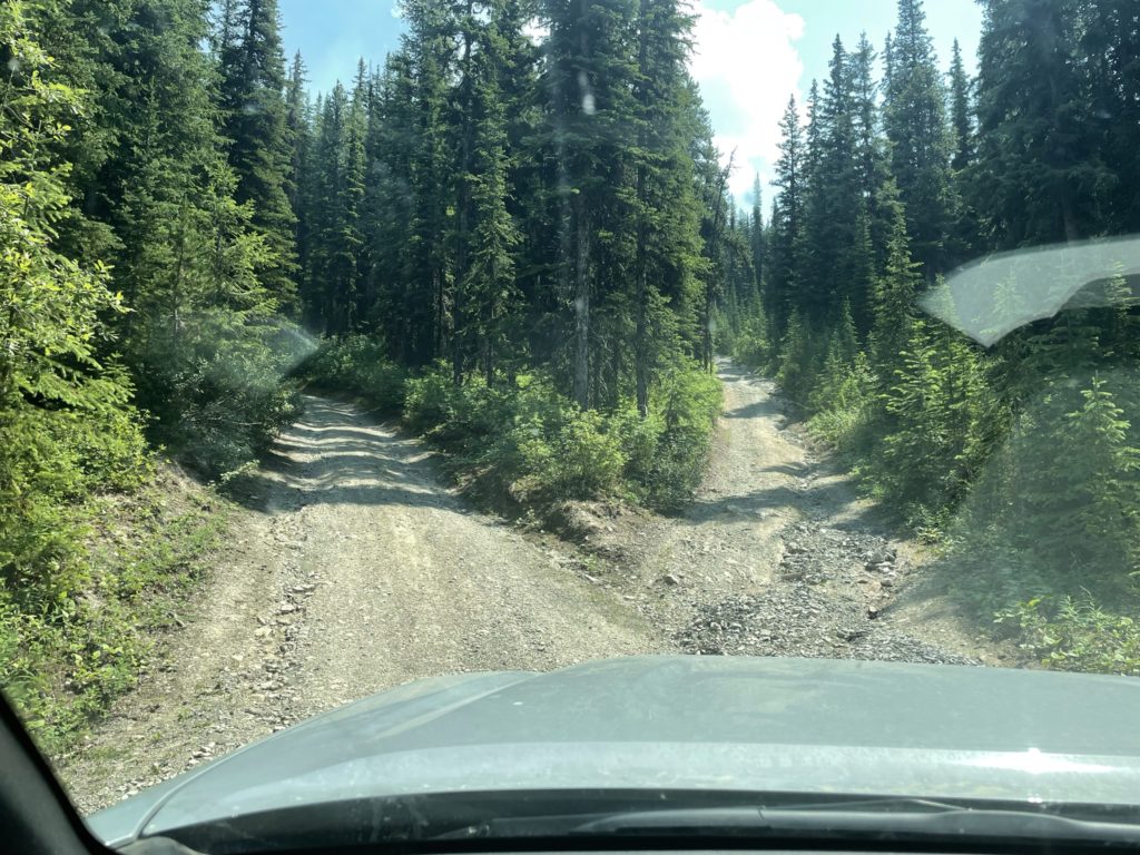
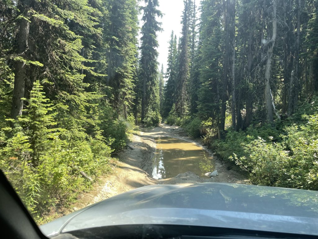
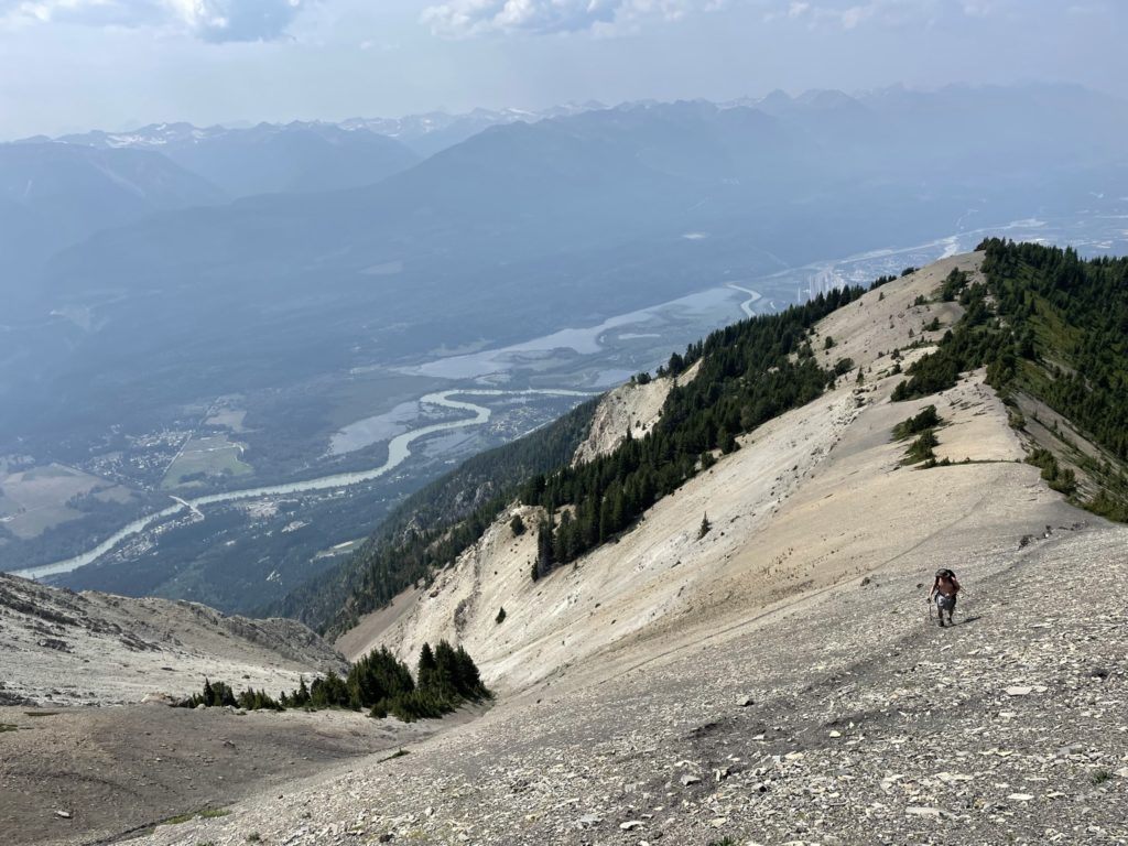
That day came on July 13th, after we paused for lunch in Golden. To reach the trail head we took the well maintained Mt. 7 FSR up to around 1920m in elevation. Here there was a launch site for paragliding and parking for the trail head. The trip report I had read mentioned that you could take a 4×4/atv trail even further up, albeit through some treacherous road conditions. I figured it was worth a try in the truck and so we changed into 4 low and started the climb up the steep track. The road had some exceptionally bad sections including a 2 foot water pool, rough steep rocky sections and run outs, but we made it to the top in the end after all. Doing so helped dispatch with ~3km of distance and 200m of elevation gain.
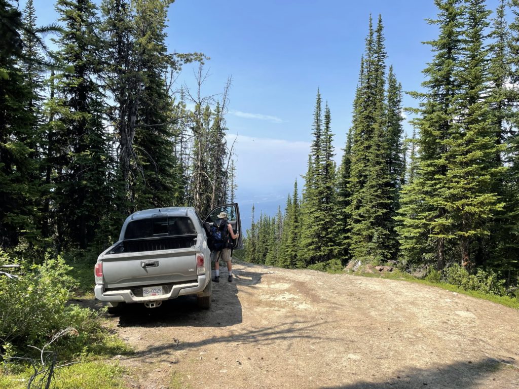
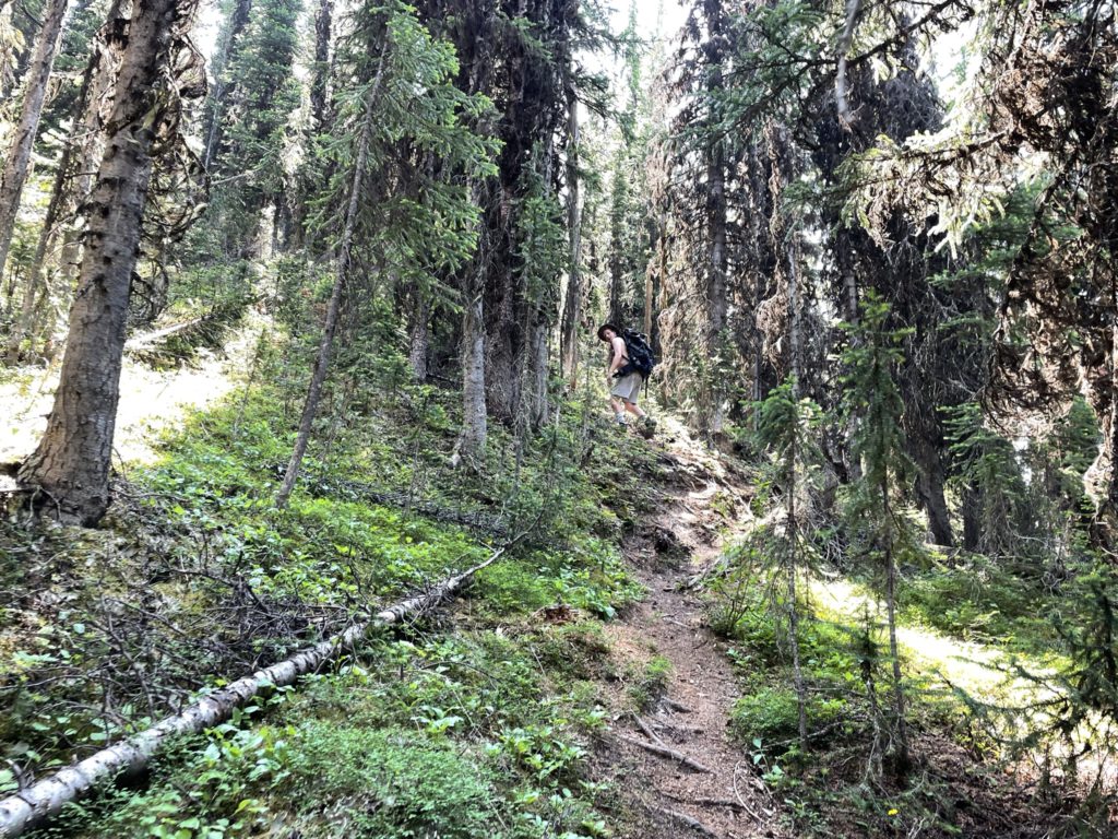
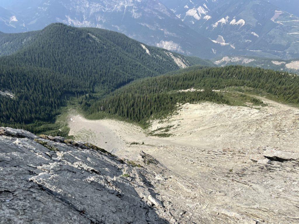
Once I got the truck in a good parking spot, we got our boots on and started the trek through the woods. The trail was obvious and easy to follow and after reach a small opening to the end of a different FSR, we started a descent down into the woods before having to regain the elevation again a few hundred meters later. The mosquitos in this section were quite atrocious and so we made as fast of a pace as we could to get out of there.
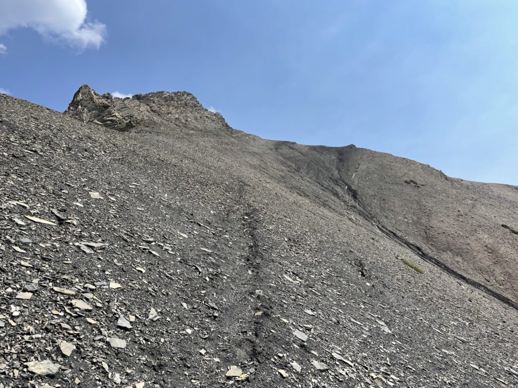
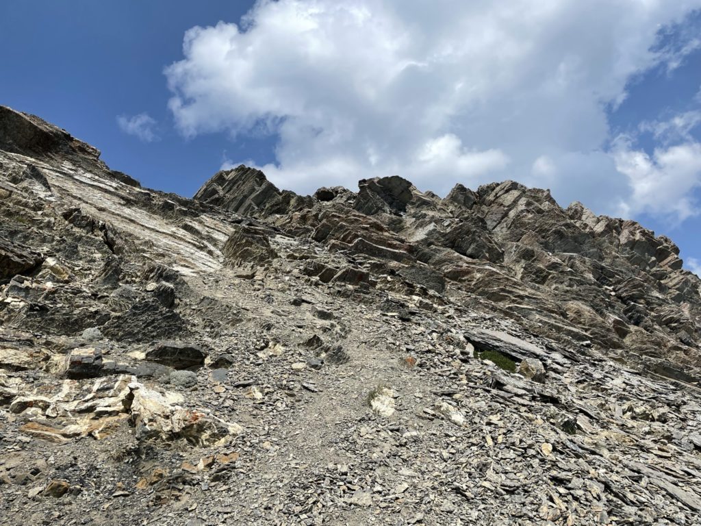
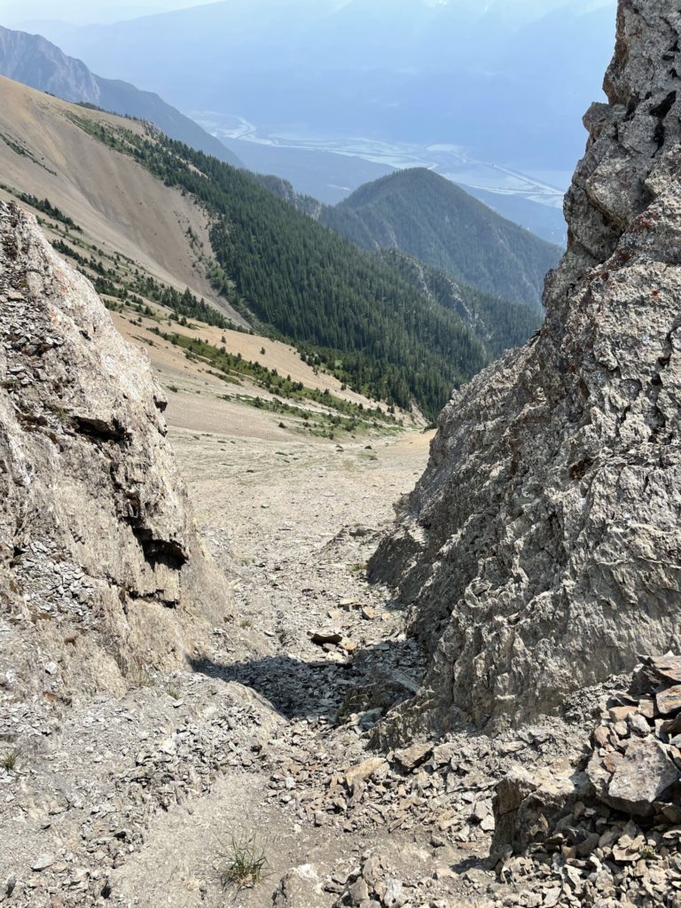
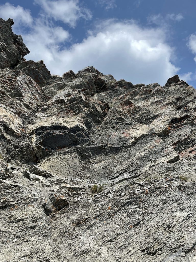
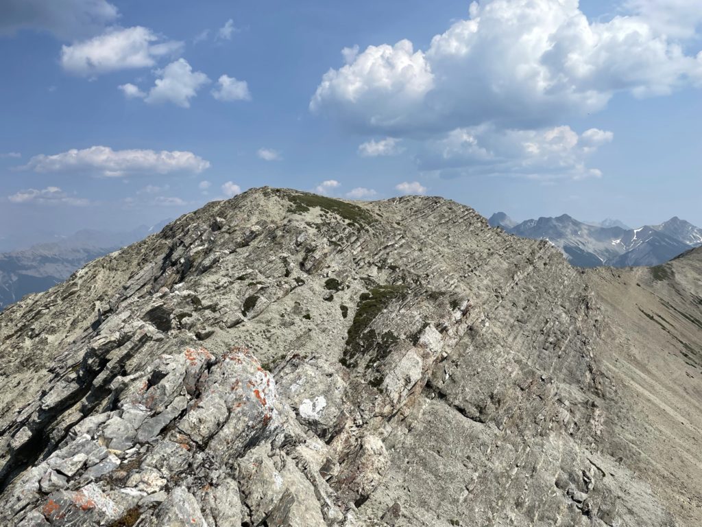
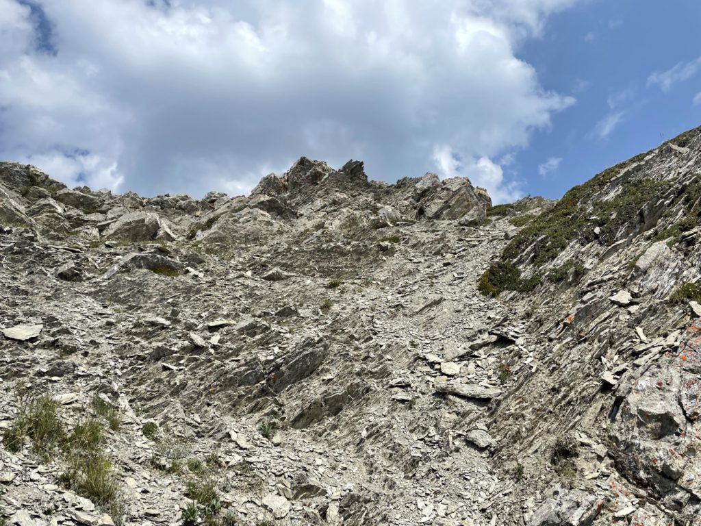
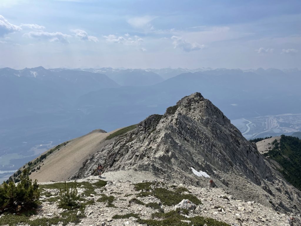
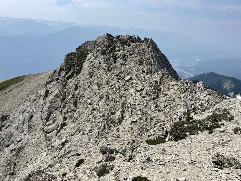
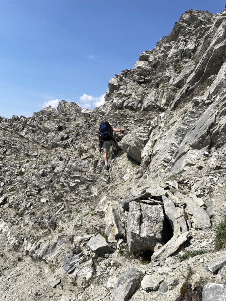
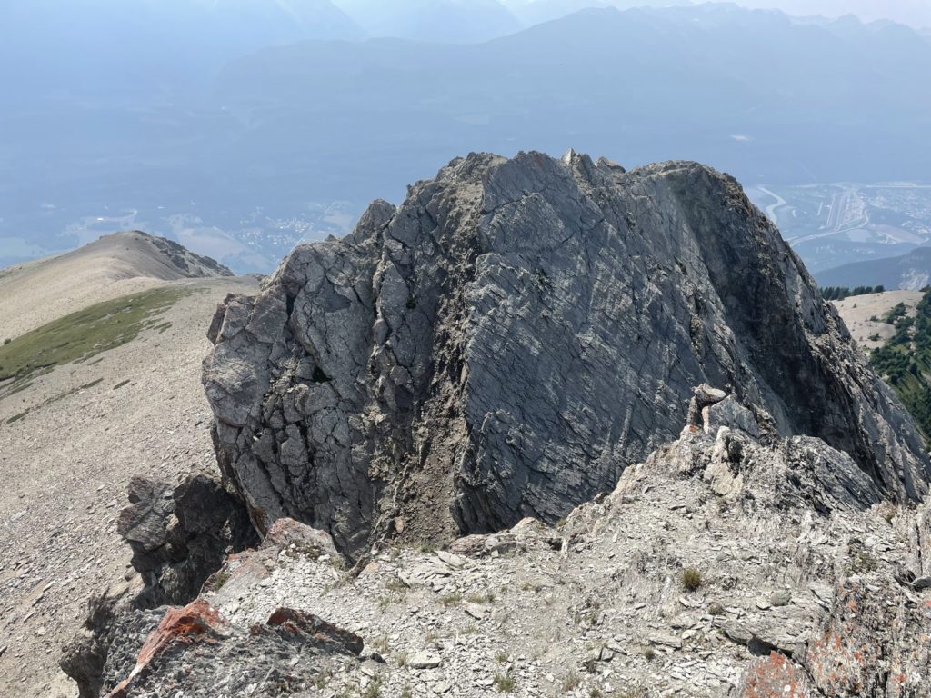
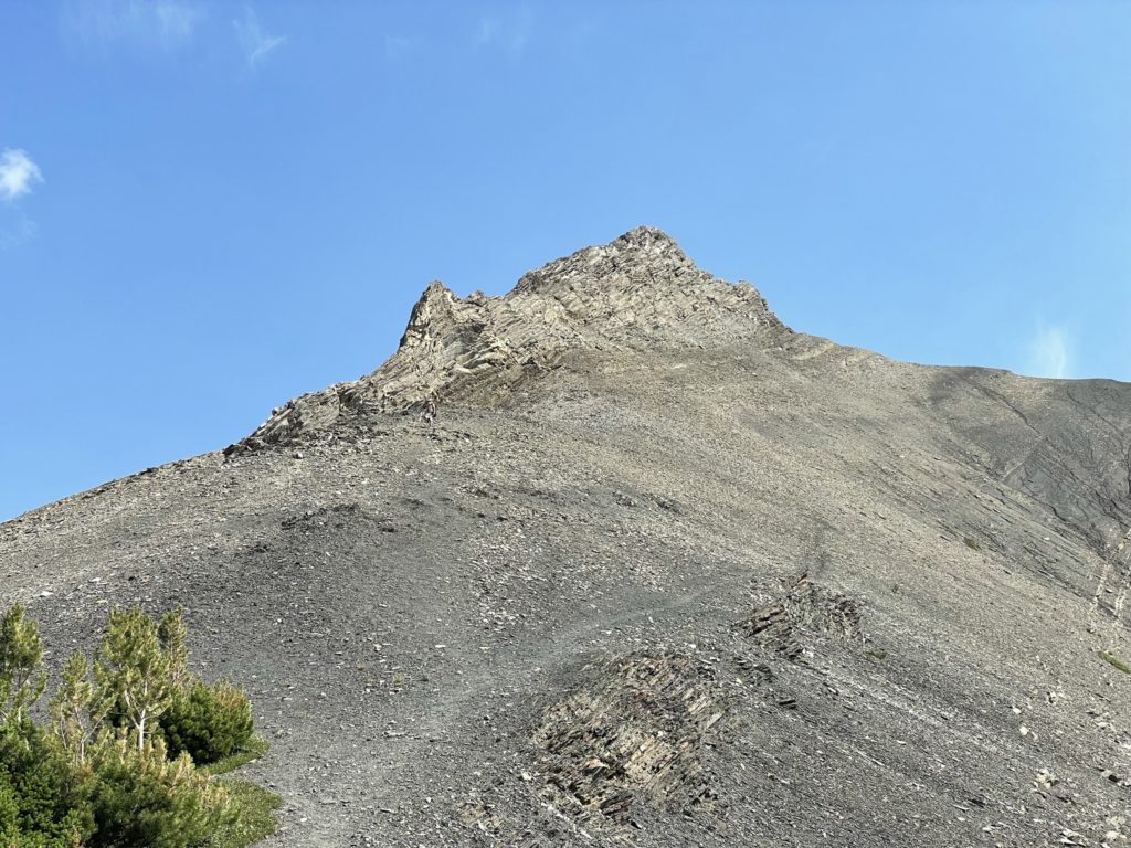
At around the 2300m mark we broke out of the forest onto a ridge line. What stood before us was a daunting looking scree slope and pinnacle above that. I could make it faint tracks up through the scree slope and figured we could just follow those. As is often the case, the closer you get to the slope the sooner you realize it’s not as steep as it appears from afar. Sure enough, the scree slope was actually pretty mild and we had no issues getting up it. The looming rock pinnacle above definitely posed some rock fall hazard, so we were careful not to linger in this section for long.
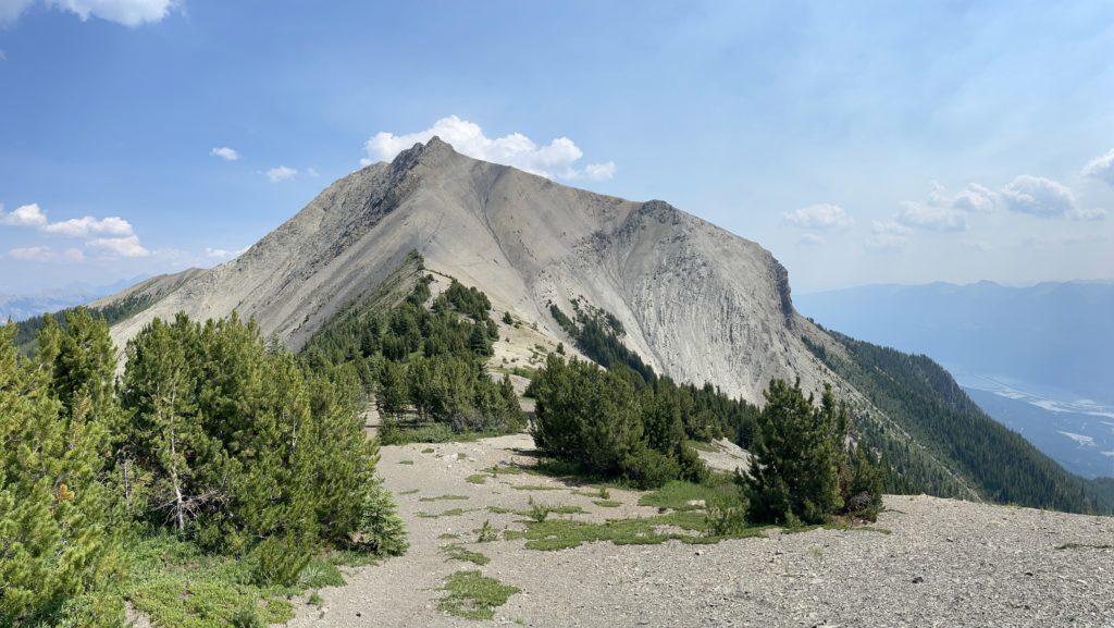
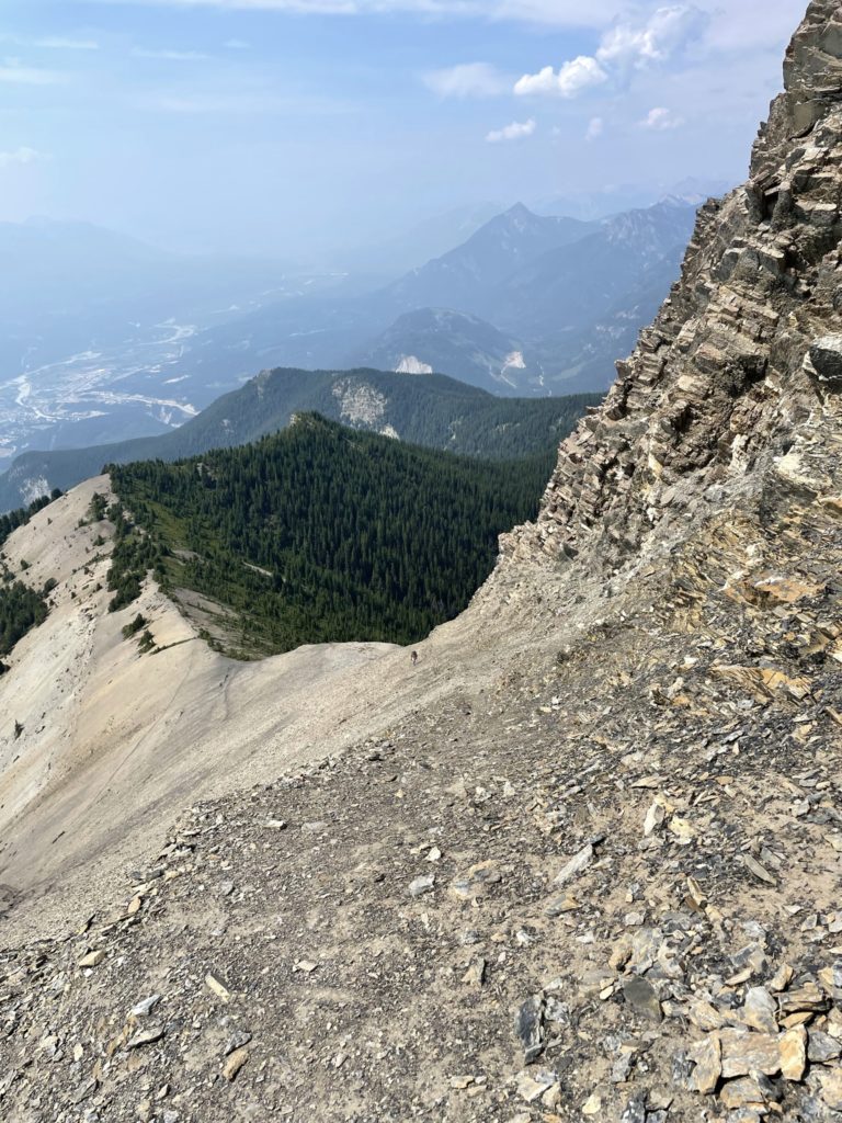
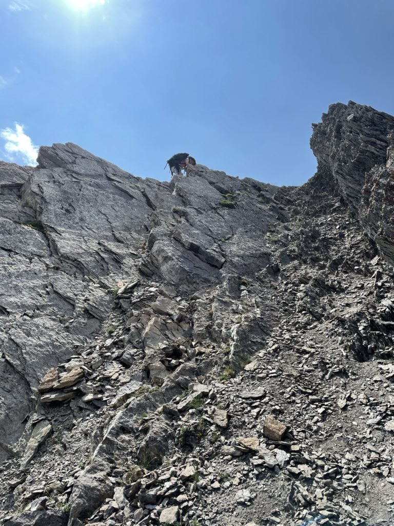
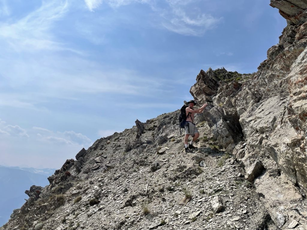
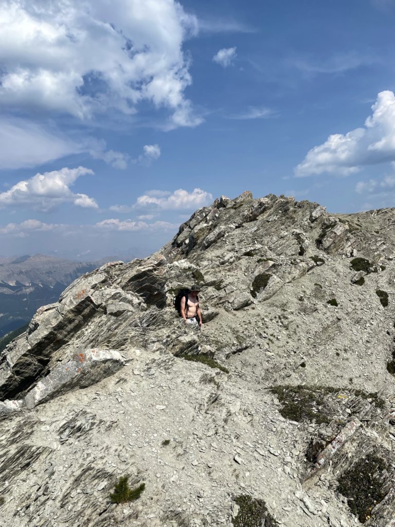
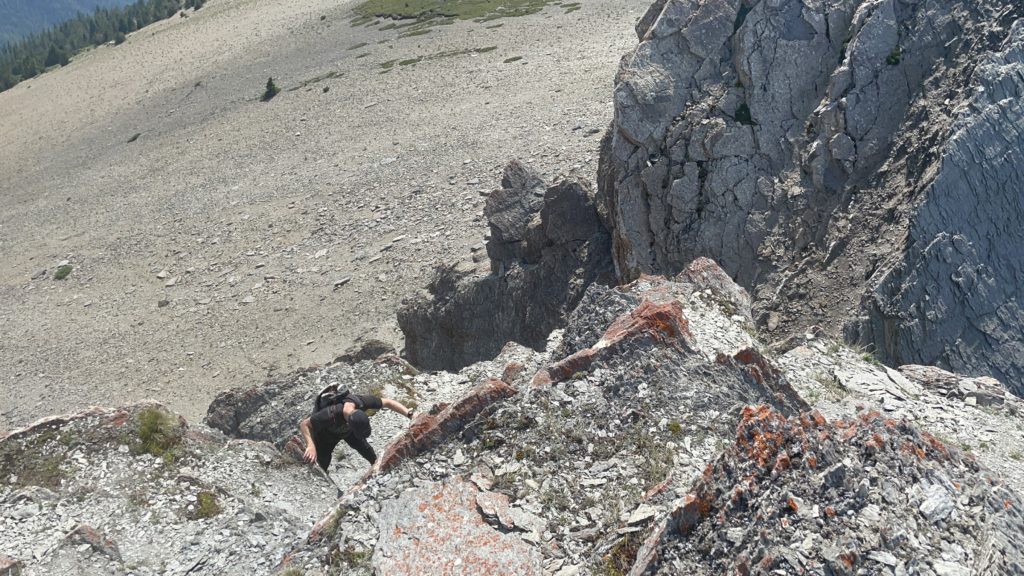
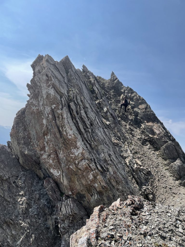
Once above the scree slope, we followed a short path up to the ridge and then had a better view of the summit route. Between us and the summit were a series of ridge high points and notches that needed to be ascended and descended before reaching the summit. The first such notch was a steep class 2 section with no real exposure and we were able to down climb it with relative ease. At the bottom of this notch was a small class 4 wall with some high consequences and exposure. I opted to go climber’s right along a small ledge to see if there were any other options. Getting up the class 4 section looked okay, but coming down was going to be less fun. Around the corner I find a more suitable class 3 route and started my way up that. Simon opted for the class 4 section and we met at the top of the next ridge. The rock was a bit flaky in places and there was loose scree over hard rock, but otherwise it was very straightforward to ascend.
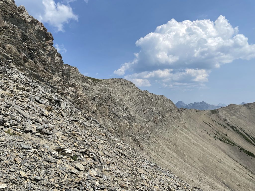
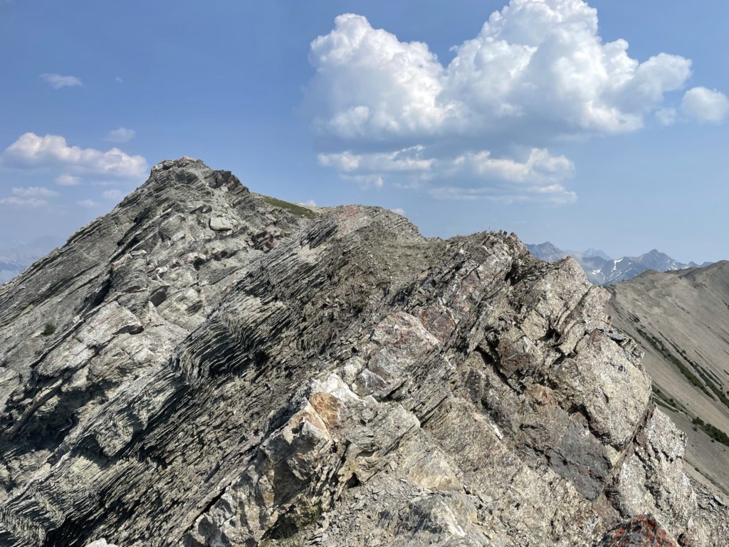
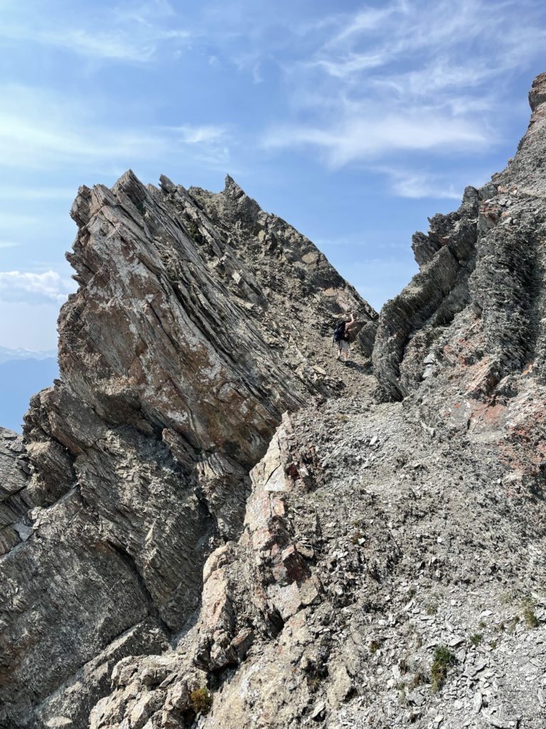
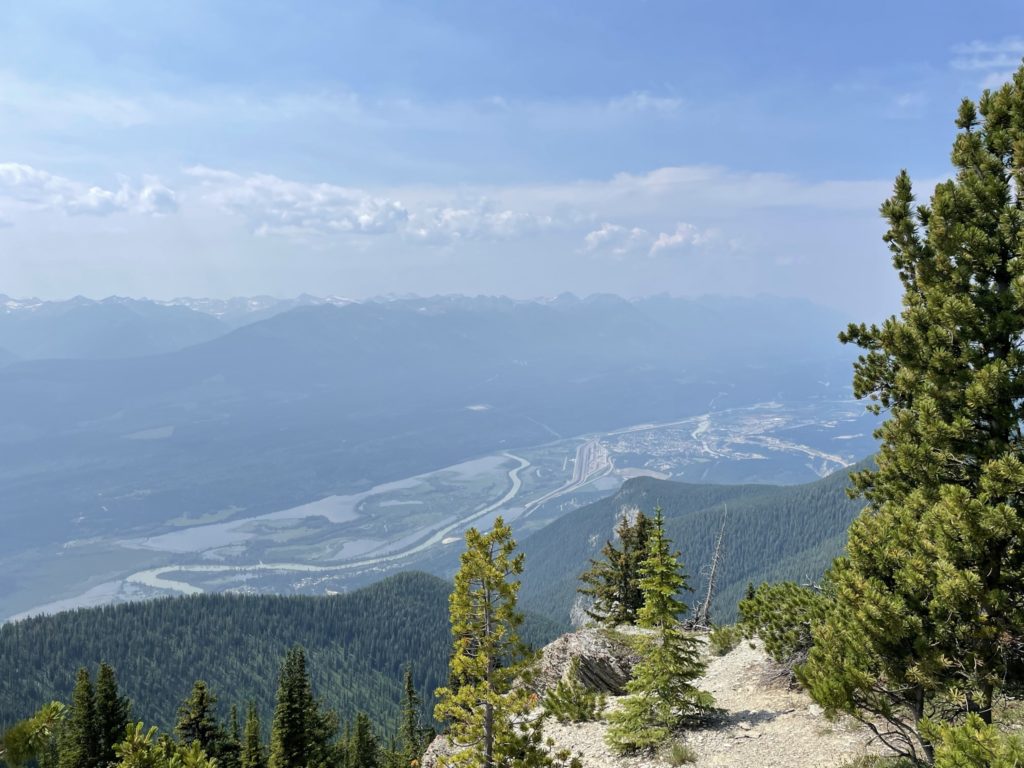
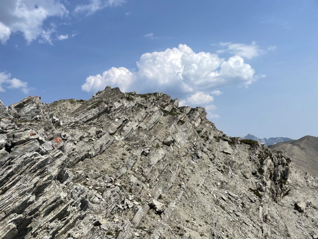
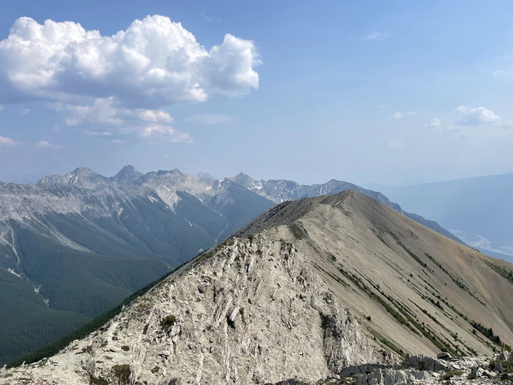
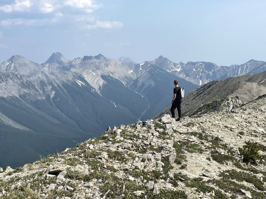
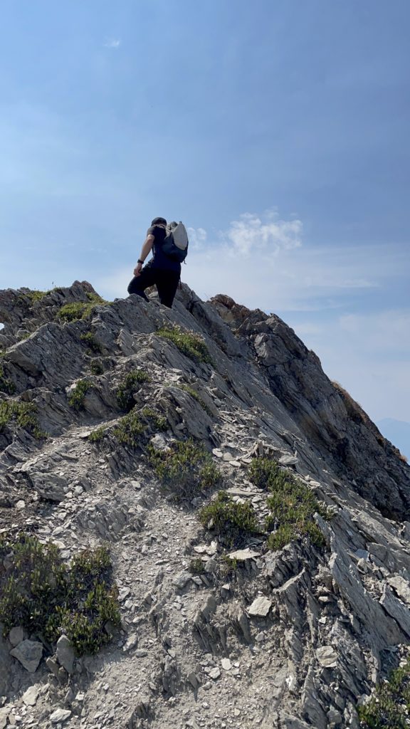
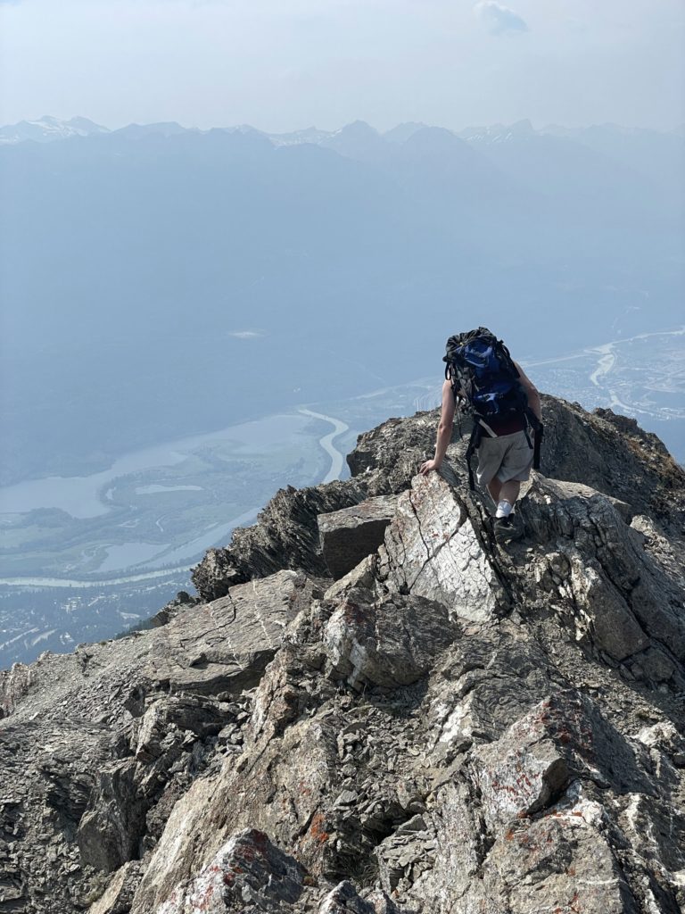
From the second high point, there was another small down climb below the ridge to traverse to the next high point. This area wasn’t too steep and there were good holds/options to gain the ridge again. After that we just traversed along the final narrow ridge before reaching the broader summit area. The summit itself had ample room to hang out and take in the views. We spread out taking photos and then found a place to sit down for some food. Simon was pretty tired after finishing his first hike in awhile, so we hung out at the top enjoying the sunshine for awhile.
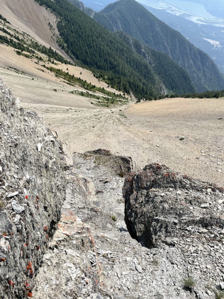
After maybe 30 minutes or so, we started our way down. We simply back tracked our original route until the class 4 section. Here we took my route down and had to rely on the holds quite a bit to avoid the scree loaded rock slabs. Once back at the small ledge we walked around the first notch and then reascended the pinnacle, which was much easier on the way back. At the top of the pinnacle we took the small foot path back to the scree slope and then rode the scree treadmill back down the forested ridge. Then it’s a basic plod back to the truck.
Mt. 7 ended up being an incredibly fun scramble with some great route finding and very short approach. I highly recommend this peak to anyone looking for a short fun route in the Golden area.