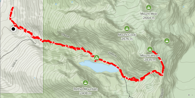
Distance: 22.17km
Elevation: 2,200m
Total Time: 11 hours 39 minutes
Date: August 8th, 2020
On August 8th,my two friends: Kyle and Mike and myself set out to summit Mt. Weart, the second tallest peak in Garabaldi park. The original plan was to hike as a group to Wedgemount lake where Kyle would head back solo due to some time constraints. Mike and I planned to push onwards from there.
We left the car around 10:49am after driving up from Vancouver and set off for Wedgemount lake. Early on the trip had a mishap, as I accidentally took us down a wrong turn following an old FSR and it wasn’t until a km later that we noticed. After realizing our mistake we back-tracked the km to the trail head and proceeded on as normal.
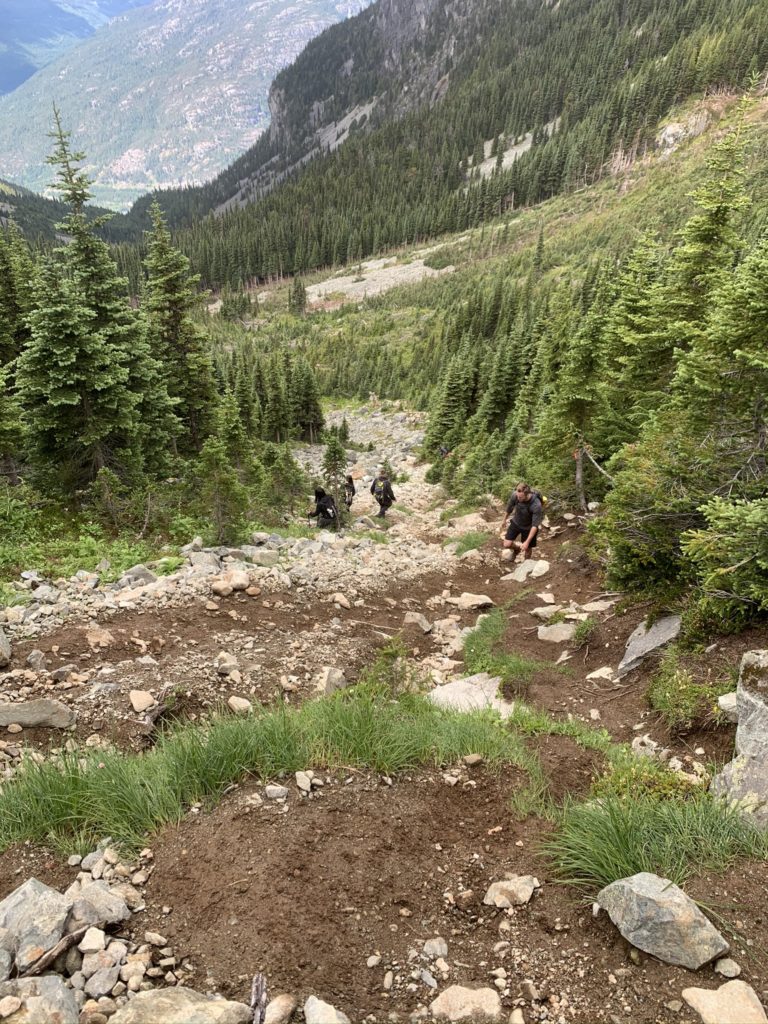
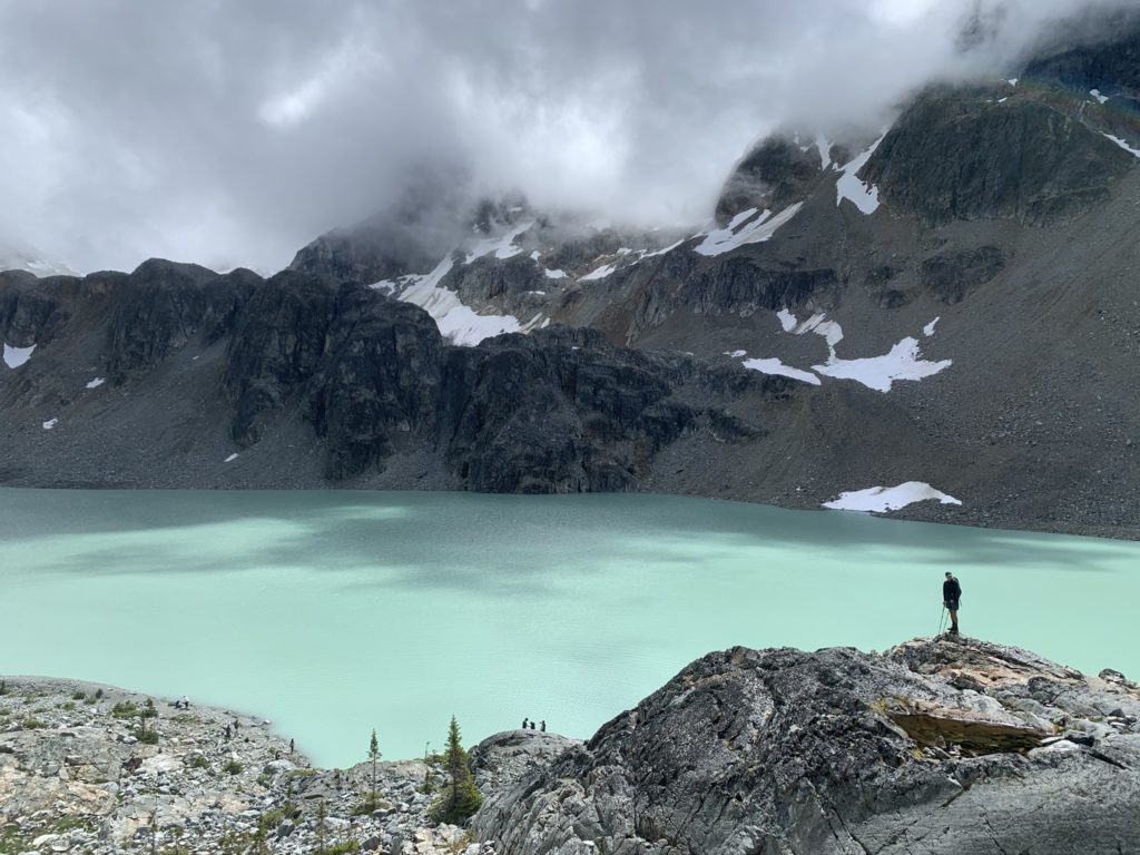
I didn’t take any photos during this time as it’s mostly an uneventful but steep ascent through dense forested area. We set a pretty good pace and made it to the lake in about 1.5 hours gaining ~950m in elevation across 6km. We paused at the lake for some food and to enjoy the views. It seems most people come up for the lake exclusively and I can see why. At this point my friend Kyle decided he might as well come along for the summit too.
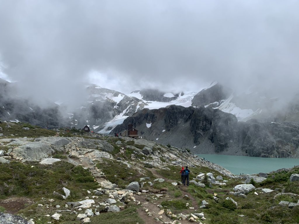
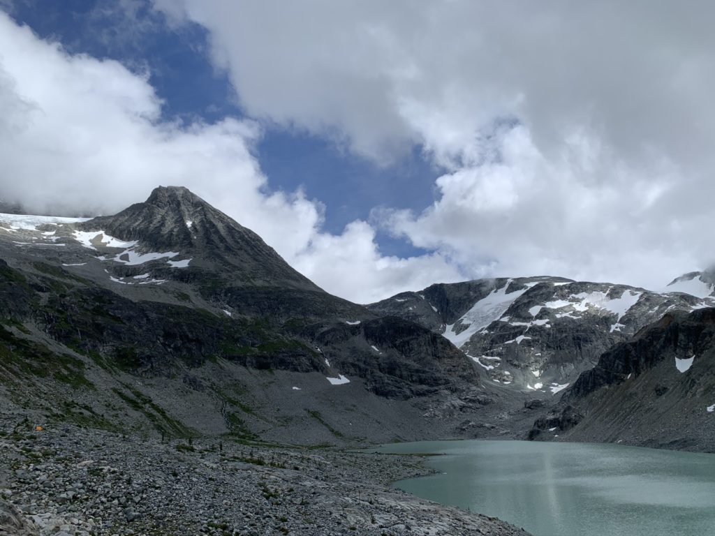
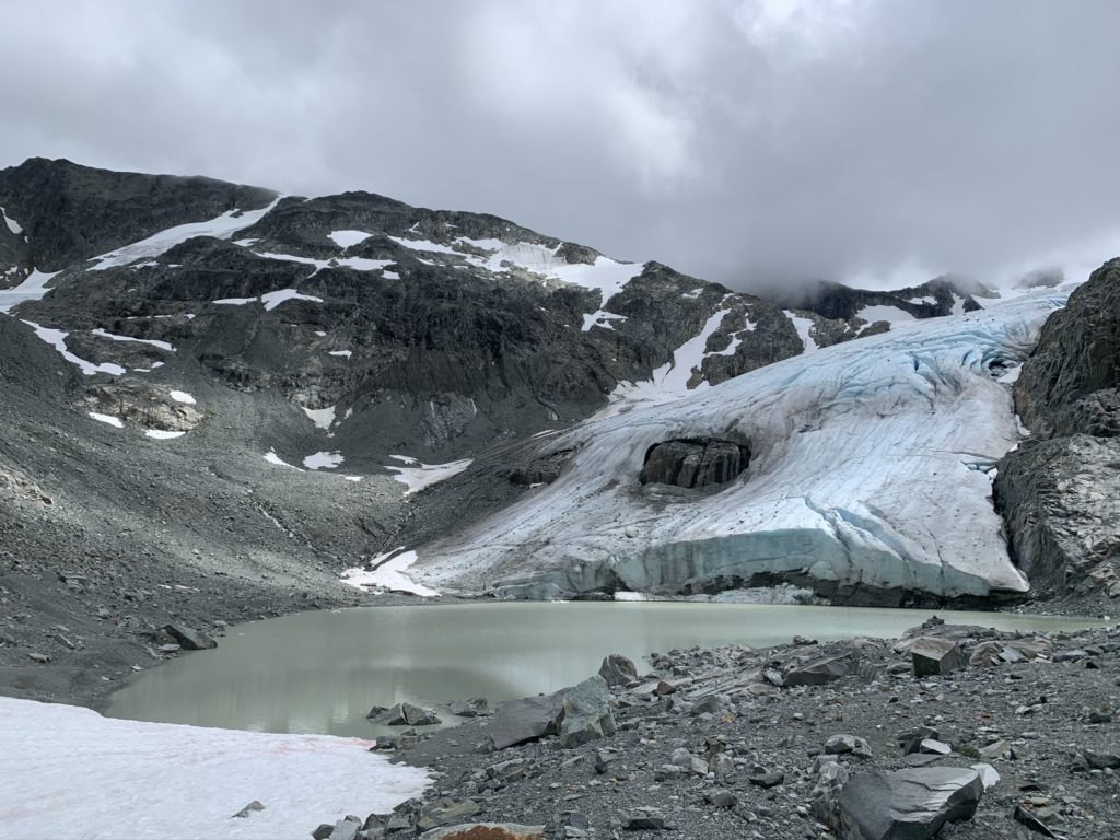
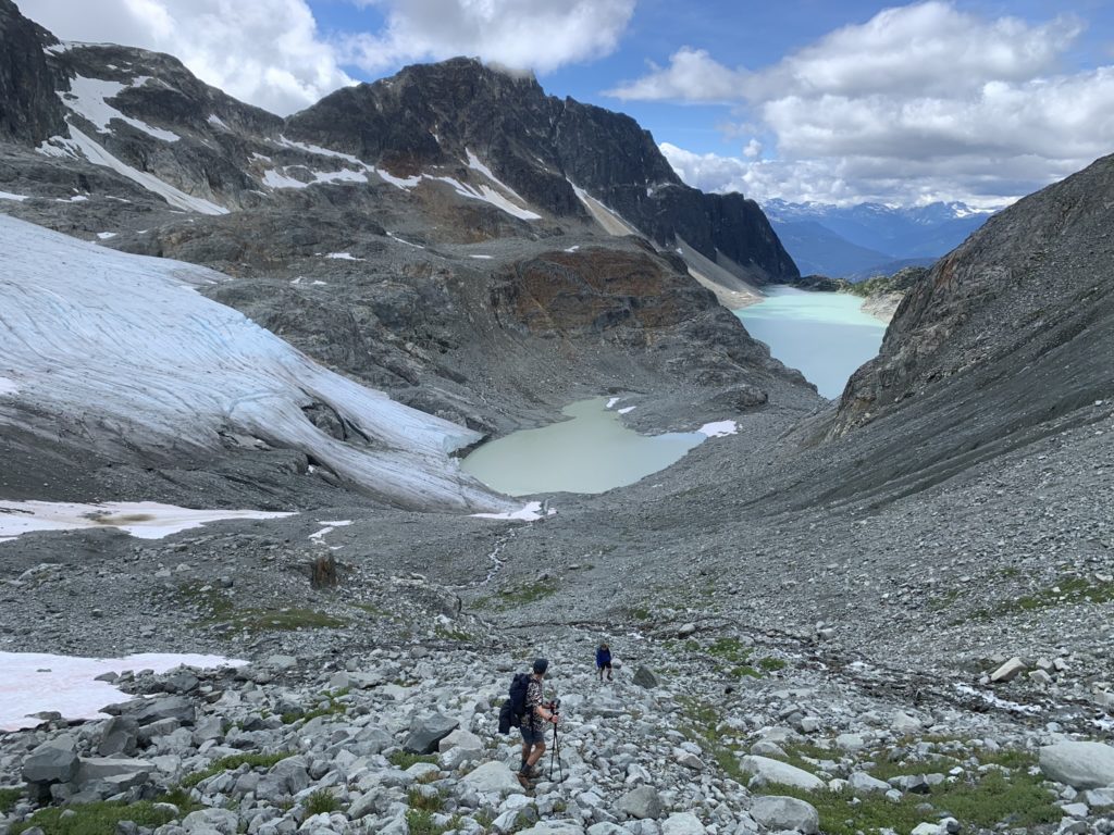
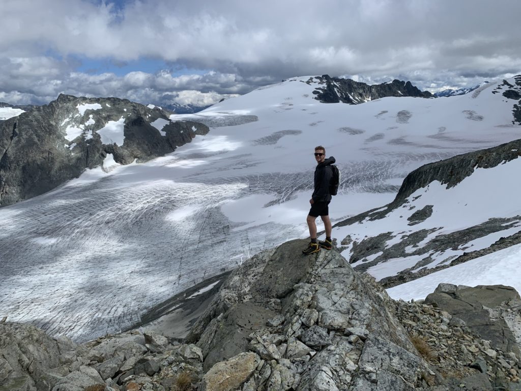
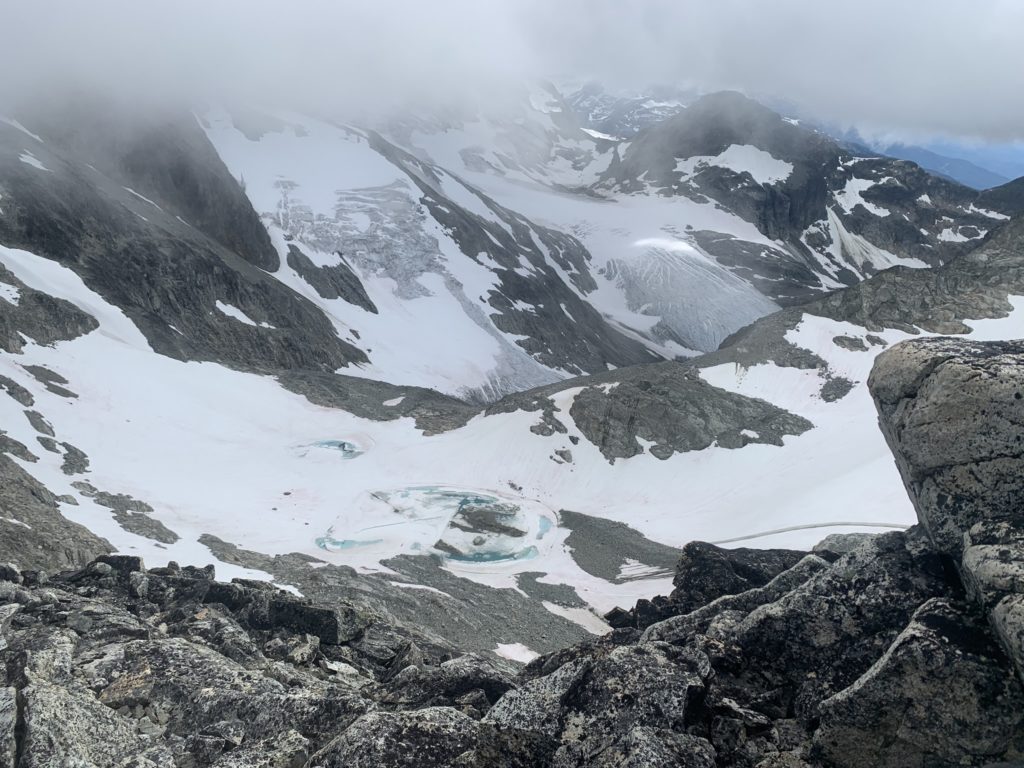
After enjoying lunch for 15-20 minutes, we pushed on along the north side of the lake, following the established trail. It’s fairly flat along this section and it took no time to reach the bottom of the Wedgemount Glacier. Just after the glacier we turned left up a steep and loose talus slope. The slope elevates upwards ~150 meters before flattening out. There you can find a small tarn and another small glacier to the east, hanging off the Mt. Weart/Wedge Mountain col.
At the end of the flat section was another steep talus field and from afar looked pretty sketchy, with a cliff band running across a large stretch of it. Luckily another group was in the process of down climbing and we were able to pick out a mellow route based on their descent. As you get closer you’ll also notice it’s not as steep as it first appears. The boulders that make up the slope were prone to shifting so we had to be mindful of hand and foot placement as well.
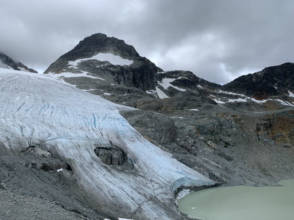
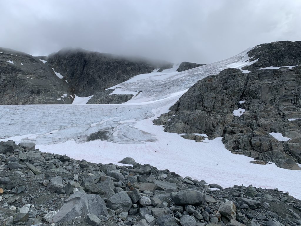
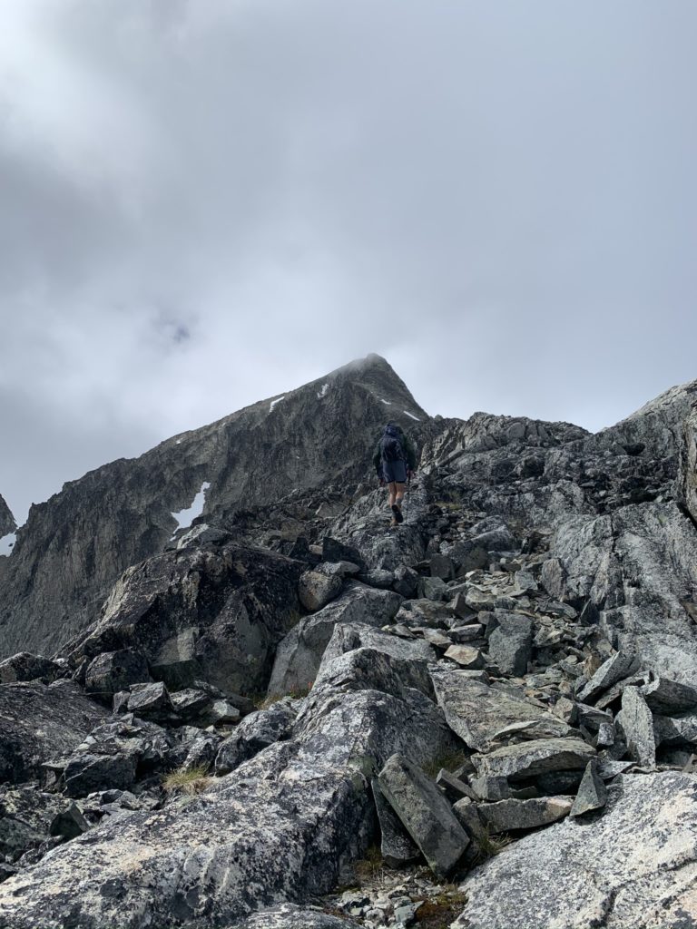
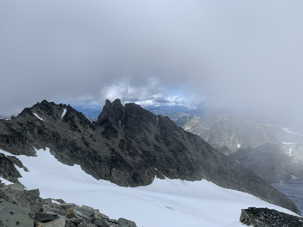
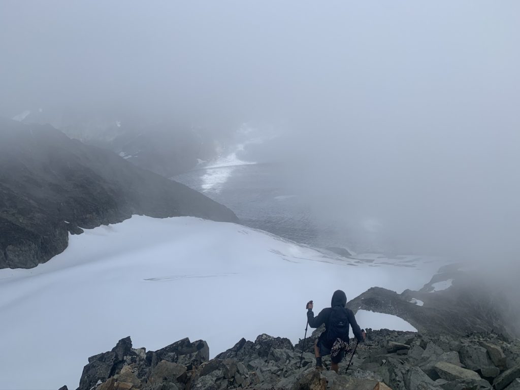
Once we made it up the boulder field, there was a final flat section with a partially melted tarn and snow field. From this area, there was a good vantage of the ridge line up to the summit. To reach the ridge line there was another steep scramble section for ~100 meters, but it was simple to climb up with some basic route finding. At the top of the ridge line was a panoramic view of the Weart Glacier, Mt Eureka and the Owls. In my opinion the Weart summit ridge line offers the most spectacular views out of the whole journey and was worth every step of the massive of elevation gain.
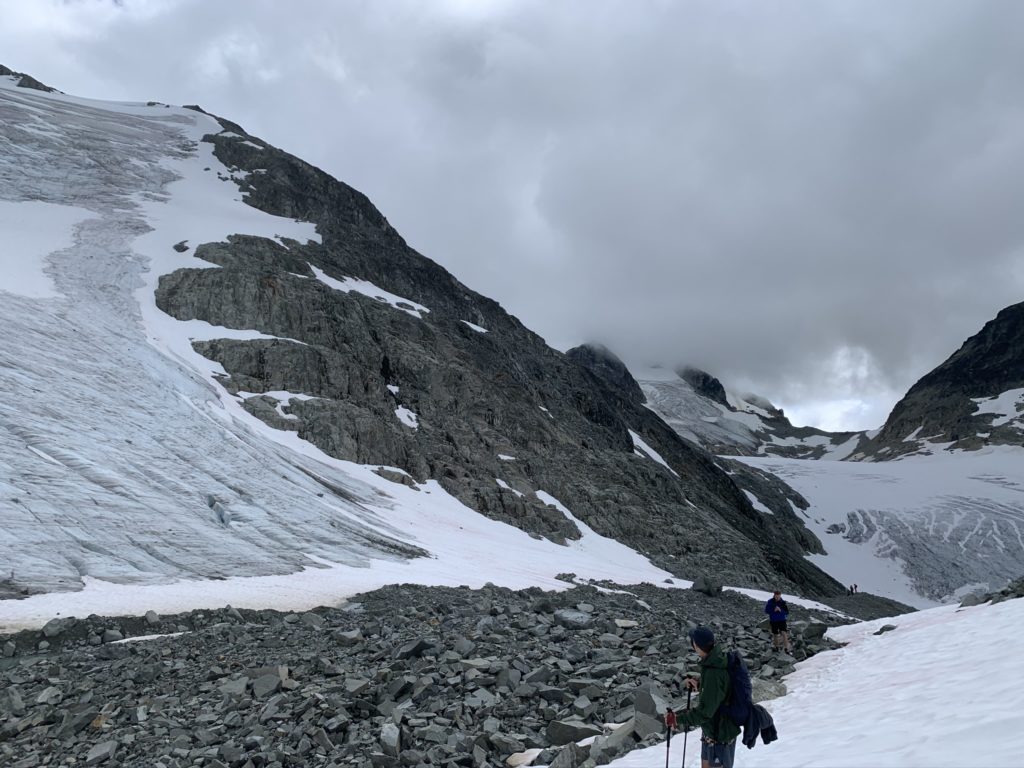
We stopped for 10-15 minutes to take in the views and snap some photos. From there we eyed up the final summit route and from our vantage it looked quite intimidating. The route looked steep and exposed, but as we approached closer an easy enough route started to reveal itself. When we reached the base of the final pitch it was clear that, while still steep, it had no exposed sections and involved some straightforward scrambling to the top.
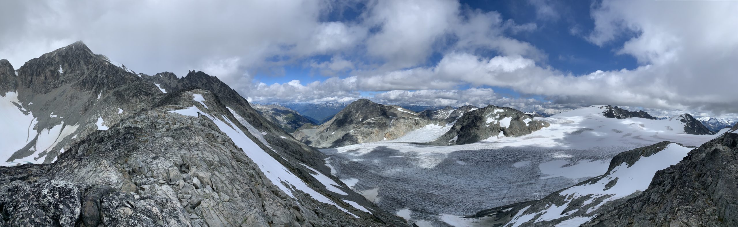
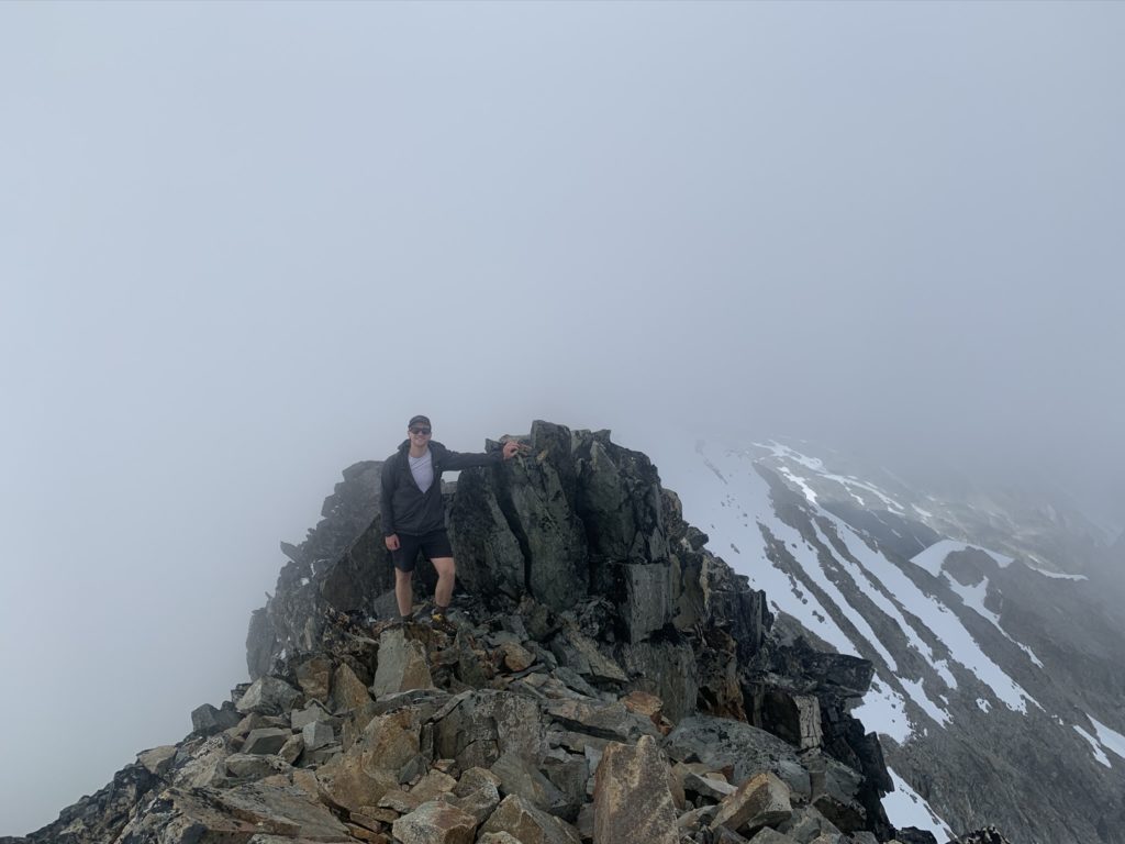
The last 300 meters or so were slow going. We were pretty tired from the big day so far and going from sea-level to nearly ~9,300 feet was also playing a big factor. Mike and I reached the top, while Kyle elected to wait for us at the bottom of the last pitch. We took a few minutes to get some photos, but the clouds had started to roll in and the view quickly became obscured.
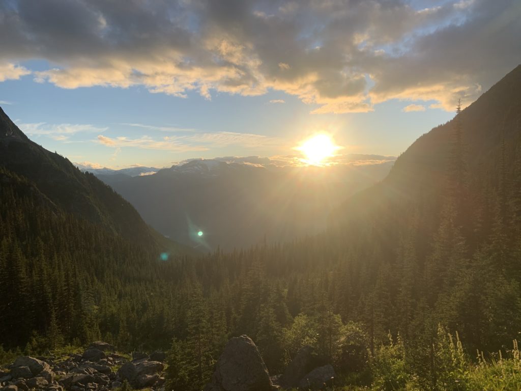
We followed the same route down, but it was slow going with the large boulders and tedious foot placement/balancing. In hindsight some hiking poles would have made a nice difference. When we finally made it back to Wedgemount lake it was a slow plod back to the car while the sun began to set.
Somewhere around the 2km mark from the car we ran into two hikers who were lost and one had an injured ankle. At this point it was starting to get very dark and while we had head lamps they had none. They looked frightened and in need, so we decided to help escort them back to the parking lot and hopefully save local SAR the effort of coming out. It took another 1.5 hours to cover the last 2km, but at long last we made it back to the car where the RCMP and the lost hiker’s friends awaited their arrival. After a quick send off, we hopped in our cars and drove the 2 hours back to Vancouver. Overall a 10/10 adventure with amazing glacier views and elevation gain.