
Elevation Gain: 2,398m
Distance: 14.34km
Total Time: 2.5 days
Date: October 5th, 2025
Mount Judge Howay is considered by many to be the siren call of the Stave River valley. The sharp and aesthetic twin summits of the Judge dwarf their surroundings and they can be seen from far flung ranges on a clear day. These peaks attracted mountaineers and adventurers from its earliest days going back as far as the early 1910’s. That’s when a prominent mountaineer by the name of Tom Fyles, set his eyes on the Judge. Tom hailed from the BCMC and was an intrepid explorer of the era making first ascents on many notable summits including: Mount Cayley, The Table, The Black Tusk (true summit), Mount Meager, Mount Job and more. He and his brother made their first reconnaissance trip in 1917, taking a train that used to operate up to the power plant at Stave Falls. From this jump off point they were able to borrow a canoe and paddle up the lake to try and get their first glimpse of what was then called “Snow Peaks”. Unfortunately, due to weather, they returned home empty handed. Tom would make another trip to scope the area out before finally making the first ascent in 1921 along with Harold O’Connor and Eric Fuller.
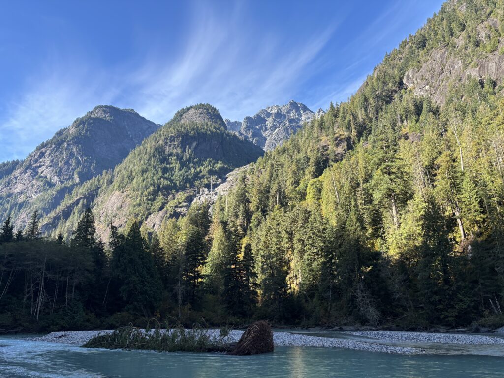
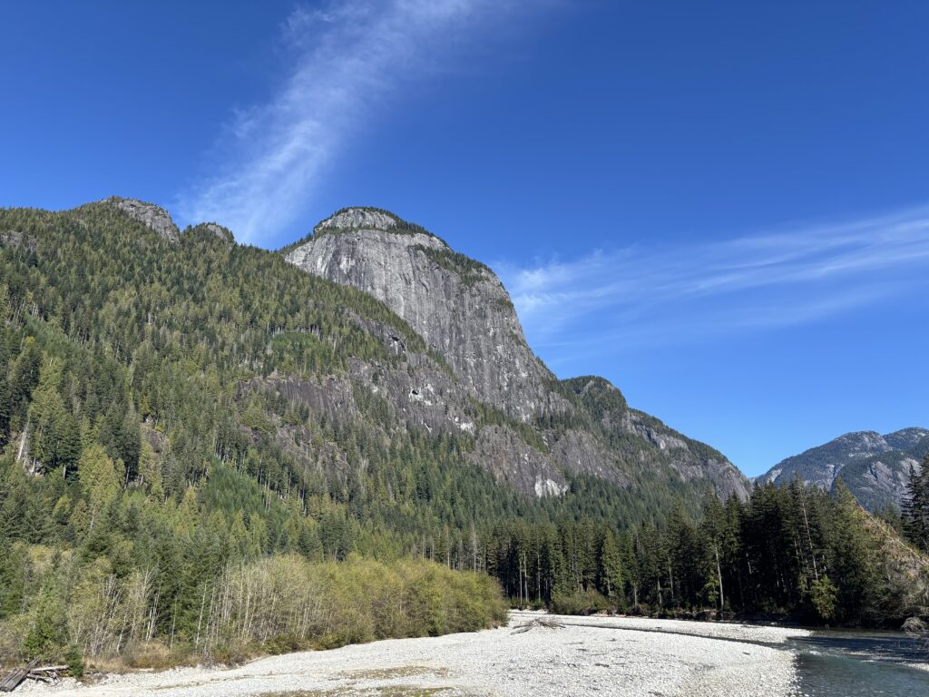
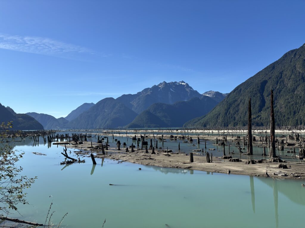
Much has changed since that first ascent, but the Judge still remains a logistical challenge and an adventure to reach. A logging road now snakes it’s way up the Stave River valley, but it’s disconnected from any other road system. In order to reach it, most elect to canoe up Stave Lake and then bike or hike up the road. More recently, some parties have bushwhacked down from Kenyon Lake to reach the Stave FSR, but then the road must be travelled on foot as the terrain is too steep to bring bikes. The Stave itself can still be challenging to ford and climbers need to time the water levels if they wish to make a crossing. Generally, early spring and fall offer the easiest crossings. Once you’re across the river a flagged trail might guide you through the bluffs up to a hanging water platform before one final bad section of bushwhacking lands you out of the trees and into the massive gullies of Judge Howay’s eastern aspect. The difficulties from this point are dependent on snow conditions, but generally ease off until the summit. Finally, a seasonal snow bridge offers the only 4th class route up to the summit. If the bridge is out, parties will need to come prepared with a light rack and rope to climb the steeper alternatives.
Now when Alex and Trevor invited me to climb the Judge for the first weekend of October, I knew little of what I’ve just told you. I had seen a few ascents over the years and only read them with a passing curiosity. The Barkers had approached me about climbing the Judge earlier in the year too, but the window never came. This was an ascent we were all fired up to make happen before years end. Finally, after a week of rain and potential snow, a high pressure system swooped in with a 4 day reprieve. Our window arrived for the Sunday/Monday and we all carved some time off work to make it happen. Normally, we wouldn’t have been able to ford the Stave with the recent rain run off, but we had the good fortune of gaining access to a canoe from our ferry ride to The Stave. I can’t offer much about how we would reach the crossing for the Judge except to say that we were able to take a boat, followed by fast travel down the road with a canoe in tow.
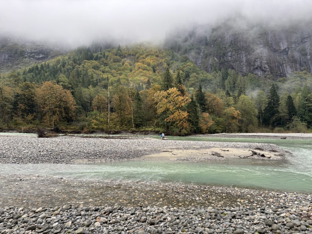
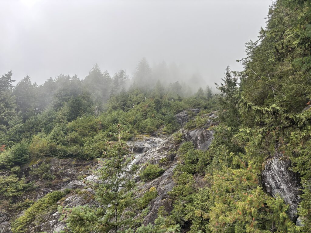
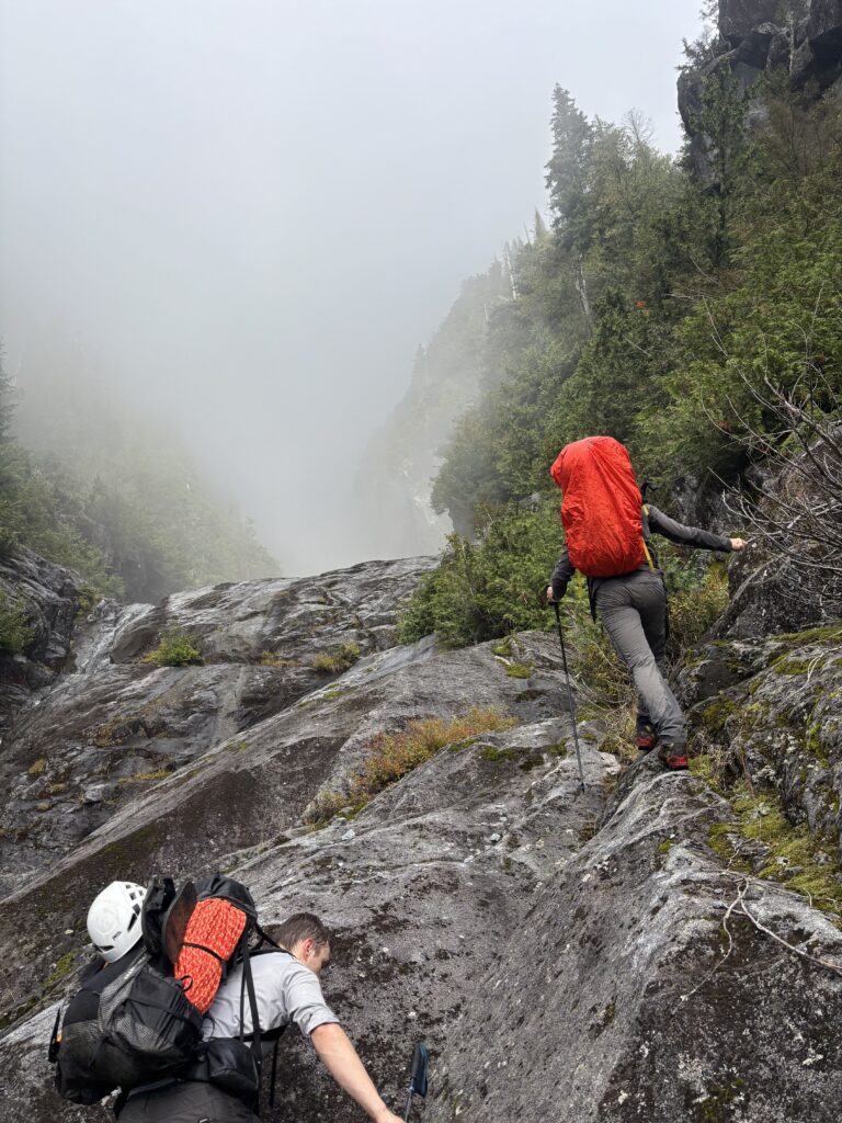
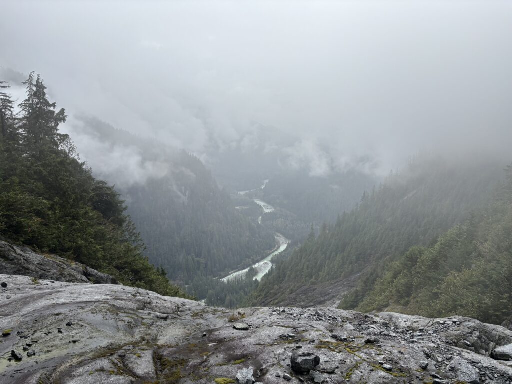
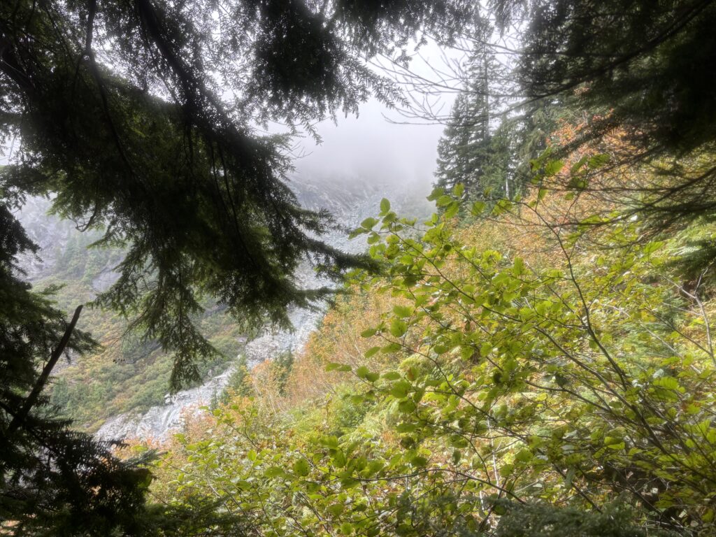
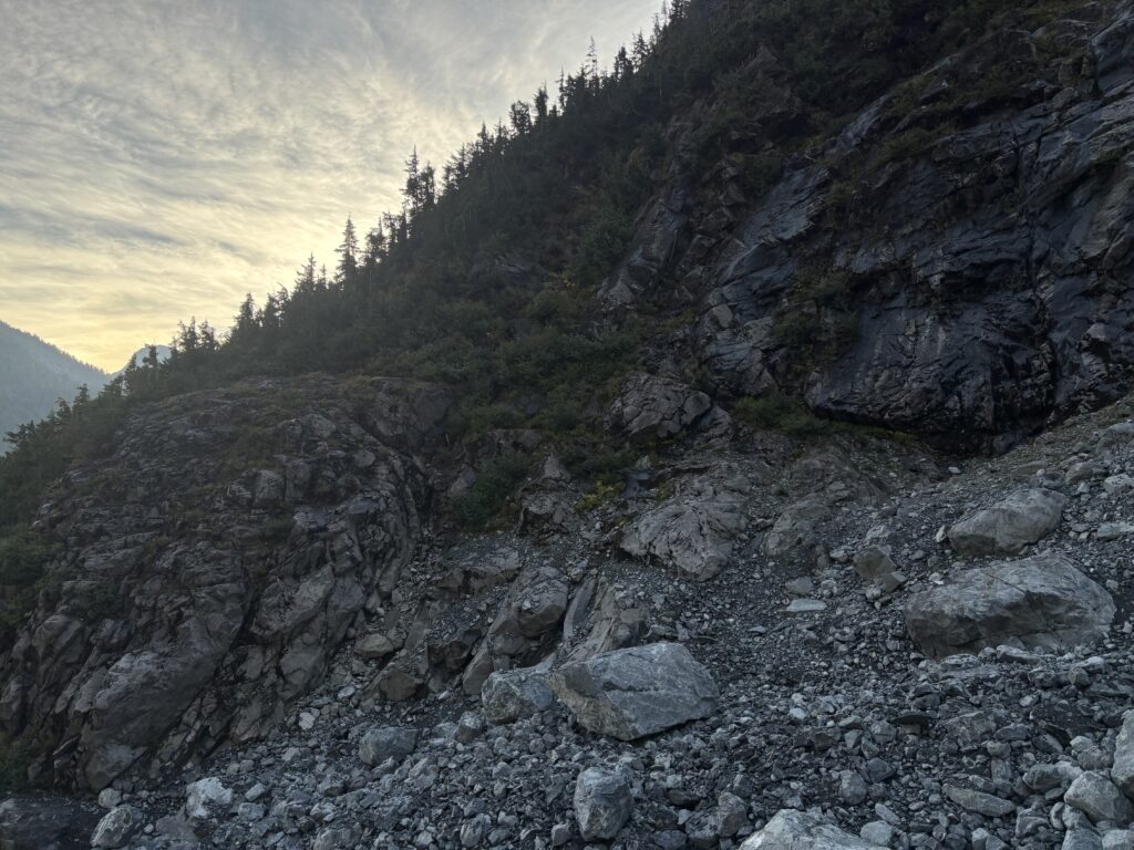
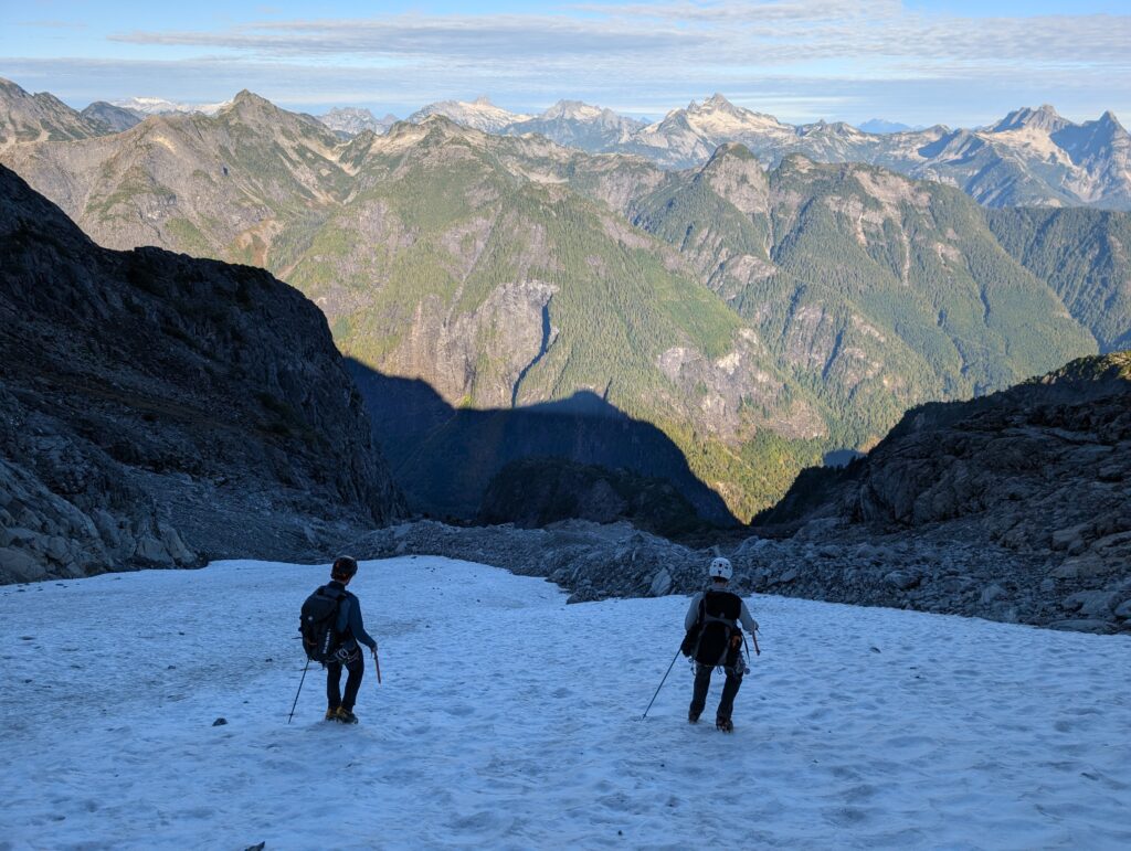
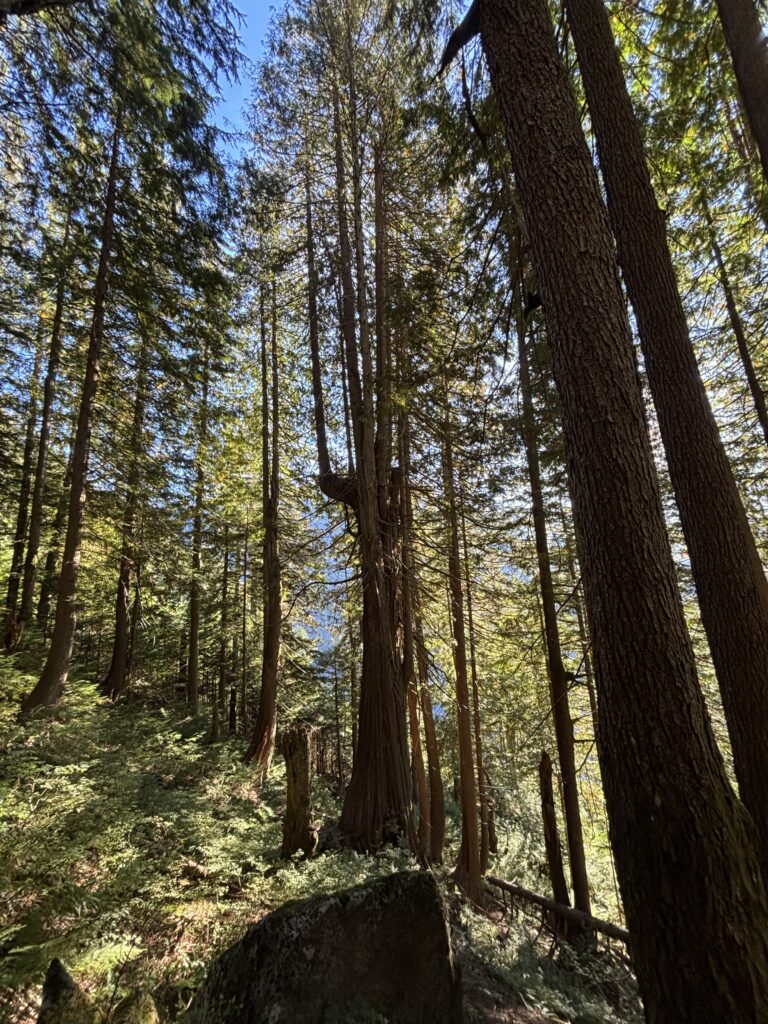
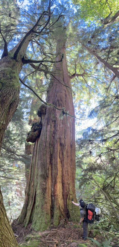
On the first day of our ascent, the clouds hung low above Stave Lake and only the lower sections of long running wet slabs and forests were visible below. We made great time across the lake and before long we were 3 in a canoe preparing to cross the river. The crossing was short and uneventful and we quickly stashed the canoe and started up the trail. Initially we bushwhacked a bit too far up the slopes before course correcting to the flagged trail. We had heard of parties missing the flags and bushwhacking for hours to reach the famous water platform. In modern times the trail has become easier to follow and we knew if we could keep with the flags we’d have a straightforward approach.

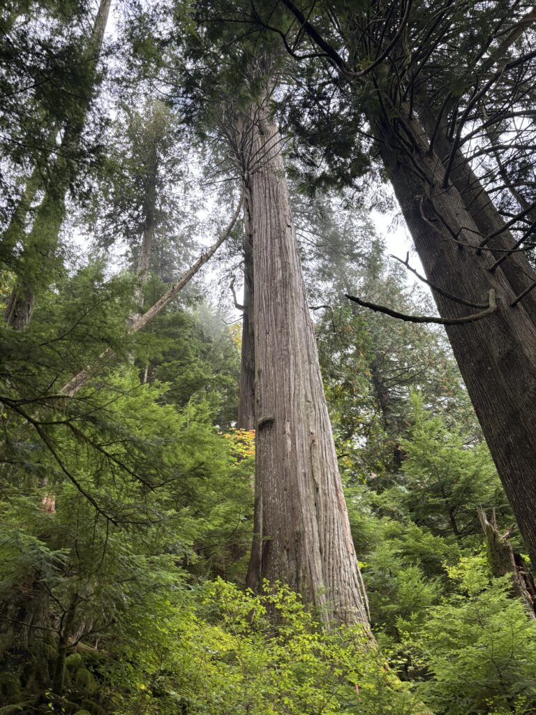
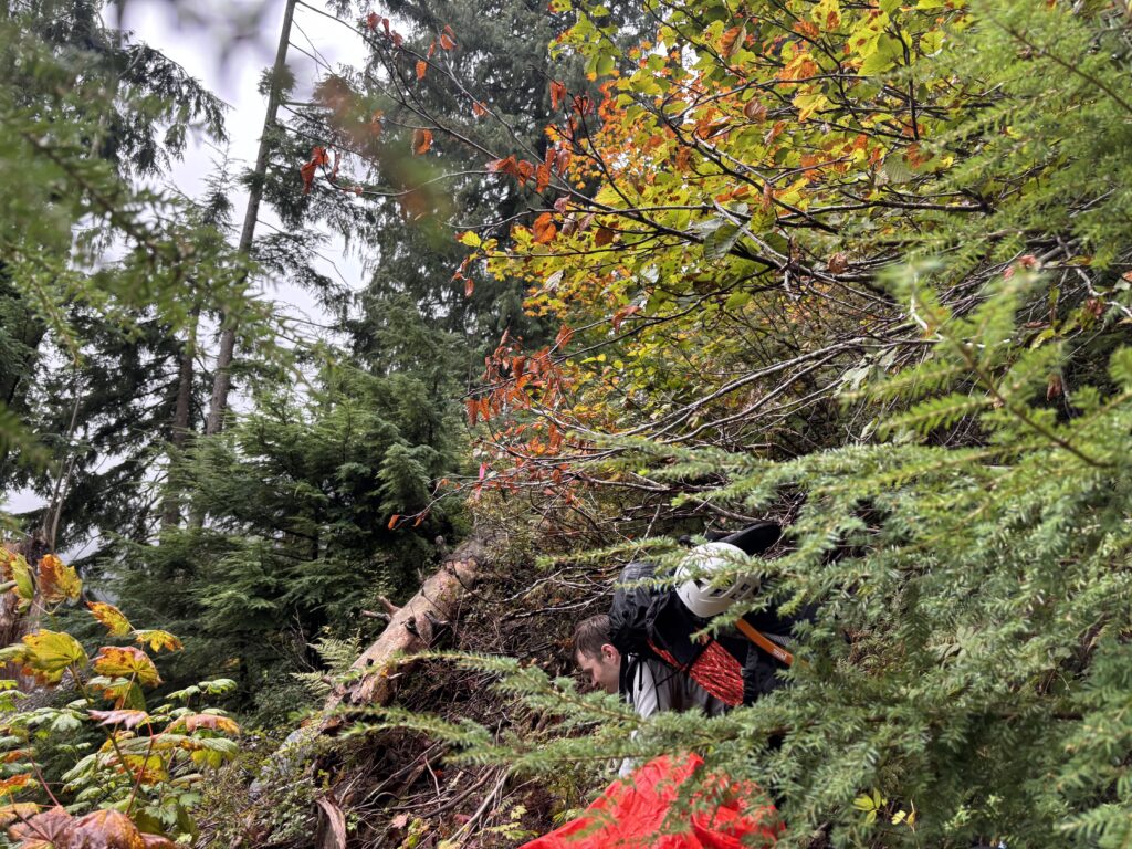
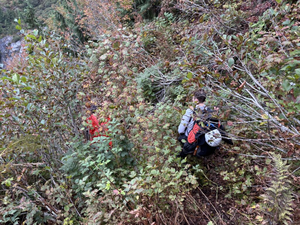
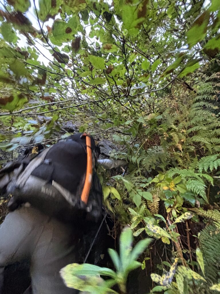
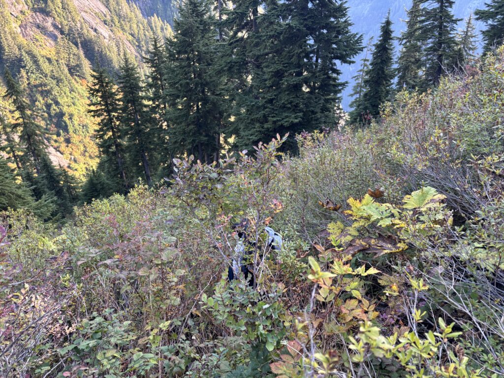
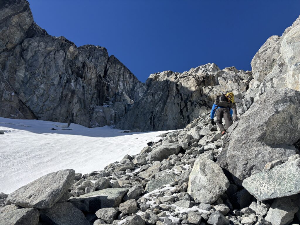
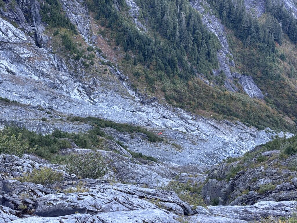
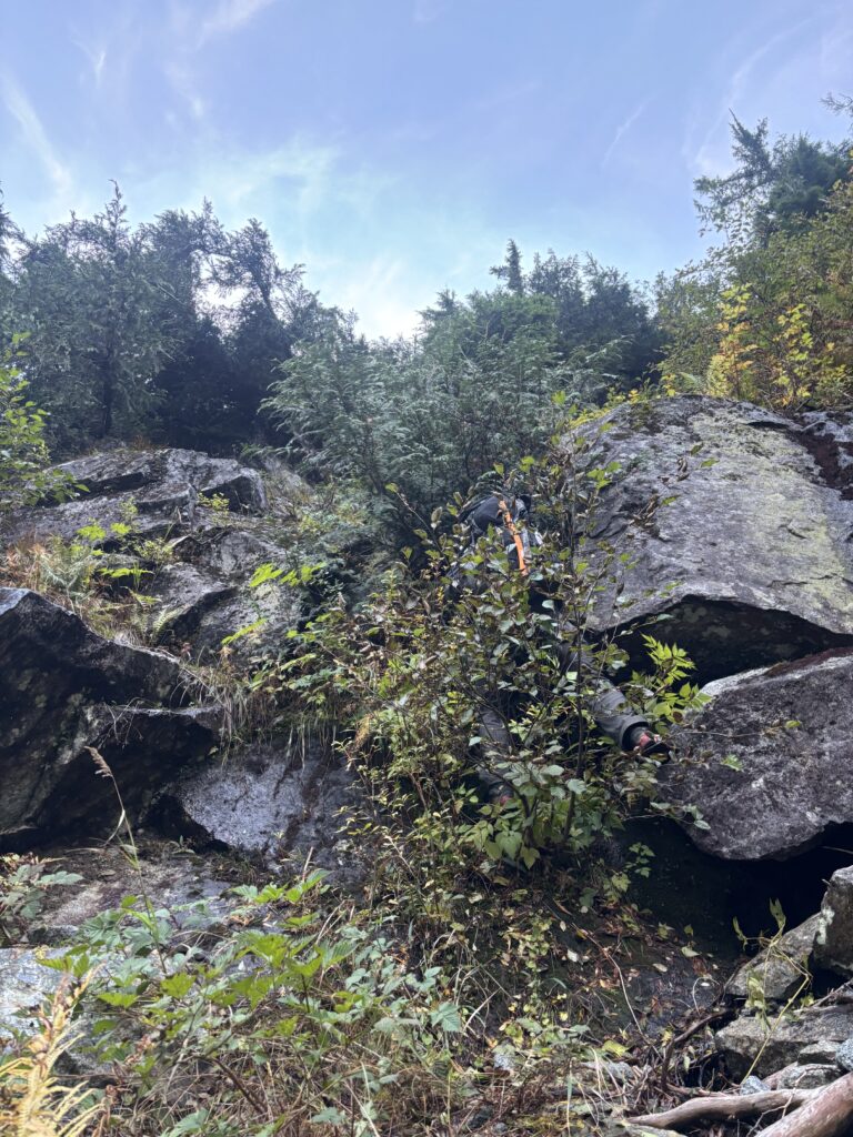
The trail wound steeply up through the forest and slithered between bluffs and across dirt steps clinging to seeping slabs of rock. Thanks to the flagging, we reached the water platform without much event by 10:30am. We took a brief break and then pressed on through a more open forest before reach a snarled section of deadfall demarcated by slide alder and bush to our left. That bushy section marked the final bad part of the approach to the gullies and many parties had reported BW4+. Again, we stuck with the flags and save for the completely soaked underbrush, it was actually much easier than expected. I think even if we didn’t have a trail to follow, it wouldn’t have been worse than BW3. Grainger by comparison was much much worse.
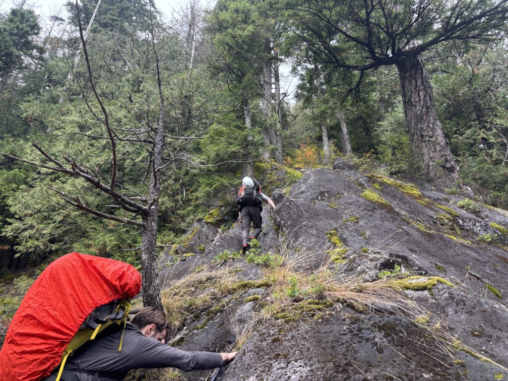
Eventually we reached a section of slabs marking the last of the bush to the more open gullies. We could see an easy route across the rock, but it was covered in a slick slime and there simply wasn’t any safe way to cross. We had to bushwhack up and around the slabs and then used a hand line to get down a short bluff and then we were virtually home free to the gullies.
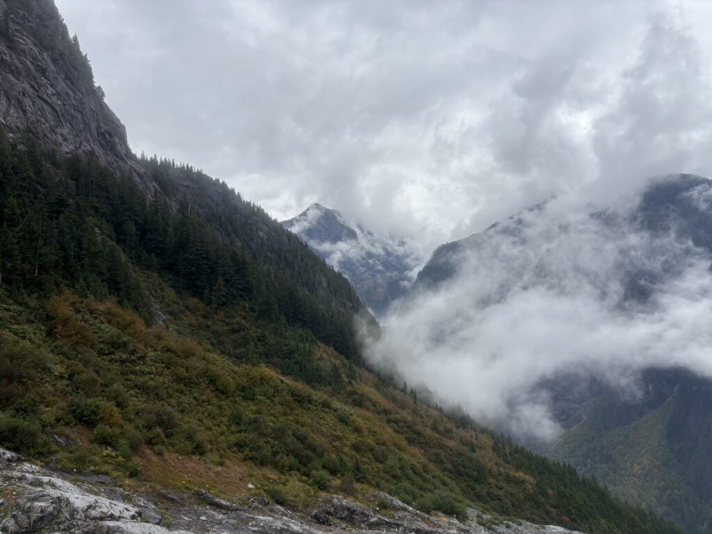
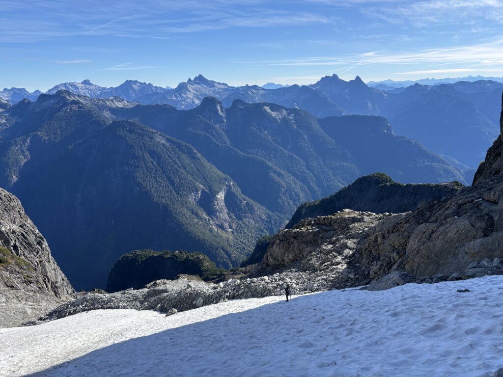
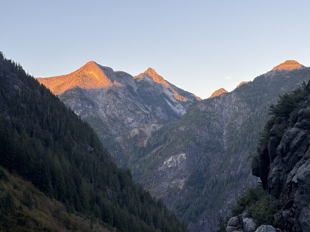
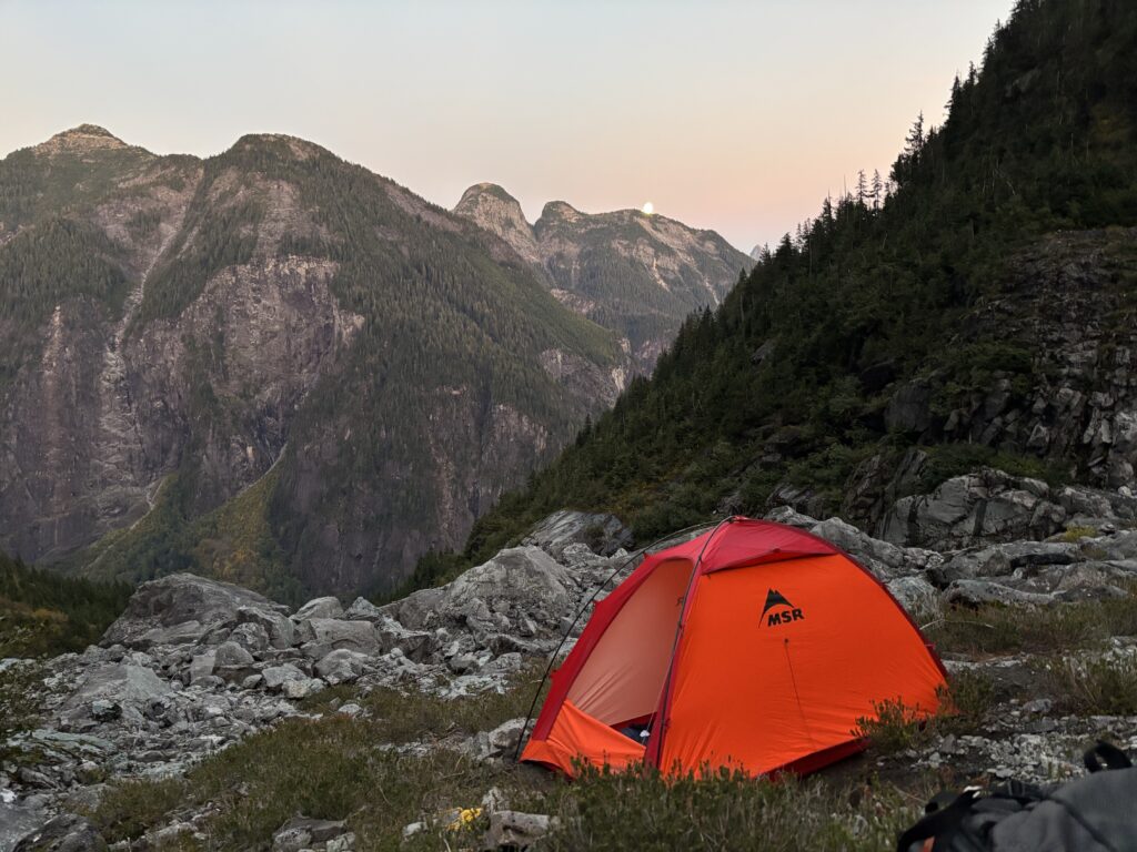
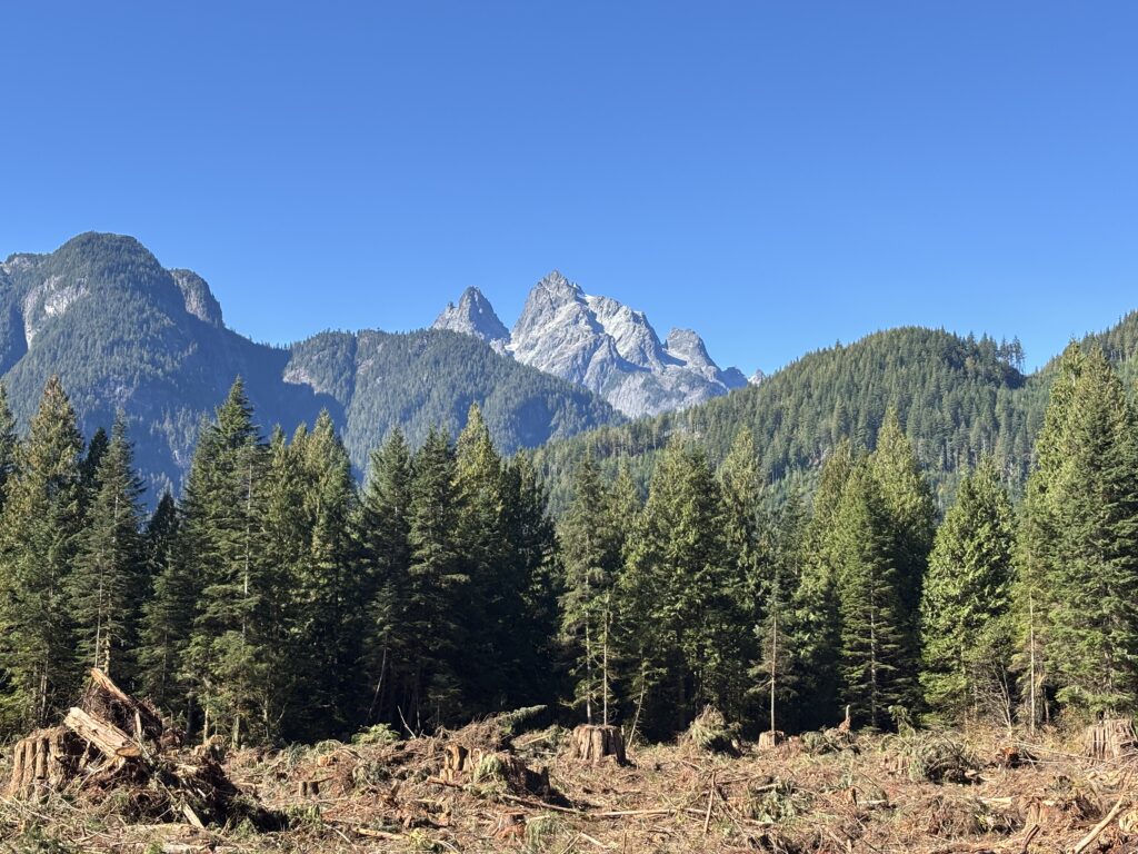
An hour was spent searching around for a suitable camp site, but there were few and eventually we resorted to just building our own tent platforms into the hill. This worked nicely and within 30 minutes or so we had two tidy tent sites to set up on. Clouds continued to linger low in the valley, but we’d occasionally get breaks towards the summits. Any lapse in the cloud break would have has craning high to see if we could spot snow, but we never got a full view of the summit. From camp the true summit was still towering another 1,500m above us. We would just have to find out in person how much snow, if any, awaited us.
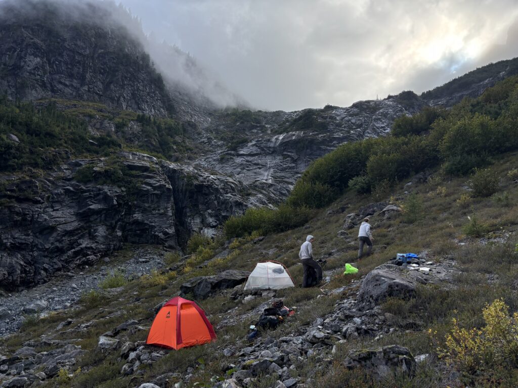
All of us settled in around 8PM and awoke to the distinct patter of rain on the tents just an hour later. It let on for another hour more before finally subsiding. This wasn’t in the forecast and there’s just no way it was helping our cause high on the summit. We all wondered if that last bout of rain might be our undoing.
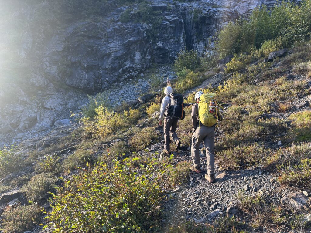
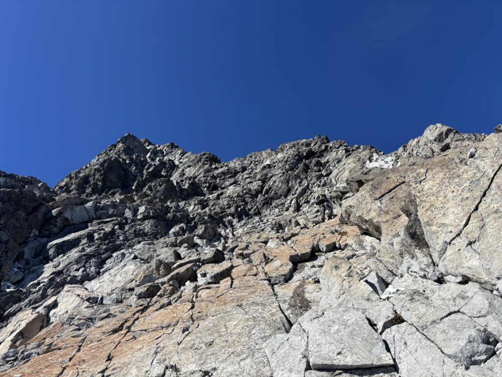
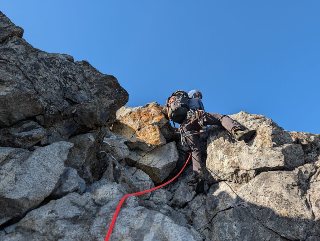
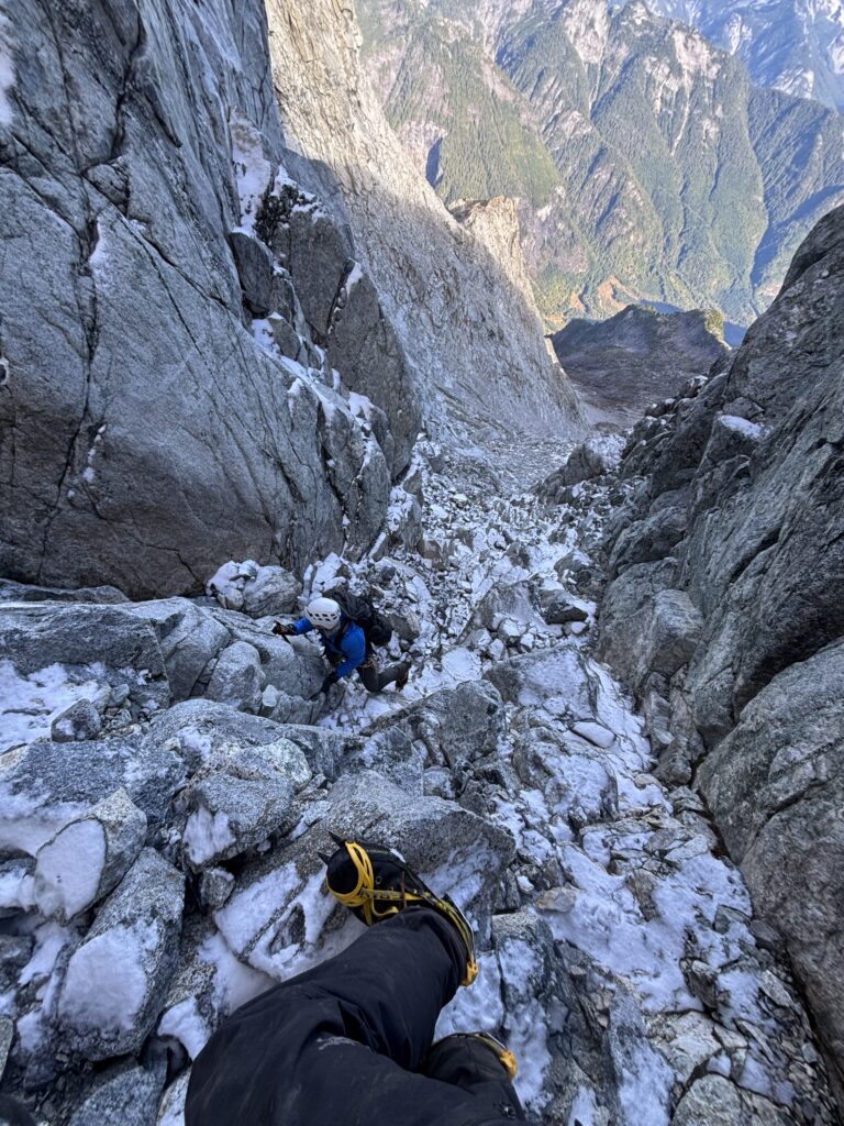
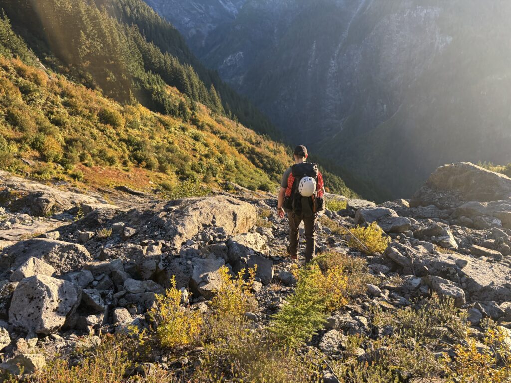
7am rolled around as light crested into the valley and we hopped out to survey the surroundings. There were no obvious changes from last nights rain and we quickly got to packing. We left camp around 8am and the first crux of the day was getting around some wet 4th class slabs. A bypass had been identified through the bush on the left and so we had a breakfast of krummholtz, branches and brambles. After dispatching with the band of bush, we entered a slick boulder field and made our away across where at the end a dry band of rack allowed us to enter the upper slabs and talus fields.
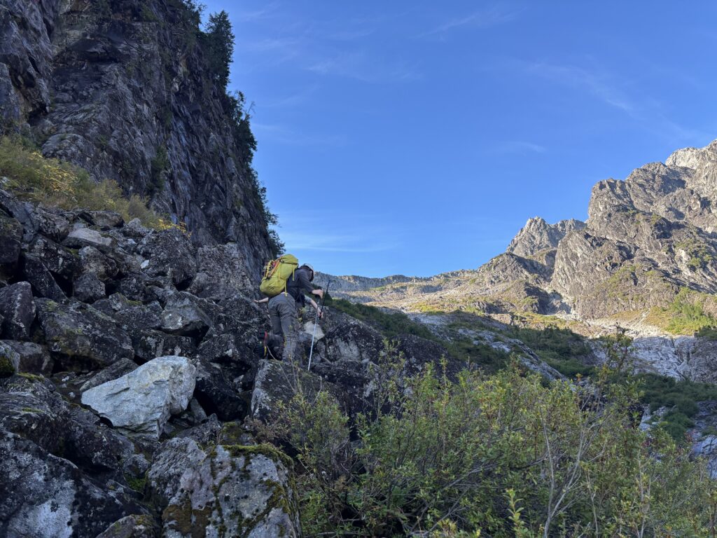
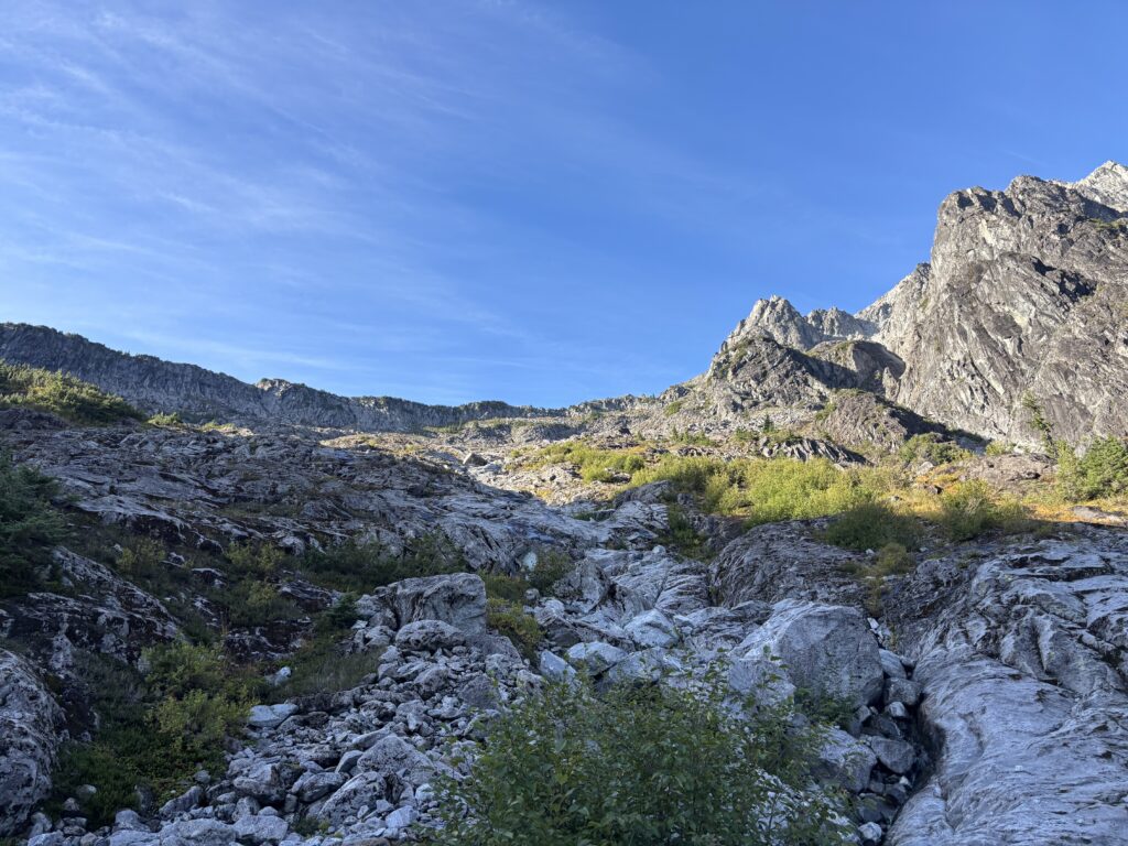
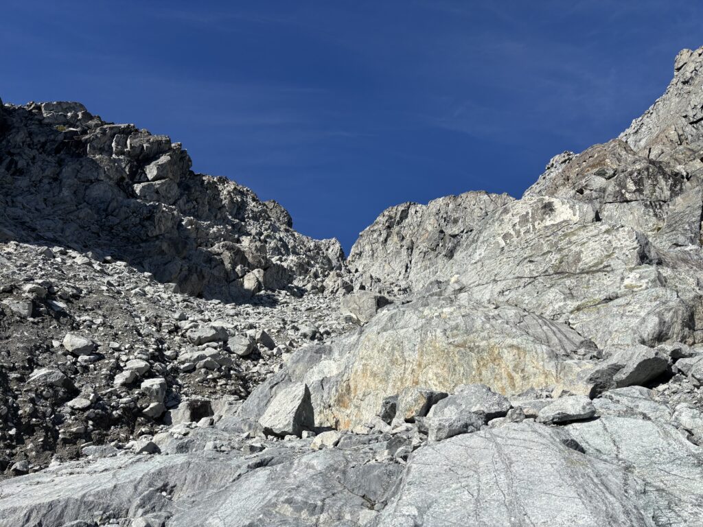
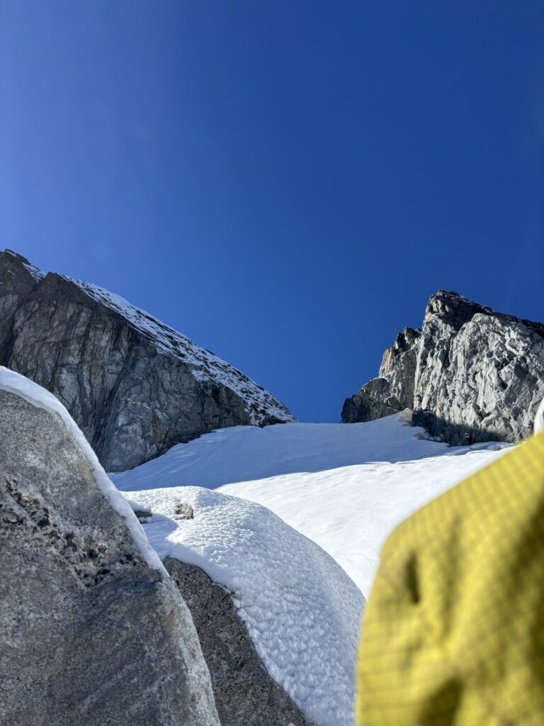
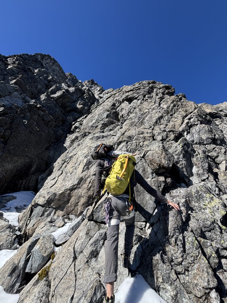
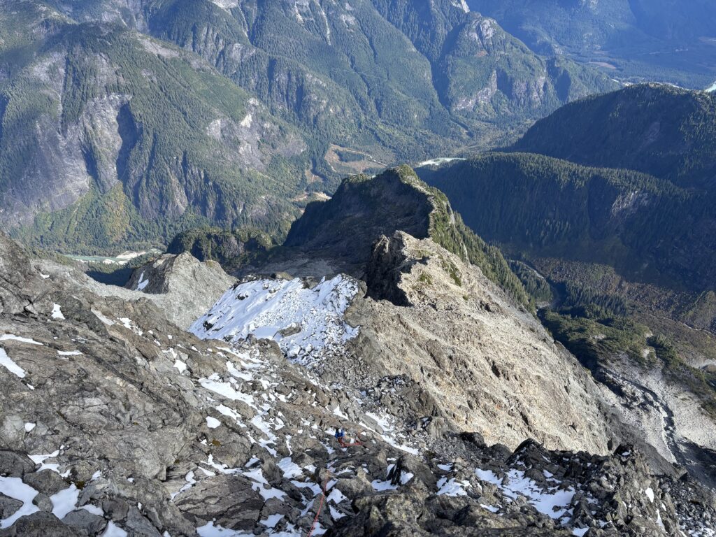
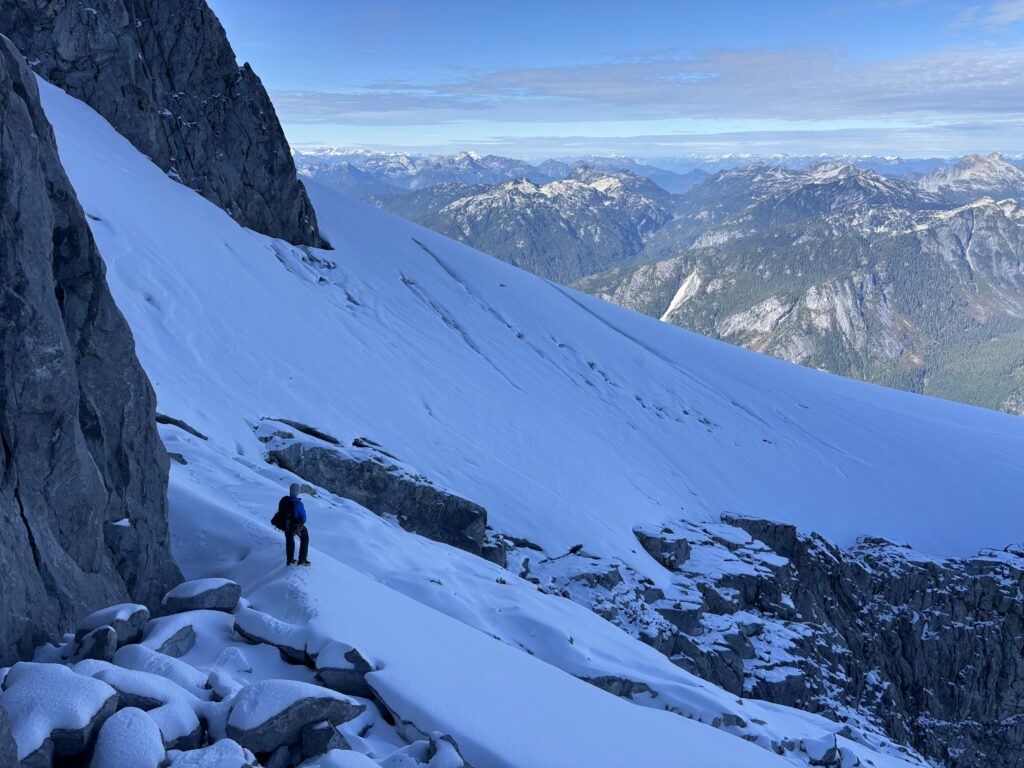
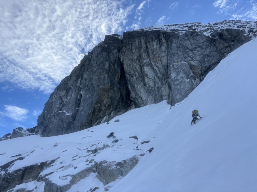
For roughly 600m of elevation gain we had easy slab hopping and hiking until we reached the lower snow field. We swapped into crampons, booted across and then packed them away to hike up loose moraine and slabs. The terrain eventually narrowed into a feature known as the “hourglass”; a natural constriction in the gully. Here we hit our first true sighting of snow, a full 3-400m below the summit. Not a great sign, but we climbed up through the snowy and iced over gully, breaking off the verglas where we could until we reached a small glacier patch that no longer connected with the uppermost glacier.
Initially we trended left up a small channel, but the moves to exit involved some committing 4th class moves on iced rock in cramp ons. Do-able on the way up, but challenging to downclimb. The mood was morose, our chances of reaching the summit were looking more and more unlikely. I, above all, thought there was almost zero chance and nearly suggested we just turn back. Thankfully, Alex and Trevor held onto some hope and we gave up on the left most channel and headed right where some 3rd class ice and rock got us up to the upper snow field.
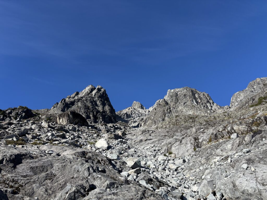
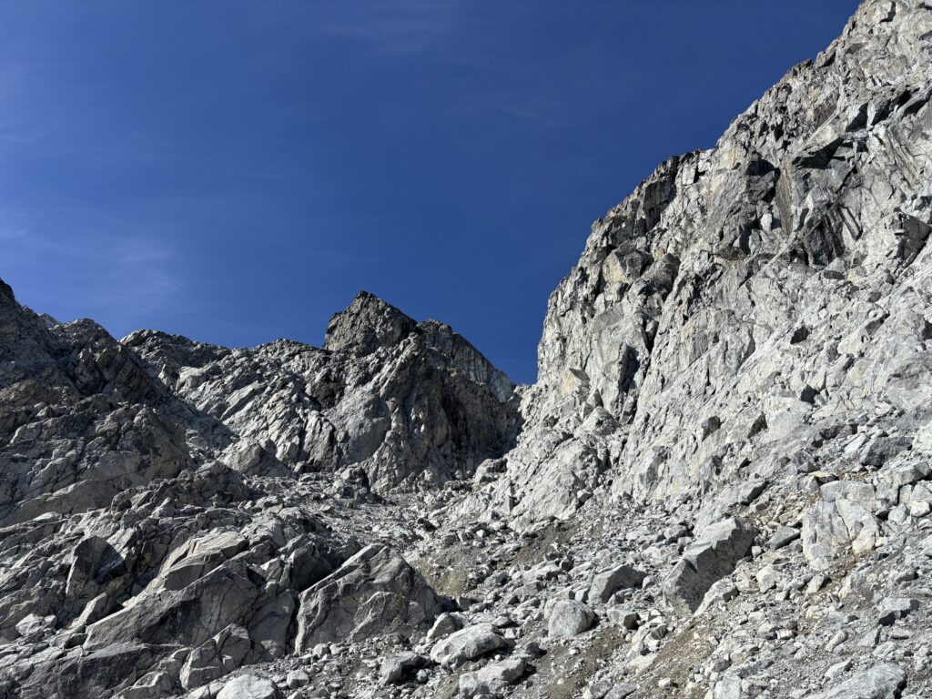
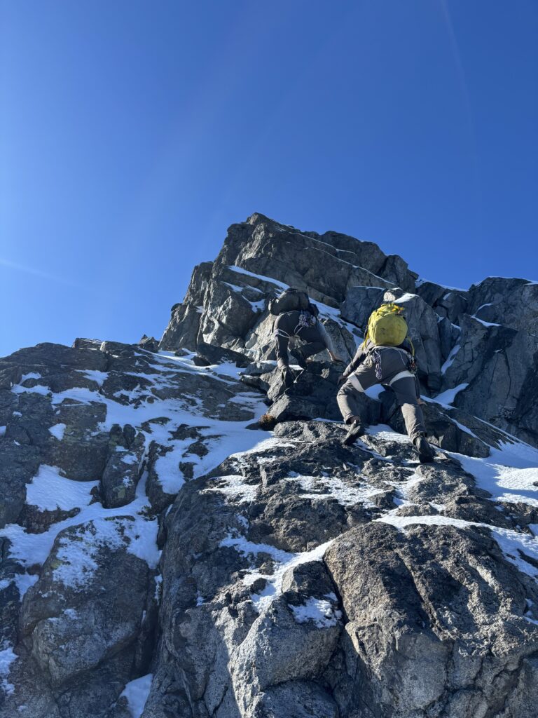
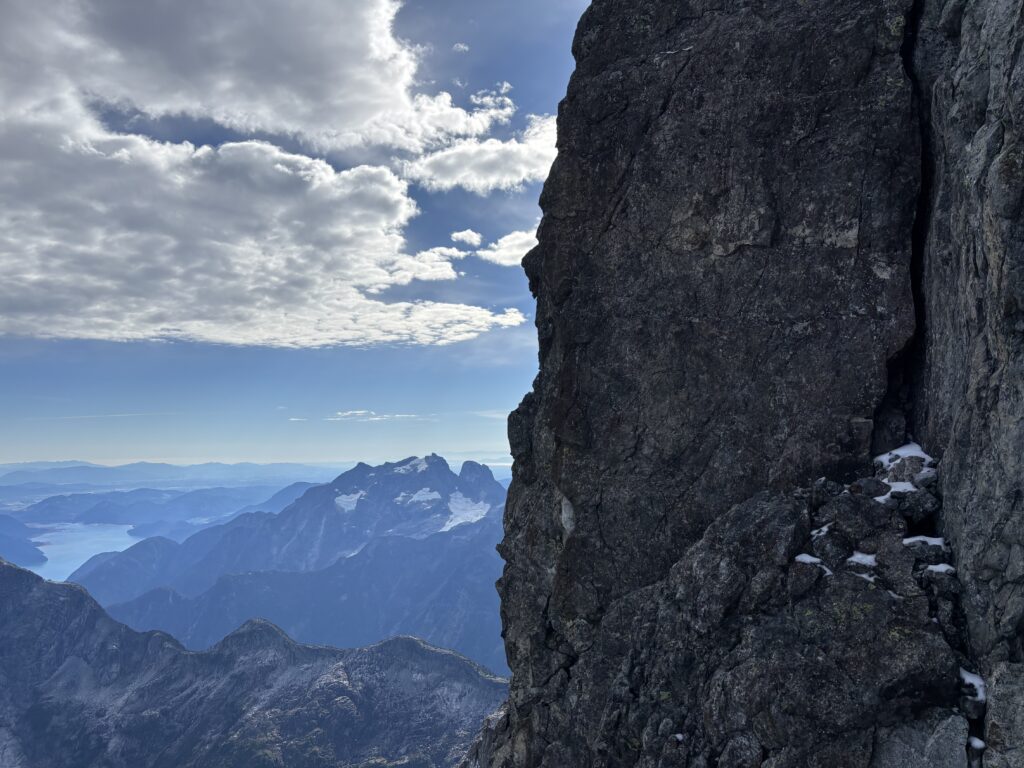
We now had a proper view of the standard route and it was out. Snow plastered the wall and there was neither sufficient snow to boot up nor enough rock exposed to simply climb. It was in mixed condition, something we weren’t prepared to do. However, our sails did not deflate in that moment. To the left, a promising left hand ridge line offered a strong potential for less snow. Trevor suggested we head straight there first, so we booted across the glacier and wrapped around to the south side of the summit block. There under the radiating warmth of the sun a line revealed itself! The bulk of the rock was snow free, save for the ledges and the climbing didn’t look all too hard. We all agreed to give it a shot.
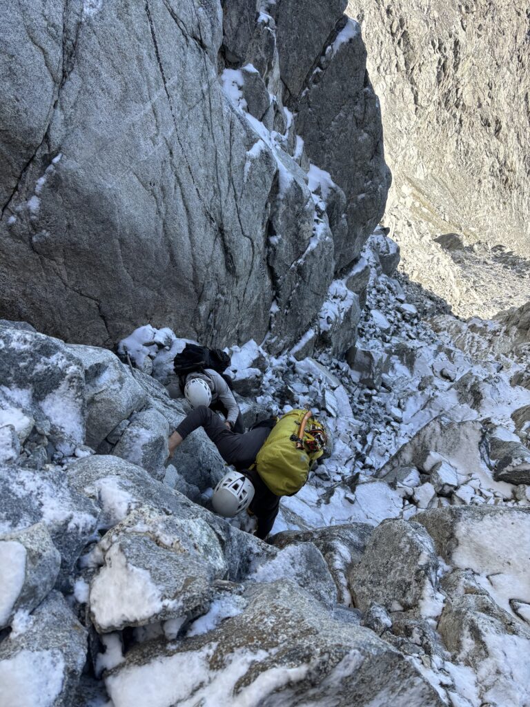
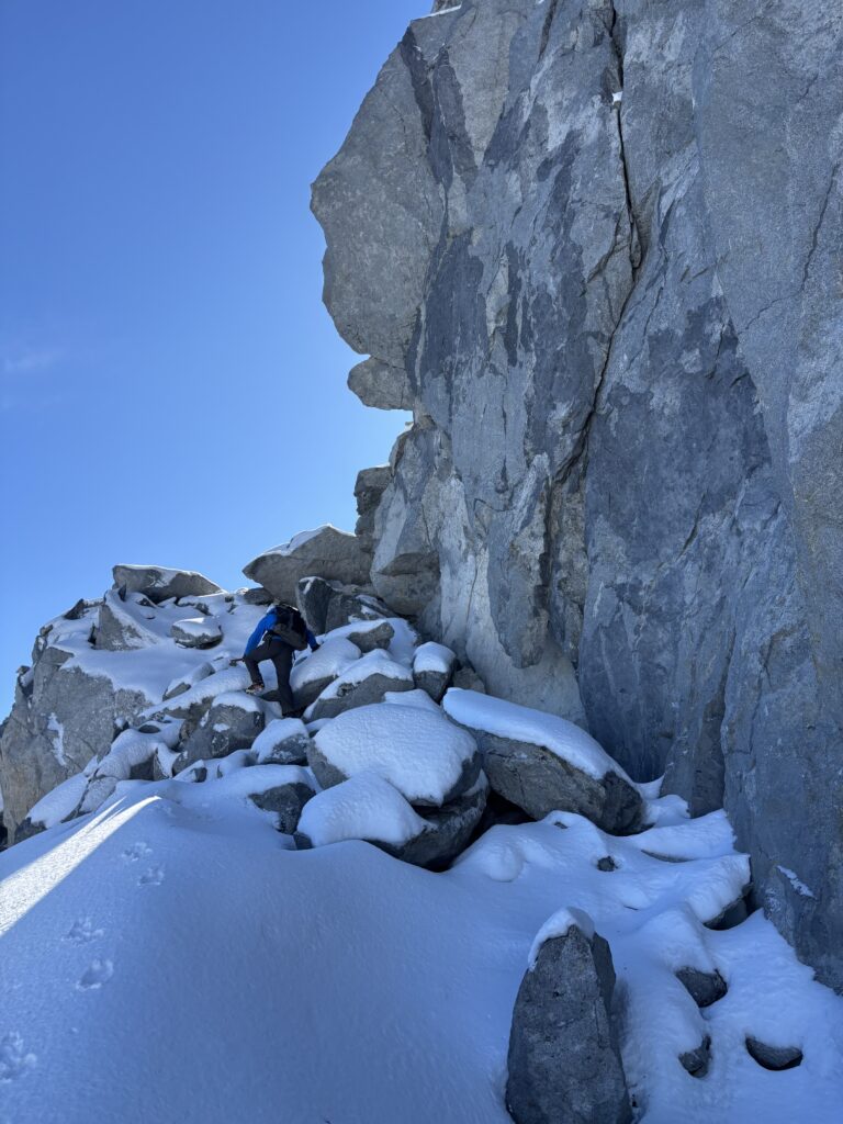
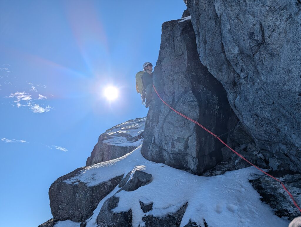
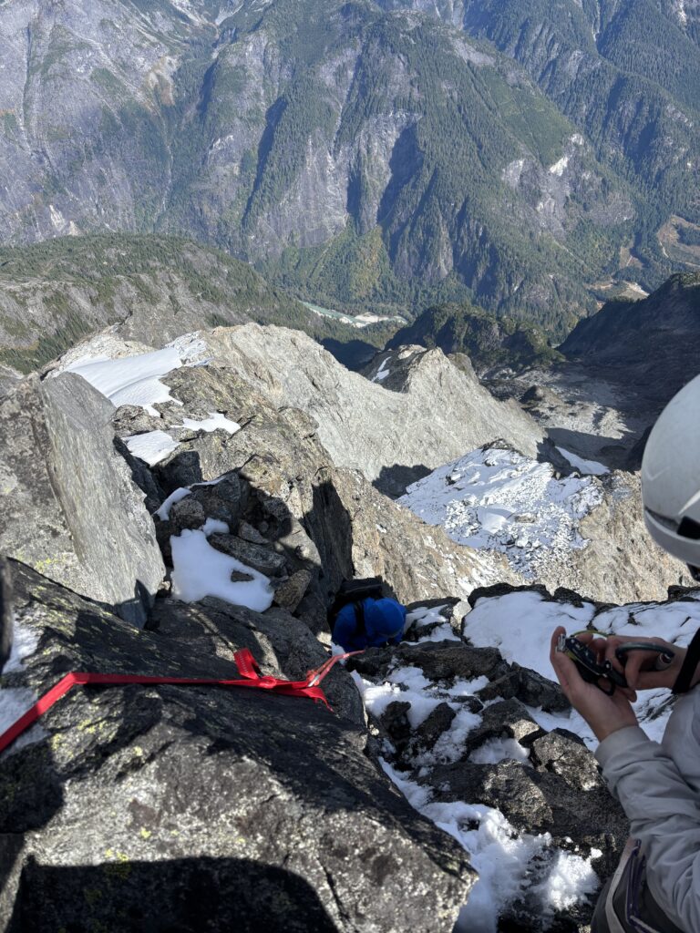
I placed my climbing shoes on along with everyone else and we ditched some heavy gear to start climbing up. The rock was gritty, with wonderful edges and the climbing was all around immaculate. Alex lead a nice line climber’s left through easy terrain and then up to just below the ridge where we trended right across and exposed traverse and on to the ridge crest. We climbed a little ways further up snow slabs and ramps where the terrain steepened just below the ridge again. Here we opted to setup our first belay; an awkward affair.
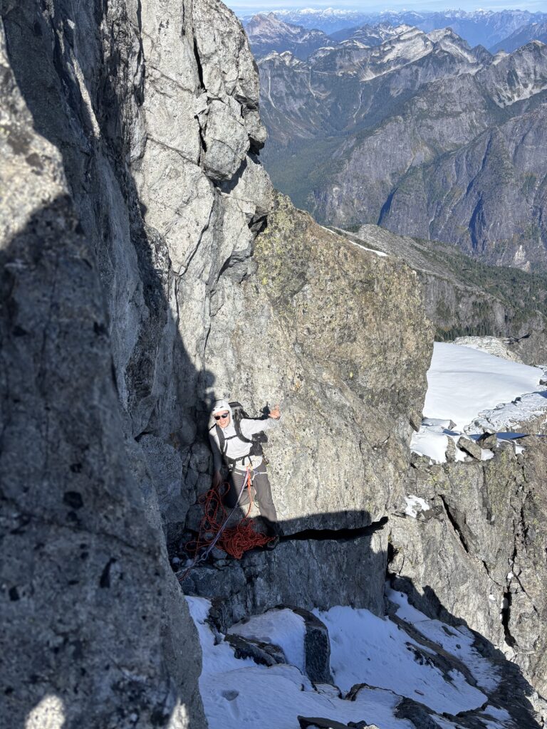
Trevor took the first lead and the initial move involved stepping up a high angle snow covered slab. His feet blew out twice, but eventually he found firm foot holds and pressed up into a chimney. The chimney itself didn’t look all that easy, but Trevor found easy face climbing out left and around and proclaimed that he was just below the summit. He setup an anchor and then both Alex and I seconded up. It looked like a few more low 5th moves to the top, so I offered to lead up next and if the terrain was harder than it looked I could belay everyone up.
I pulled up through some low 5th loose blocks and then crested onto the ridge once more. There was the summit directly above me with nothing more than some 2nd or 3rd class moves to reach it. I pushed on and setup an anchor. Alex soloed up while I belayed Trevor and then we all stood on the summit together. There was a big sense of joy and relief that we had found a way up! I can’t recall a time that I’ve been that close to getting shut down from the summit and still making it.
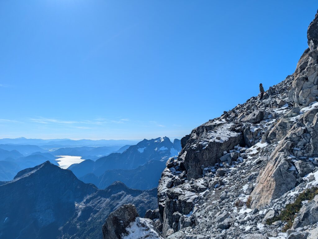
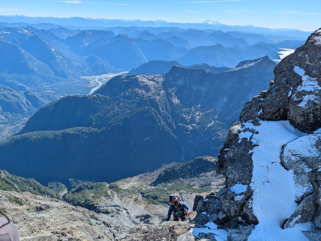
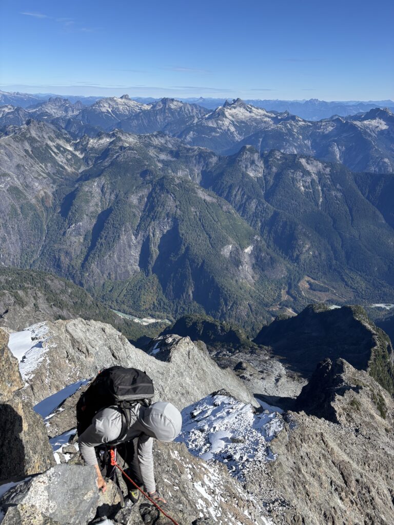
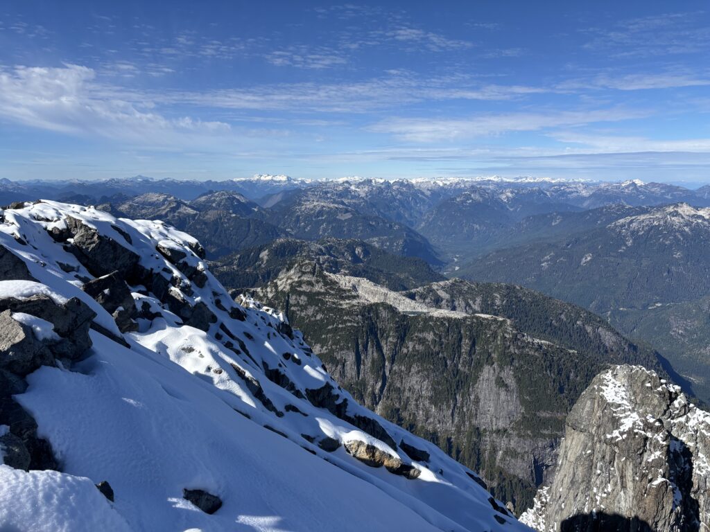
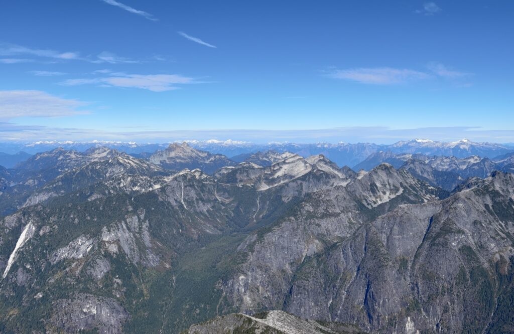
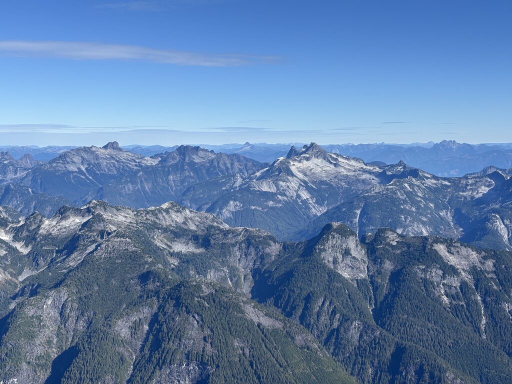
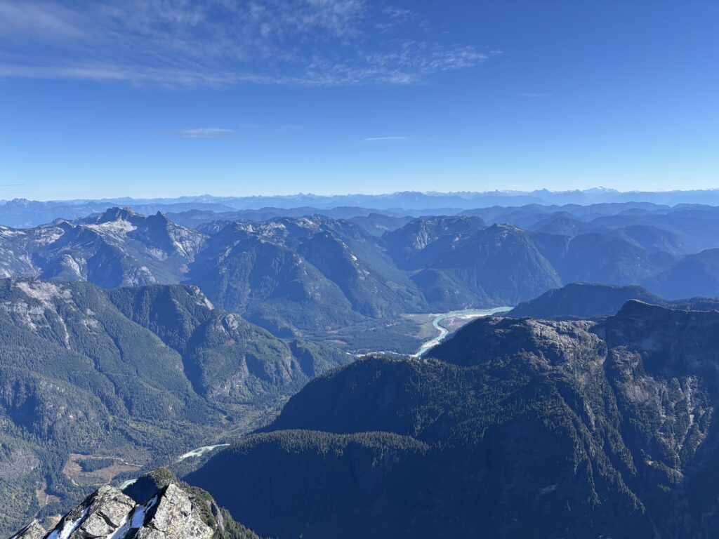
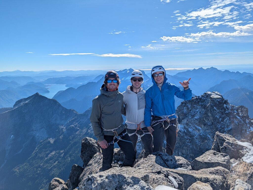
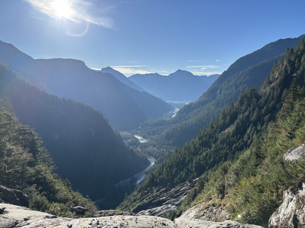
We collected endless photos at the top. The Judge is perfectly situated to cast an eye at every interesting peak on the horizon. I spotted countless future objectives and we all spent time discussing one idea or the other for the coming years. Finally, it was time to get down. We set up two clean rappels down our climbing line and reached our stashed gear hassle free. From there it was a tedious, but manageable down climb through the iced up gully. Once we hit the lower sections the snow subsided and we had an easy descent down to our last bushwhack.

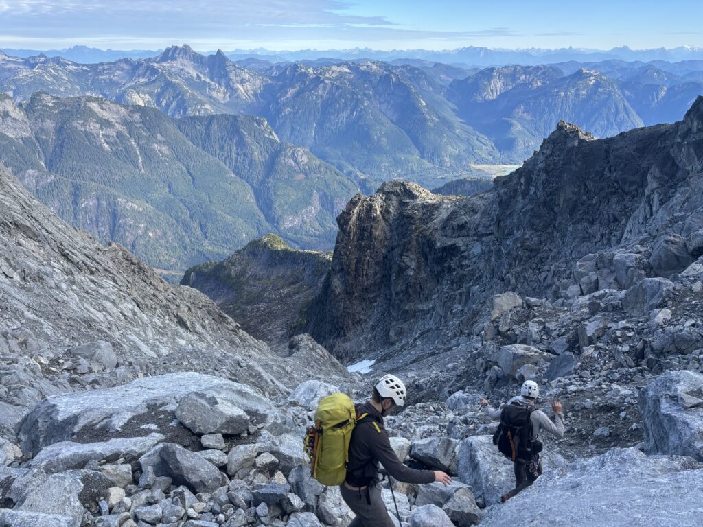
Here we took a slight variation and even found some old flagging. Near the base we diverted back over to our original ascent line and were soon ejected out onto the open rock below. Our tents and a warm meal waited for us patiently.
On the next morning we packed everything up for 8am and returned along the flagged trail. We found the descent bushwack to be not all bad and we actually reached the Stave River in roughly 2 hours. Our crossing on canoe was as easy it gets and there we rested on the shores while the sun reached into the valley and warmed us up. We hung out for a couple of hours until our ride showed up and then we were home bound. A great trip with a solid dose of luck to get to the top!
Yesterday I was starting at the Mt. Judge from the McKee peak and wondered if one could get on top of it. Very cool story!