Elevation Gain: 1,538m
Distance: 10.7km
Total Time: 1 day + night
Date: May 21st, 2023
Heading into the May long weekend Andrea and I had been floating around a couple of multi-day traverses. Finally, on Thursday we settled on a set of summits down the west Lillooet river area and started some final packing and preparations. Then, in the last minute on Friday evening, we found out the access road was now closed due to flooding. I scrambled around for a suitable alternative and found an interesting traverse idea in the Dickson Range. The downside was we had limited time to research, but I figured we could improvise with a few different route options.
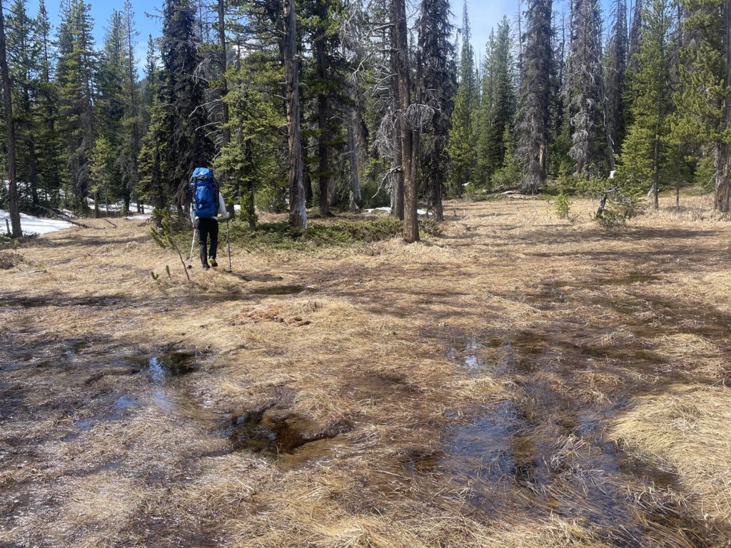
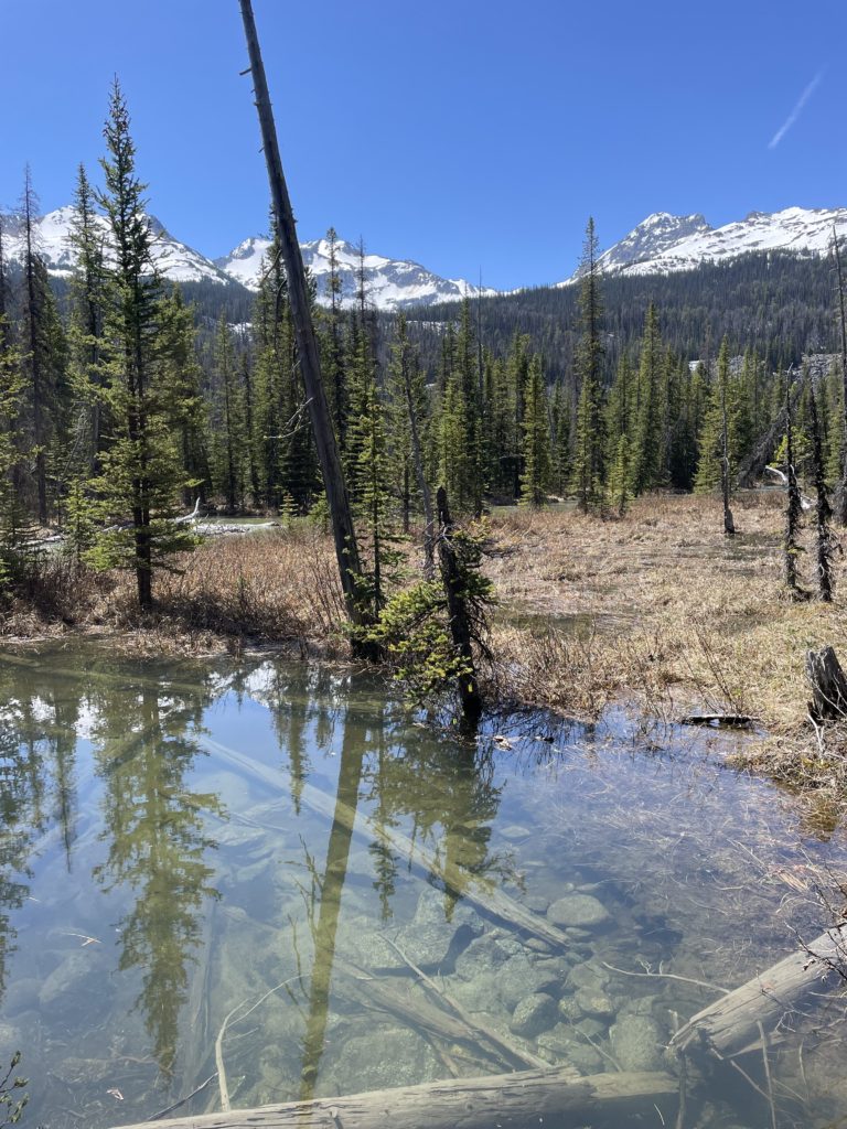
On the Saturday, we woke up early and drove ~4 hours out towards Gold Bridge and then up the Slim Creek FSR. We started on our planned route, but already there were signs the trip may go awry. For one, we hoped to cross Slim Creek on the route and it was clear the spring melt-off was going to dash our hopes. The sheer volume of water coming down Slim Creek was both spectacular and disheartening. I had a back up plan to avoid crossing and instead head up the Slim Creek valley area. However, we quickly found flooded plains and bog-like terrain. Nonetheless, we persevered for nearly 10km through watery trails and bogs. We reached the middle of large marshy area somewhere around 4:30PM and finally made the call to turn back. Facing an additional 10KM to find a crossing point and the prospect of camping in the marshy forest, we decided cutting our loss was the best option.
We hiked out and headed into Gold Bridge to find some wifi for our salvage operation. The Gold Bridge Hotel was kind enough to give us their wifi password and we started looking into some options. The new criteria was: a summit that we could still get some alpine camping on and after the bog dilemma something a bit drier and less involved.
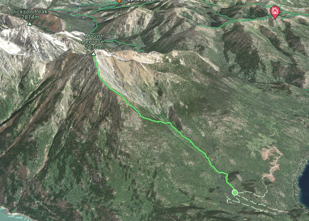
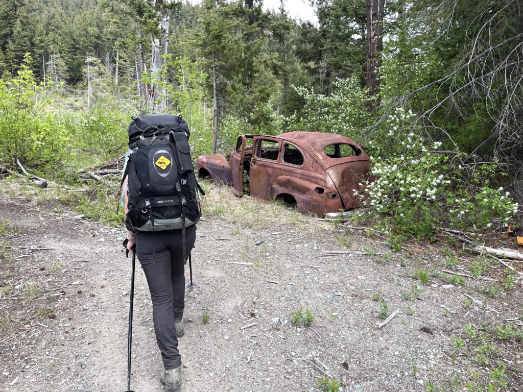
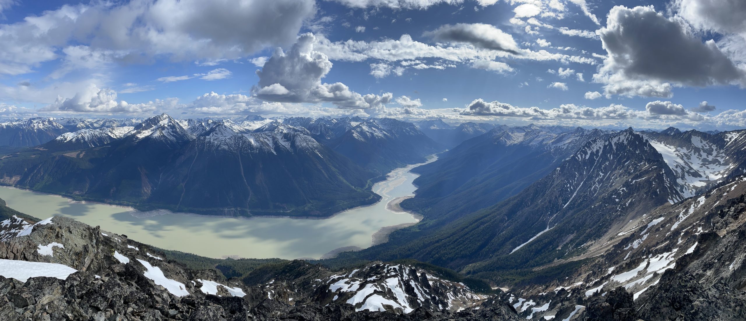
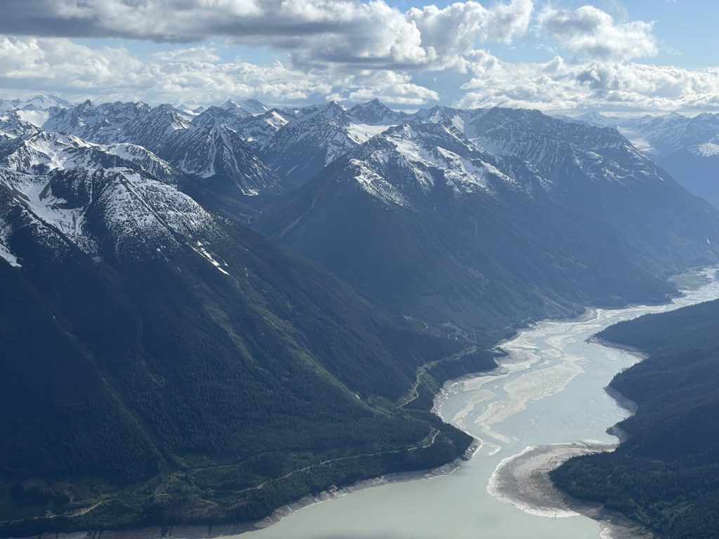
Andrea had noticed a neat summit called Mount Penrose on our drive back into town and I started with that. It rose prominently above Gold Bridge and seemed to offer some outstanding views of the trio of lakes. After a quick search I found it had a well built trail all the way to top, created by a local named Gerry Wood (thanks Gerry!!). Furthermore, my friend Steven already had a trip report on it. This fit the bill perfectly, so we headed to the Gun Creek Campground to crash for the night and would start the following morning.
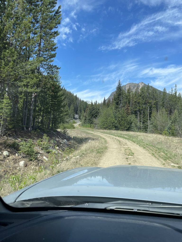
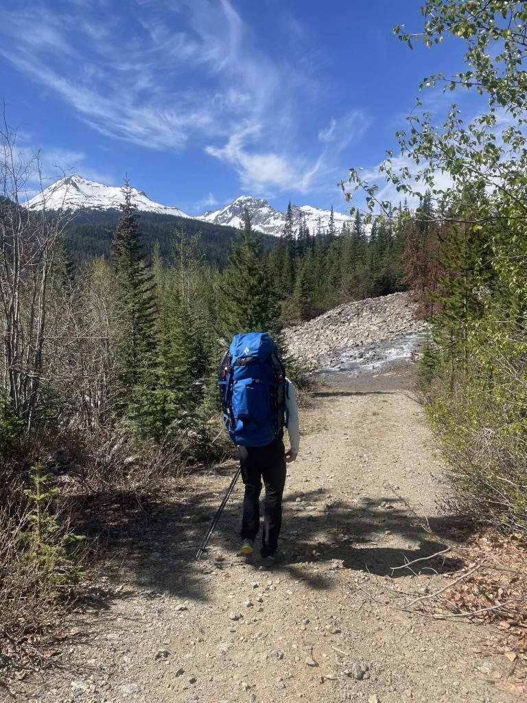
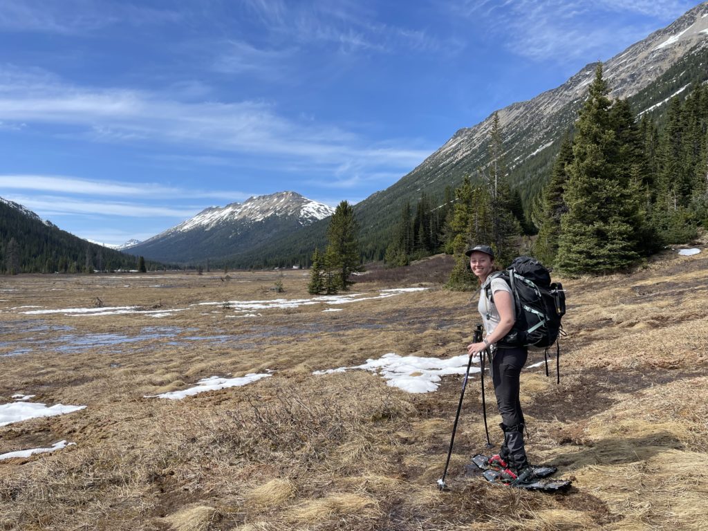
On the Sunday, we drove around Gun Lake and up the Dale FSR to the trail head. The road was in good condition and soon enough we were headed up the old ATV track that marked the start. The lower section was well marked with a clear foot bed and we made a leisurely pace up towards the Penrose Creek crossing. From up high it looked like a crossing that may involve a sketchy snow bridge. However, we found it was just an old avalanche run out with nothing in particular to worry about.
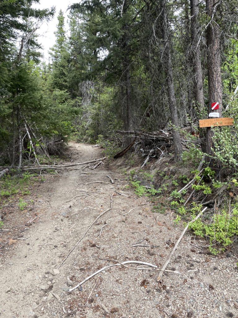
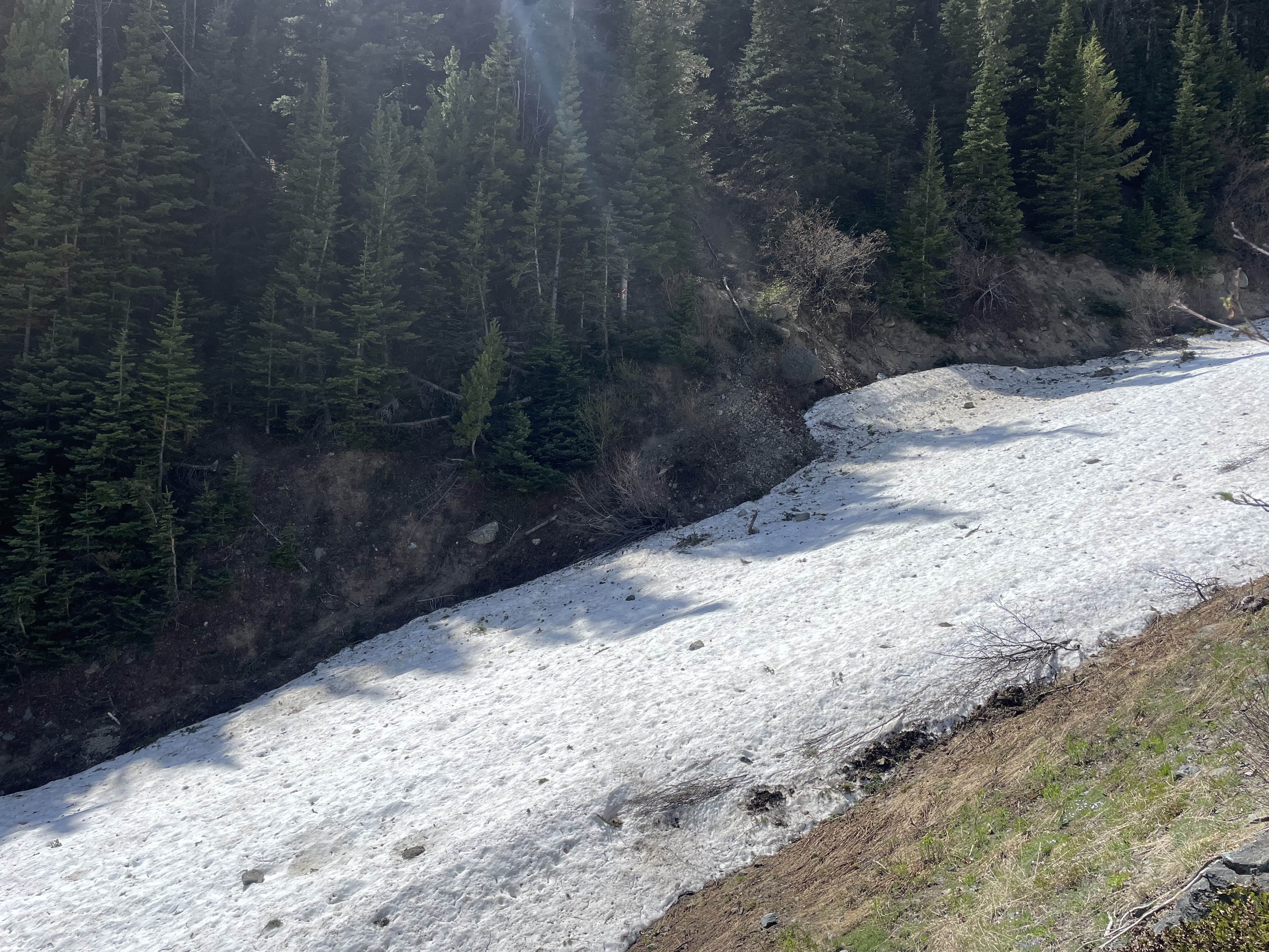
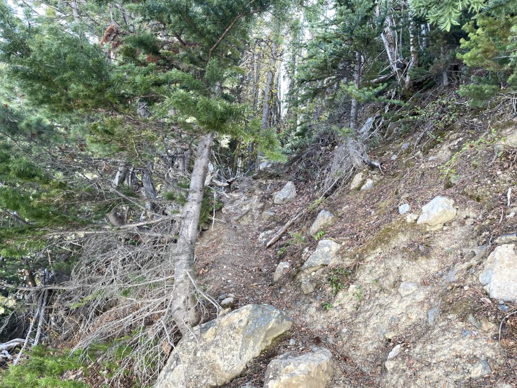
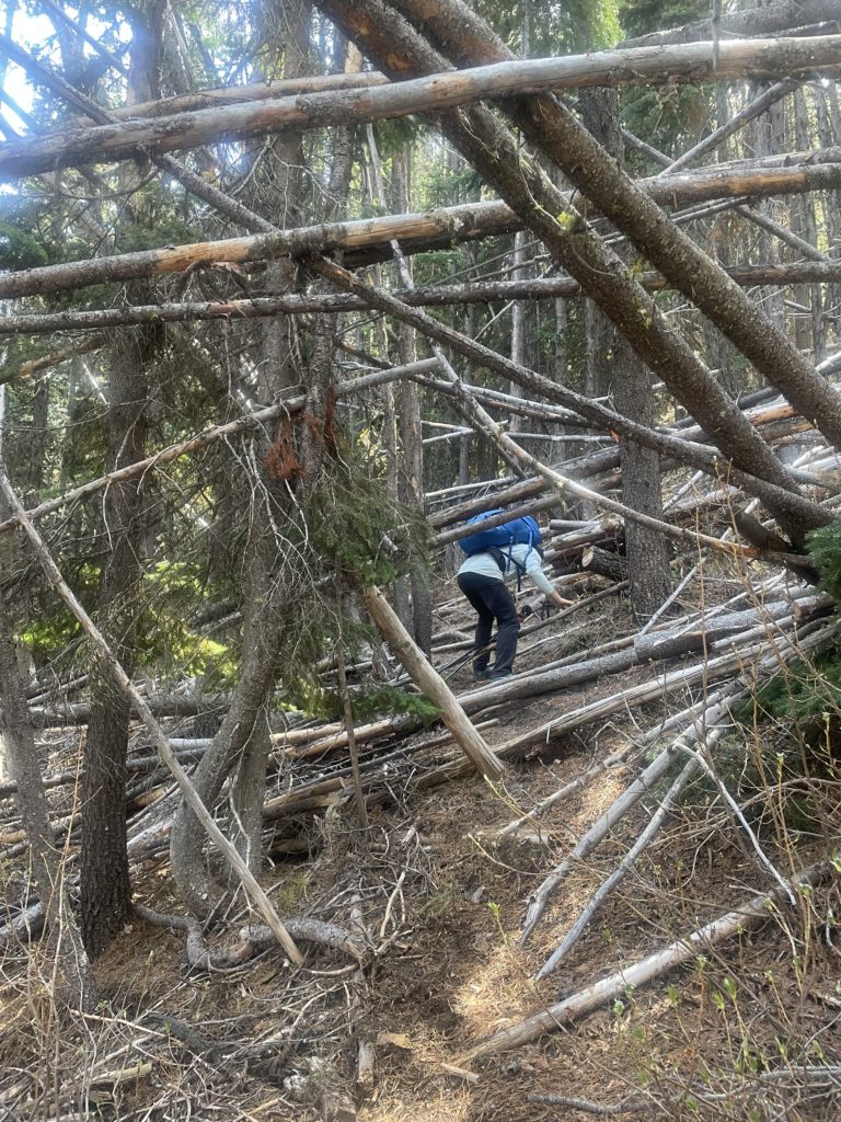
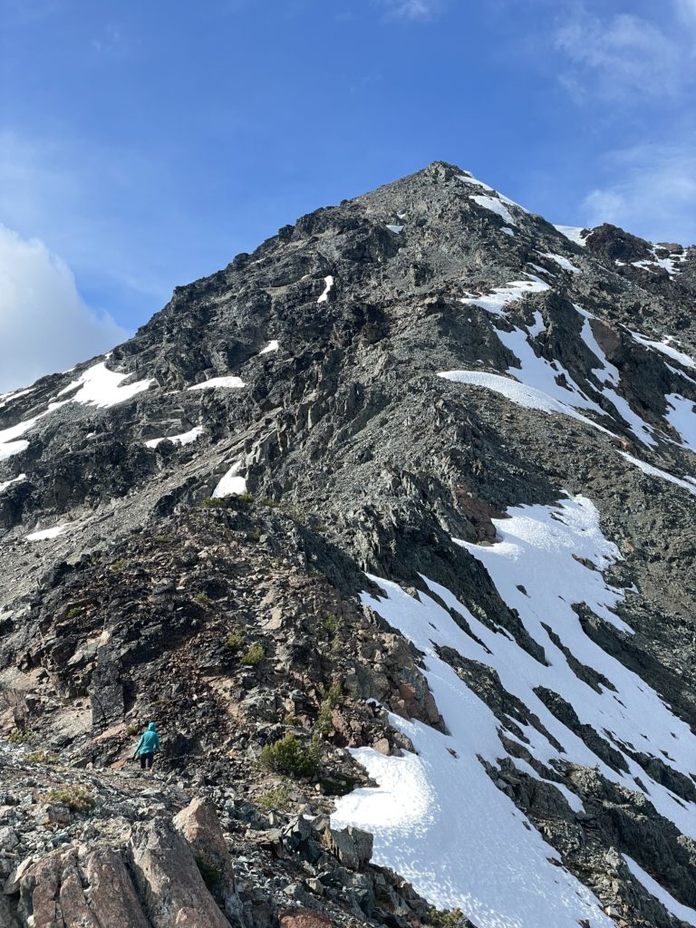
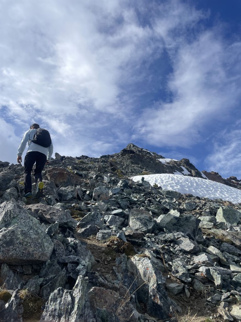
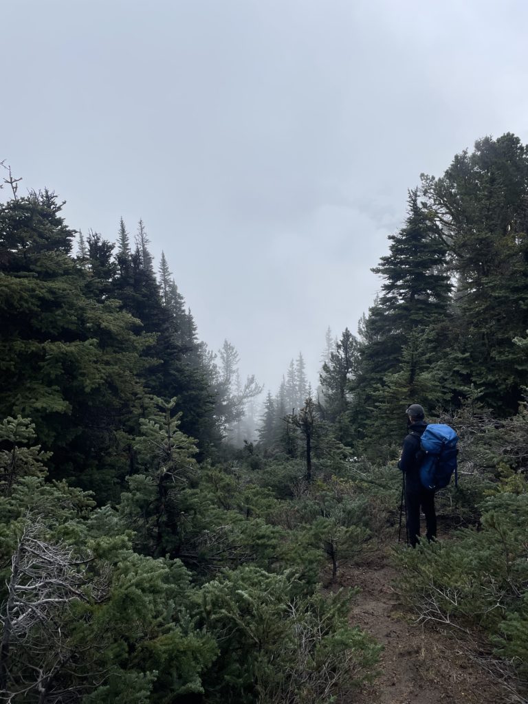
The route steepened here and we had to navigate through a dense cluster of dead fall at around the 1700m mark. Thankfully, most of it had been cleared with a chainsaw but this whole section of forest felt like it wanted to tip over. After that we continued to follow the generously marked route up to a sandy section below the ridge line. The foot bed grew fainter now, but the flagging kept us on track.
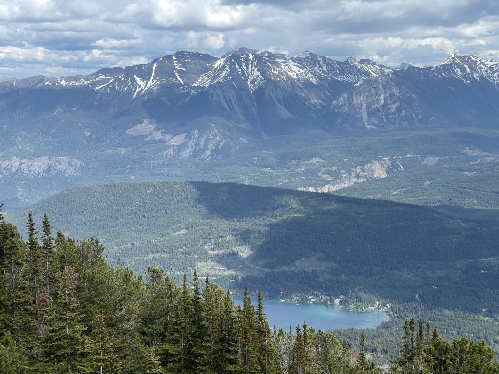
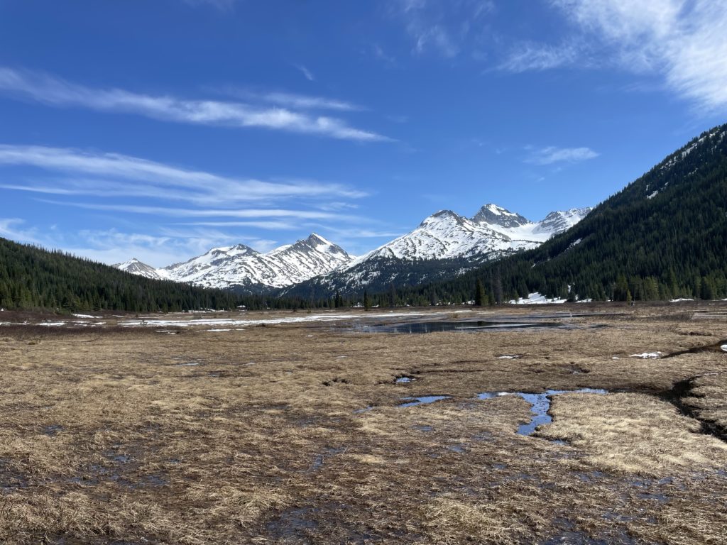
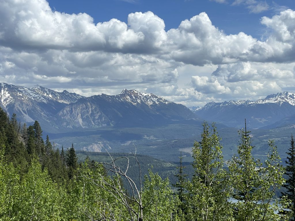
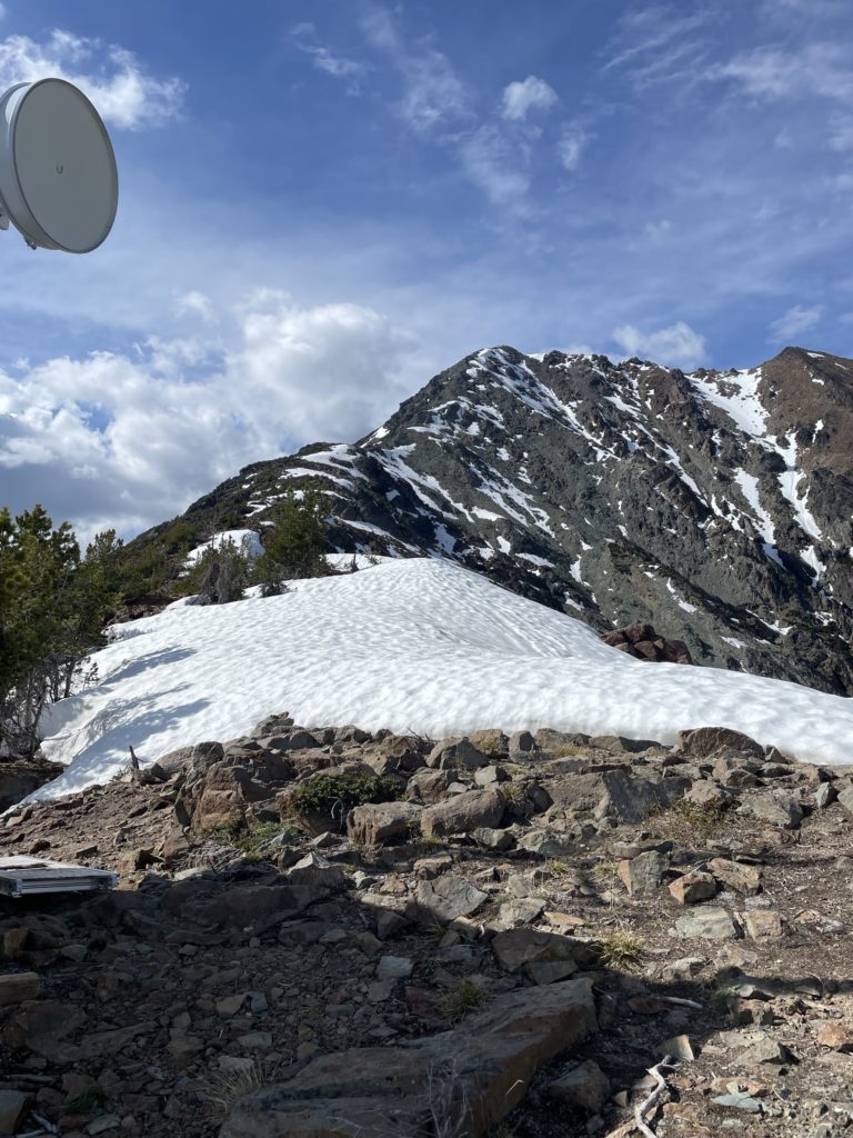
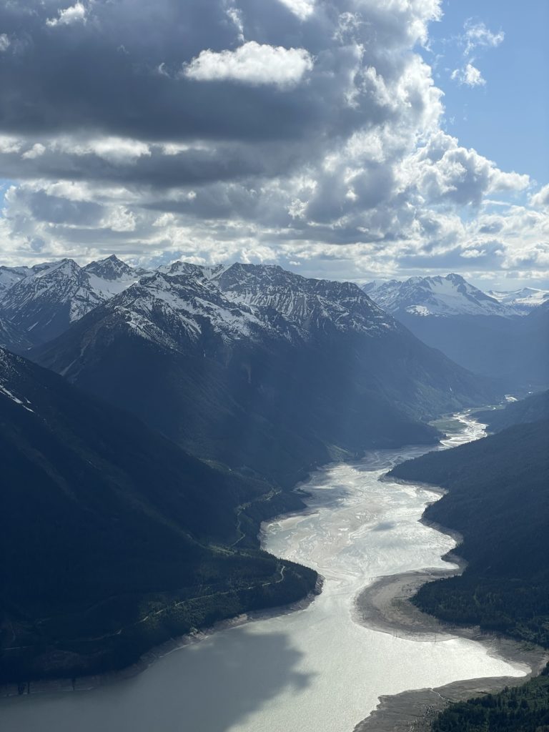
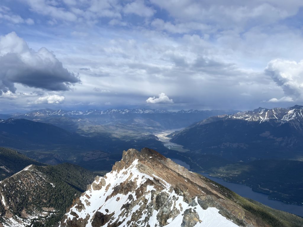
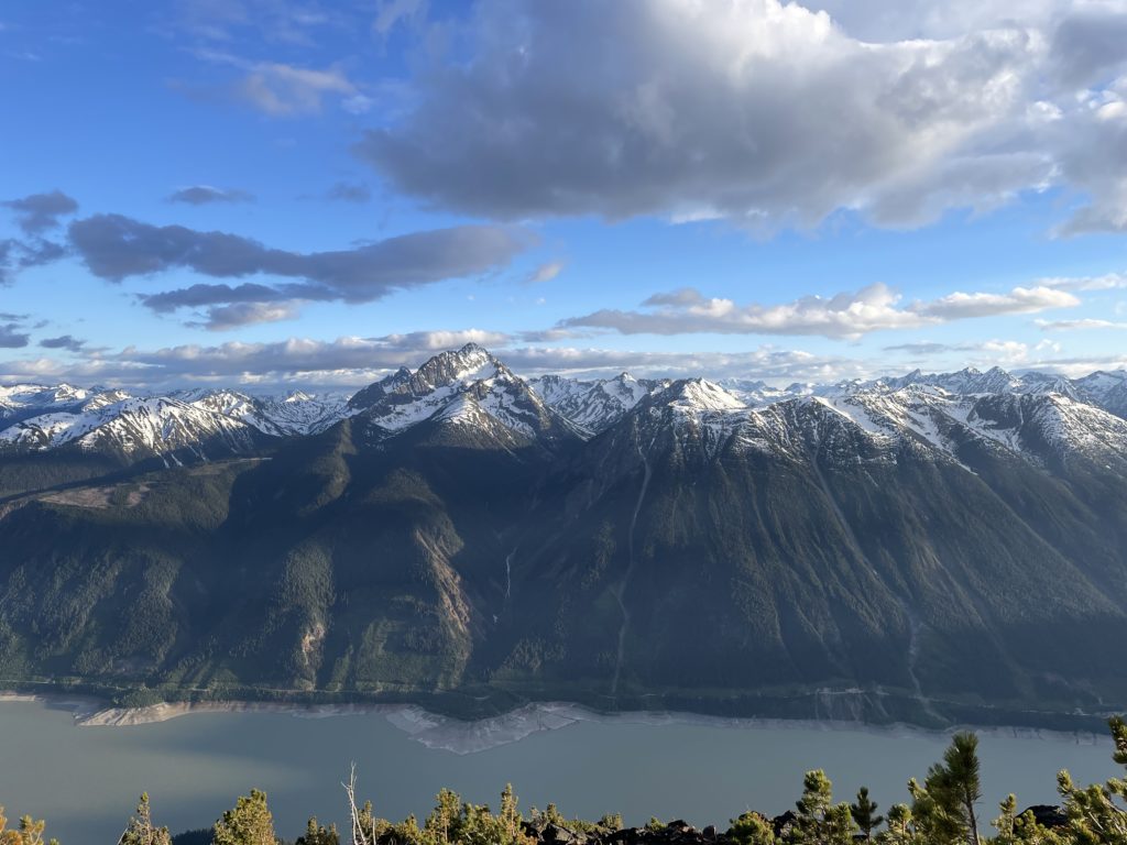
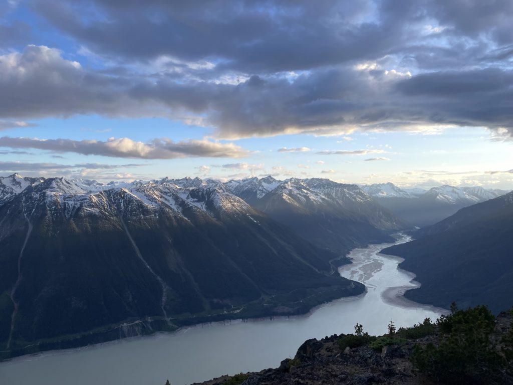
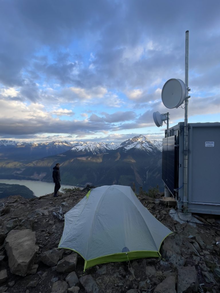
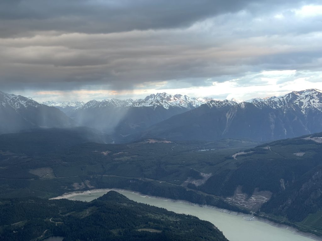
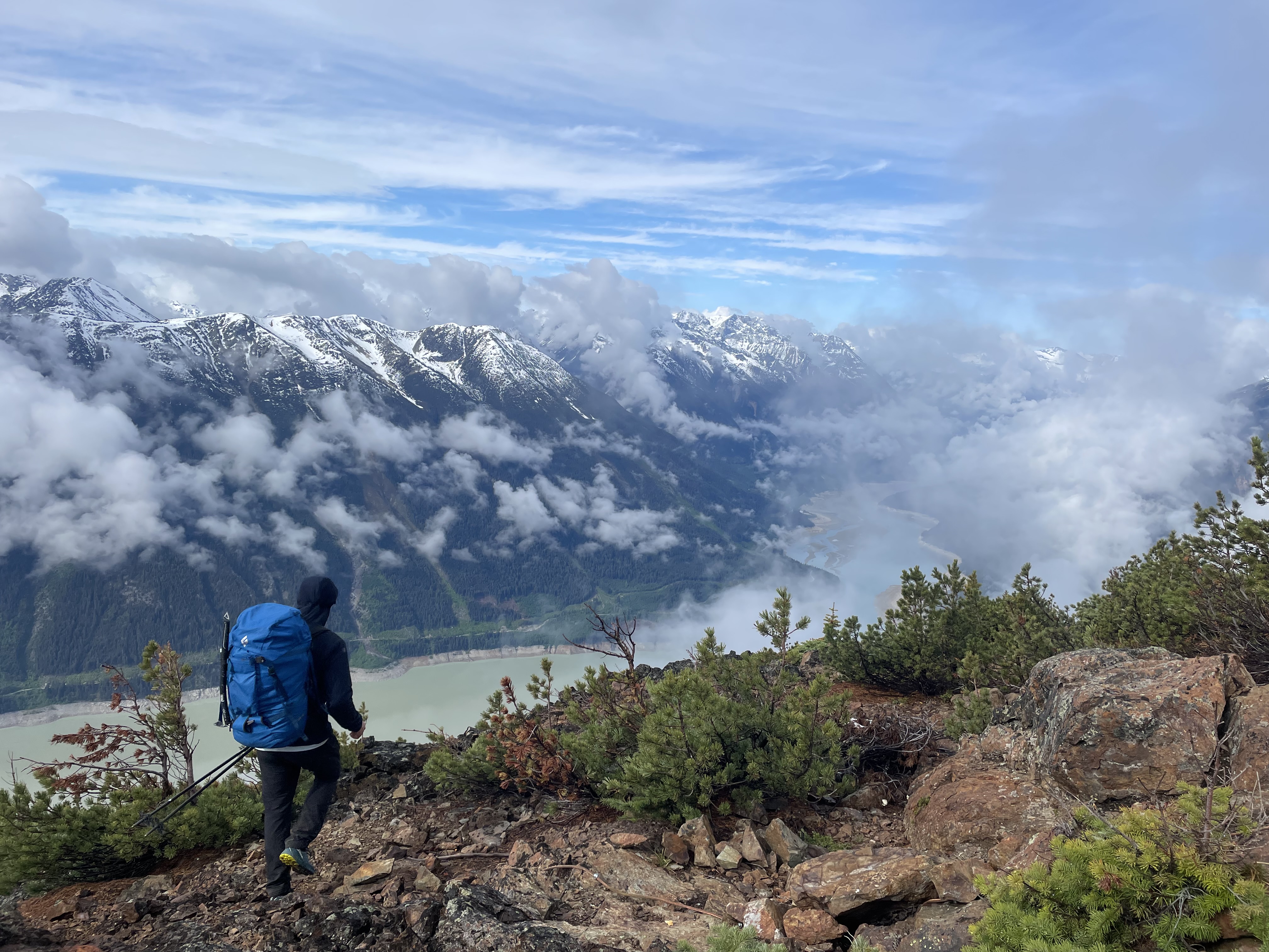
Somewhere around 4:30PM we hit the ridge line where a relay station for the James Creek power project was situated. The views were already exceptional and we paused here for a longer snack break. To the East, near Mount Truax, I could see large cumulus clouds building and starting to appear like a thunderstorm. So far it seemed to be forming far away from us, but the high afternoon temperatures were starting to look like a good recipe for lightning storms.
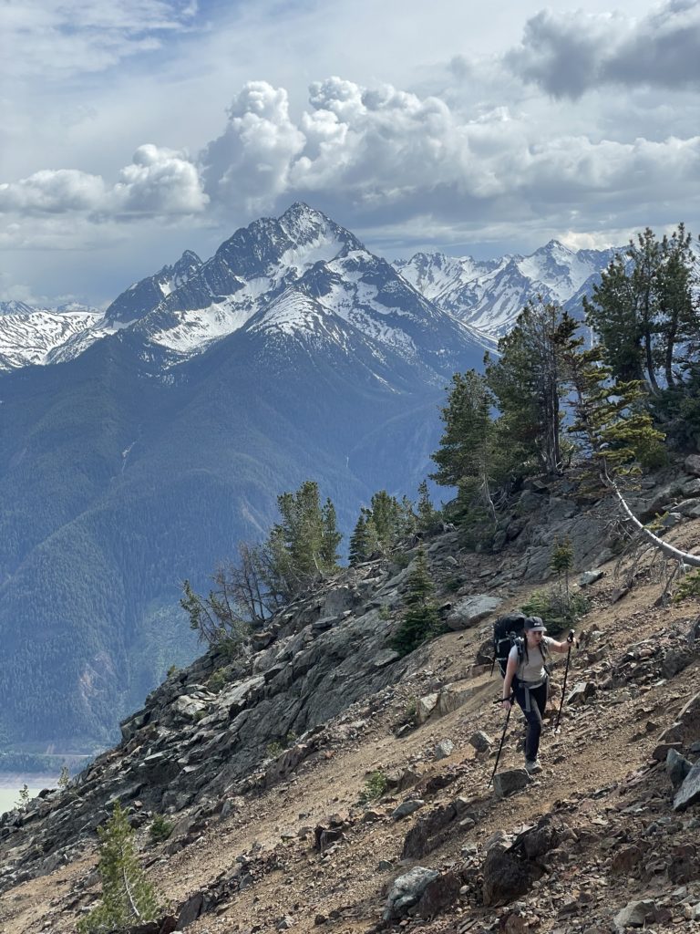
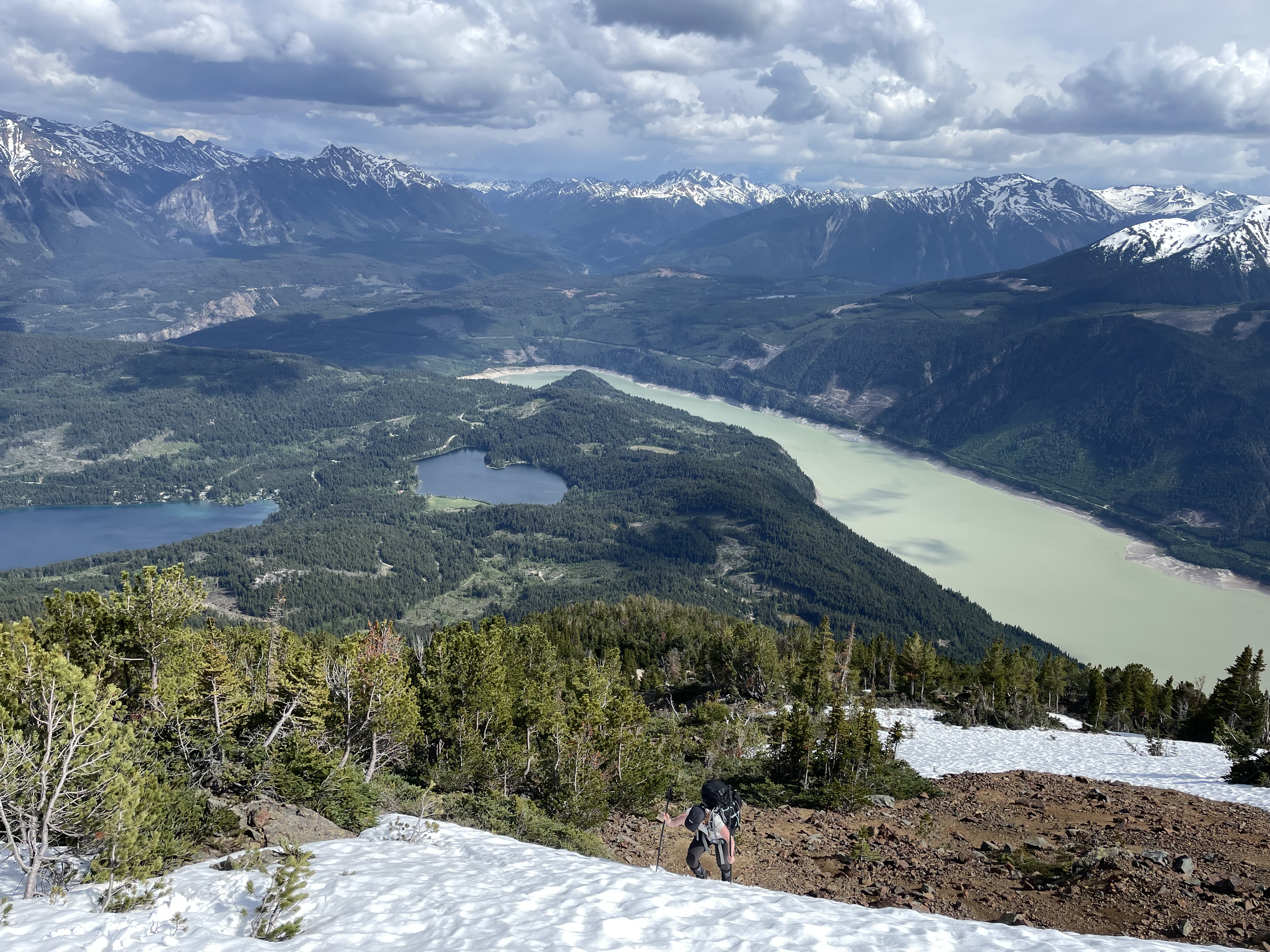
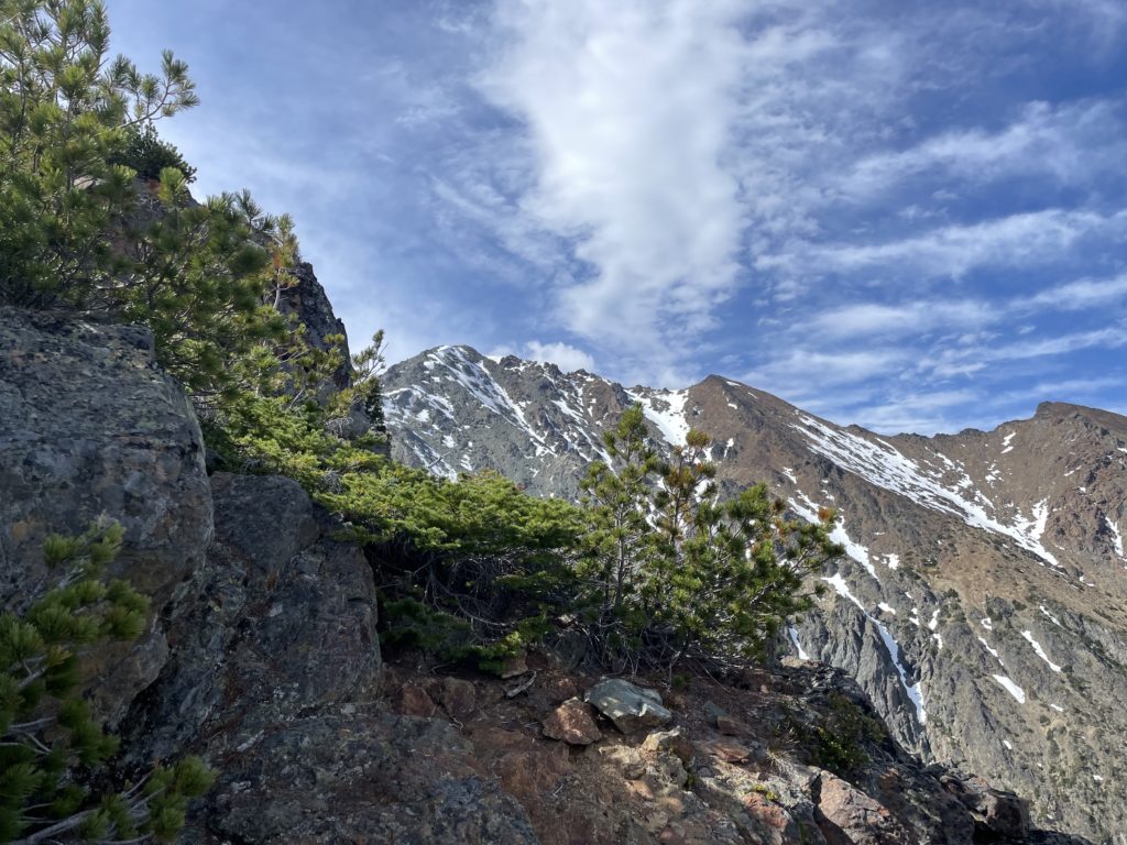
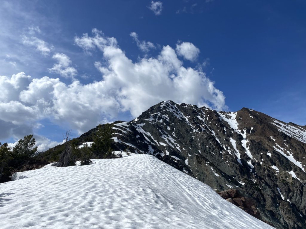
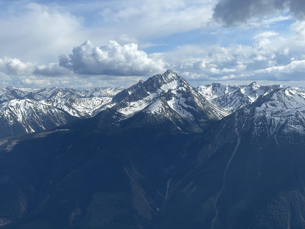
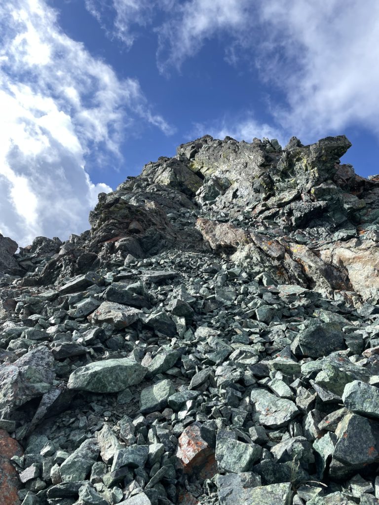
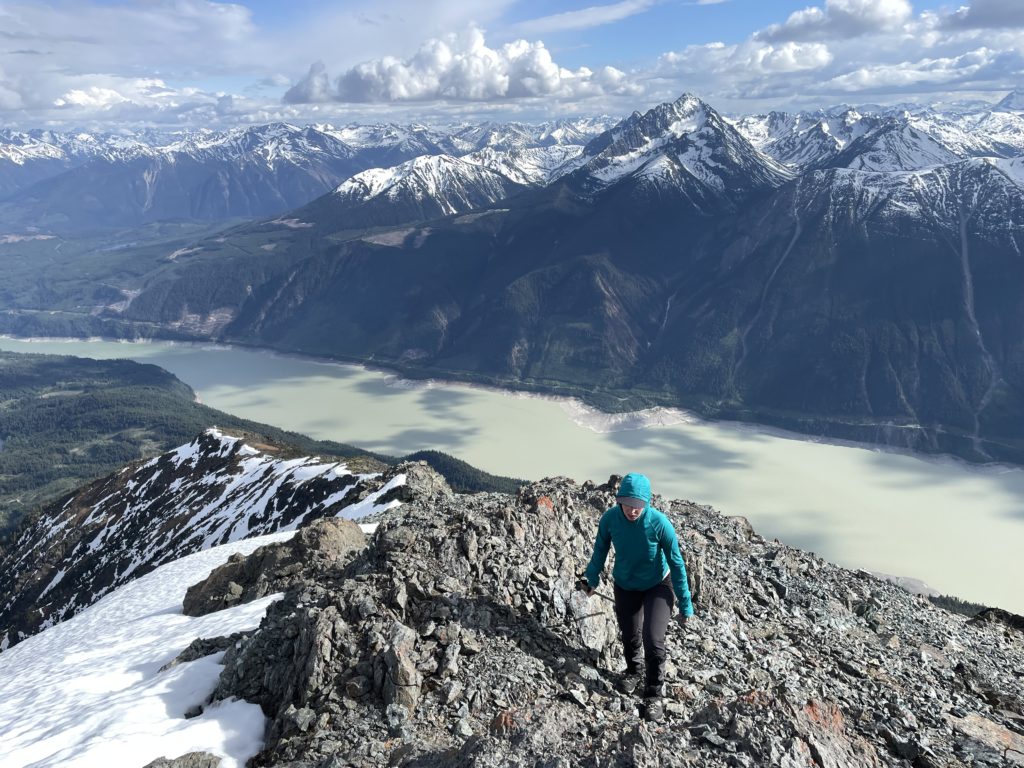
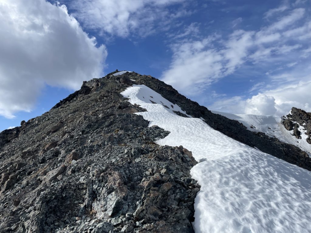
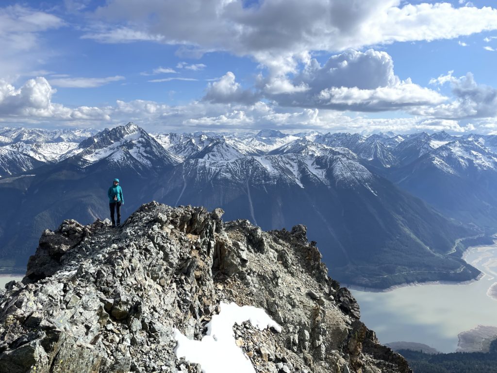
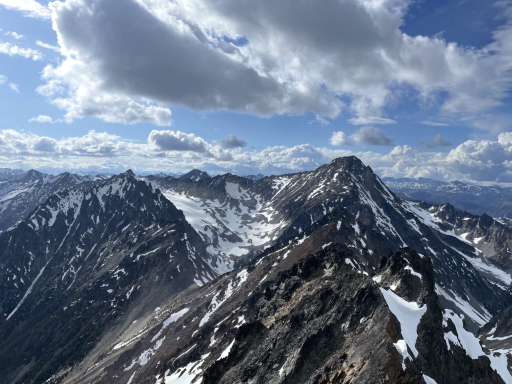
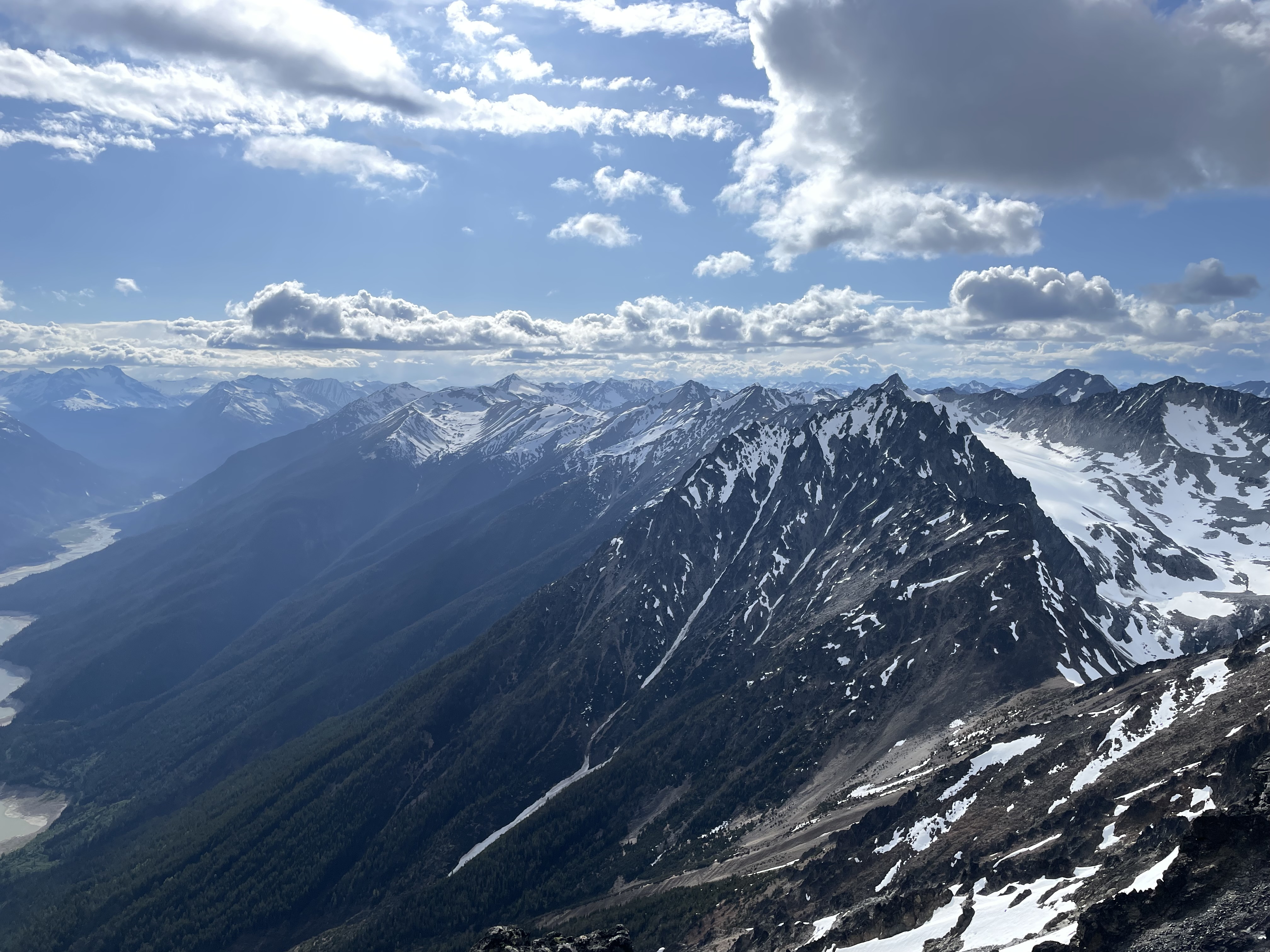
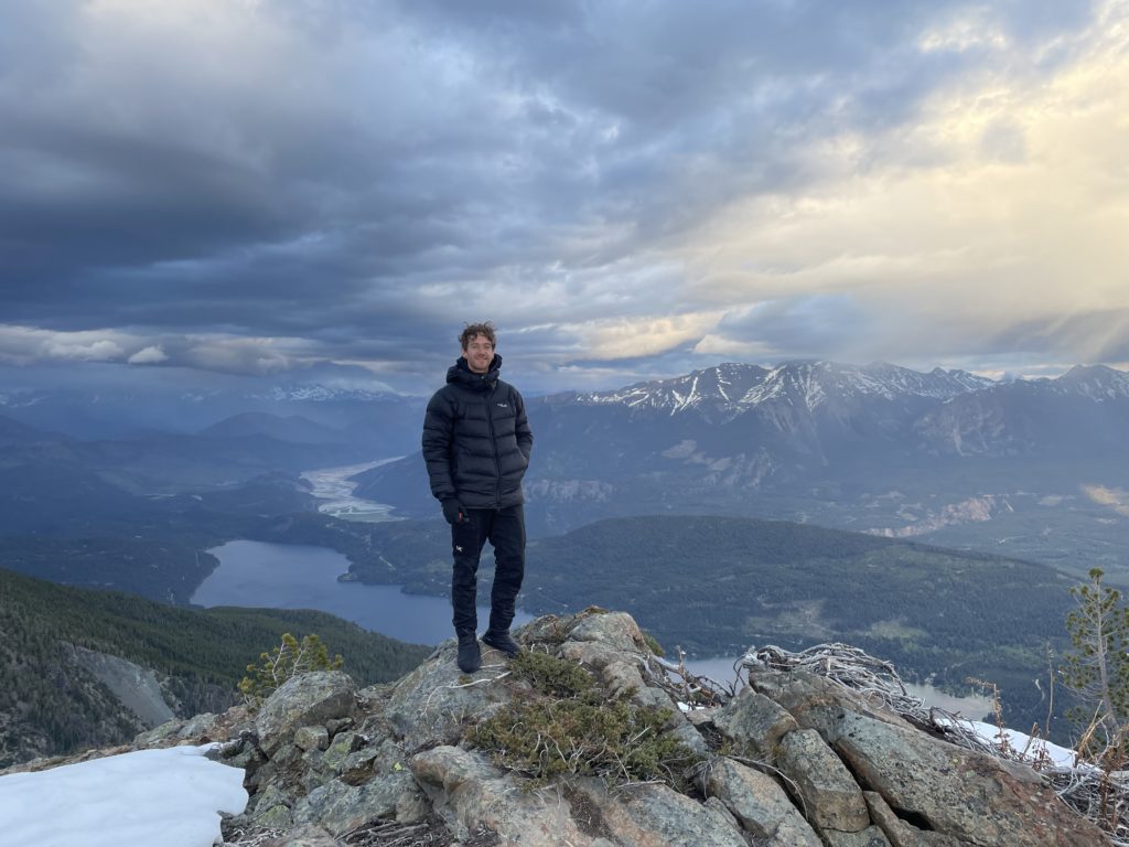
With that on our minds, we decided to cut the lunch break short and get to the summit before it was too late. The ridge above was almost snow free with a few of the flat sections requiring some post holing to reach dry rock again. As we climbed we found a mixture of chossy terrain and solid ridge line and the route never exceeded 2nd class save for a few short 3rd class moves. Exposure was limited to none, but the steepness of the ridge meant unobstructed views of the expanse below. We reached the summit around 5:30PM and hung out for awhile to enjoy the vast mountain ranges all around us.

By some luck it looked like the storm situation had subsided to the East and we felt more comfortable about establishing camp on the ridge. We headed back to the relay station to get dinner started and setup for the night. Andrea built a small flat spot on the rocky ridge while I got to work boiling some snow. By 8:00PM we were finishing up the last of our dinner and noticed the weather had started to turn again. Now dark clouds were building closer and closer to us and rain was hammering the area across the valley.
We were concerned about being exposed to lighting high on the ridge so I opted to use the weather feature on my In-Reach. A quick ping back and I saw that we were in for a night of rain and cold temps, but at least no lightning. That prospect wasn’t too great either, but it was too dark/late to pack up now so we figured we’d just wait it out in the tent. By 9:30PM we were both settled into the tent and about to fall asleep when the first few drops hit the tent.
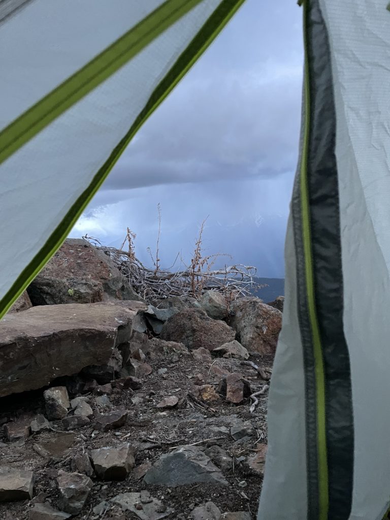
Slowly the precipitation began to build and then a rush of wind came across the ridge shaking the tent in a dramatic fashion. For the next 3 hours we had to deal with a constant battering of the wind, which at times folded the tent onto our faces and made sleep all but impossible. Initially, I was a bit fearful about the strength of the storm and worried we might get blown off or something. Half way through the ordeal, I had to get out and pee and face the storm head on. Upon exiting the relative safety of the tent, I discovered this violent affair was nothing more than a few strong gusts with a slight amount of snow. Really, the tent was just being extra dramatic, flapping about, and that finally put me at ease.
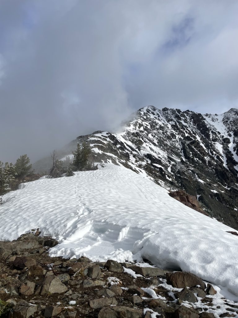
The wind and snow finally subsided a few hours into the night and a fell asleep some time after as I anticipated a strong gust to pick up again any minute. When we woke up in the morning, we discovered just a light dusting of snow on the ridge line and a mix of sun and clouds. However, we packed up quickly to avoid the next round of forecasted snow.
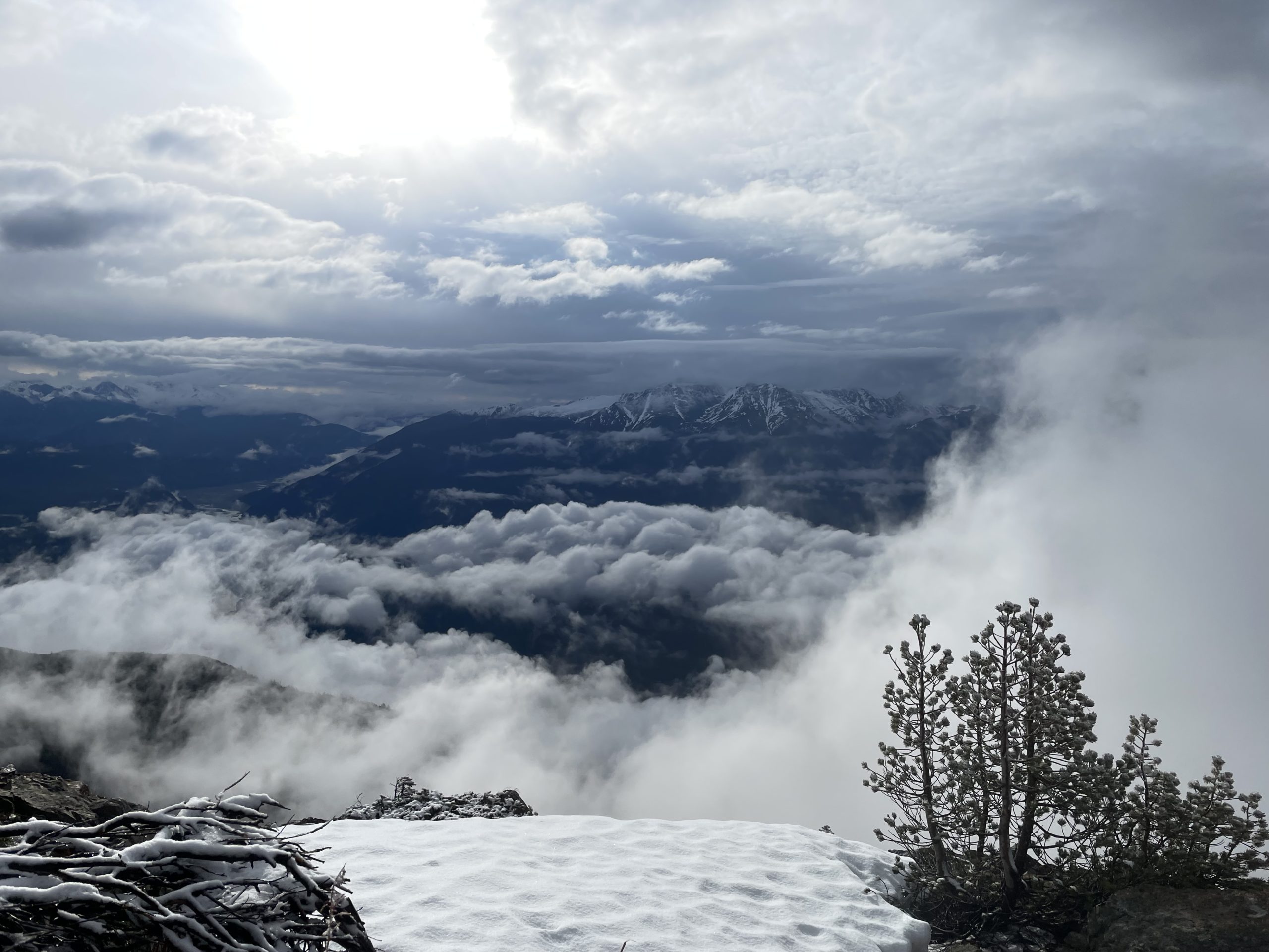
Our return journey was a quick one thanks to the easy trail and short distance. By 11am or so we were back on the truck. Despite the initial set backs on our original plan, Mount Penrose offered an excellent back up option. We were really happy to get some alpine views in the end, although we’ll settle for a more sheltered spot next time.