Elevation Gain: 1,949m
Distance: 22.14km
Total Time: 9 hours 18 minutes
Date: July 31st, 2021
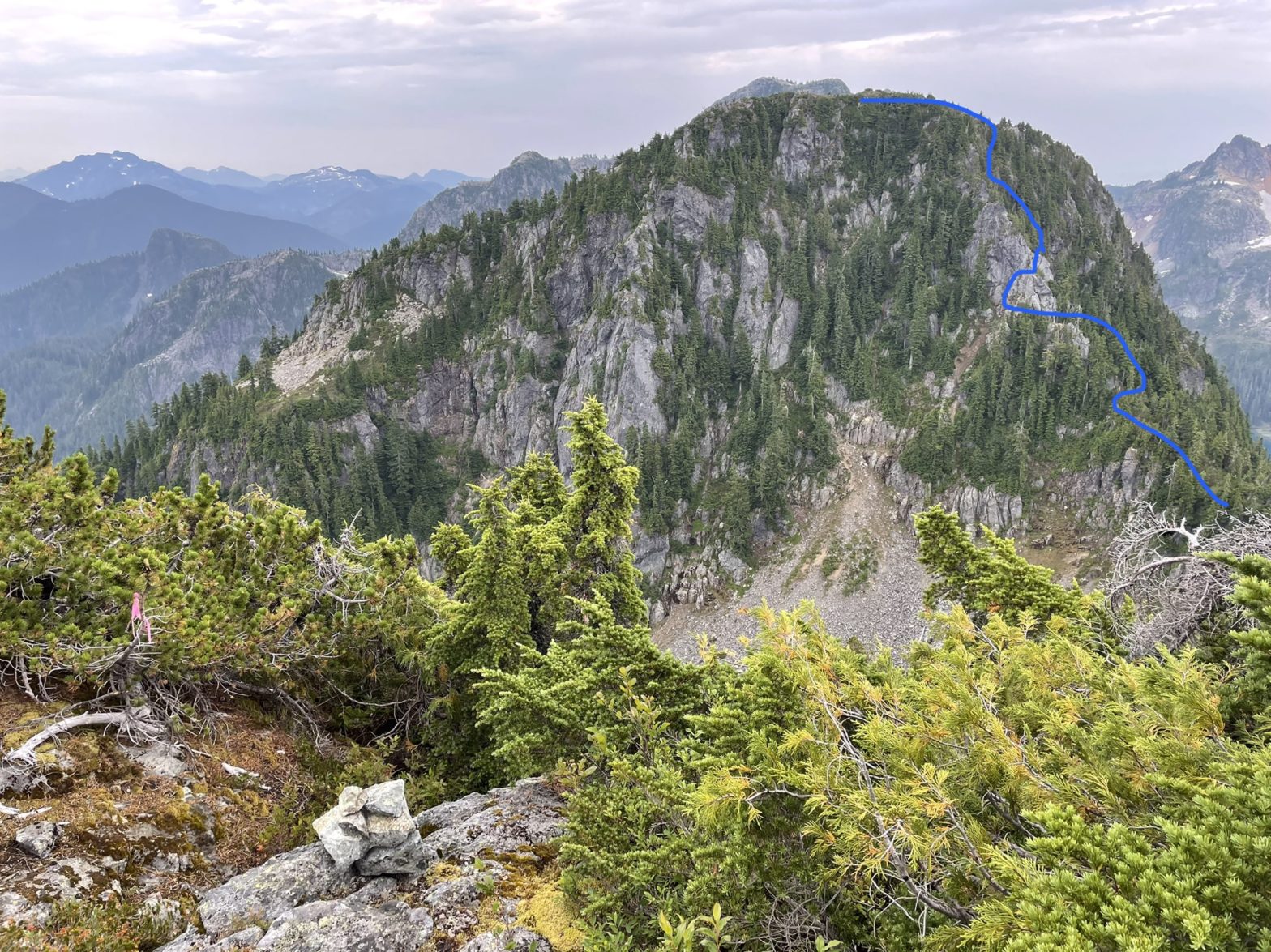
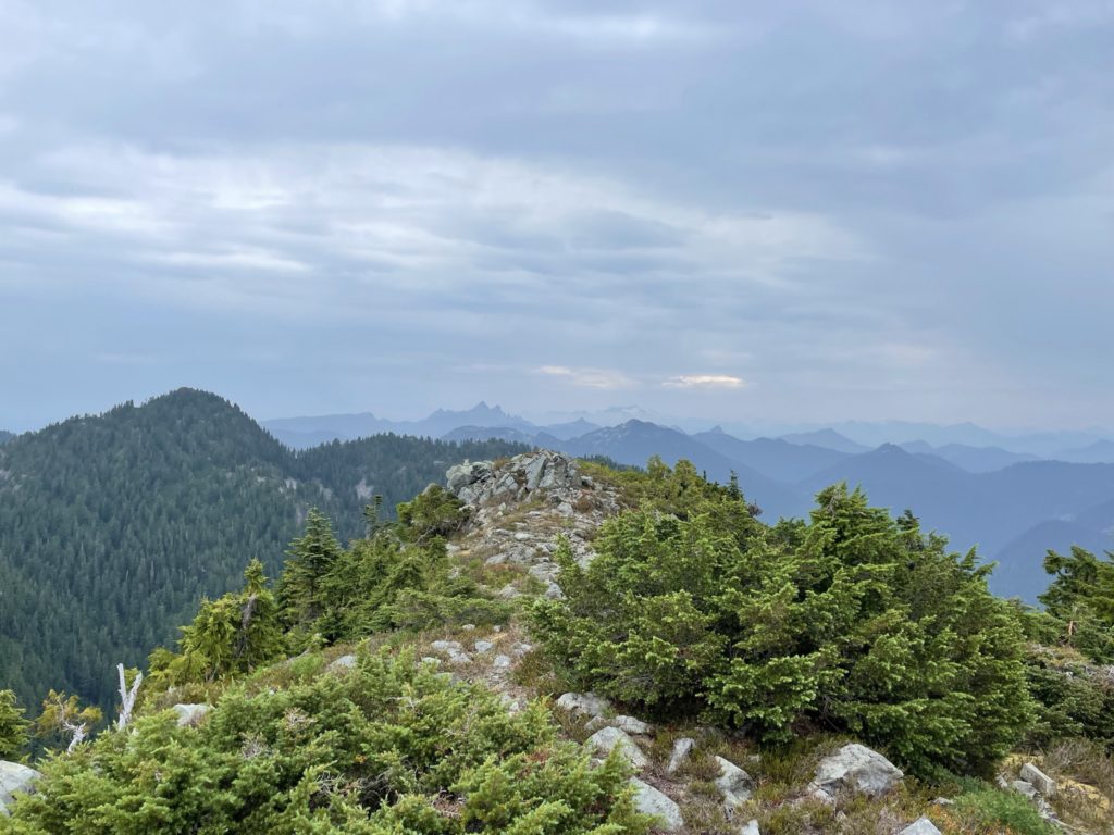
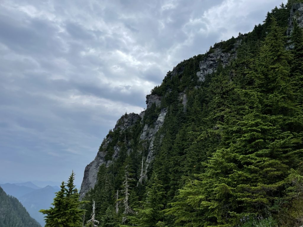
After waiting for the rain to cease and the rocks to dry, Kevin and I were finally ready to make our over to Coburg Peak from Gotha. The initial route involved descending around 100m down to the Gotha-Coburg col over some class 2 terrain. While we were heading down, I was trying to determine what the actual route would look like. There was an obvious ramp from the eastern side, but it was not accessible without ascending 5th class terrain from the eastern gully between Gotha and Coburg. Looking further west, there was significant cliff coverage and I couldn’t for the life of me make out what the route would look like. However, there was ample flagging along the route so far and so we just continued to follow that and hopefully a reasonable route would reveal itself.

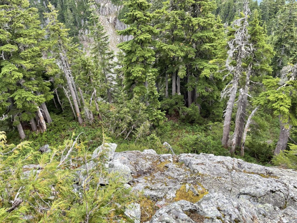
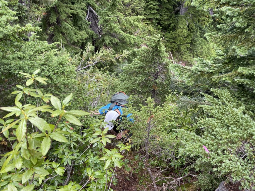
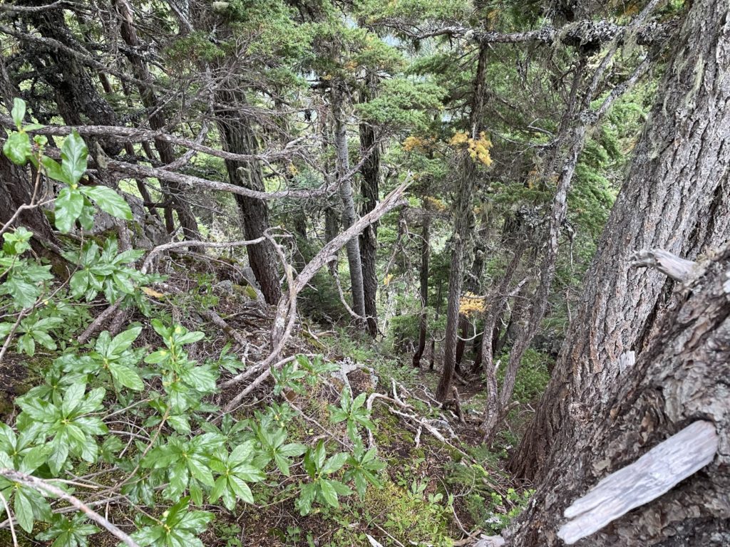
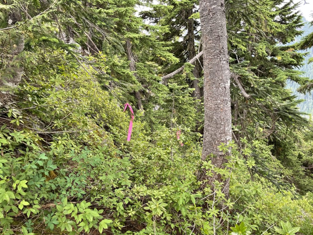
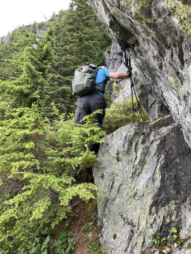
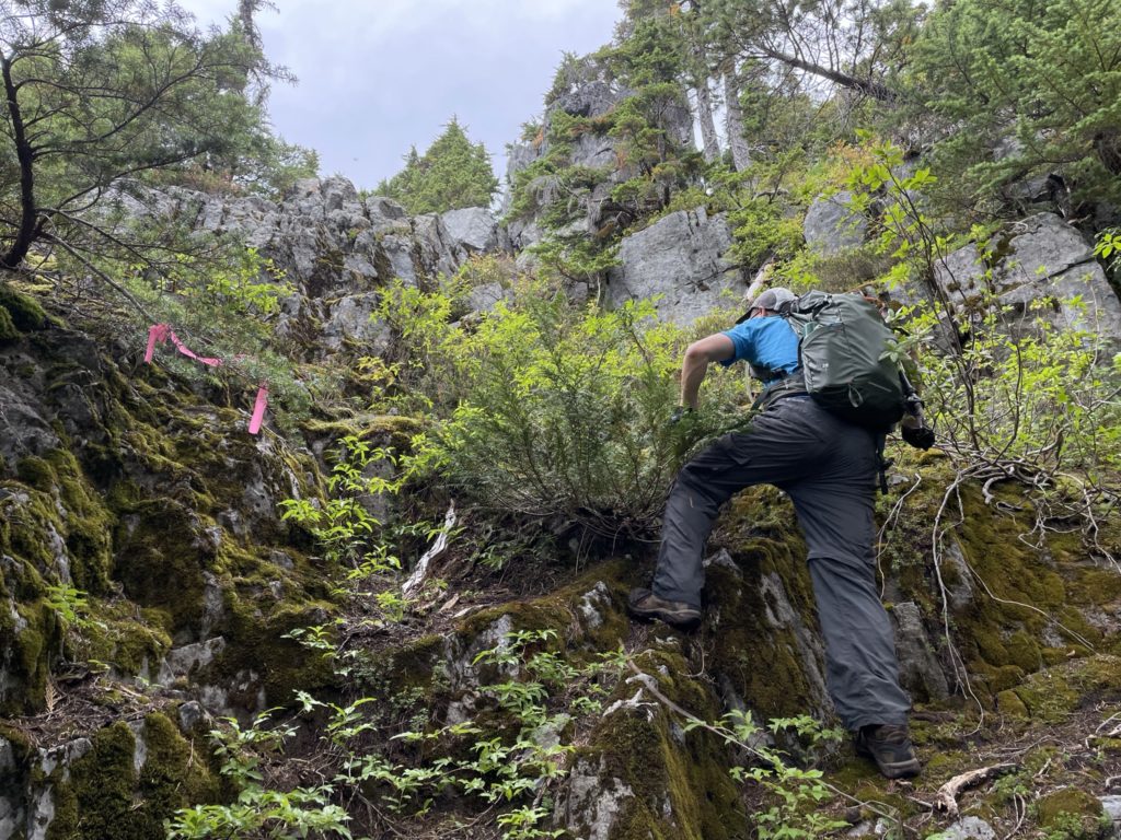
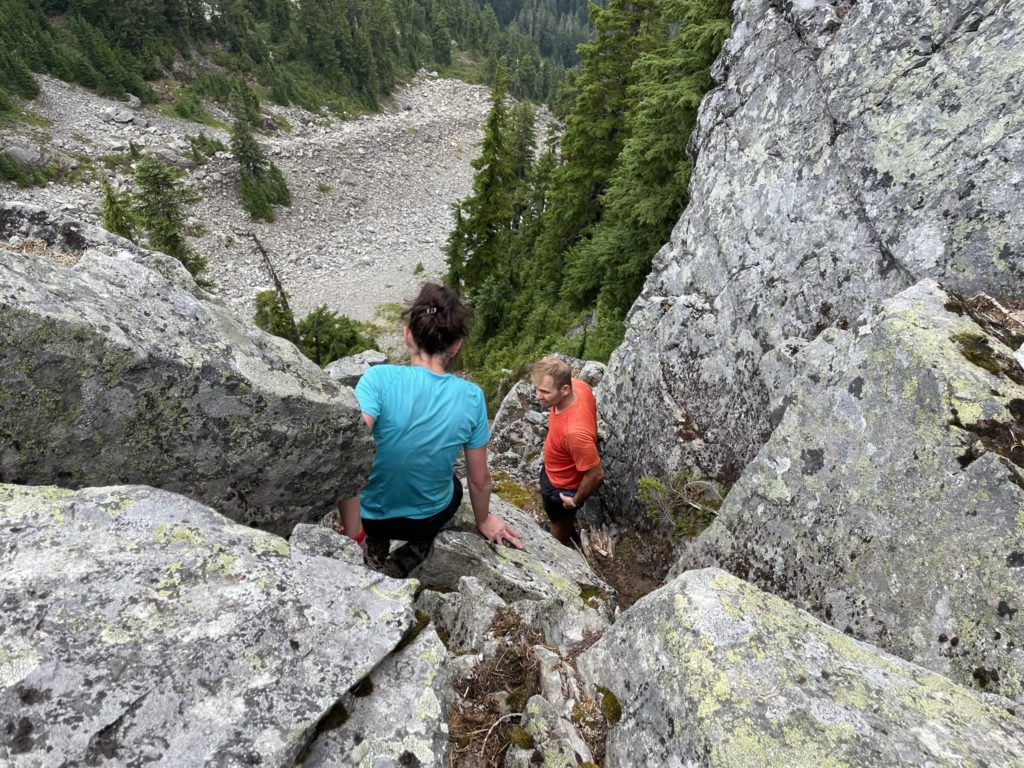
We made it down the col without any issue and then started ascending up through the bush to Coburg’s slopes. The route followed a narrow foot path that at times were just the odd foot mark in heather, but the flagging continued to guide the way. We continued pushing through the bush and then the route trended more climber’s right until we lost the flagging.
I thought I saw a worn foot path and so down climbed a steep slope until I saw a possible route to a narrow gully. I crossed the slope until I was directly under the gully and saw mostly 4th class terrain covered in wet downsloping moss. This didn’t feel quite right and I couldn’t make out any obvious foot prints so I relayed the details to Kevin. He decided to ascend back up our path to the last flag we saw. Shortly after he called out that he’d found the route again and so I climbed back up to rejoin with him.
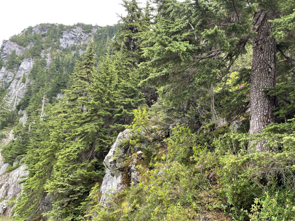
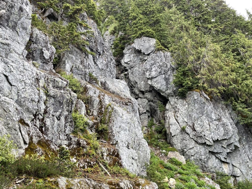
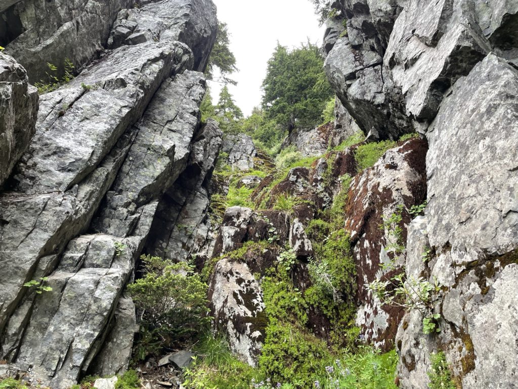
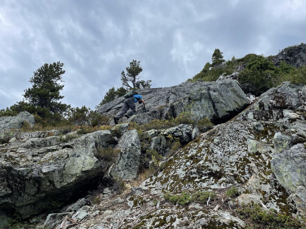
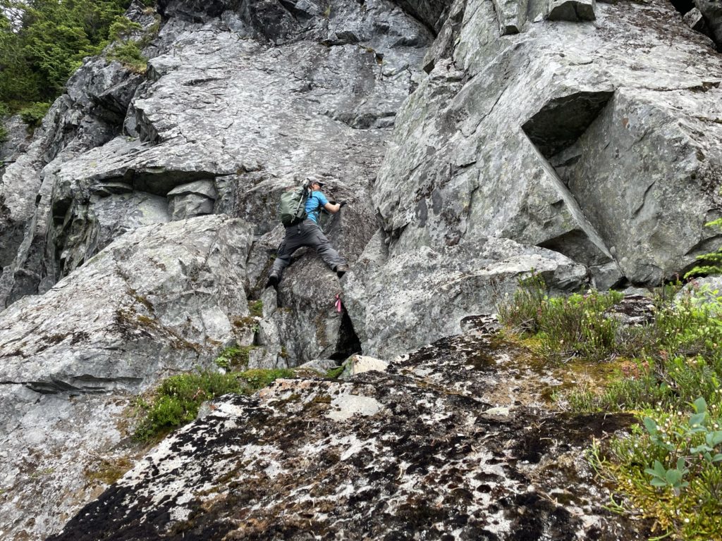
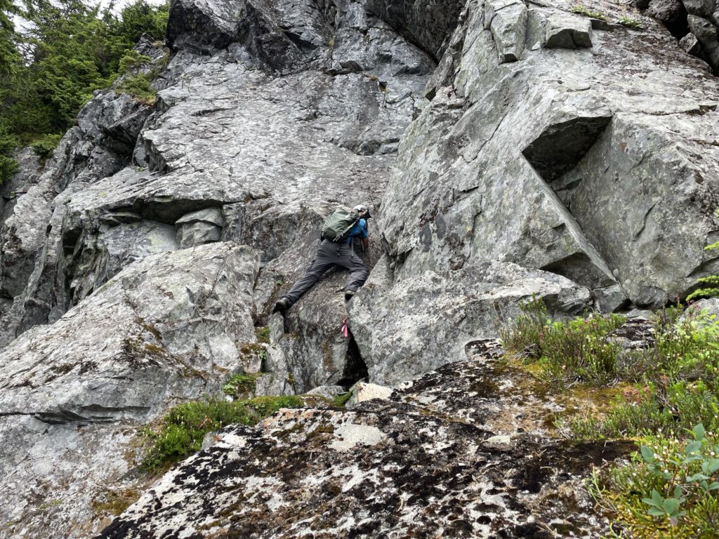
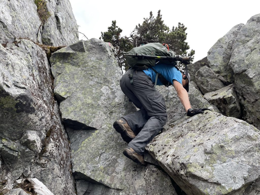
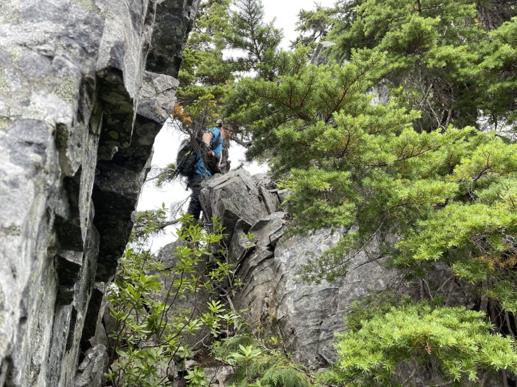
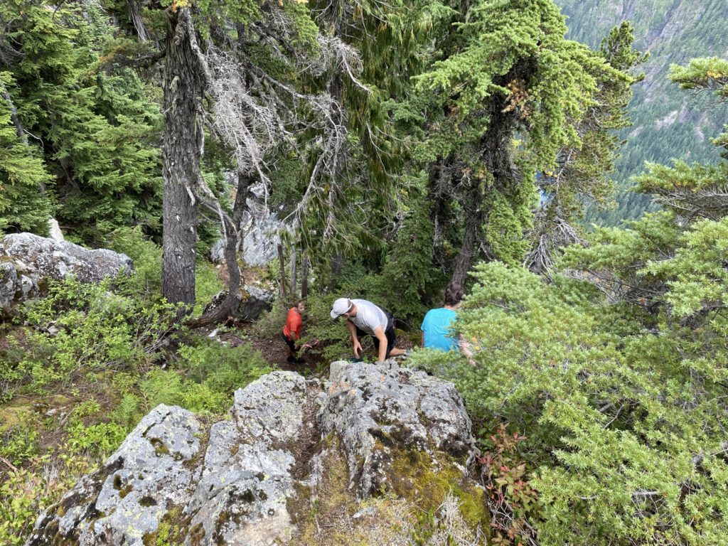
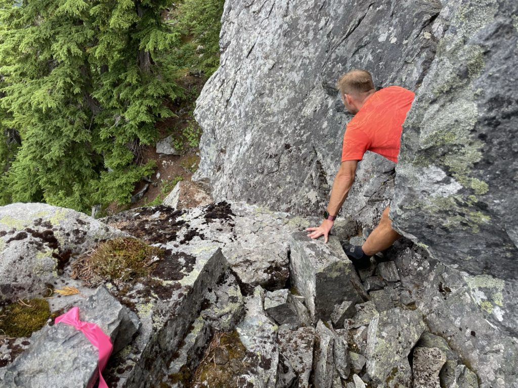
Here the route went directly up a bit further before veering climber’s left under a cliff band. On the left side was a steep dirt gully and then ahead lay some flagging that indicated a route up through the cliff. This is where we encountered the crux of the route. It was a roughly 15-17ft class 3 section that had some moderately tricky, albeit fun moves. Starting first with a stemming move across a good foot hold and then finishing with a tight squeeze through the top part of a chimney to complete the section. From that point there was a class 2 section to get above the rest of the cliff band then back to dirt.
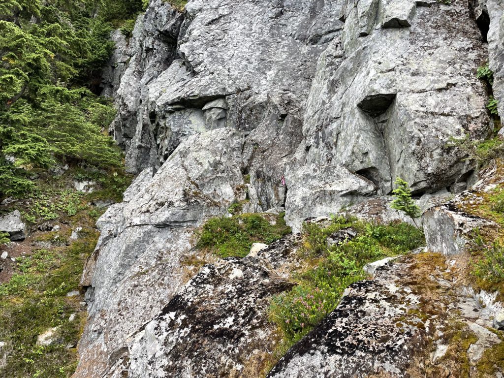
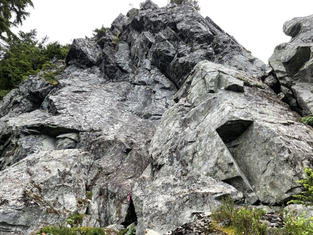
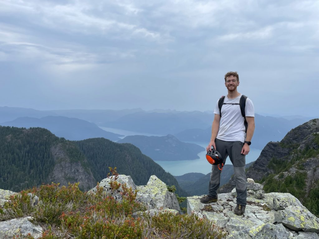
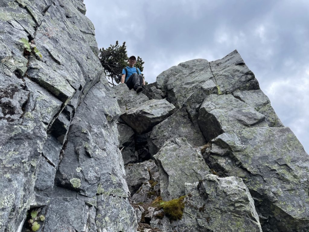
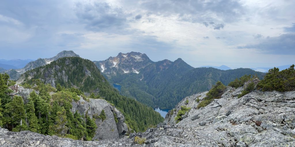
We pushed up through a bit more vegetation and another class 2 rock section and then came across a “junction” of sorts. To the right was a dirt covered slab that could be traversed with a straightforward stemming move. It was low-ish consequence as a fall would take you perhaps 5 feet down to the trees. Meanwhile on the left was a short down climb to a rope which bypassed the slab. At the time, Kevin and I weren’t sure where the rope lead so we just went with the slab route and then continued following the flagging up through the bush. The terrain finally eased out and we broke out on to the summit shortly after.
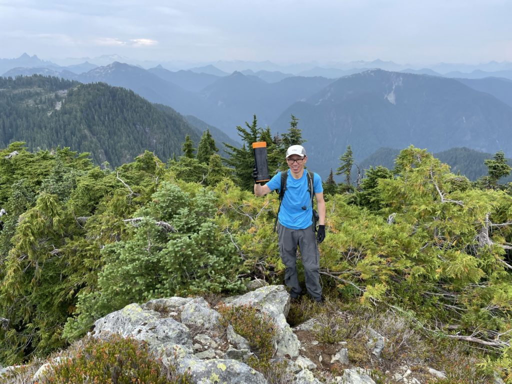
Not long after reaching the summit a group of 3 caught up with us. After a short intro we found out they were Jen, Steve and Dennis from the north shore’s Bagger Challenge group. They had actually been the ones to flag the whole route, so exchanged some appreciation for the nice work.
During this time the rain had been starting up on and off, so I didn’t want to spend long on the summit as I knew down climbing the crux section would be messy if the rocks were wet. The group of 3 started down, but Kevin wanted to hang out for a bit to enjoy the summit. We agreed I could tail the group down and he would join up shortly after on the col.
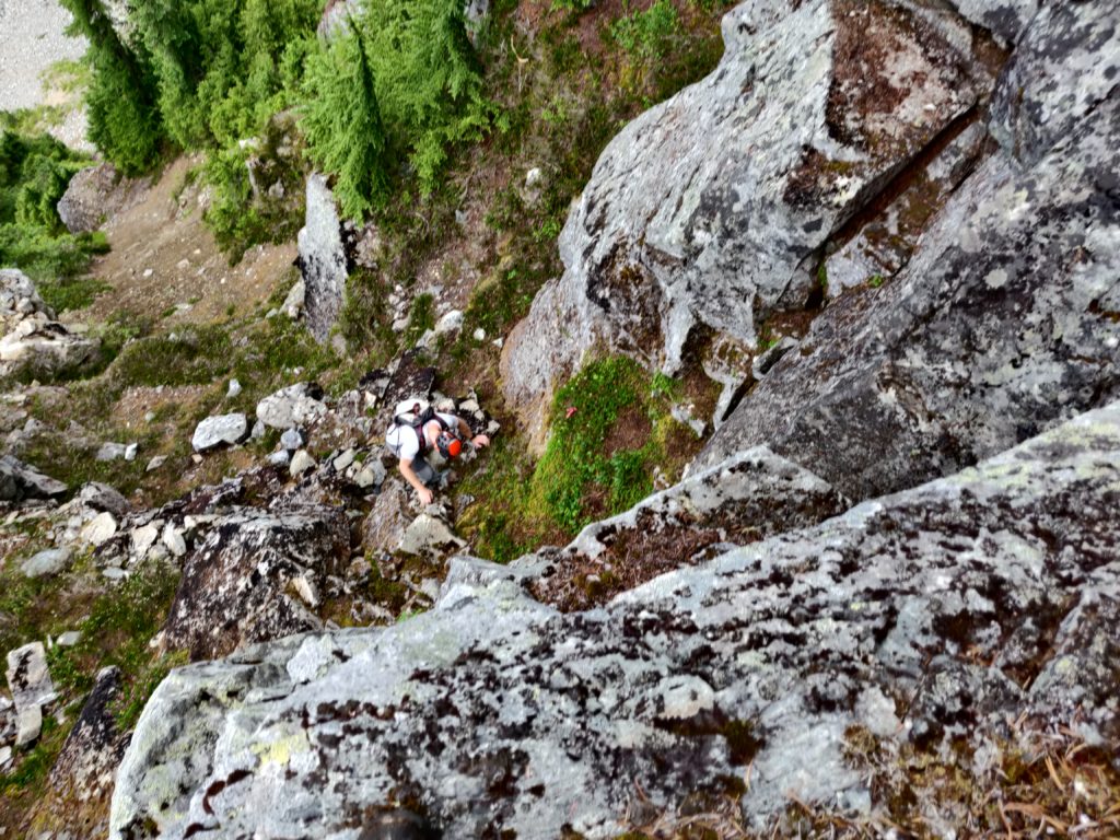
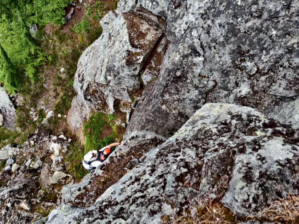
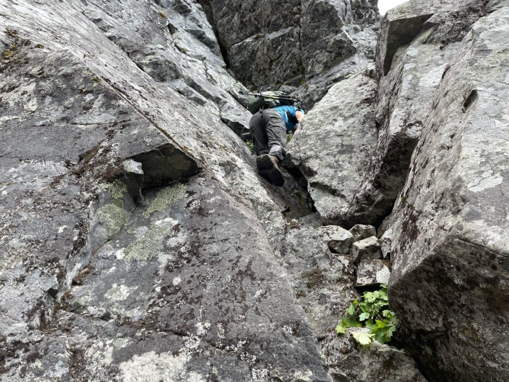
For the way down, I descended the same route I took up and was back at the “rope junction” again. I still opted to go for the slab traverse again and while it was a bit more awkward on the return, it was overall easy enough. Then it’s another short descent of some class two terrain and vegetation before we were above the cliff band again. Dennis, Jan and Steve were just ahead making their way down the first class 2 section above the crux. I waited for them to clear and then descended to a flat spot above the crux to wait for everyone to finish down climbing. At this point Kevin rejoined with me and was quicker on the descent than I expected.
Once the trio was through crux section, I started my descent. Dennis was kind enough to come back and spot my foot placements if need be. However, downclimbing was actually much easier than the ascent and I was able to get down easily without assistance. Kevin made it down shortly after and now the toughest section was out of the way. We followed the flagging back to the col and then pushed back up to the summit area of Gotha.
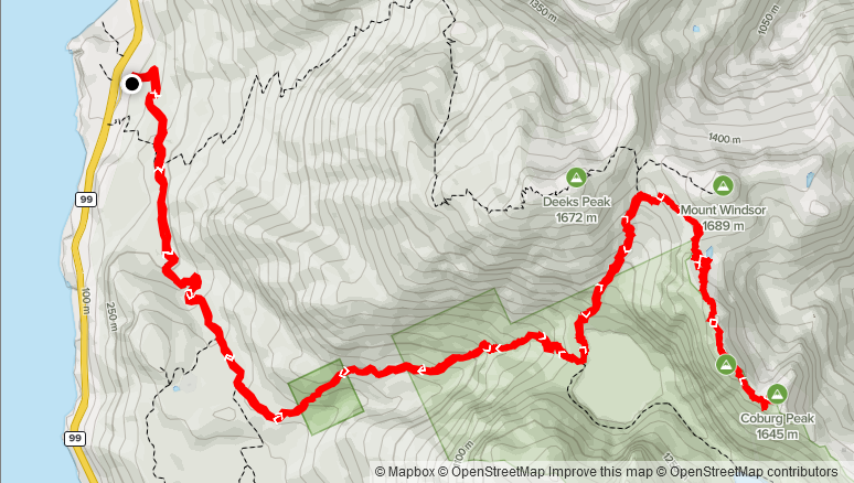
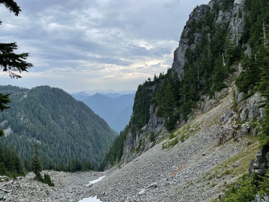
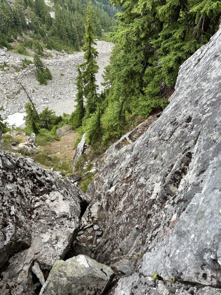
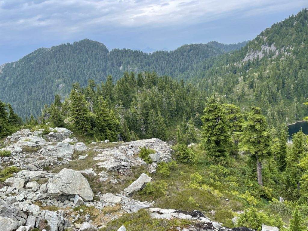
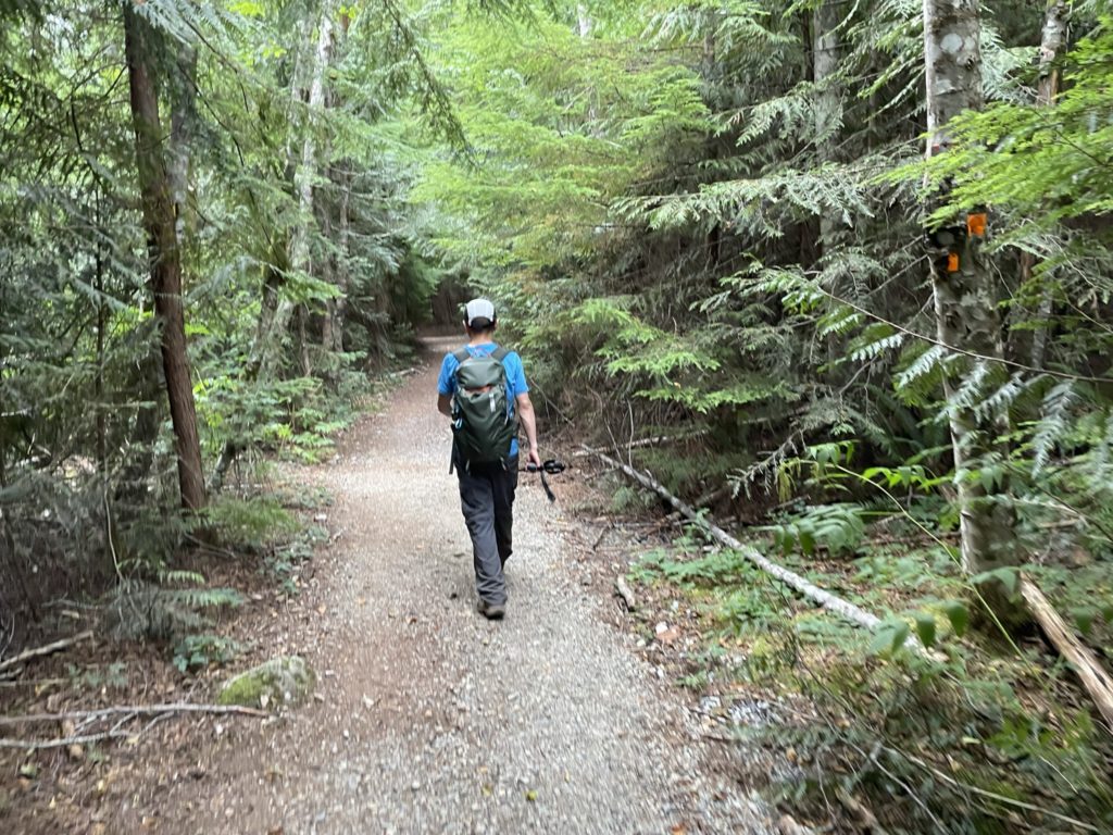
Again we paused for a small break at Gotha and then started the long plod back to the car. We retraced our steps down the boulder field and then onto the bench meadow and finally back to the main trail for Mount Windsor. From there it was a long, uneventful, 8 km + descent back to the car.
After it’s all said and done, I found Coburg Peak to be super fun. Gotha makes it worthwhile since you get 2 peaks for 1 on the journey. The only downside to this route is the unfortunately long approach from the trail head. Otherwise, it’s a fantastic scramble and thanks to the flagging eliminates a lot of difficult route finding that may otherwise lead you into treacherous terrain.
Thanks for this trail report, it was super useful! I did Cotha & Coburg yesterday, and your details & pictures are 100% valid. I did find the Coburg crux chimney much easier than it looks in the pictures. It did not have exposure, and the only move that required any real scrambling skills was the the first step to get to the top of the small 140-150cm cliff at the bottom of the crux. From that point upwards the crux was easy.
Agreed, the crux is pretty straightforward! Glad the report was useful!
Hey. Love the trail report. Thank you.
Will be doing this Sunday.
Do you think it’s possible to go down colburg and meet up with the HSCT ? Or is out and back my best bet.
Hey Deric, I think you’d be able to drop down to Deeks Lake and join up that way, but there’s not a straightforward route as far as I know. If you brought a rope to rappel with you may be able to find a tenable shortcut. The terrain is quite bluffy though