Elevation: 726m
Distance: 12.5km
Total Time: 6 hours 44 minutes
Date: March 27th, 2021
Yet another weekend of rain in the forecast for the lower mainland with low cloud cover. Wanting to avoid another white out high in the alpine, I figured I’d pick a smaller objective with potential for views. This lead me to Mount Saint Benedict, which I had considered doing in the past, but skipped out for one reason or another. My friend Jacob was once again willing to join along and so we set our day for Saturday as it had the least amount of rain in the forecast.
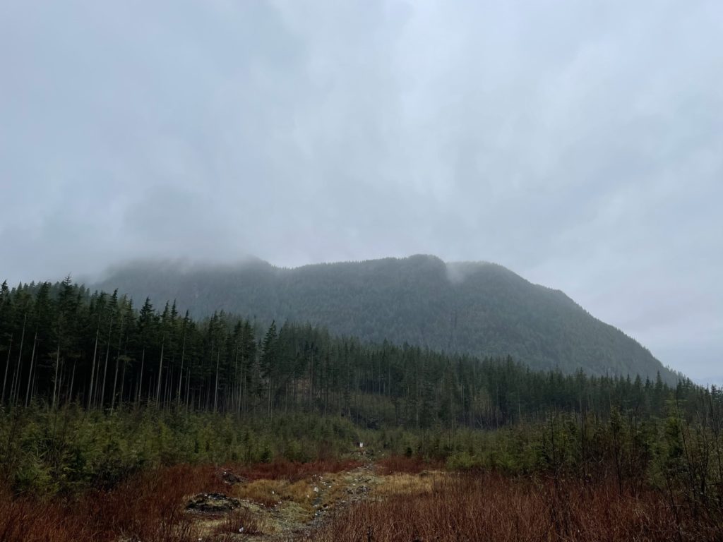
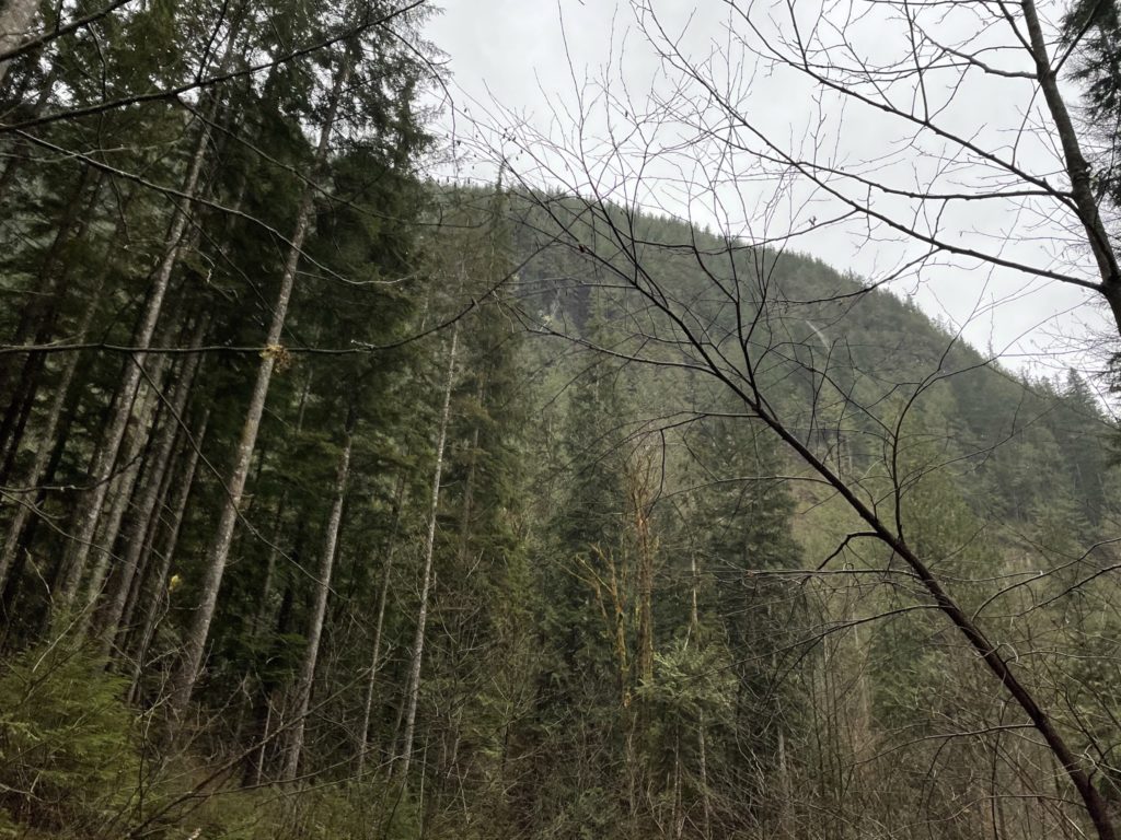
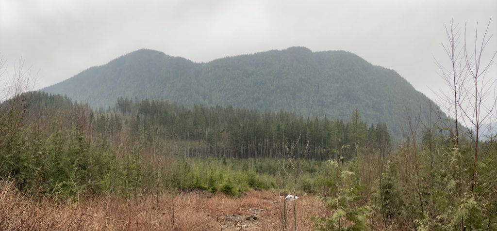
By 10:40am, on Saturday, we had reached the trail head to Mount Saint Benedict. It was totally covered in cloud and for the conditions, didn’t seem that appealing. Jacob was doing a scan around the area and noticed an interesting peak directly west of Mount Saint Benedict. It wasn’t particularly tall, but it was below the clouds and it had some steep looking terrain. The entire eastern aspect was buttressed by massive cliffs, but I popped open my offline maps and had a look anyways. Sure enough, it was named summit called: Monastic Peak. It stood at a rather small 665m and there was no established trail that I could see on the maps. The lack of trail meant a bushwacking adventure most likely, but I couldn’t pass the idea up of discovering something less traveled and with no service no beta to find either. A closer look on the maps also revealed more friendly topography on the western aspect and luckily for us an FSR ran all the way around the to the west side.
With the new plan, we started our drive towards the base of Monastic Peak. Unfortunately, we didn’t make it far. I drove us there in a small FWD car and it simply wasn’t up to the task for the FSR to Monastic Peak. We checked the maps and it looked like an additional 3km by foot, which on an FSR is easy street. So, we parked the car, geared up and headed out. (For those with an AWD or higher clearance vehicle, this road would be no problem what so ever).
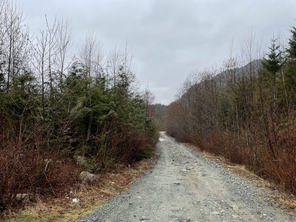
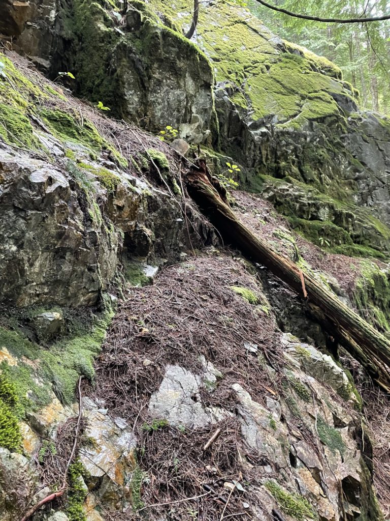
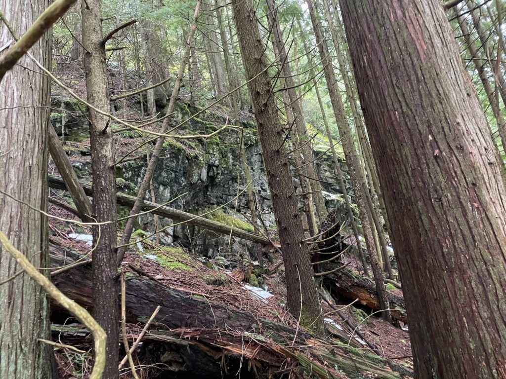
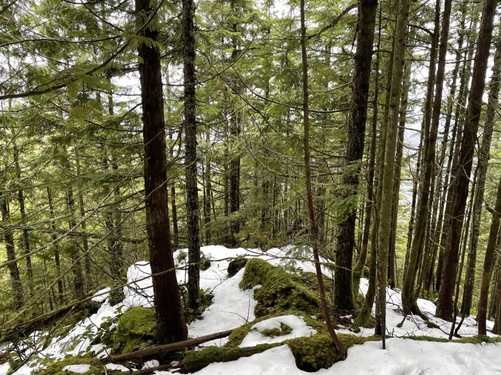
The walk down the FSR was fairly uneventful and we set a good pace as it slowly drew us closer to the North East aspect. There, we saw how formidable the Eastern aspect really was. Cliff after cliff covered in wet moss and spanning upwards of 100ft or more at times. We hurried along to the Western aspect, hoping there would be some relief in the terrain. After 45 minutes or so we made it around the bend and now had a clear look at the route ahead.
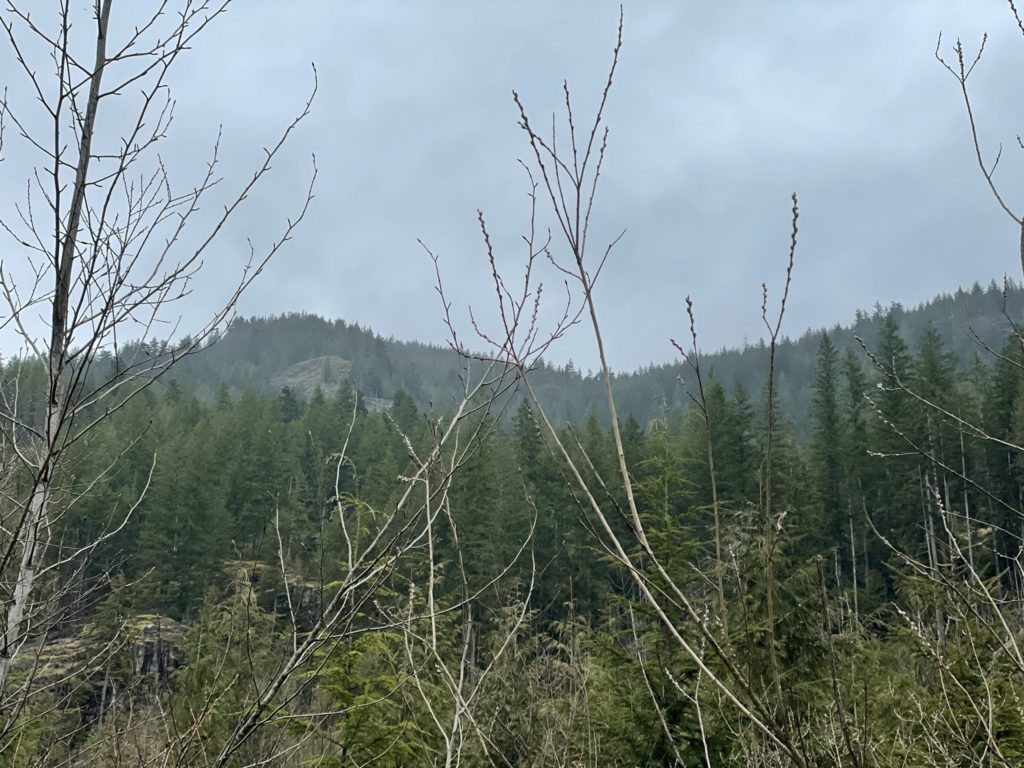
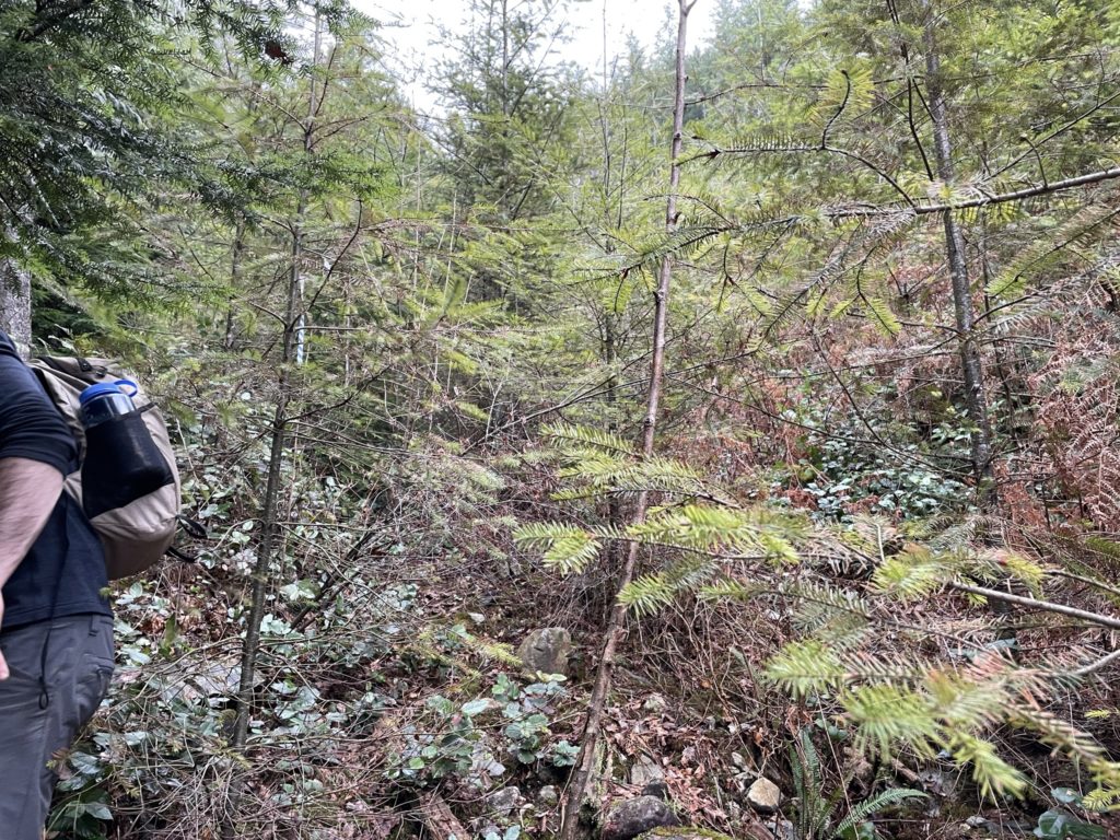
To our surprise the Western aspect also had huge cliff bands with some sitting right below the ridge line. I had some doubts we’d be able to find a route up, but studying the map a drainage creek looked to be our best bet. Given there was no established trail (that we knew of), we decided to just veer off into the bush and start making a direct line for the creek. The map indicated the FSR continued a bit further around, but we decided to skip it as it didn’t look necessary.
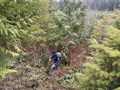
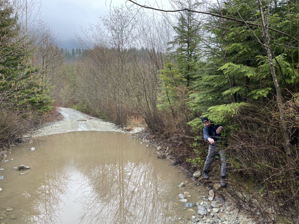
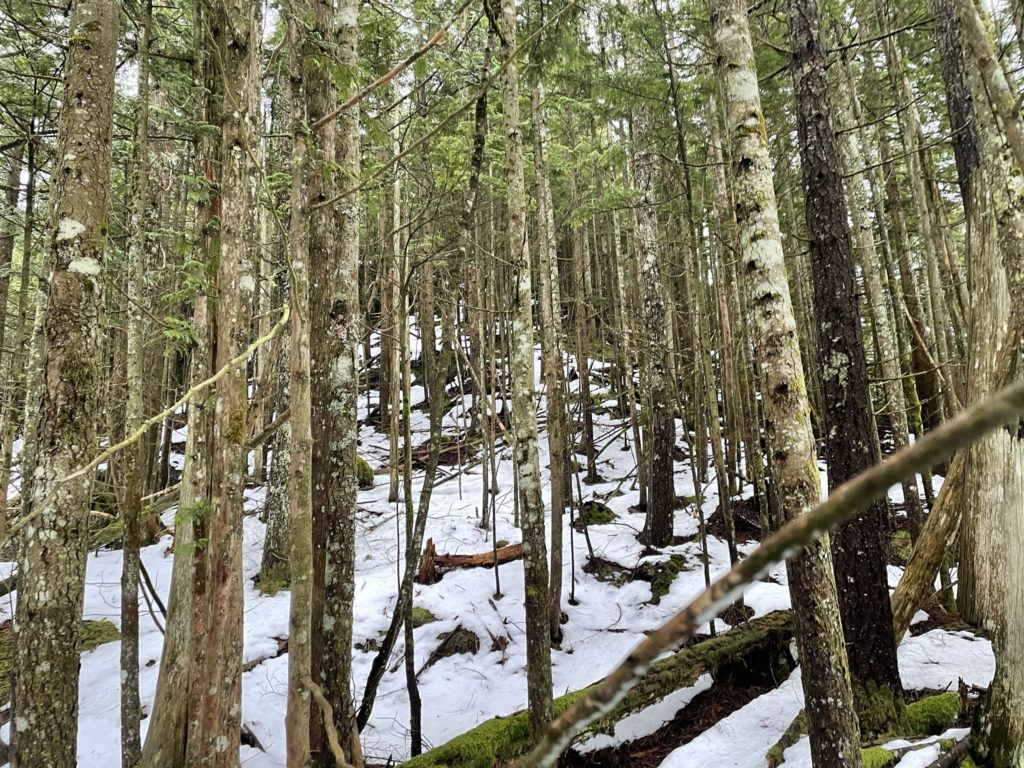
Well… we were wrong. We bush whacked in thick thorny vegetation and deadfall for about 250m and lo and behold, we burst out out of the bush at the end of the FSR we had tried to skip. After laughing it off, we pushed up into the forest where the FSR had now terminated. The creek I was planning to follow was about 20m climber’s right and we were slowly making our way over when we came across of fresh set of flagging along a different creek. Naively, we thought this might be trail flagging and elected to follow up this secondary creek.
We continued to follow the secondary creek + flagging up further. After awhile, I realized all of the flagging had the word “Creek” printed on it and that perhaps we weren’t on some established trail after all. Likely, this was some environmental marking for loggers or perhaps a navigational aid, I wasn’t sure. With that being said, the creek was passing through large cliffs and we were so far avoiding any of the problematic terrain we spotted from the base.
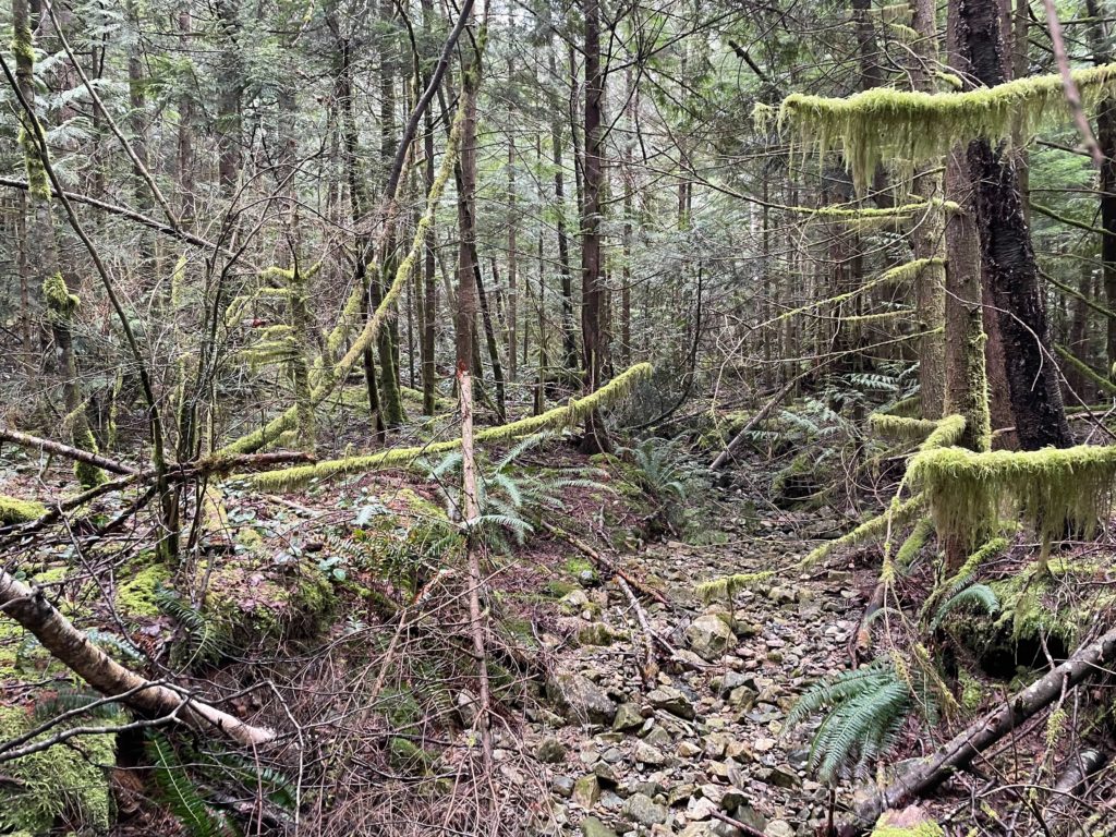
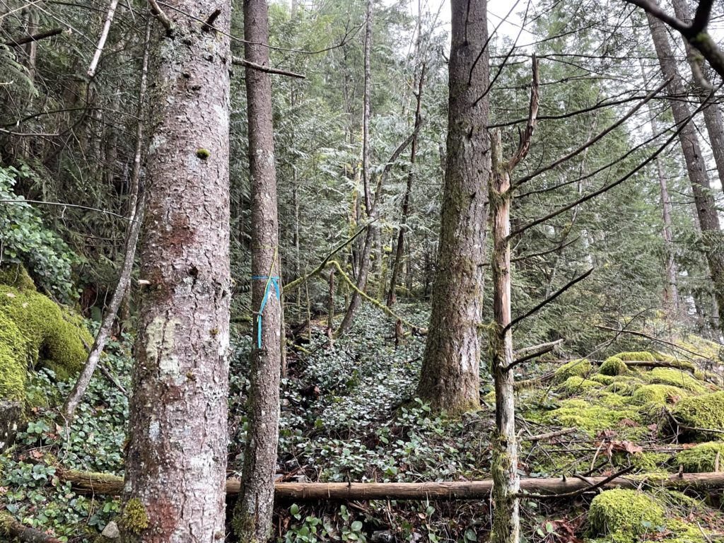
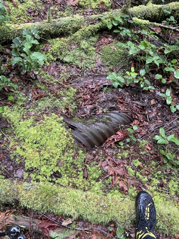
As we pushed up to the 300m mark, the trail suddenly veered climber’s right towards the first creek. We spotted more flagging, this time in blue, and opted to cross over. When we popped out on the other side of the creek, we found even more flagging and what looked like some semblance of a trail. Wanting to skip out on more route finding, we kept following the flagging and spotted scant boot tracks through the vegetation. All along this part of the route something felt a bit unnatural, the grade wasn’t too steep and the terrain was flat and wide. Perhaps 20 minutes up, I confirmed my feeling when I spotted a rusted culvert.
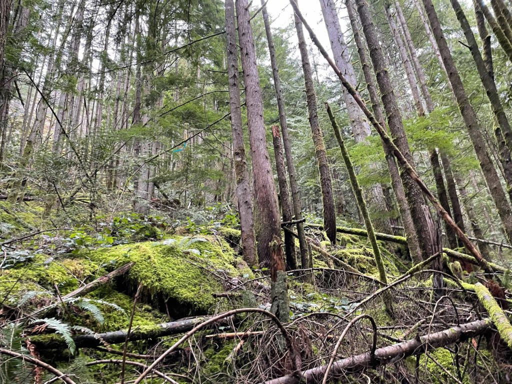
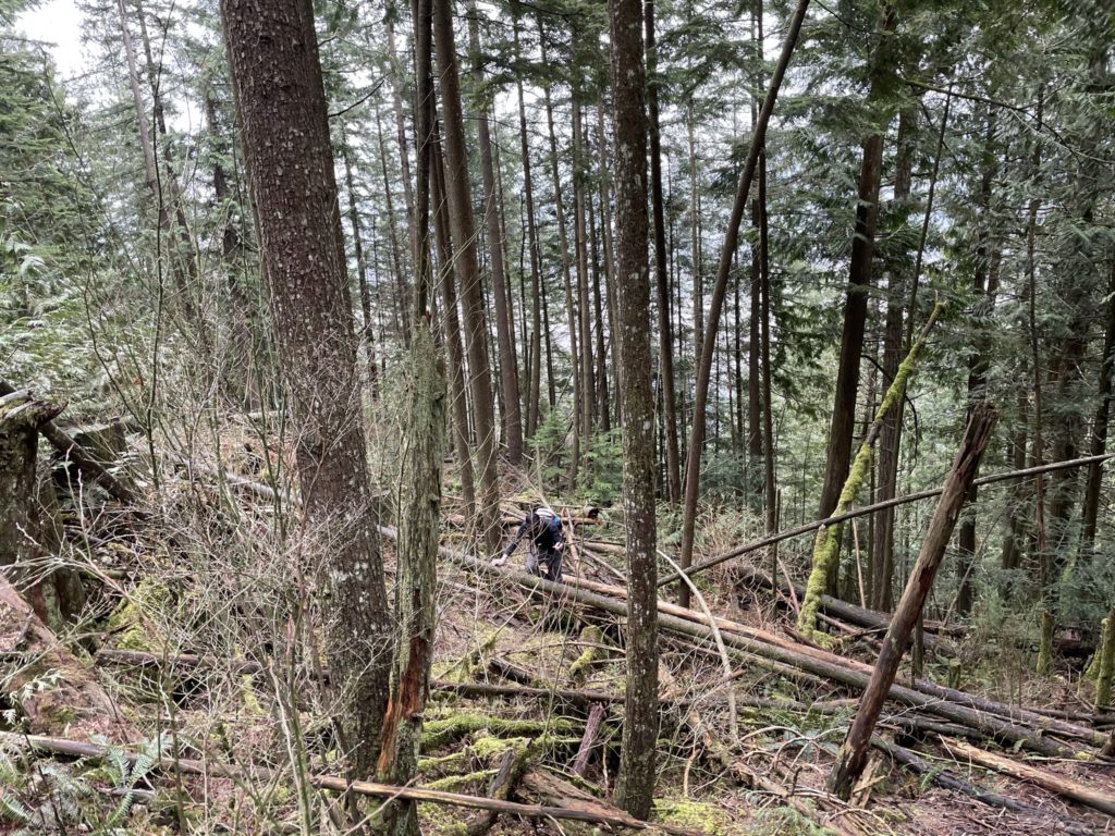
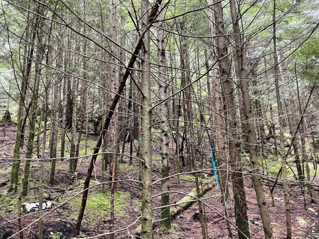
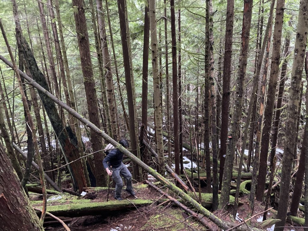
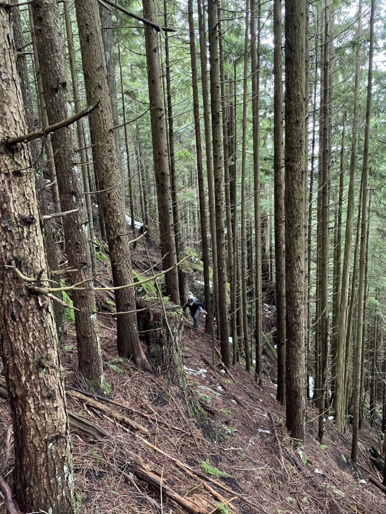
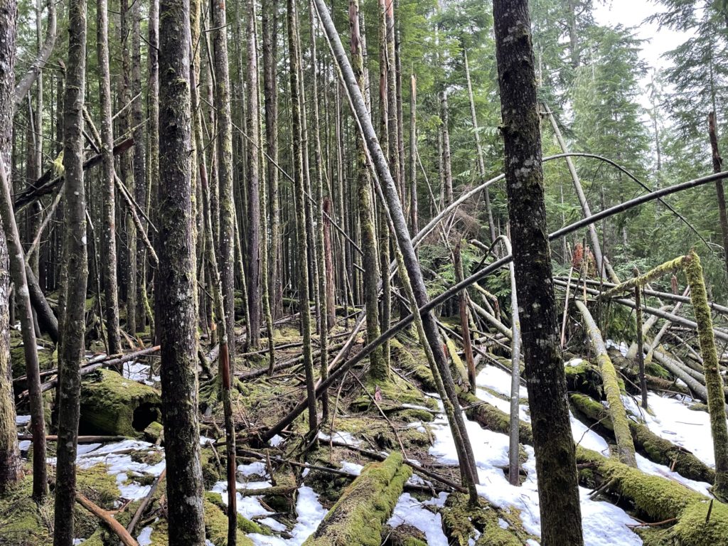
Sure enough, we were on an old FSR. The FSR had largely been reclaimed by nature and looking at the size of trees was perhaps 15 years old or more, but I was excited nonetheless. We had found an old FSR that would hopefully lead us up to the ridge line and avoid steep deadfall ridden slopes and moss covered cliff bands. The FSR itself was heavily inundated with deadfall as well, which made for slow progress, but at least we didn’t have to focus on route finding.
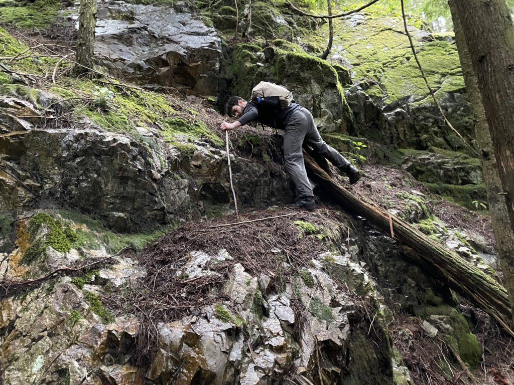
At about 350m or so we hit a small cut block that looked like it had been more recently logged and was likely the cause for the new flagging we had been following. It proved to be a big pain the ass with huge trees blocking our route forward. We picked a line through this crappy terrain and we when made it out to the other side the FSR terminated. However, the flagging still continued and so we pushed onward. The route went further North through the forest underneath a small cliff band and then up a small 3m rock scramble. Under sunny dry conditions, this would have been a breeze, but the rocks were wet, slippery and covered in loose dirt. We carefully made our way up and continued towards the ridge line.
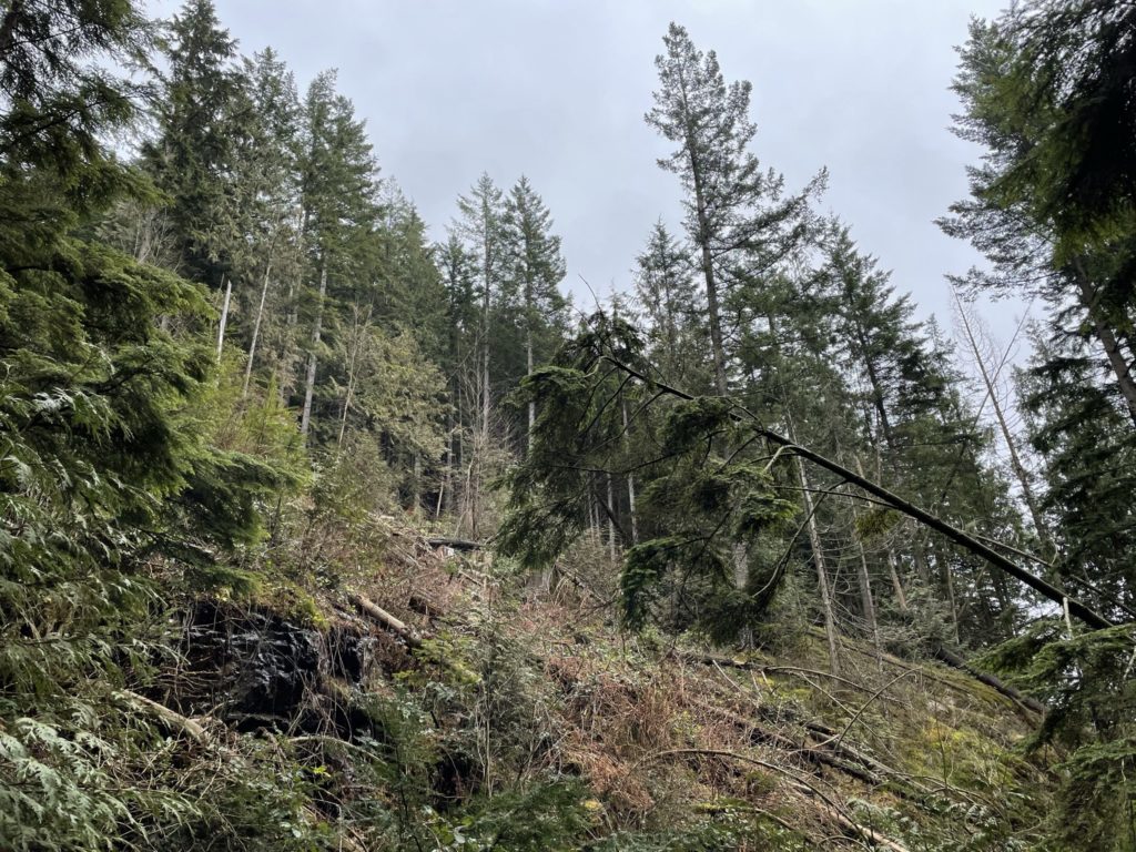
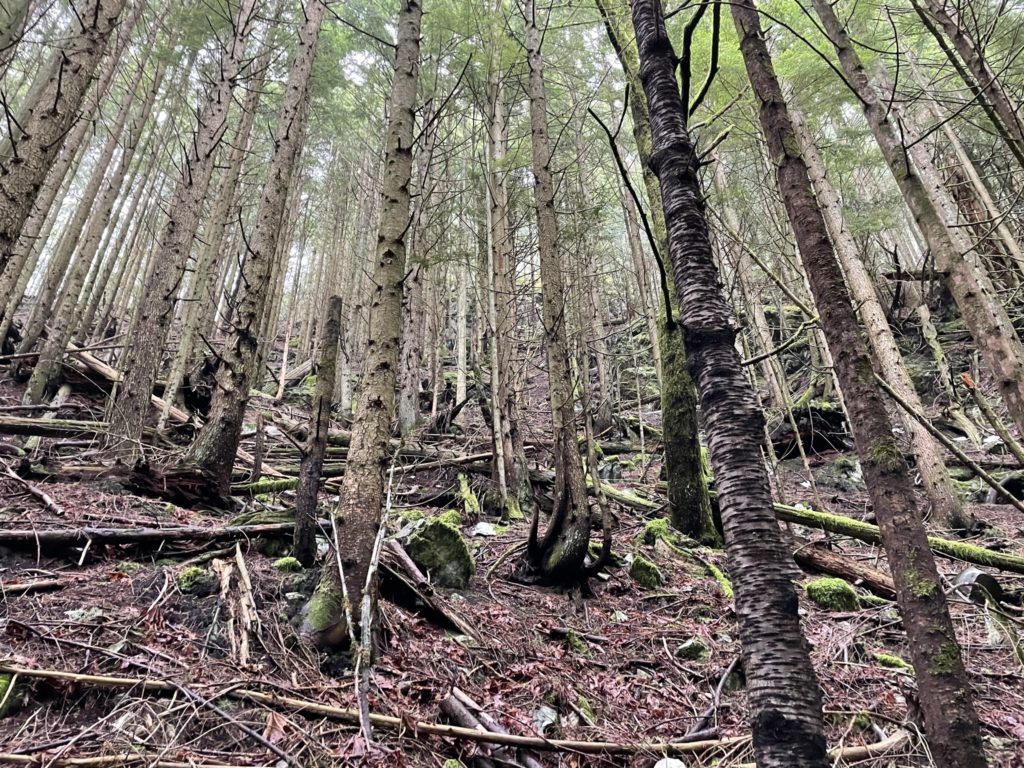
Again we spotted more flagging and this time it pulled us Southwards until we linked up with a higher section of the FSR we were on originally. I can only surmise that the FSR would have originally gone through where the cut block was, but it had been covered in deadfall and so loggers had flagged a detour up and around through the forest. The FSR continued up to the ridge line at about 520m. From there it became impassible deadfall and so we picked a more direct line through the forest to the summit.
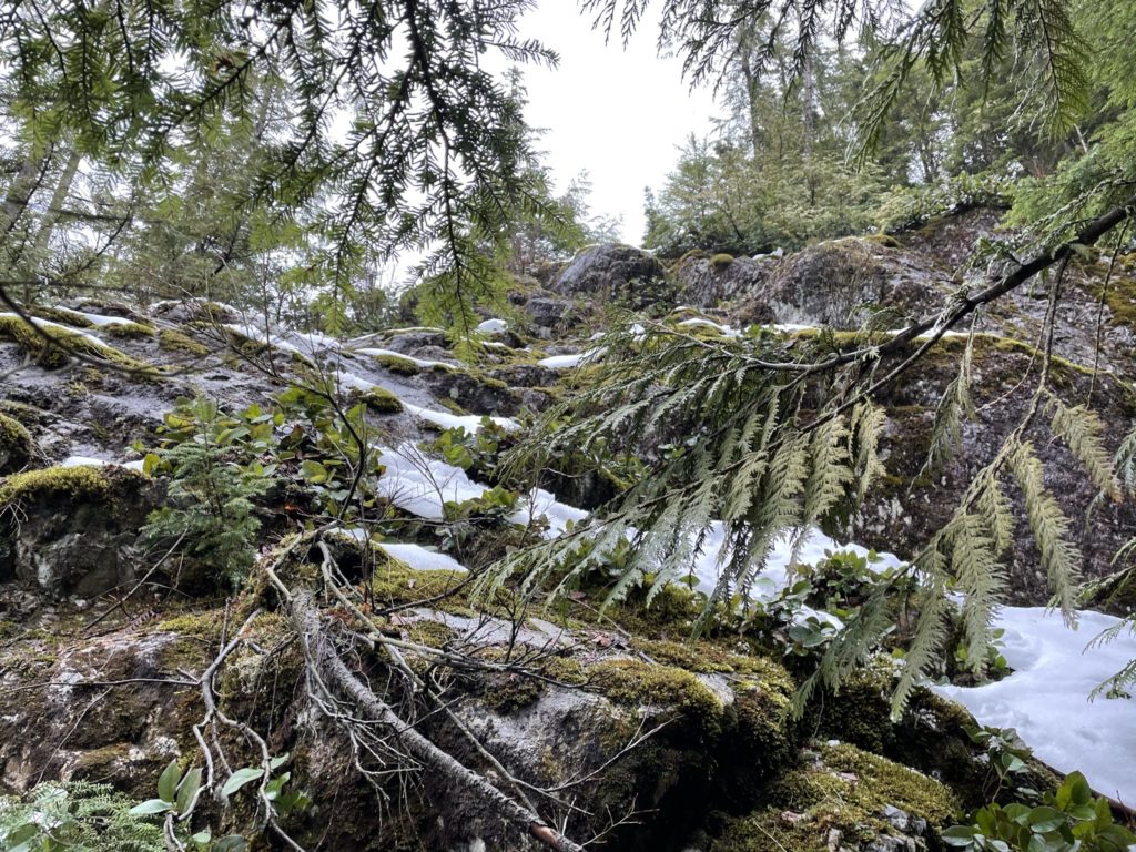
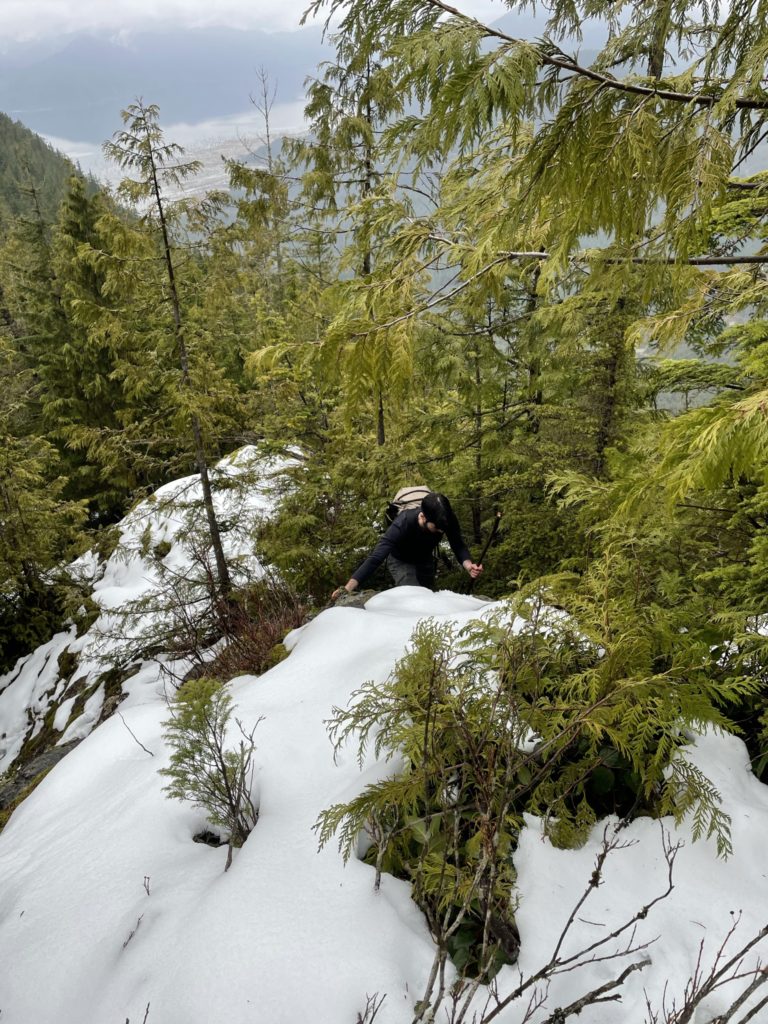
This section of forest required the least amount of bushwhacking so far and we made good progress towards the final pitch for the summit. When we reached the the base of the final pitch, I discovered that we were in for another challenge. The flagging was gone along with the FSR and the summit slope had large cliffs visible all around the top. Adding to that, the slopes below the cliffs were quite steep. We scouted around the base for a bit and then finally found a line that appeared to skirt around the upper cliff band. While the slope was steep, it was comprised of soft roots and vegetation that actually provided decent grip. It felt like the forest floor equivalent of boot-packing up snow.
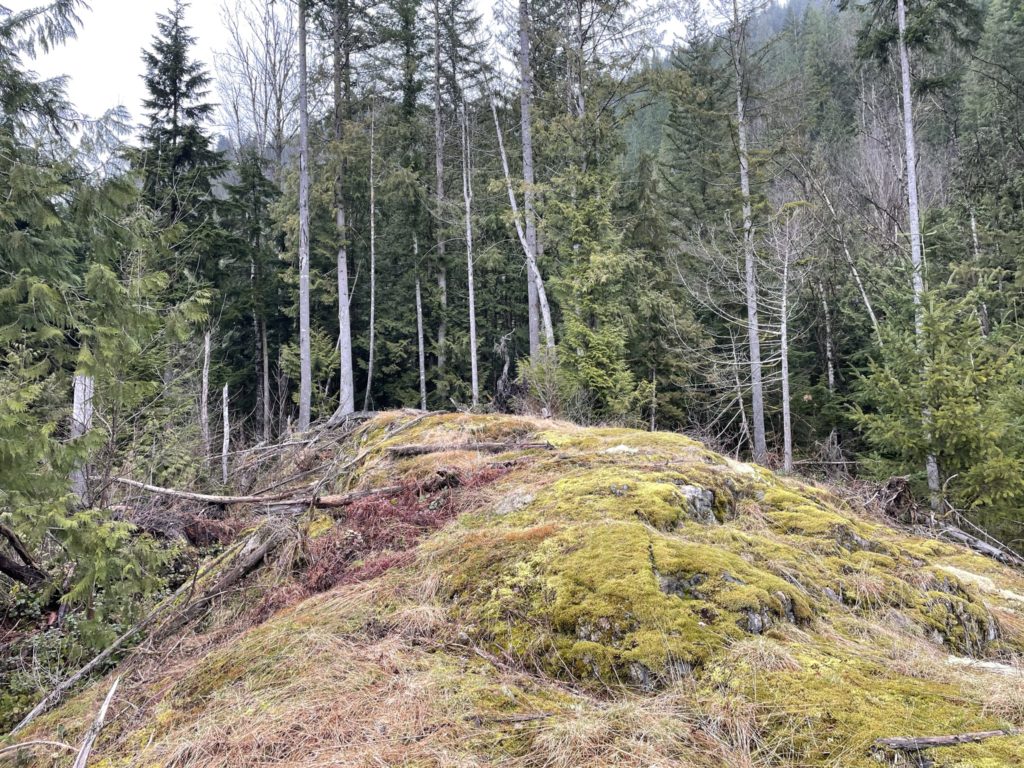
Just before the cliff band, we veered climbers left towards the ridge line and discovered a small scramble section. It was class 2 at most, but the rock face was soaked and slippery so we’ll say class 3 for a spring ascent. With the brief rock section out of the way, the terrain eased and we just had to follow through the densely packed forest to the summit. As is often the case in these more mellow forested summits, we had to walk around to find the highest bump which we could call the summit. Using the GPS I was able to confirm, roughly, which bump we could call the “top”.
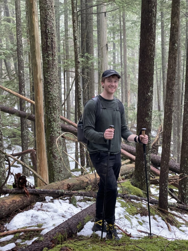
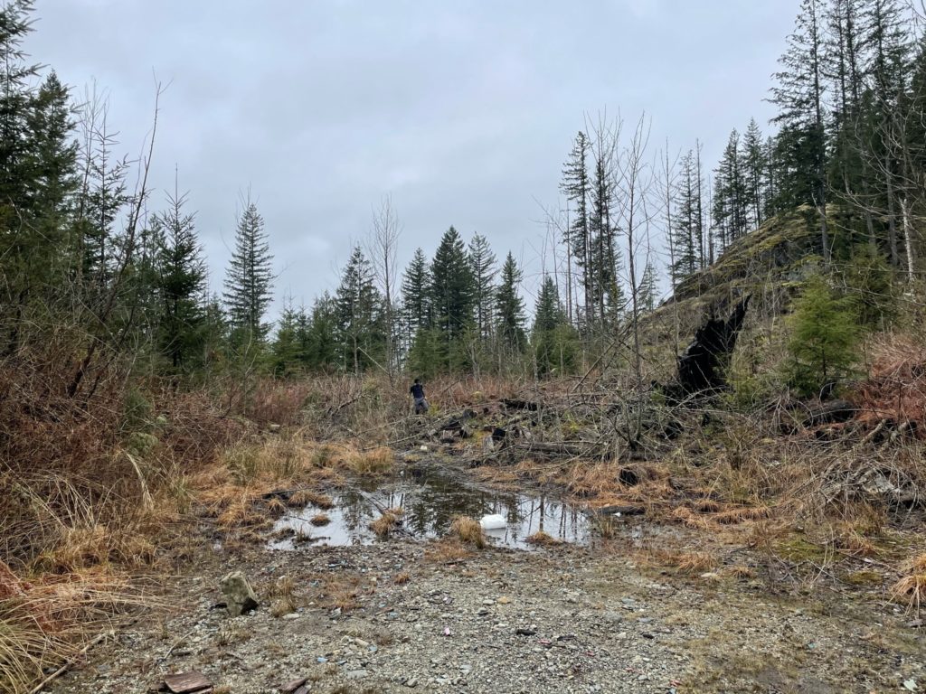
With that, we took photos as usual and then headed back down. The only sections of concern were the two slippery rock steps and then it was just a standard bushwhack back to the bottom. The pace to the FSR at the base of the mountain was slow going though as we had navigate through countless downed trees and brush. Eventually we made it back to the creek where we had originally discovered the old FSR. We chose to follow the old FSR back down instead of our original ascent track. This brought us into even thicker brush where, eventually, the entire road was covered in 10-12 foot tall bushes and trees.
With only 100m or so the maintained FSR we veered right towards the creek and found the terrain opened up significantly. There we just followed the creek back to the maintained FSR and then it was an hour or so long plod back to the car.
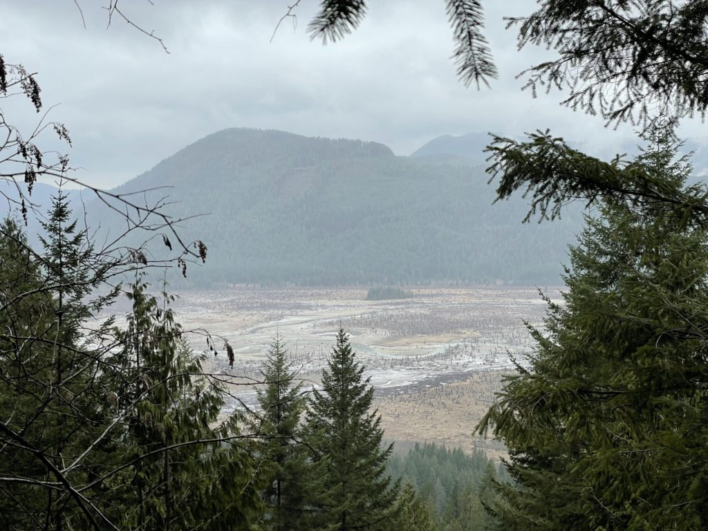
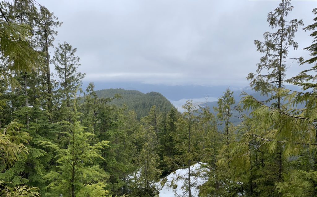
All in all, this trip took almost 7 hours for a mere 655m peak. The deadfall, bush whacking and route finding absorbed most of our time. Now that we know there’s an old FSR and have our GPS track, I can say this hike could be done quite easily in the spring/summer time so long as you don’t mind navigating dead fall. The summit has no views, but there were a few view points along away that actually surprised me as being decent. If you’re looking for more of an adventure/bush-whack type of day, I could certainly suggest Monastic Peak.