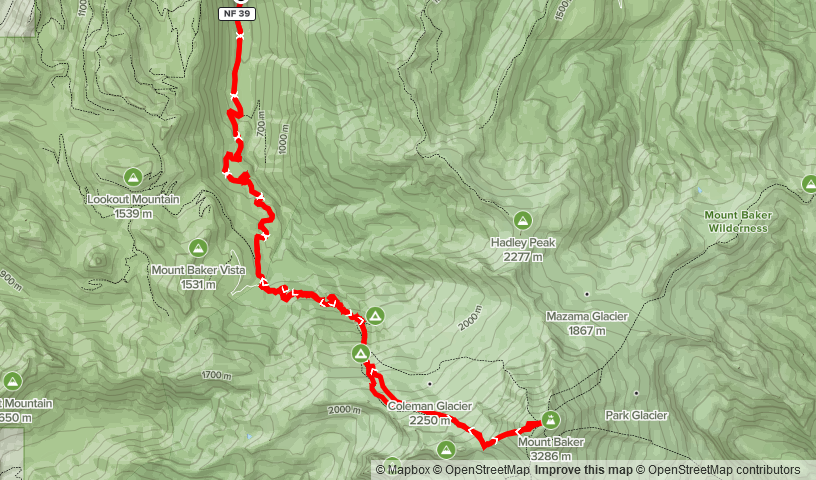
Elevation Gain: 2,829m
Distance: 37km
Total Time: 16 hours 33 minutes
Date: July 24th, 2022
On any clear day in Vancouver, you can see the sheer prominence of Mount Baker as it towers above the skyline south east of the Fraser Valley. For the nearly 5 years that I’ve lived in Vancouver it’s captured my attention any time I see it. It wasn’t until getting into climbing mountains in 2020, that reaching the top crossed my mind. So when Andrea asked if I’d be interesting in making an attempt on it in a weeks time I couldn’t say no. We set out about doing some research and decided on the Coleman-Deming route, which runs up the glaciated western flanks of Mount Baker. While it’s technically a bit more challenging than the similarly popular Easton Glacier route, it’s typically a shorter distance. As we were planning to do this in a single day push, the shorter of the two made the most sense.
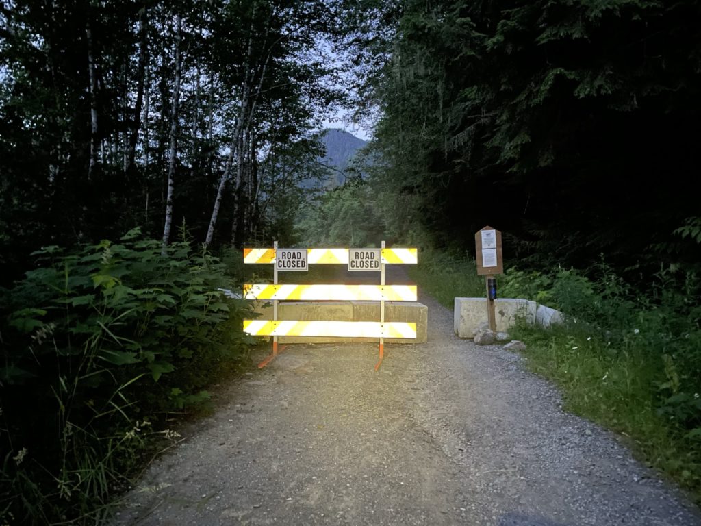
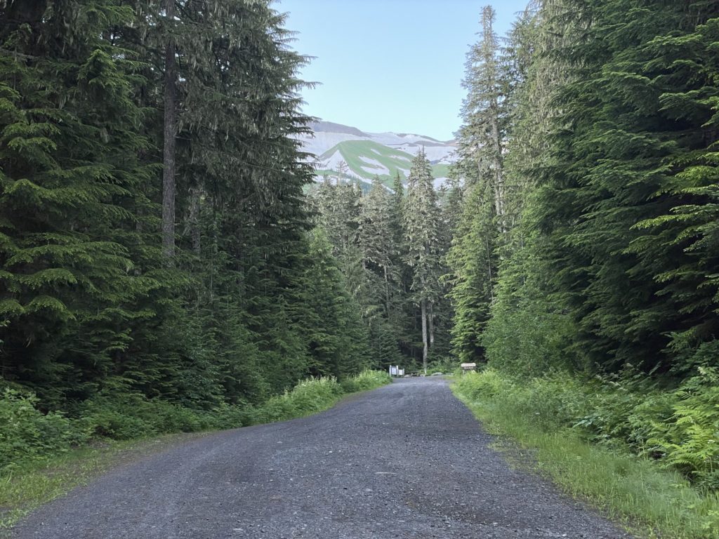
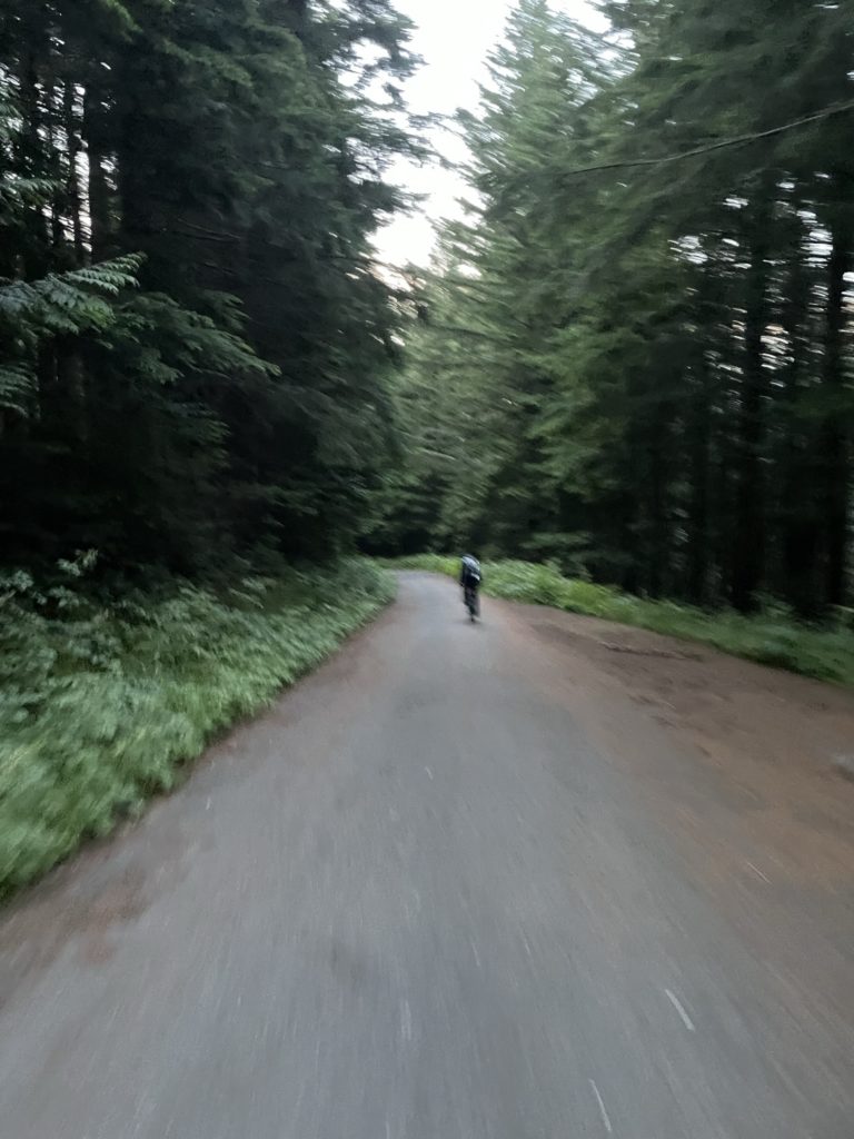
Despite how popular Mount Baker is, all routes involve travel across significant glacier terrain and depending on conditions/time of year the crevasses can be massive. The Coleman-Deming route is no exception, but besides the glacier terrain the route is otherwise fairly tame with a moderately steep snow ascent on the final head wall. Adding to that, there is often significant foot traffic and while we planned to be self-reliant it did ease our mind knowing we’d have a good chance of existing tracks to follow through the glacier portion. One final caveat to this route was that a wash out was blocking the road ~7km before the actual trail head. As a result, we decided on bringing bikes to facilitate a faster ride up and easy cruise down the boring road section.
The plan was to take on the summit early Sunday morning as we had just finished a fun ascent up Kangaroo Temple earlier in the day. We drove from Concrete, Washington up highway 542 and stopped in some small town gas station to sort out our packs for the morning and get water. Just as we finished loading up the packs, I went to buy some water and discovered the gas station had closed, only a few minutes too late. As it turned out practically everything was closed all the way to Mount Baker and I only had 500ml of water to work with. Andrea improvised and we found a sleepy campground on the way where we were able to snag some water from the fill stations before continuing on. From there we drove back towards Glacier, Washington and then up the FSR towards the trail head. We stopped at a pullout maybe 750m from the washout at around 12:30 at night. Thanks to the car camping setup, we actually had a pretty luxurious sleeping arrangement complete with a nice comforter and pillows in the back of my truck. The plan was to wake up at 4:30am, a little later than we had hoped, but the trade-off was having more sleep and therefore more energy to keep up the pace.
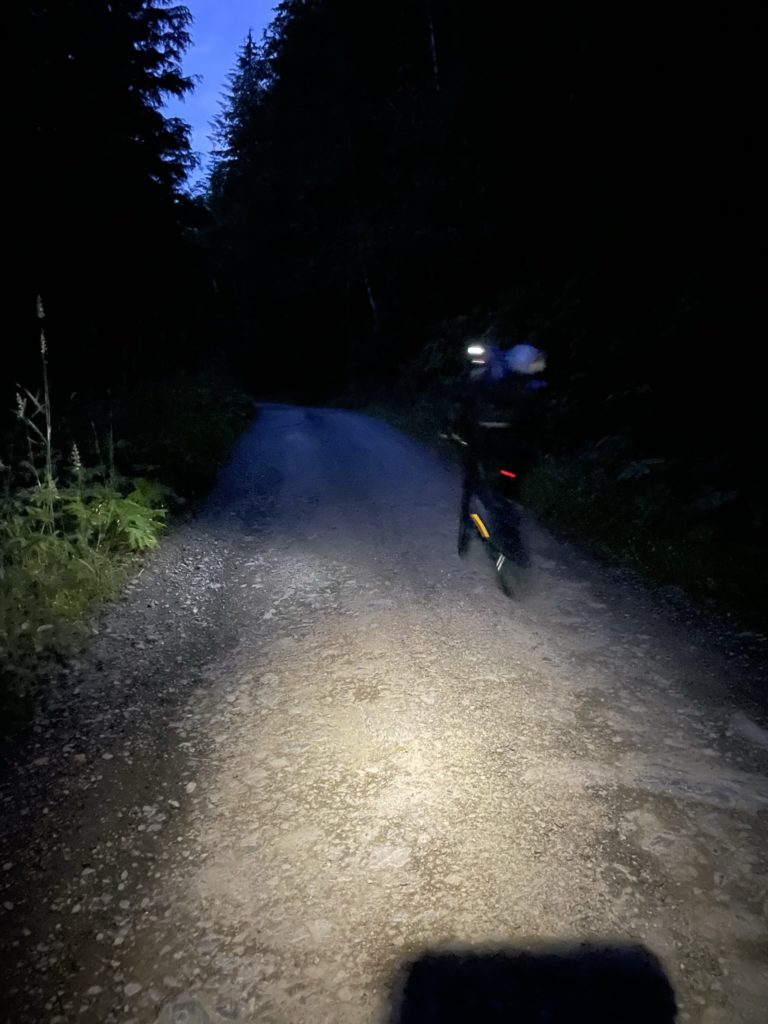
As the alarm went off a few hours later, it took all my strength to leave the comfortable setup we had, but the mission must go on. I did my best to eat some offensively sugary frosted flakes and an apple, but didn’t have much of an appetite. By 4:40 we were starting the foreshortened bike road to the trail head. Initially, it was smooth sailing, but a few hundred meters after the washout the road steepened drastically and the force of gravity threw its mighty weight against my legs. I could barely make it up the first steep section, my legs totally unaccustomed to biking with a heavy pack. Andrea and I resorted to just walking the bikes the remainder of the way, making a few attempts to bike sections where it flattened out. I may be a bit over dramatic about the steepness, but it might as well have been vertical for out of shape a bike rider I was. This miscalculation put us at the trail head later than expected, but the days are long and the weather was perfect, so we weren’t too concerned.
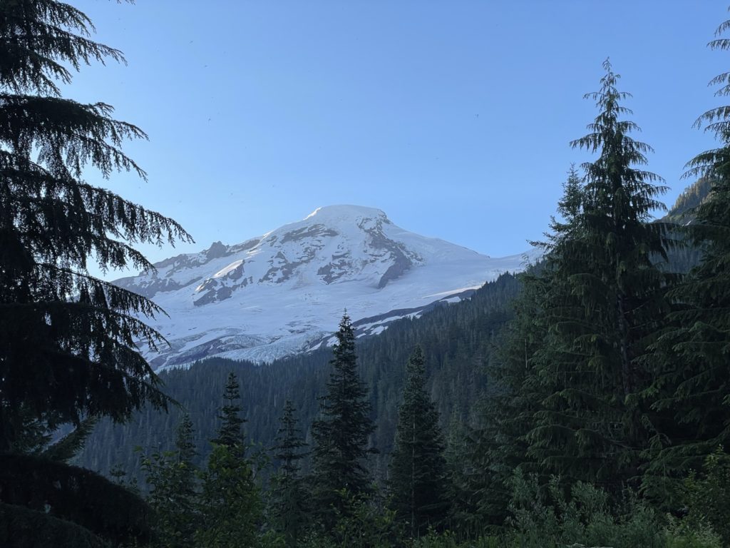
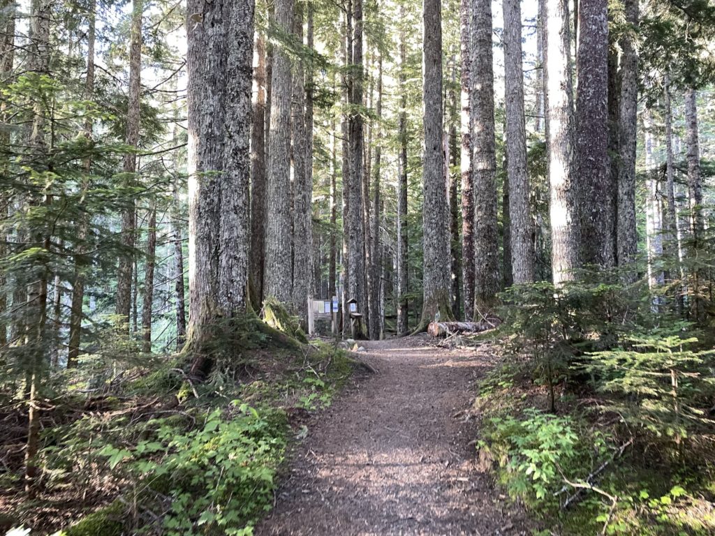
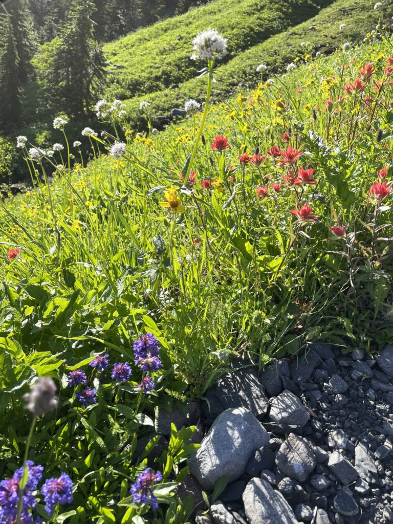
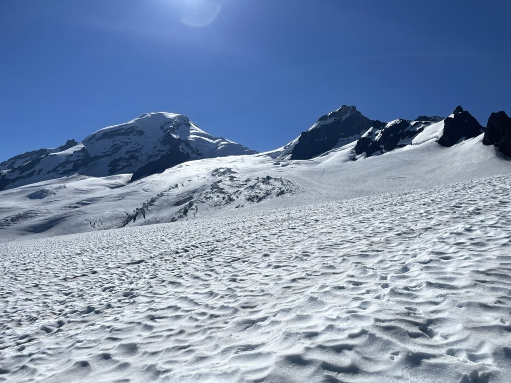
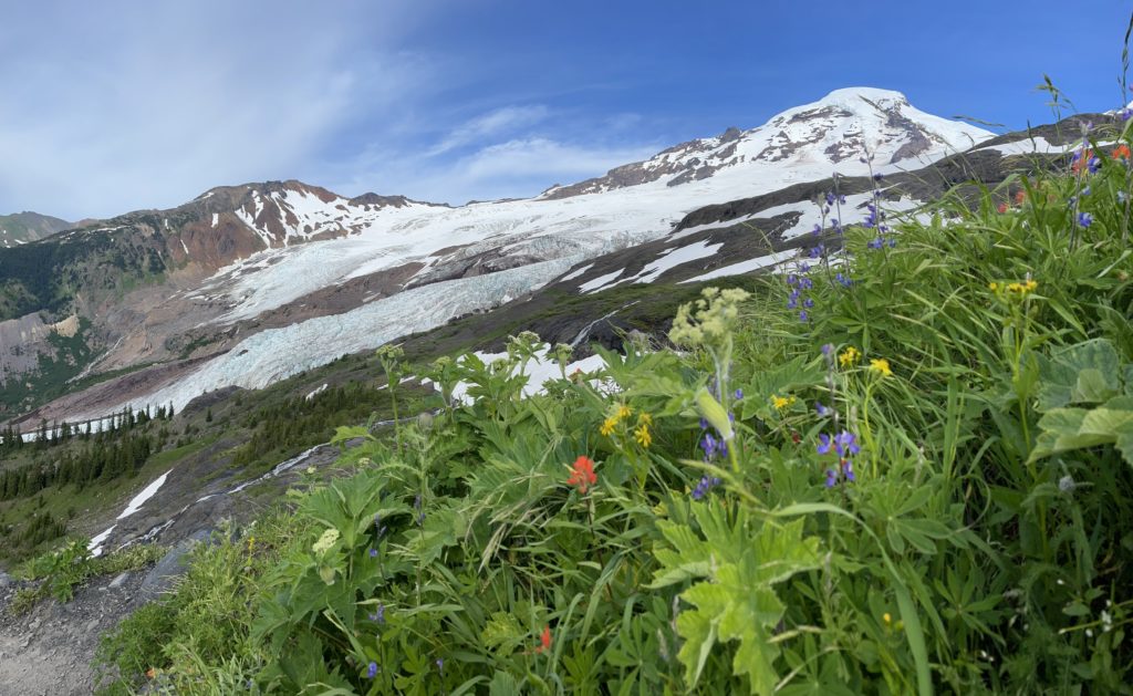
Both of us a had quick break at the trail head while I stashed the bikes and then we got going down the Heliotrope Ridge Trail. As I’ve found to be common in the US, the trail was exceptionally well maintained except for one washed out section and we ascended easily up through the forest. Before long we were emerging out of the tree line and into alpine meadows with a dominating Mount Baker as the back drop. Even from the tree line you could see the terrain around Baker is massive. The road walk had taken some wind out of my sails, but now seeing the summit route I was getting fired up and stoked to get after it.
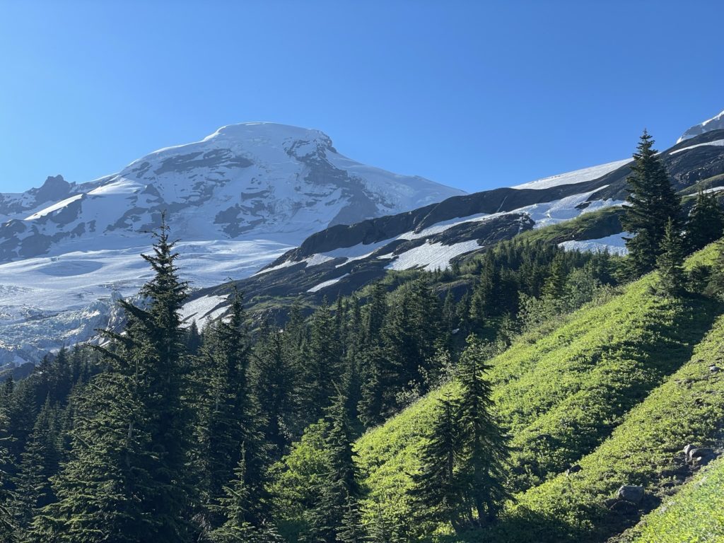
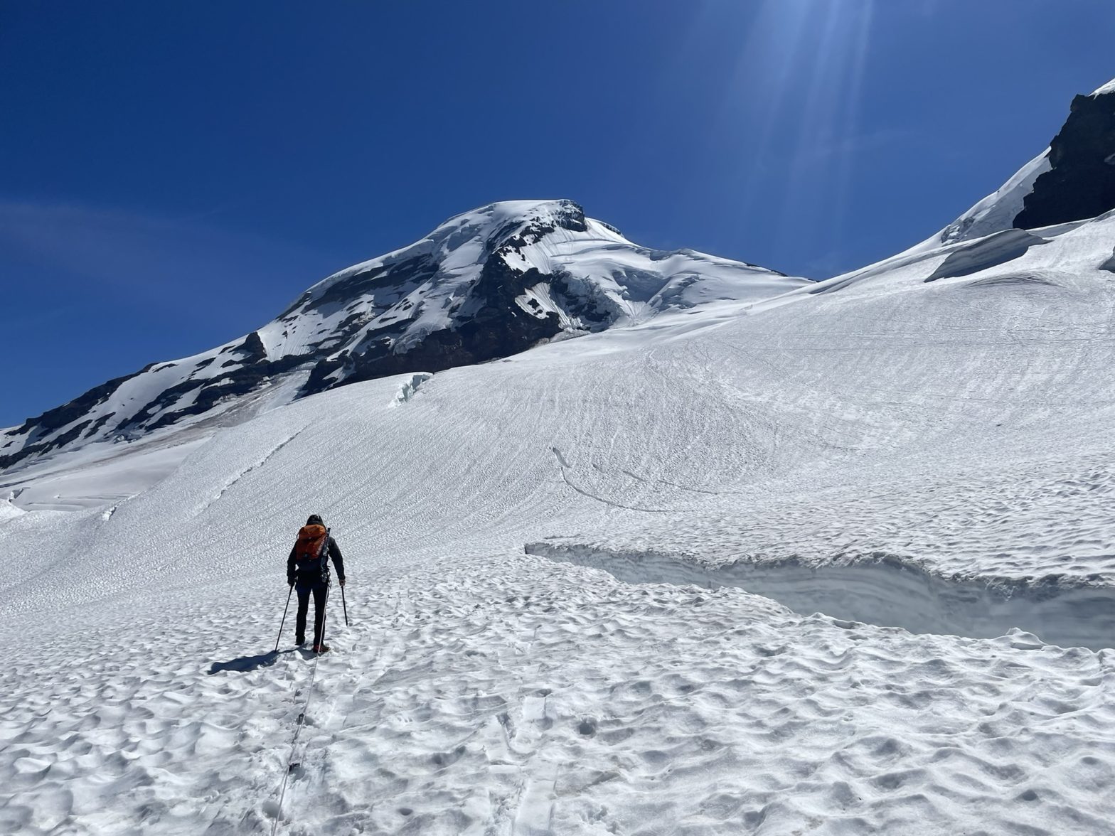
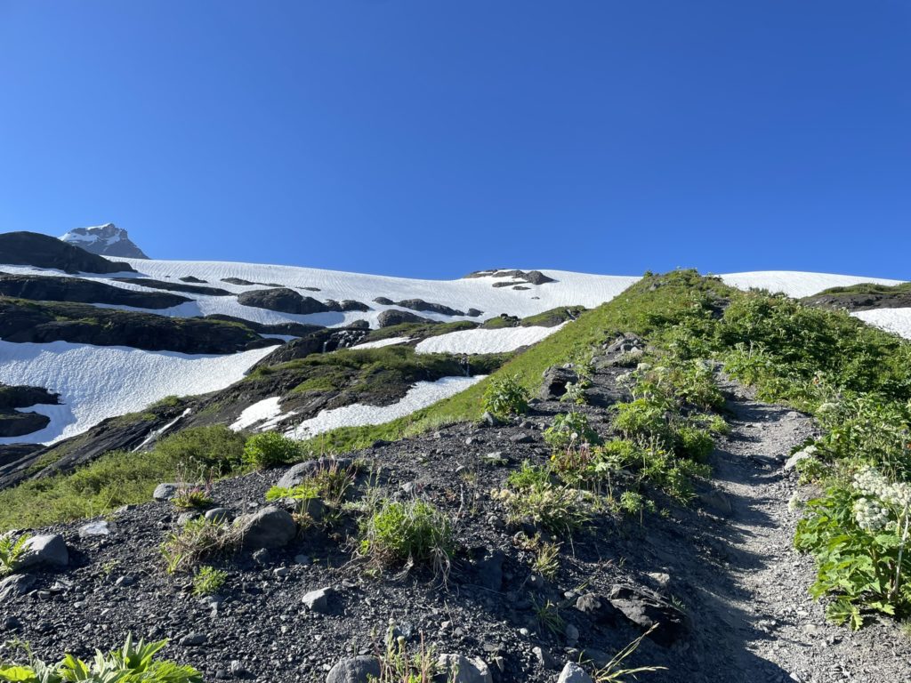
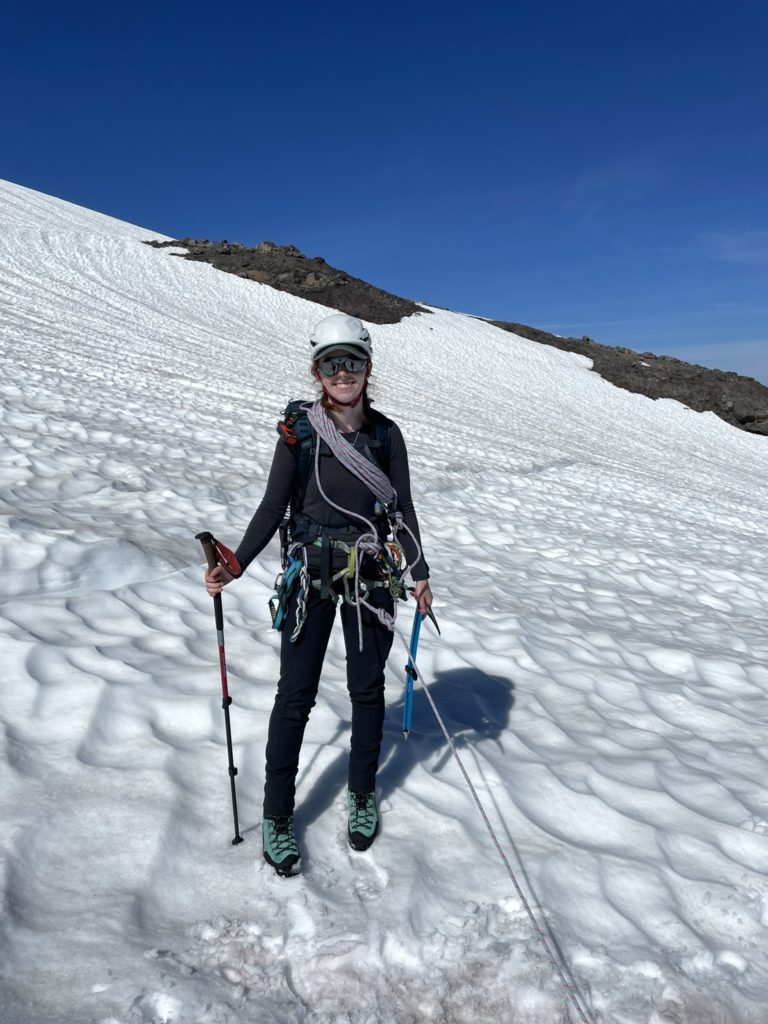
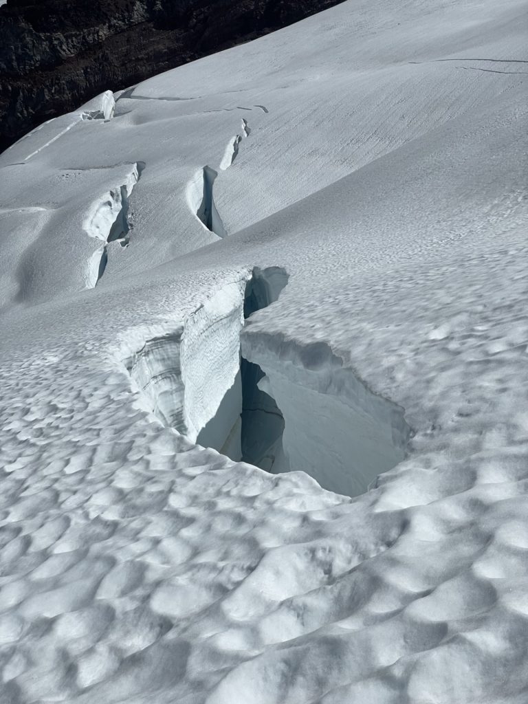
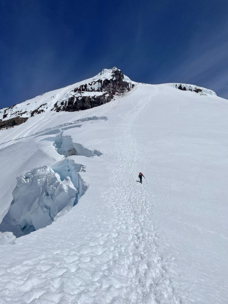
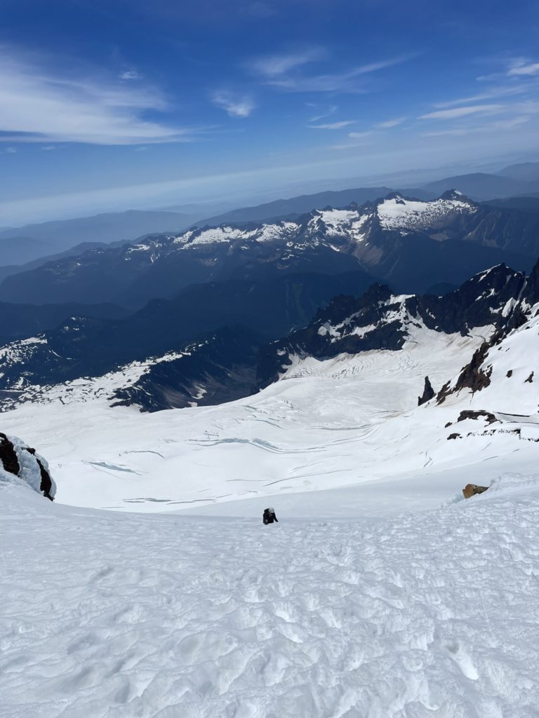
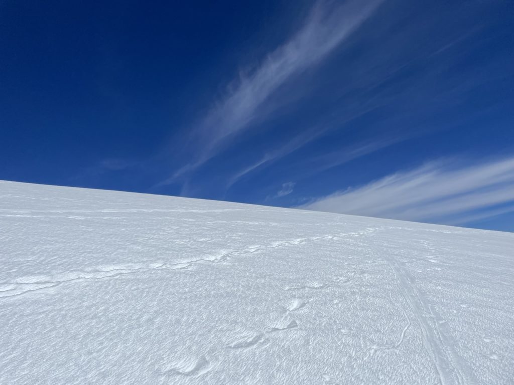
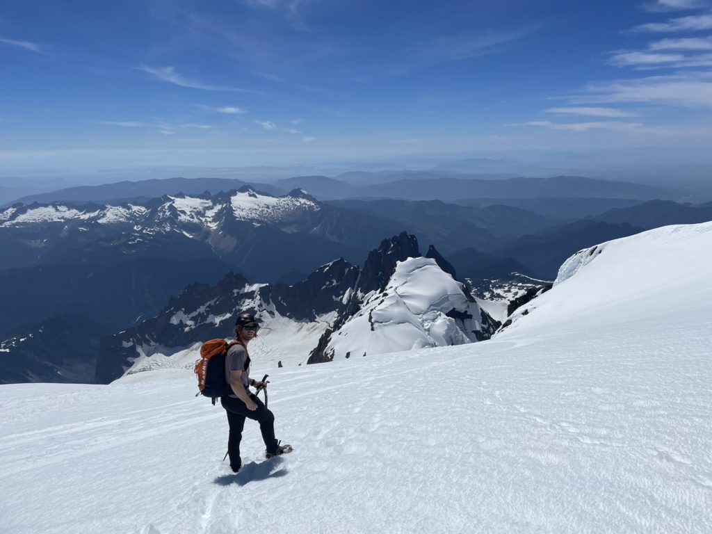
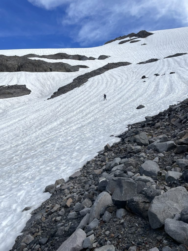
Above the alpine meadows the terrain transitioned into typical glacial terminus terrain and we started our ascent up a steepish sun-cupped slope to gain the Coleman Glacier. As we crested the first ridge I could see a long high way of tracks off in the distance so I knew we’d be aiming for that. We plodded along the first section of glacier for only 20m at most before spotting the first crevasse. A small one at first, but this was our sign to rope up. I would take the lead so that Andrea would have a better chance of holding a fall versus facing away from me and being pulled downwards. We spotted some tracks through the first section of small crevasses, but decided to plot our own course navigating further south around the majority of them and then up one of the many rolls along the way.
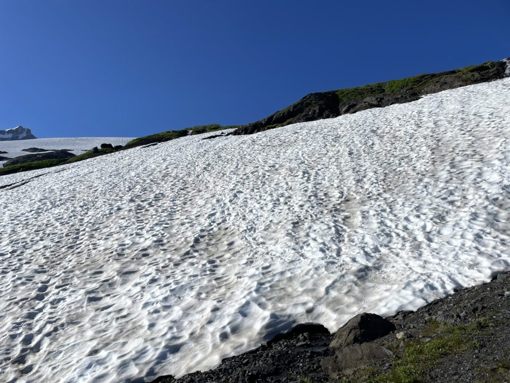
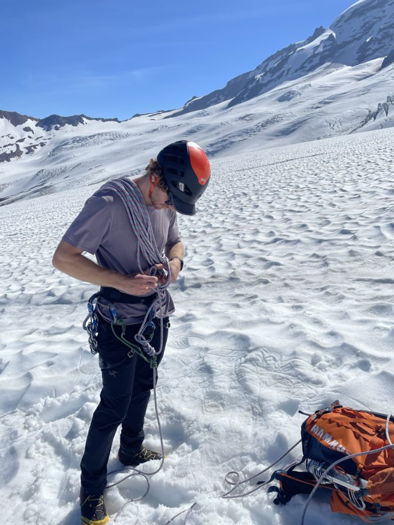
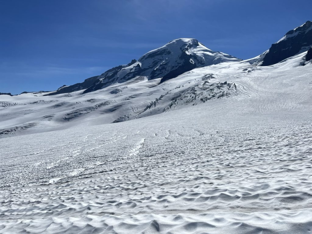

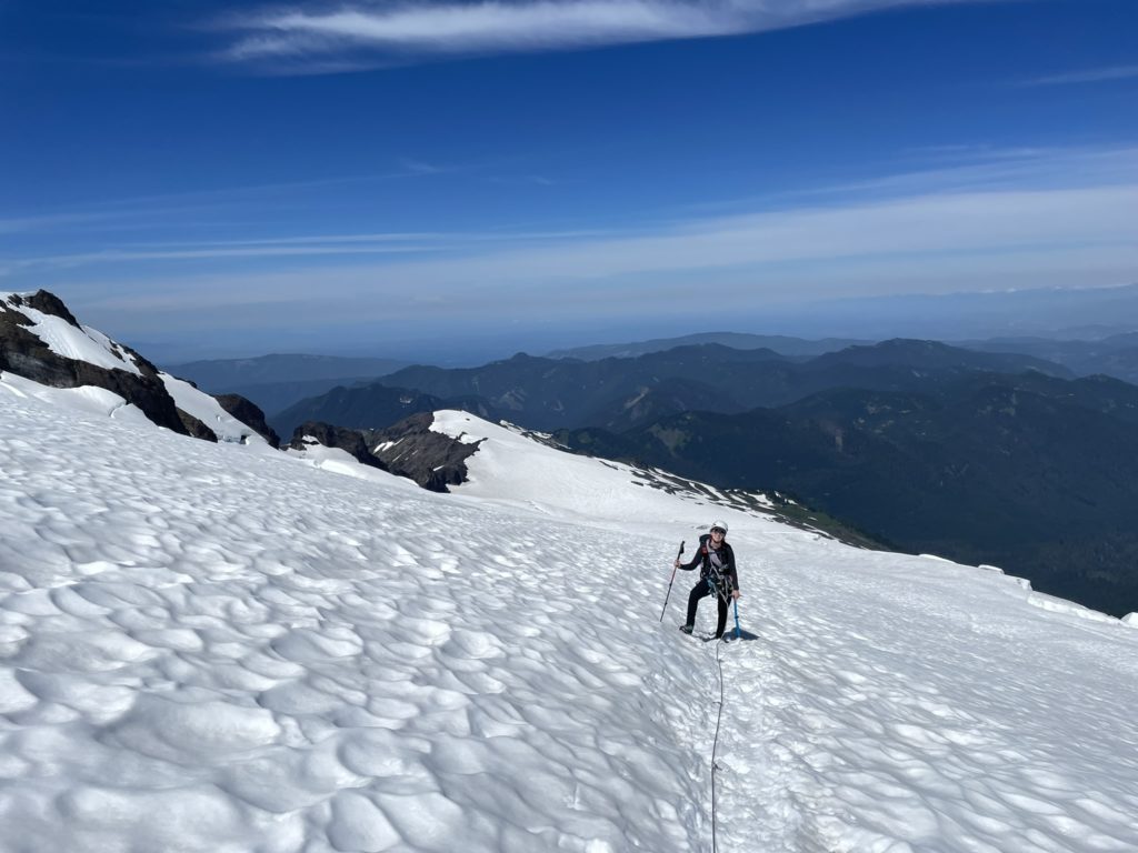
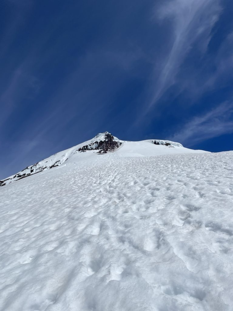
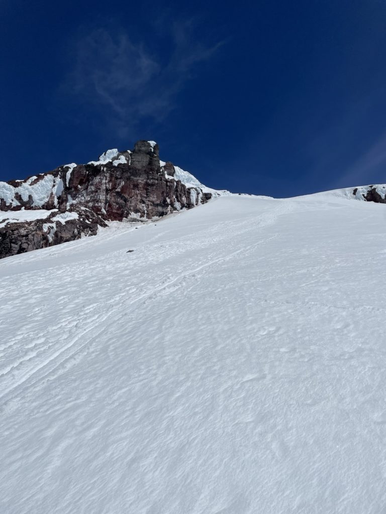
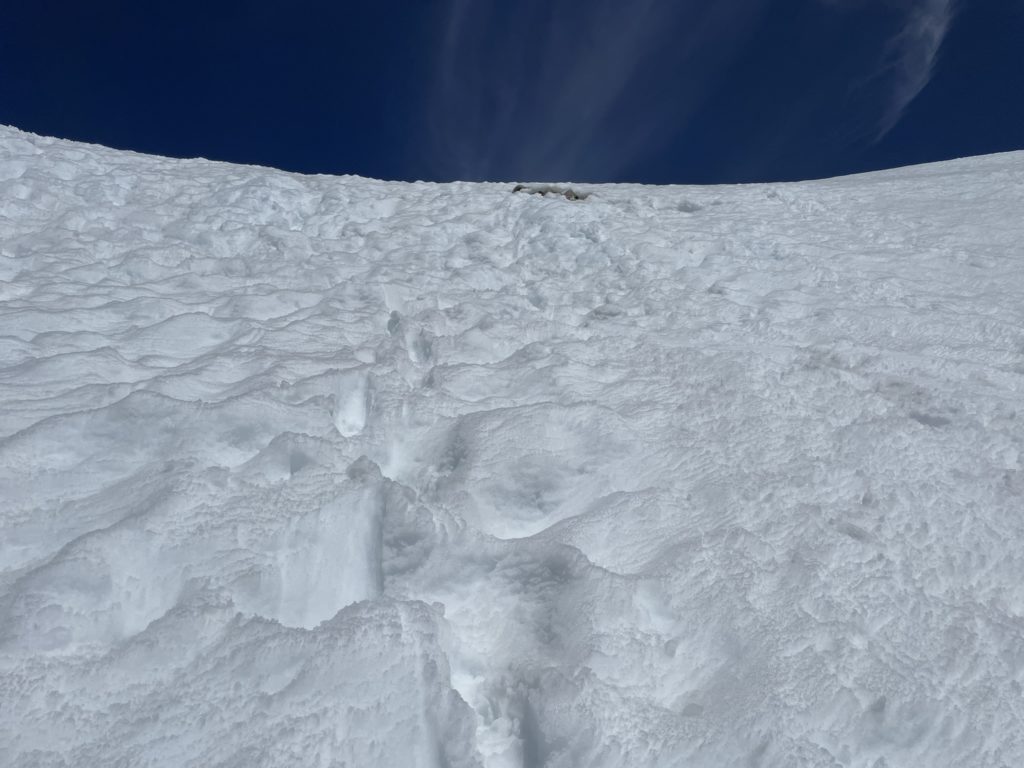
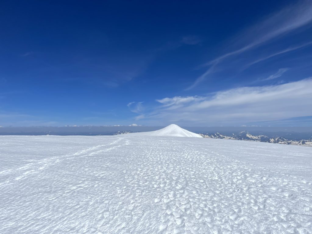
As we reached the 2050m mark, the crevasses really started to grow in size with some appearing almost bottomless. At this point we stuck to the existing tracks and found our way over several snow bridges with relative ease. The route was straightforward enough and we were able to keep a consistent pace up to the safer portion of the glacier just after Colfax Peak. We gained the ridge leading up to the summit around 1PM and ditched our rope while transitioning to cramp ons. Along the way up, I had observed quite a bit of isothermal snow and so I wasn’t sure how the steeper parts of the Roman Headwall would hold up (the final slope on the south side of Baker). I didn’t have any reason to turn back yet though, so decided we could assess as we went up.

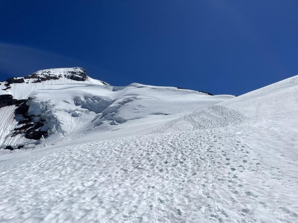

I lead the way up the ridge with Andrea following closely behind and part way up we ran into a descending party. They reported the snow largely intact, but to avoid the tracks close to a set of bluffs at climber’s left. There was reported hang fire and rime chunks falling off. We continued up a ways and then diverted further climbers right on the wall to avoid rock fall. Even though it was nearing the hottest part of the day, I found the snow to be still quite supportive and a few tests failed show indications of potential wet loose activity. Still, I tried to set a fast pace so that we could be out of the firing zone in quick time and avoid too much deterioration of the snow slopes. Andrea pushed hard with me and we soon reached the steepest section at the top of the Roman Headwall. I was expecting much steeper terrain, but it was actually pretty tame over all and we just had to contend with a few rotten steps over rocks before we were on the broad summit plateau.
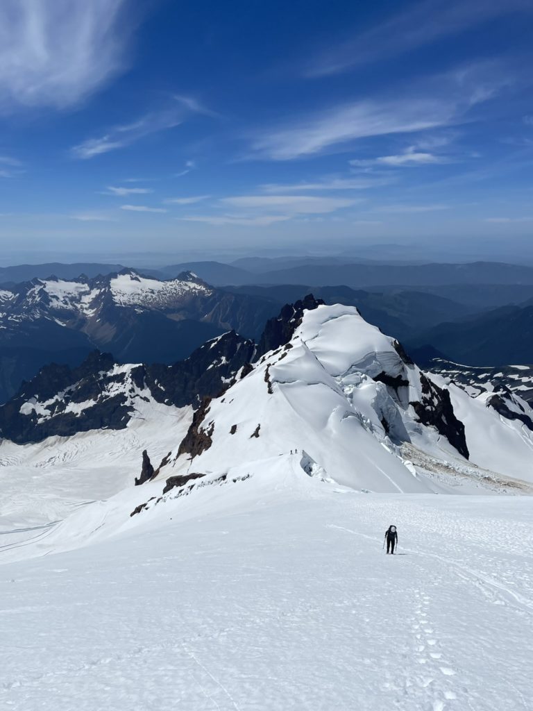
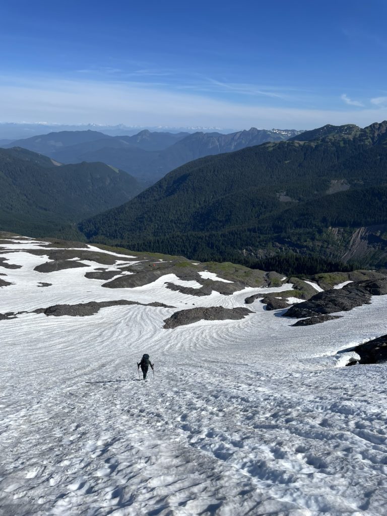
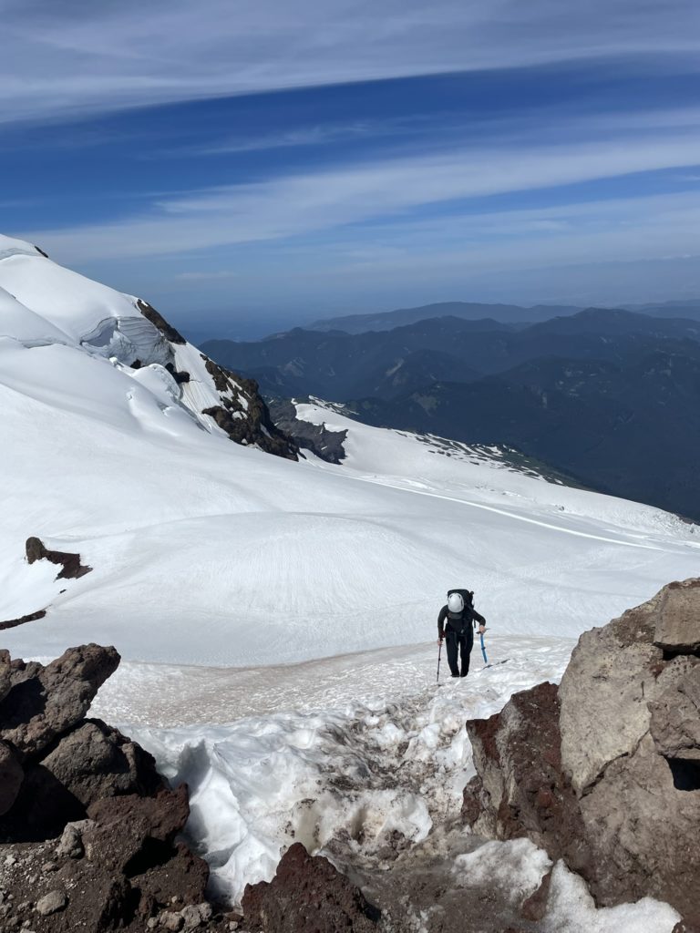
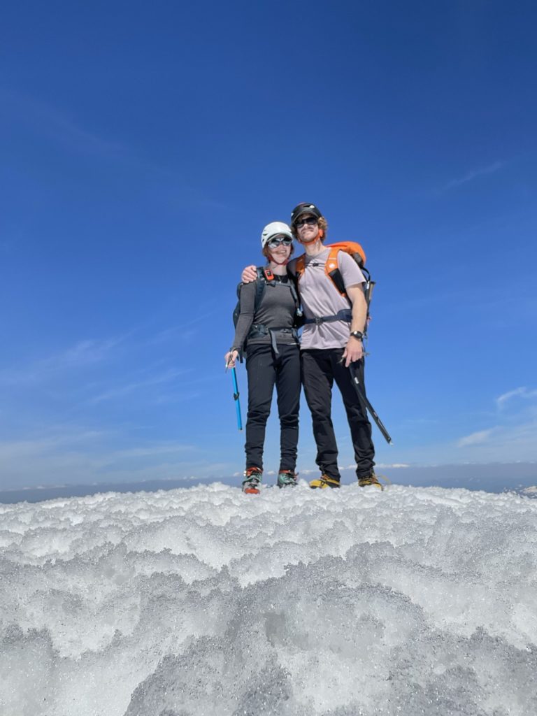
Unbeknownst to me, there was actually still a few 100m of traversing to gain the summit from the Roman Headwall, but the hardest part was now behind us. Andrea and I plodded across the long summit area and over towards the true summit, which looked merely like a small hill in a huge snow field. By 2:38PM we were finally standing on the summit, stoked as ever. We didn’t stick around for too long though as I wanted to be off the steepest section of snow before the sun could do it’s damage. Reversing course was easy and we found the Roman head wall still in great condition. We were both able to just face out and heel step the whole way back to the ridge.
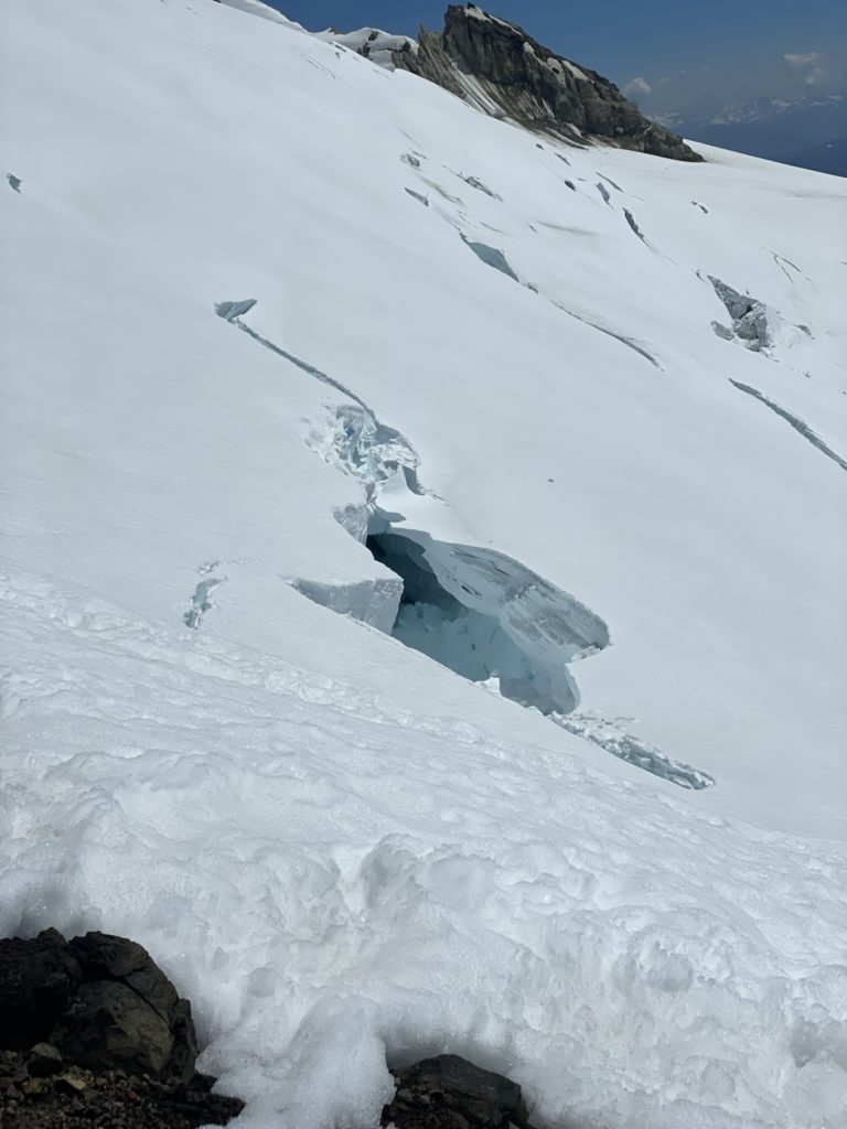
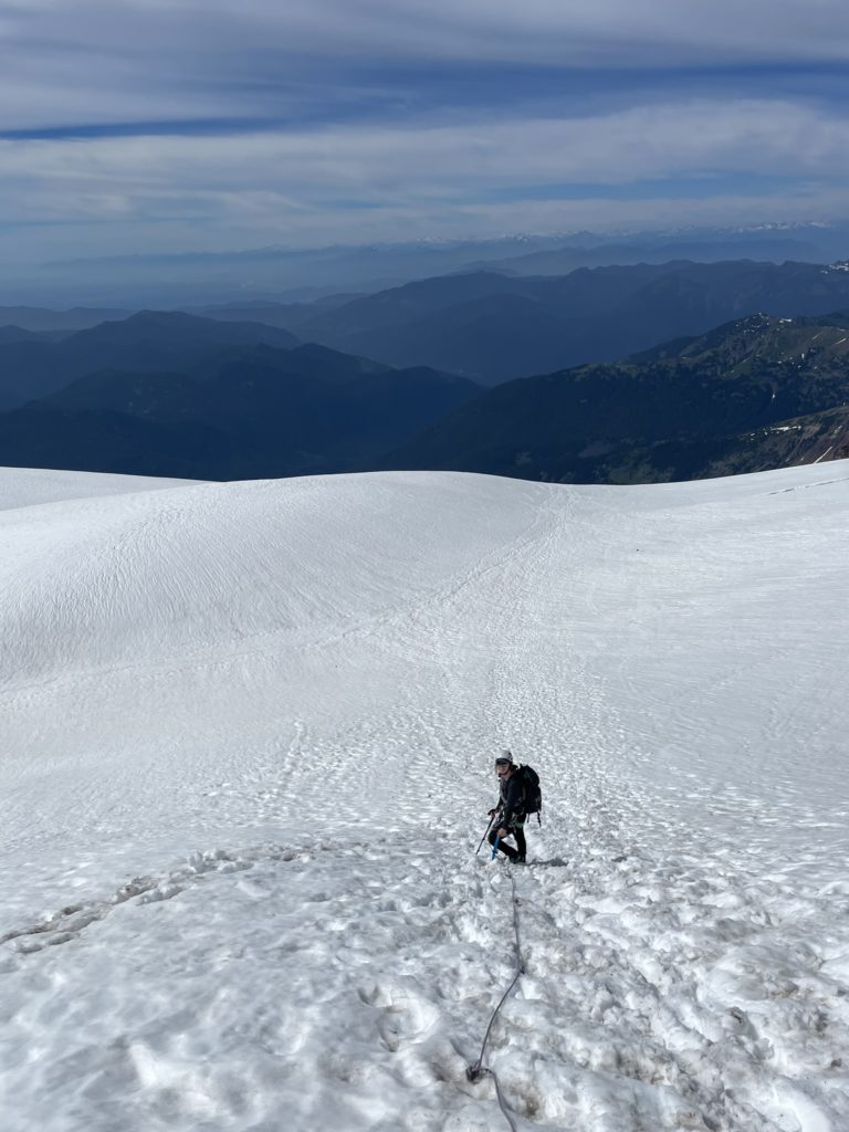
At the gear stash we hung out for a bit catching our breaths and then roped up again for the crossing back. Andrea took lead this time, since I’d be falling uphill from her giving her a nice advantage to catch me. Coming down from the ridge we noticed the massive seracs on Colfax’s north side had shed significant amount of ice dangerously close to our route. We could hear sharp cracks as the ice strained to stay together and a whole column of ice looked precariously close to falling. Neither of us wanted to be around when any of these chunks gave way, so we decided to run through the entirety of the potential fall zone until reaching safer ground. It was a little tricky maintaining a run while attached to a rope, but we managed well enough and relaxed our pace lower down.
We unroped towards the end of the glacier and then navigated through the alpine meadows to reach the start of the Heliotrope Ridge Trail. No more than 40m down the trail, we stopped to sit down and take in the days adventure. Our break turned into a nap, with both of us falling asleep briefly on the dirt trail. When we woke up, we ended up hanging out for awhile longer enjoying the slowly setting sun and the nice breeze through the meadow.
After awhile, it was time to get going again and descending the trail was easy business. When we reached the trail head, our bike idea paid dividends. Now we had a fast cruise down 7km of FSR with no effort required. The ride back was awesome and I felt a like a kid wandering around the forest with the summer air blowing through my hair. We reached the truck just before dark and then made the 2+ hour drive home, concluding a 16.5 hour summit push and an unforgettable day in the mountains.
Now every time I look down the valley and see Mount Baker I’ll have a very fond memory to think of. Yet another awesome day out in the mountains with Andrea <3.
Very well written report Francis.